My Store
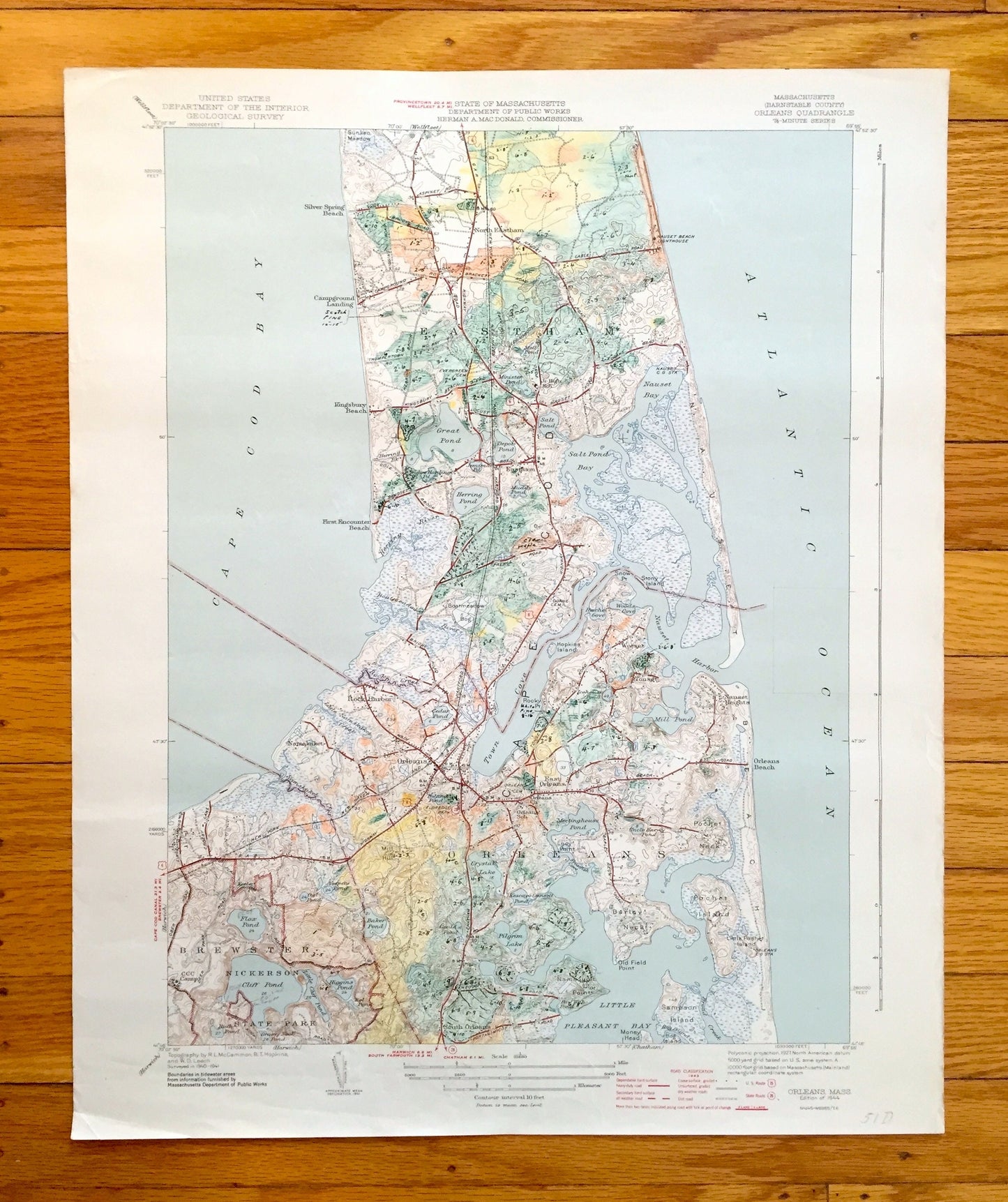
Antique Cape Cod, Orleans, Massachusetts 1944 US Geological Survey Topographic Map – Eastham, Brewster, Nauset Kingsbury Beach Barnstable MA
Antique Cape Cod, Orleans, Massachusetts 1944 US Geological Survey Topographic Map – Eastham, Brewster, Nauset Kingsbury Beach Barnstable MA
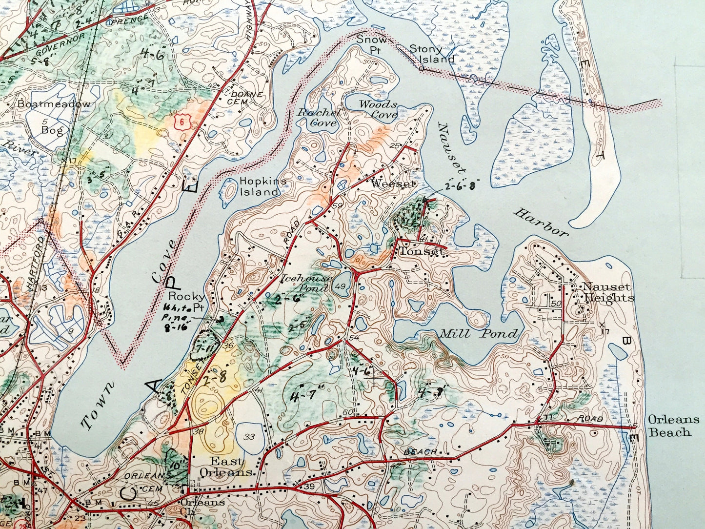
Beautiful, antique map of Cape Cod including Orleans, North Eastham, Eastham, Nauset Beach, Kingsbury Beach, Thumpertown Beach and Brewster, Massachusetts. This is an authentic 1944 print from the U.S. Geological Survey and is NOT a computer reproduction.
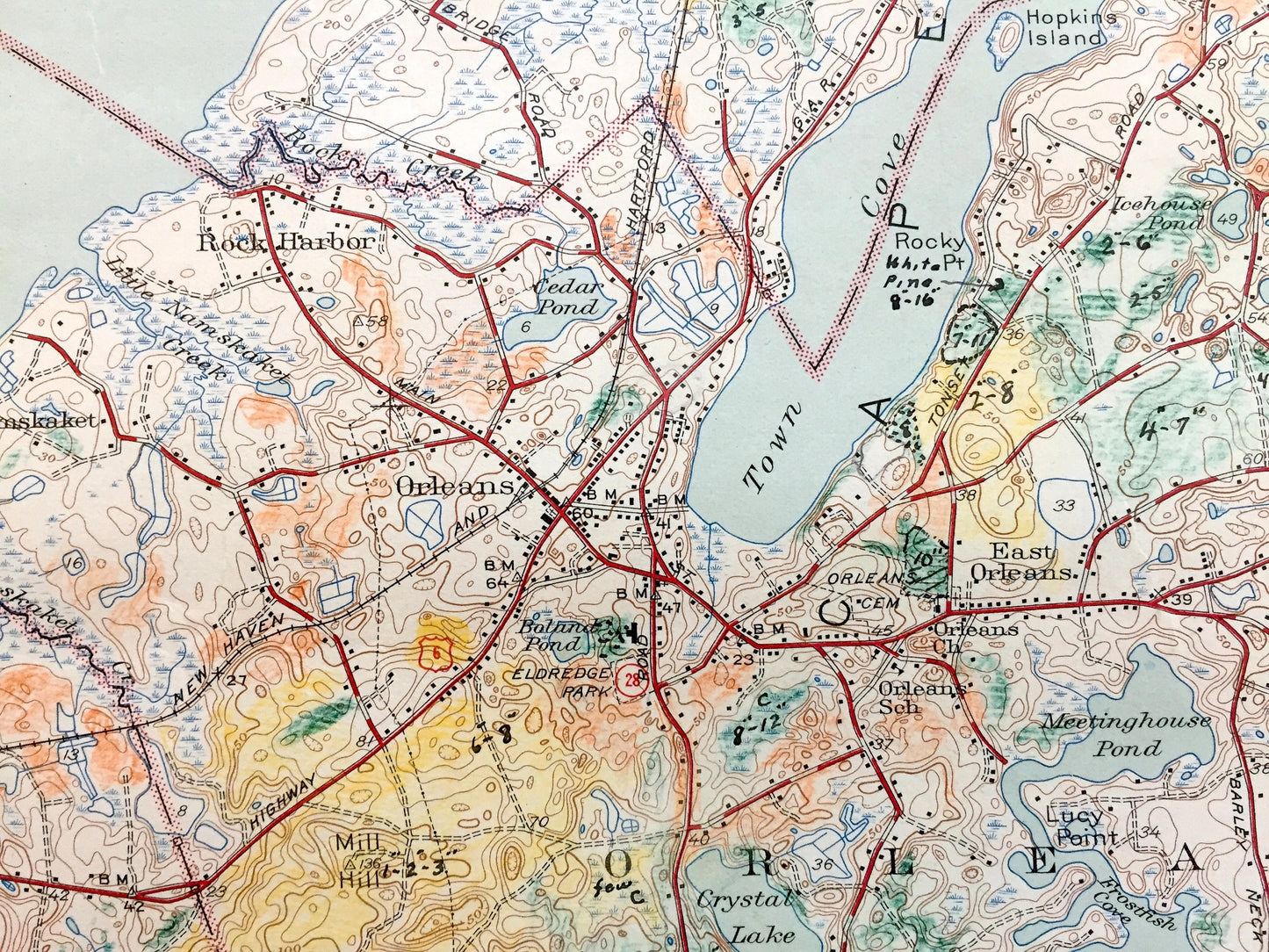
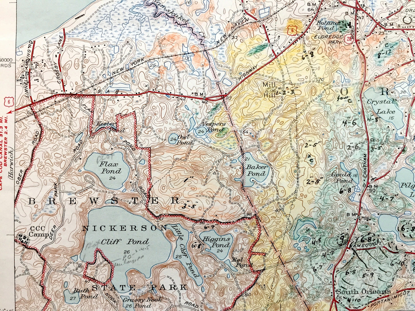
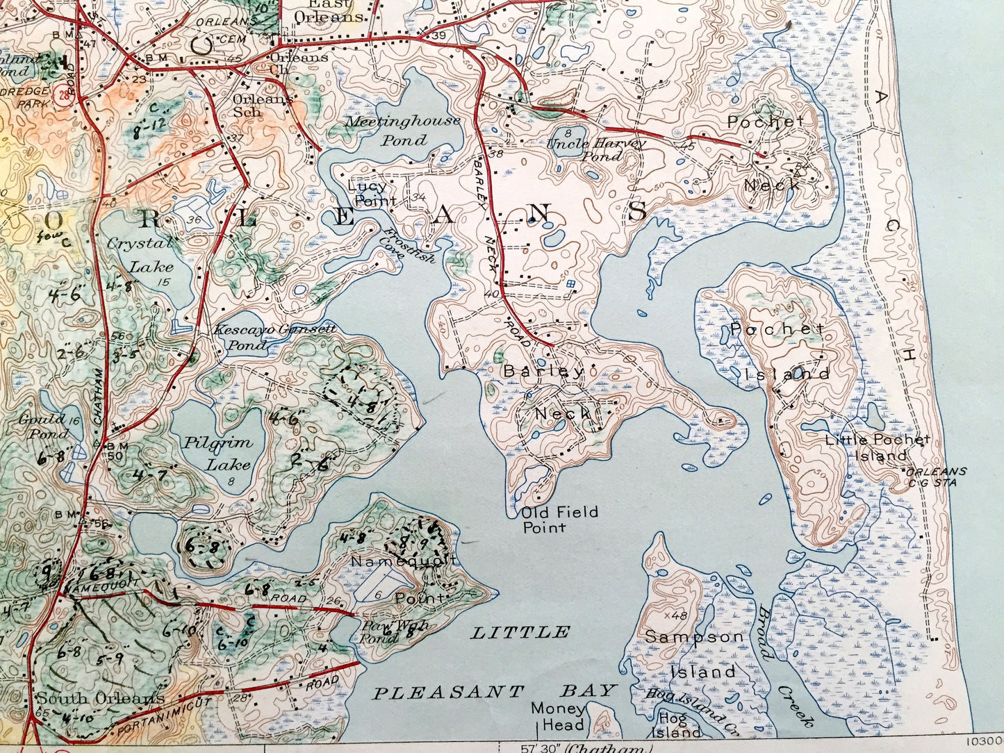
See what Cape Cod looked like 80 years ago. Lots of intricate details and geological contours. Map even has little squares for every house that existed at the time. The USGS cartographers were very thorough back then! On the back is a description of topographic symbols and map guide. This map was most likely used in the field and has many notations and coloring throughout the map, making it a very unique specimen.
Perfect for the historian, map-lover, the curious or just as a conversation starter. Wonderful and rare. Vintage maps such as these make great gifts.
Edition of 1944, printed 1944
Dimensions: 16 1/2" width x 20" height
----
Features
Cities & Towns: North Eastham, Silver Spring Beach, Campground Landing, Thumpertown Beach, Kinsbury Beach, First Encounter Beach, Shaket Beach, Namskaket, Rock Harbor, Orleans, Eastham, Nauset Beach, Orleans Beach, Brewster, South Orleans.
Points of Interest: Barnstable County, Woods Beach Rock, Nauset Beach Lighthouse, Nauset Bay, Salt Pond Pay, Cape Cod Bay, Great Pond, Herring Pond, Depot Pond, Cranberry Bogs, Skymeadow Airfield, Orleans Regional High School, Town Cover, Crystal Lake, Eldredge Park, Nickerson State Park, South Orleans Post Office, Little Pleasant Bay, Barley Neck, Pachet Neck, Atlantic Ocean, and lots more ponds, bays, beaches, houses, and roads
Condition: Good or "Very Vintage" condition, commensurate with age. This map is in great shape for being about 80 years old. Has some edge-wear, foxing, and copious writing and notations, as well as hand-coloring, but this will all add to vintage character when framed.
----
We will happily adjust shipping price for multiple purchases. Maps are rolled up and shipped in sturdy mailing tubes, never folded.
Couldn't load pickup availability
Share