My Store
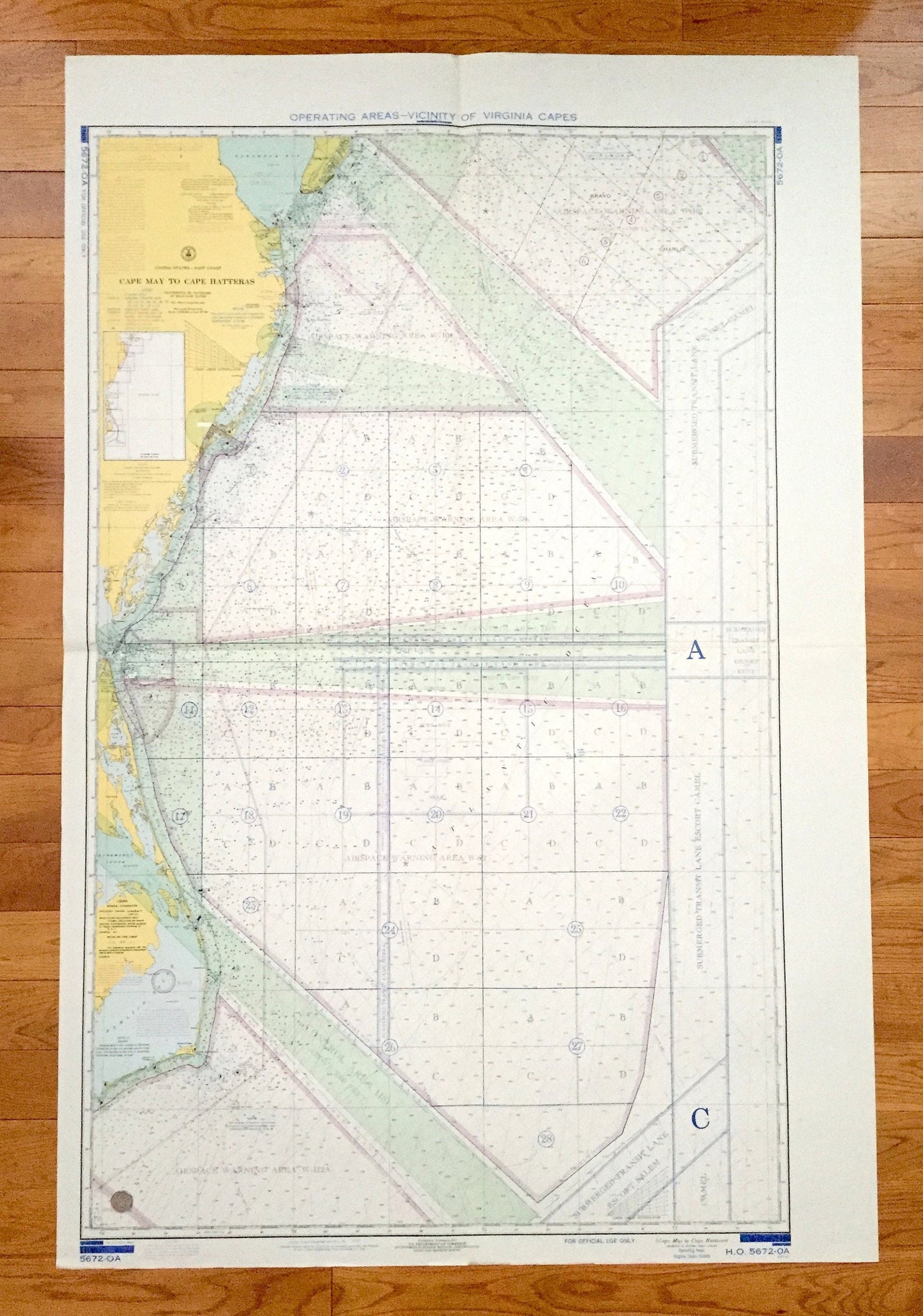
Antique Cape May to Cape Hatteras 1969 US Coast Guard Nautical Map – New Jersey, Delaware, Maryland, Virginia, North Carolina, Bethany Beach
Antique Cape May to Cape Hatteras 1969 US Coast Guard Nautical Map – New Jersey, Delaware, Maryland, Virginia, North Carolina, Bethany Beach
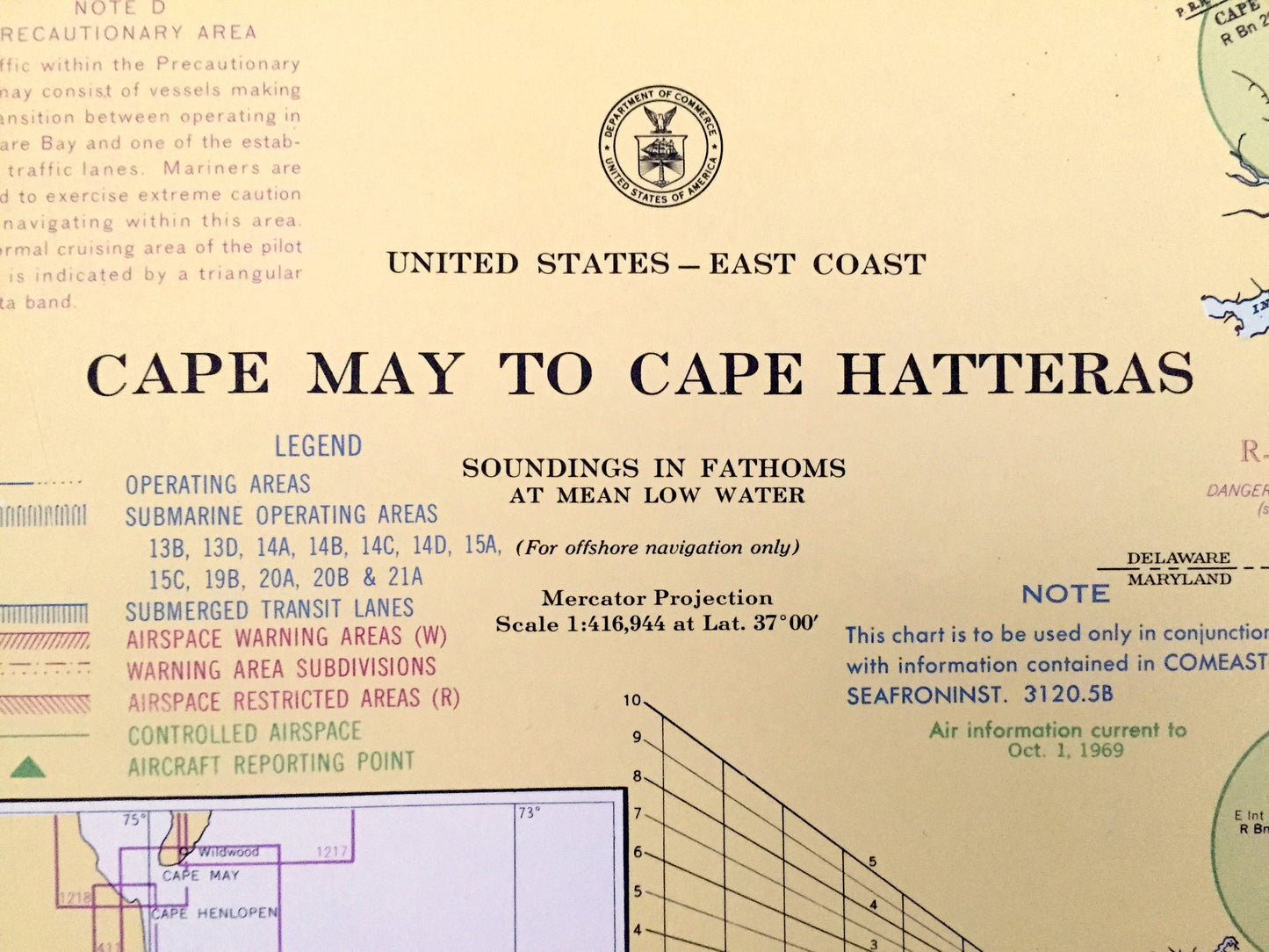
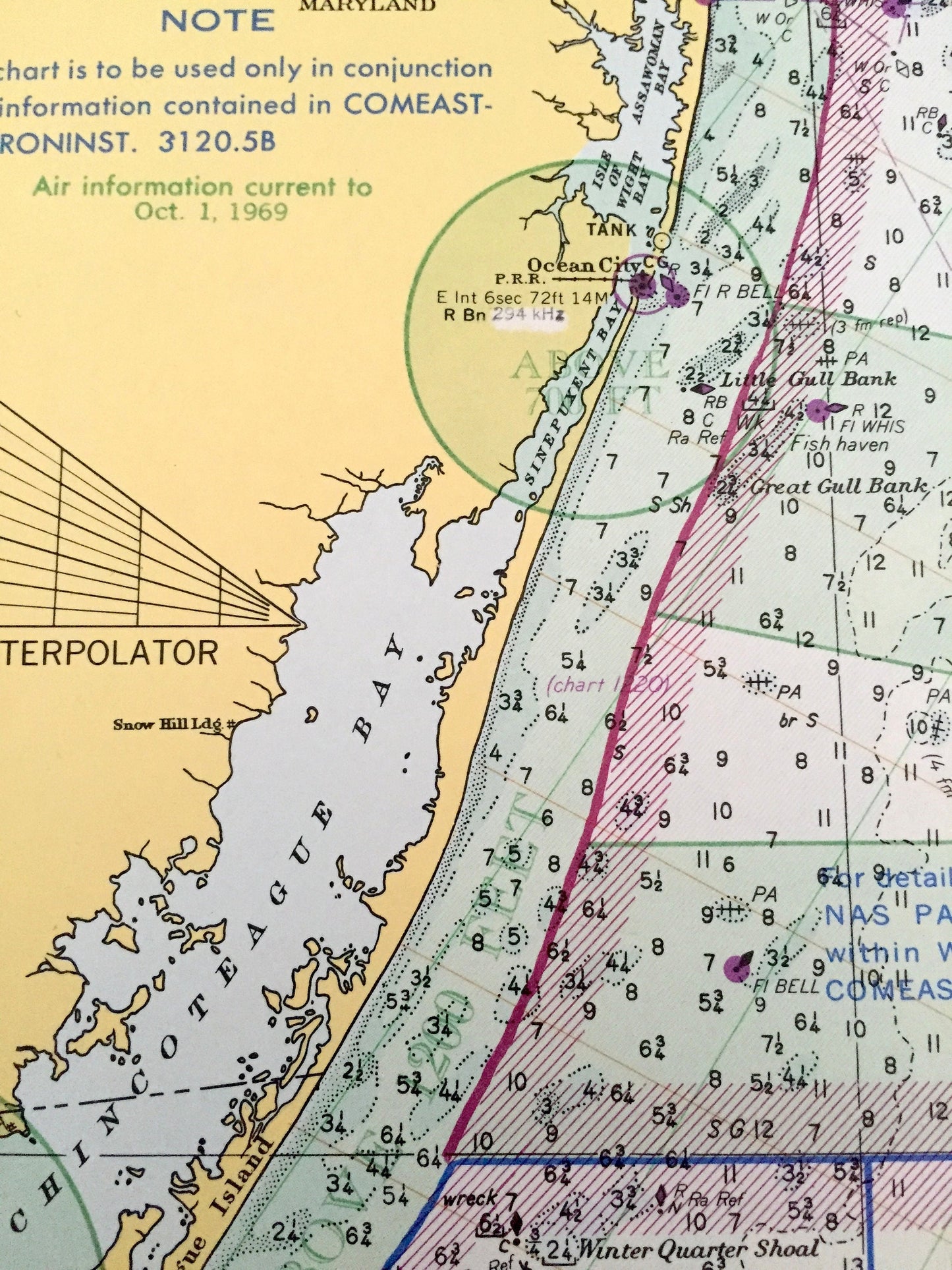
Beautiful, antique nautical chart of Cape May, New Jersey to Cape Hatteras, North Carolina, including all of the eastern seaboard coastline in between. This is an authentic 1969 edition map from the United States Coast Guard & Geodetic Survey, published in 1970 and is NOT a computer reproduction. Verso is blank.
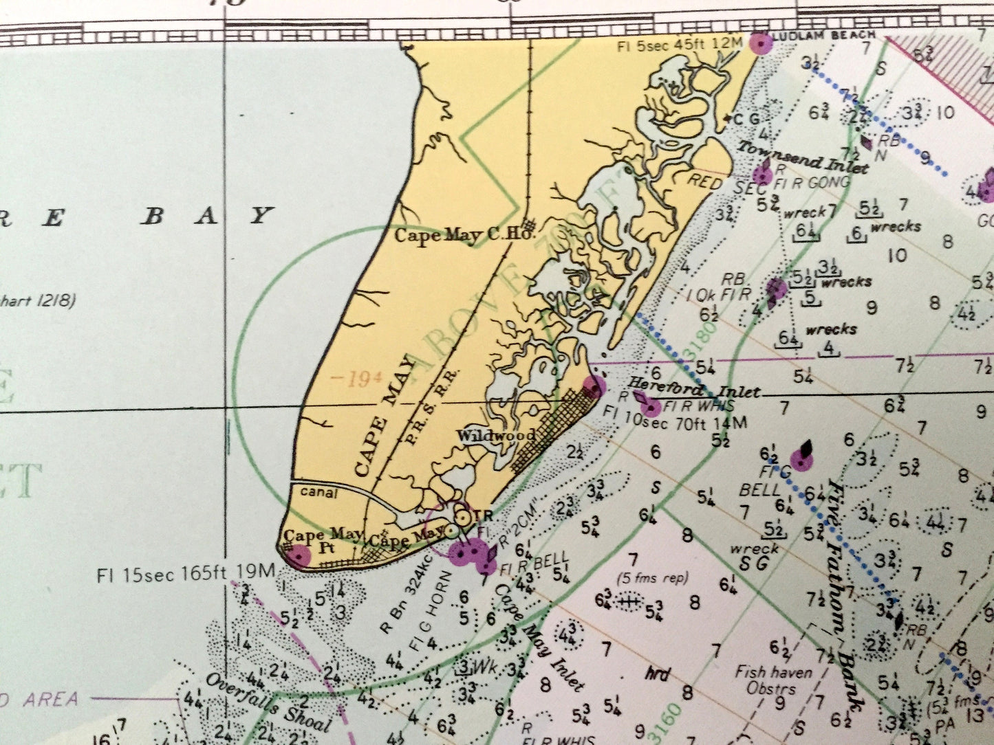
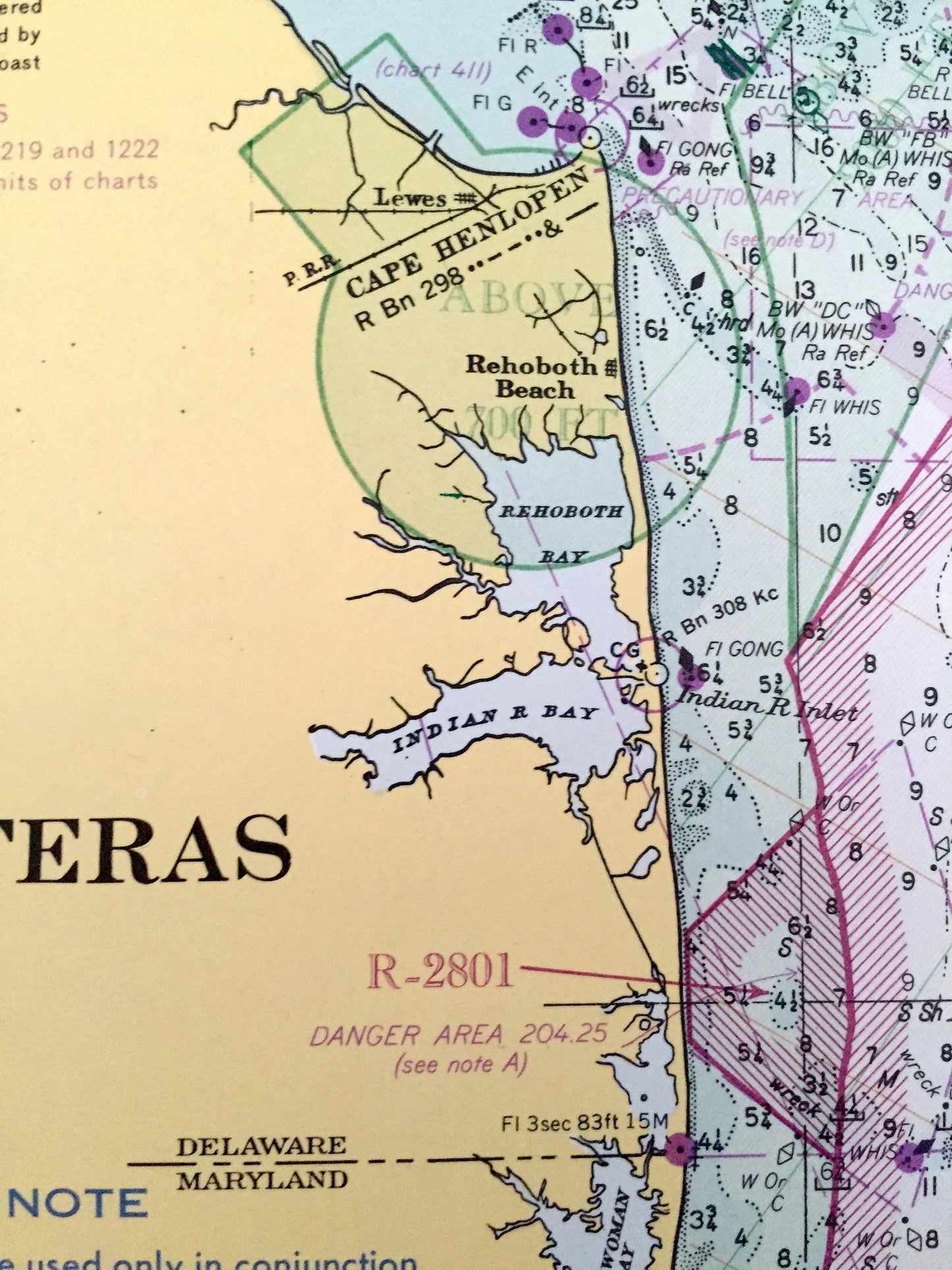
See what the Mid-Atlantic Coast from New Jersey to North Carolina looked like more than 50 years ago. Lots of charming, intricate details and contours, including depth soundings, cities, streets, rivers, anchorages, magnetic anomaly areas and other points of nautical interest. Map is very large and would be the focal point in whatever room it is hung. (See quarter in bottom left corner of map for idea of scale.)
Perfect for the historian, seaman, map-lover, the curious or just as a conversation starter. Wonderful and rare. Vintage maps such as these make great gifts.
Edition of 1969, printed 1970
Dimensions: 36" width x 54" height
----
Condition: Very Good Vintage condition, commensurate with age. This map is in great shape for being 50 years old. Has light edge-wear and folds as-issued, but these will flatten easily and all will read as vintage character when framed.
----
We will happily adjust shipping price for multiple purchases. Maps are rolled up and shipped in sturdy mailing tubes, never folded.
Couldn't load pickup availability
Share