My Store
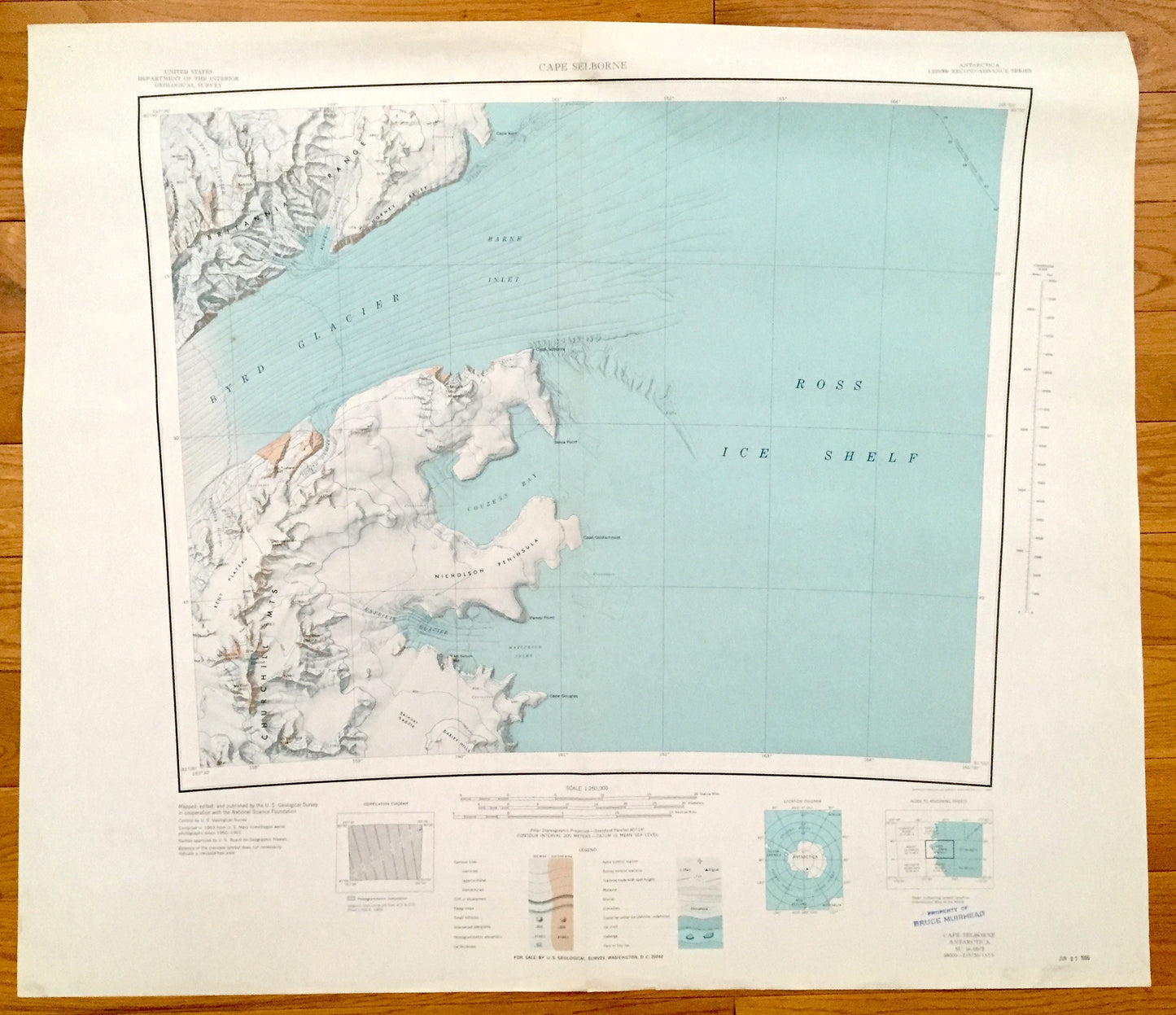
Antique Cape Selborne, Antarctica 1963 US Geological Survey Topographic Map – Ross Ice Shelf, Byrd Glacier, Churchill Range, Britannia Range
Antique Cape Selborne, Antarctica 1963 US Geological Survey Topographic Map – Ross Ice Shelf, Byrd Glacier, Churchill Range, Britannia Range
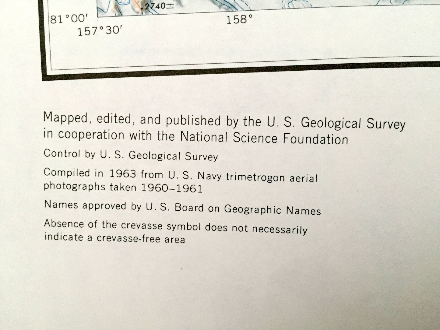
Beautiful, antique map of Cape Selborne and the Ross Ice Shelf of Antarctica. This is an authentic 1963 print from the U.S. Geological Survey Reconnaissance Series and not a computer reprint.
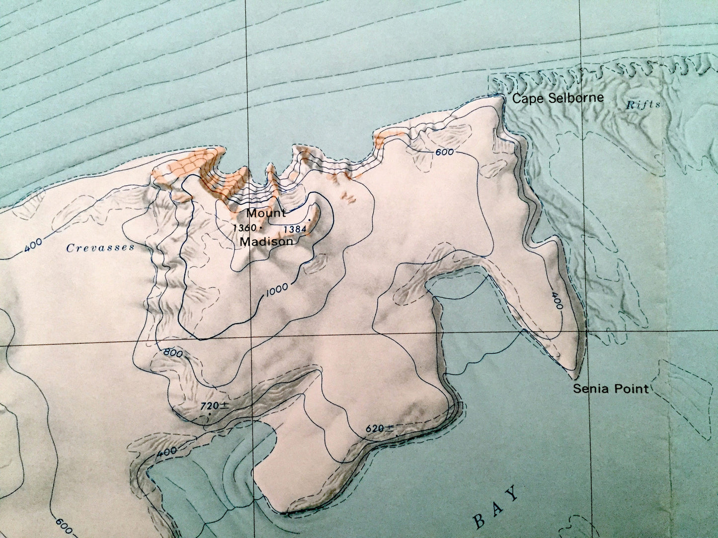
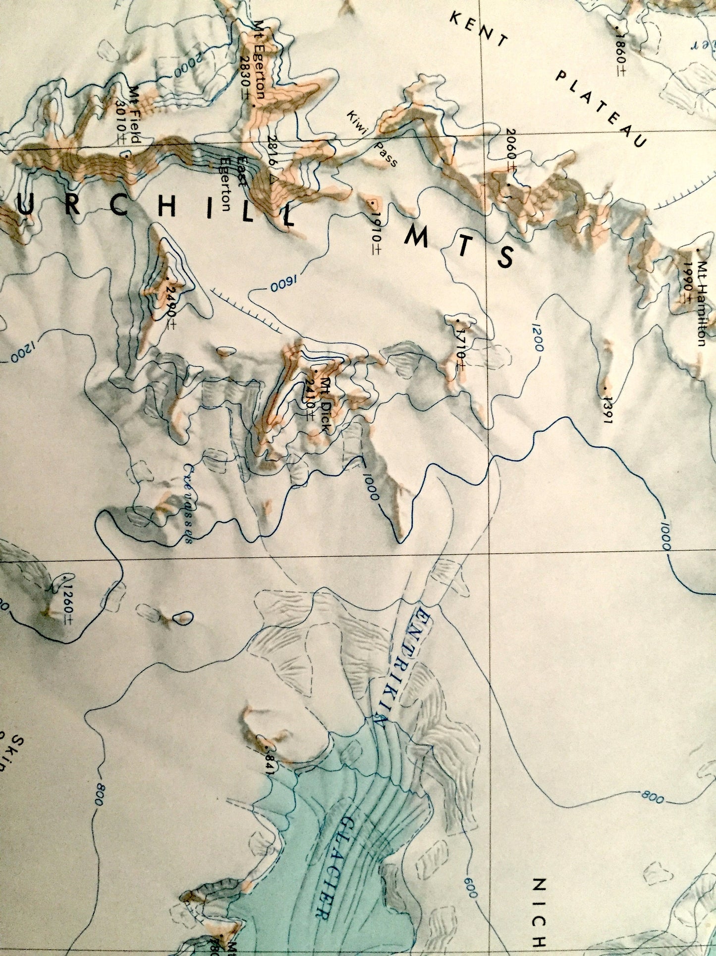
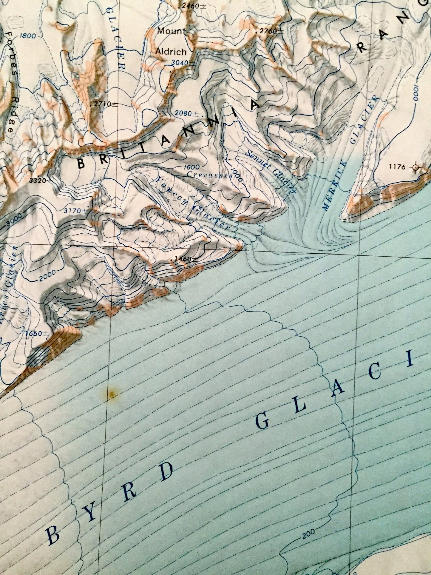
See what Antarctica looked like almost 60 years ago. Lots of intricate details and geological contours. The USGS cartographers were very thorough back then!
Perfect for the historian, map-lover, the curious or just as a conversation starter. Wonderful and rare. Vintage maps such as these make great gifts.
Edition of 1963, printed 1963
Dimensions: 30" width x 26" height
----
Features
Points of Interest: Ross Ice Shelf, Byrd Glacier, Barne Inlet, Britannia Range, Churchill Mountains, Kent Plateau, Nicholson Peninsula, Skinner Saddle, Darley Hills, Couzens Bay, Matterson Inlet, Merrick Glacier, Ragotzkie Glacier, Horney Bluff, Cape Selborne, Cape Kerr, Senia Point, Cape Goldschmidt, Penny Point, Cape Douglas, Mt. Dick, Mt. Durnford, Mt. Field, Mt. Egerton, Mt. Hamilton, Mt. Tuatara and many more mountains, glaciers, inlets, promontories, crevasses, névés, massifs and bays.
Condition: Good condition, commensurate with age. This map is in incredible shape for being almost 60 years old. Has some edge-wear, all of which will read as vintage character when framed.
----
We will happily adjust shipping price for multiple purchases. Maps are rolled up and shipped in sturdy mailing tubes, never folded.
Couldn't load pickup availability
Share