My Store
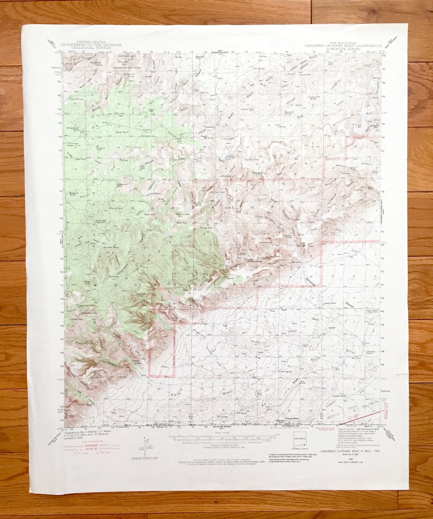
Antique Carlsbad Caverns, New Mexico 1940 US Geological Survey Topographic Map – National Park, Eddy County, Sitting Bull, Guadalupe, NM
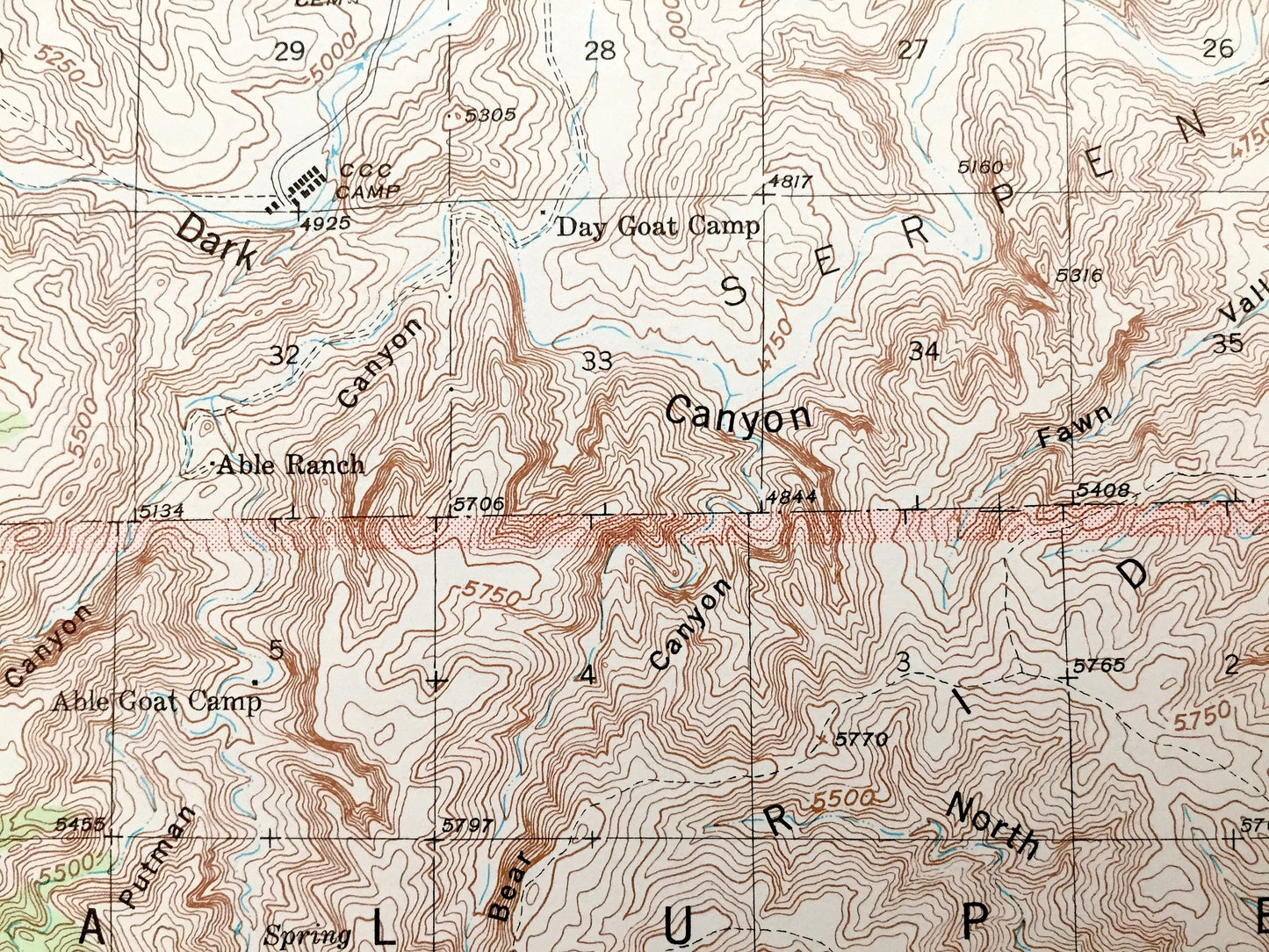
Antique Carlsbad Caverns, New Mexico 1940 US Geological Survey Topographic Map – National Park, Eddy County, Sitting Bull, Guadalupe, NM
Beautiful, antique map of Carlsbad Caverns, New Mexico and the surrounding Eddy County area, including The Guadalupe Mountains. This is an authentic 1894 edition, 1948 print from the U.S. Geological Survey and NOT a computer reproduction.
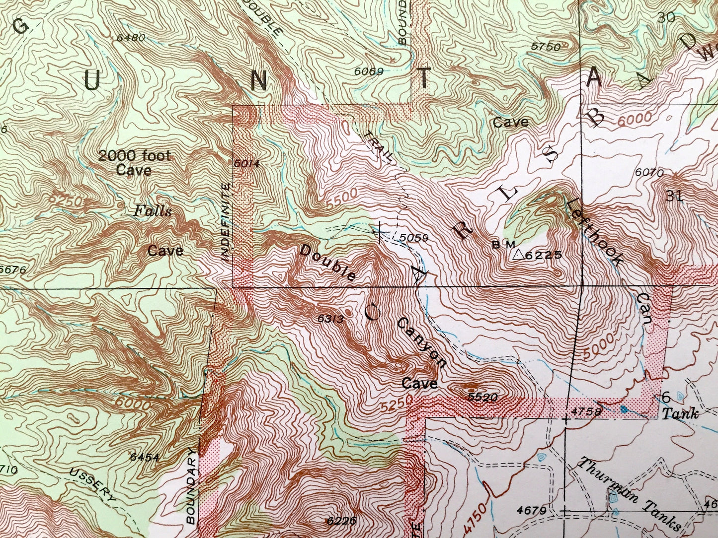
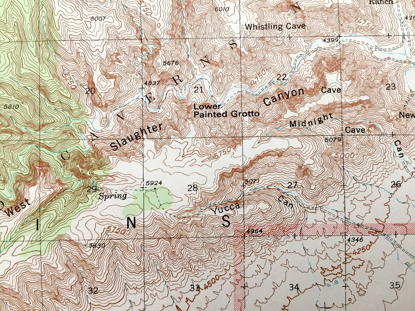
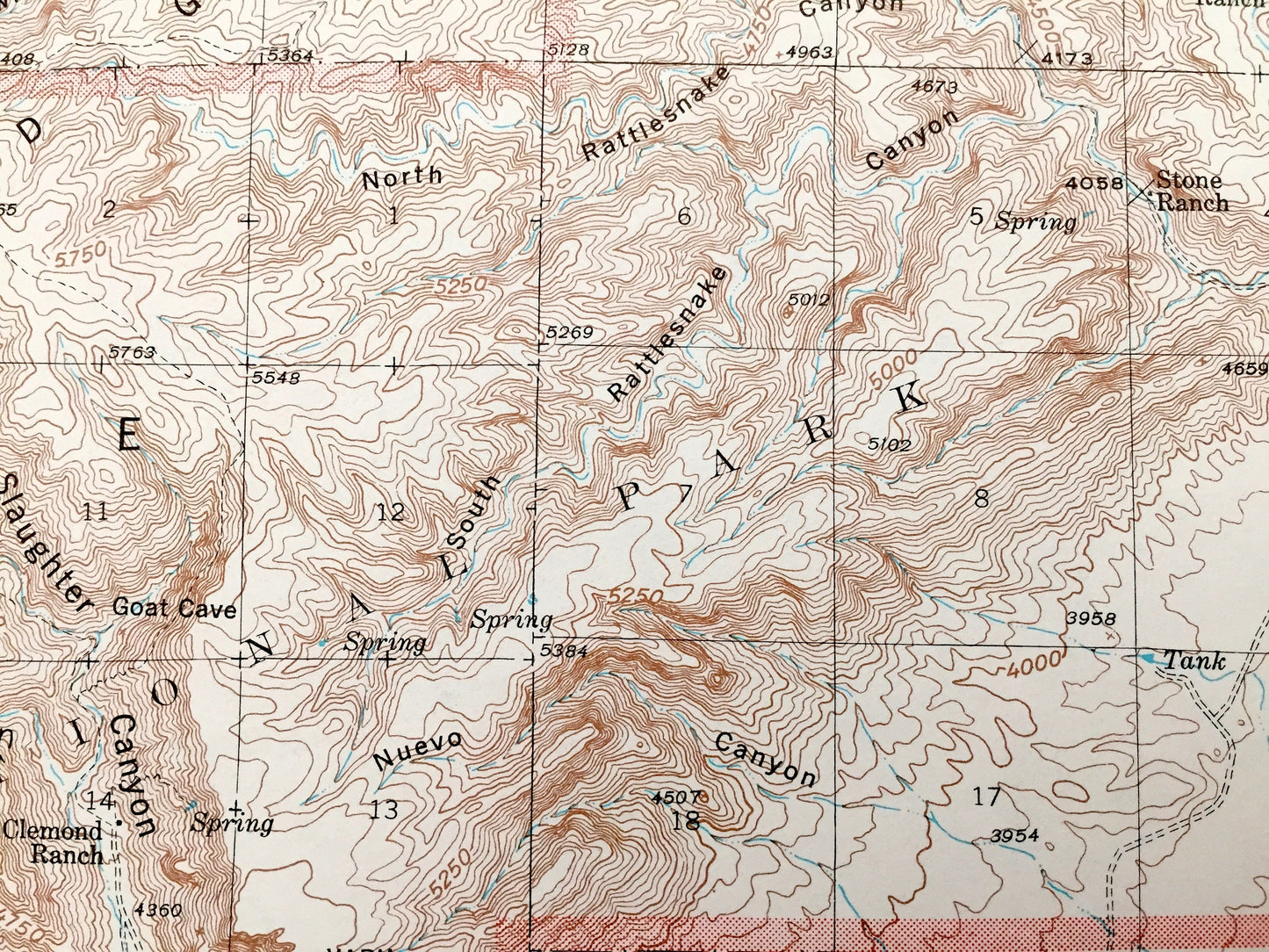
See what New Mexico looked like over 80 years ago. Lots of intricate details and geological contours. Map even has little squares for every house that existed at the time. The USGS cartographers were very thorough back then!
Perfect for the historian, map-lover, the curious or just as a conversation starter. Wonderful and rare. Vintage maps such as this make great gifts.
Edition of 1940, printed 1984
Dimensions: 18" width x 22" height
----
Features
Points of Interest: Eddy County, Guadalupe Mountains, Carlsbad Caverns National Park, Sitting Bull Recreational Area, Serpentine Bends, Black River, Slaughter Canyon, Lower Painted Grotto, New Cave, Ogle Cave, Goat Coave, 2000 Foot Cave, Hidden Cave, and many more mountains, valleys, mesas, canyons, train tracks, creeks, roads, train tracks and houses.
Condition: Good Vintage condition, commensurate with age. This map is in great shape for being over 35 years old. Has light edge-wear, but this will add to vintage character when framed.
----
We will happily adjust shipping price for multiple purchases. Maps are rolled up and shipped in sturdy mailing tubes, never folded.
Couldn't load pickup availability
Share