My Store
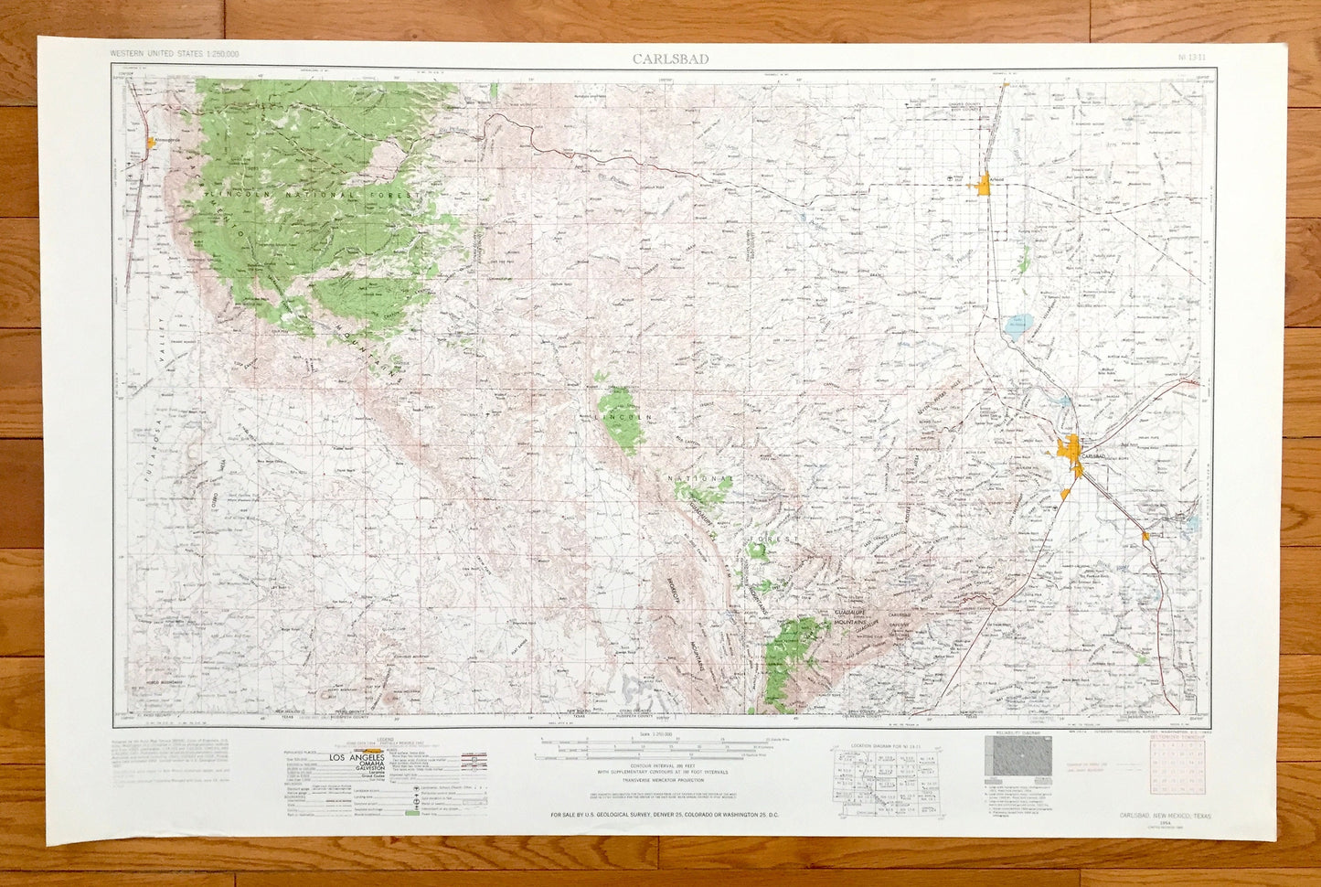
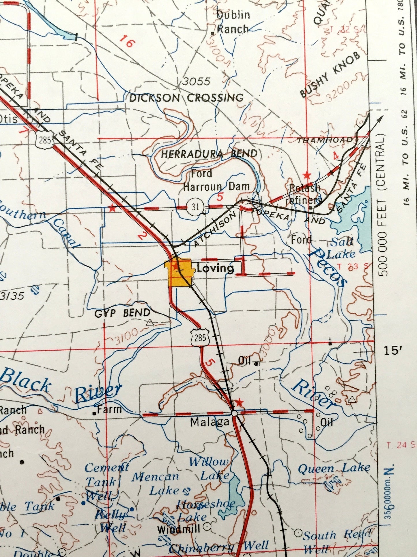
Antique Carlsbad, New Mexico 1954 US Geological Survey Topographic Map – Loving, Otis, Artesia, Lake Arthur, Hope, Alamogorde Pecos River NM
Antique Carlsbad, New Mexico 1954 US Geological Survey Topographic Map – Loving, Otis, Artesia, Lake Arthur, Hope, Alamogorde Pecos River NM
Beautiful, antique map of Carlsbad, New Mexico and surrounding Texas areas. This is an authentic 1954 edition, 1963 print from the U.S. Geological Survey and NOT a computer reproduction.
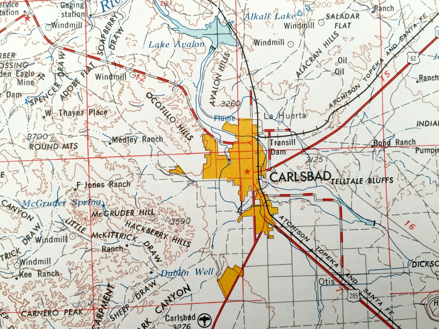
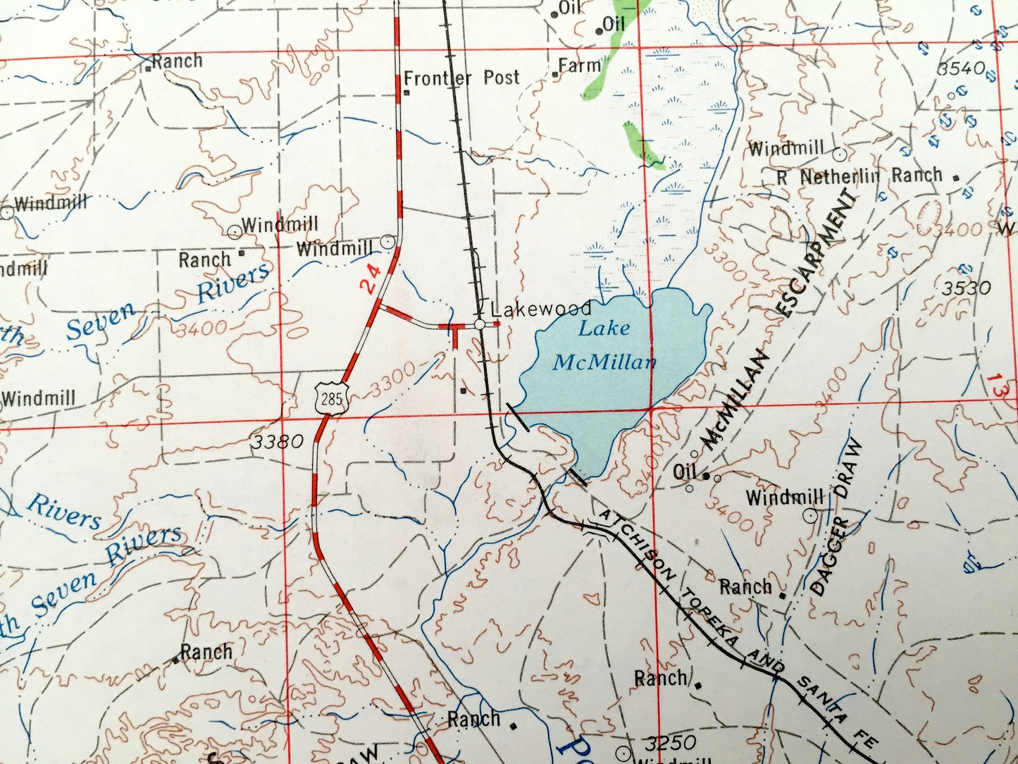
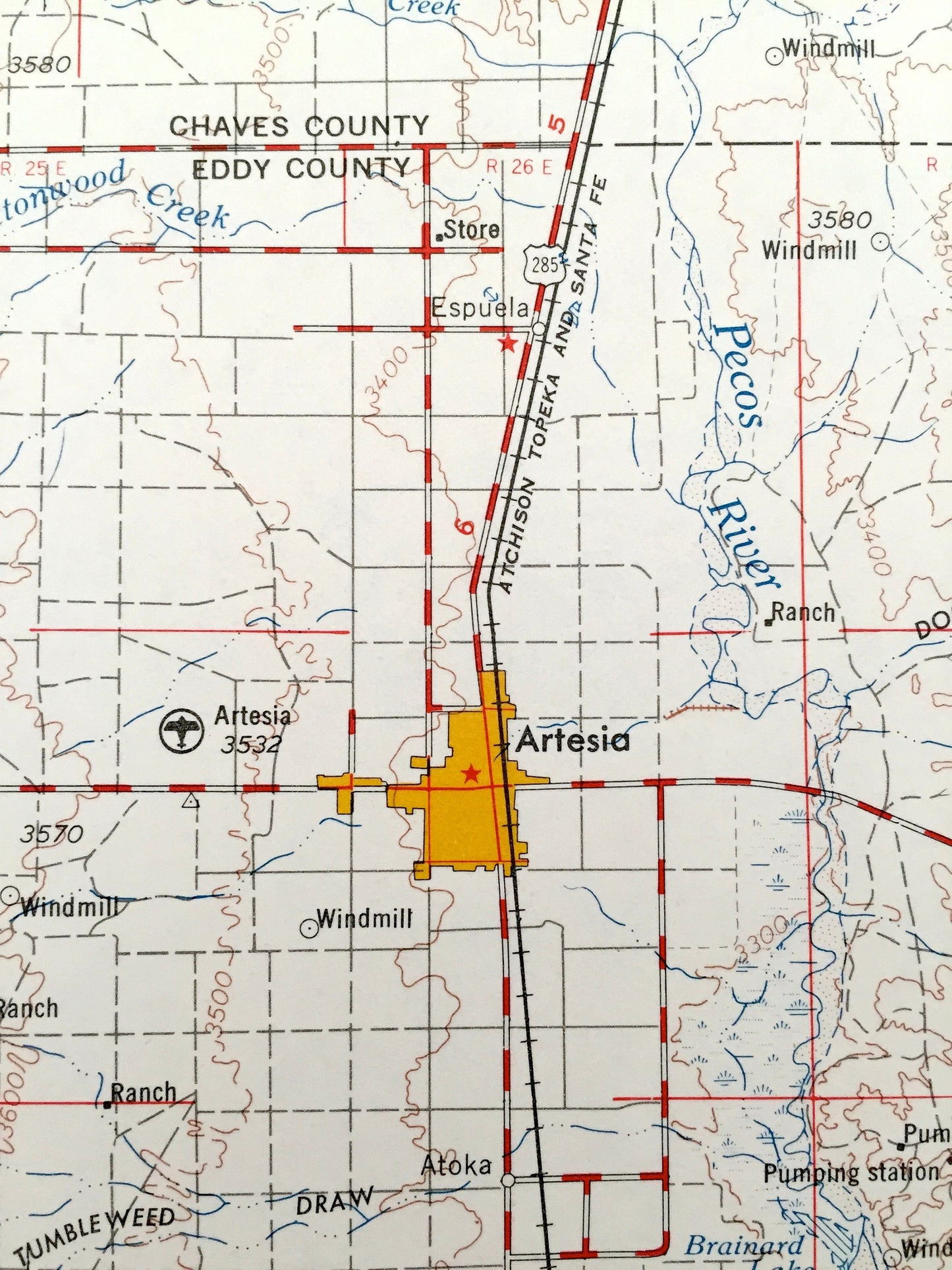
See what New Mexico and Texas looked like over 65 years ago. Lots of intricate details and geological contours. Map is incredibly large and in the grand 1:250,000 scale. The USGS cartographers were very thorough back then!
Perfect for the historian, map-lover, the curious or just as a conversation starter. Wonderful and rare. Vintage maps such as these make great gifts.
Edition of 1954, printed 1963
Dimensions: 32" width x 22 1/2" height
----
Features
Cities & Towns: Carlsbad, Loving, Otis, Artesia, Lake Arthur, Hope, Alamogorde.
Points of Interest: NEW MEXICO - Tularosa Valley, Lincoln National Forest, Sacramento Mountains, Brokeoff Mountains, Guadalupe Mountain, Seven Rivers Hills, Azotea Mesa, Dark Canyon, Black river, Pecos River, Carlsbad Caverns National Park, Lake McMillan, Alkali Lake and lots more hills, mountains, rivers, lakes, creeks, roads, highways and railroads.
TEXAS - El Paso County, Hudspeth County and Culberson County.
Condition: Very Good Vintage condition, commensurate with age. This map is in incredible shape for being over 55 years old. Has light edge-wear, but this will read as vintage character when framed.
----
We will happily adjust shipping price for multiple purchases. Maps are rolled up and shipped in sturdy mailing tubes, never folded.
Couldn't load pickup availability
Share