My Store
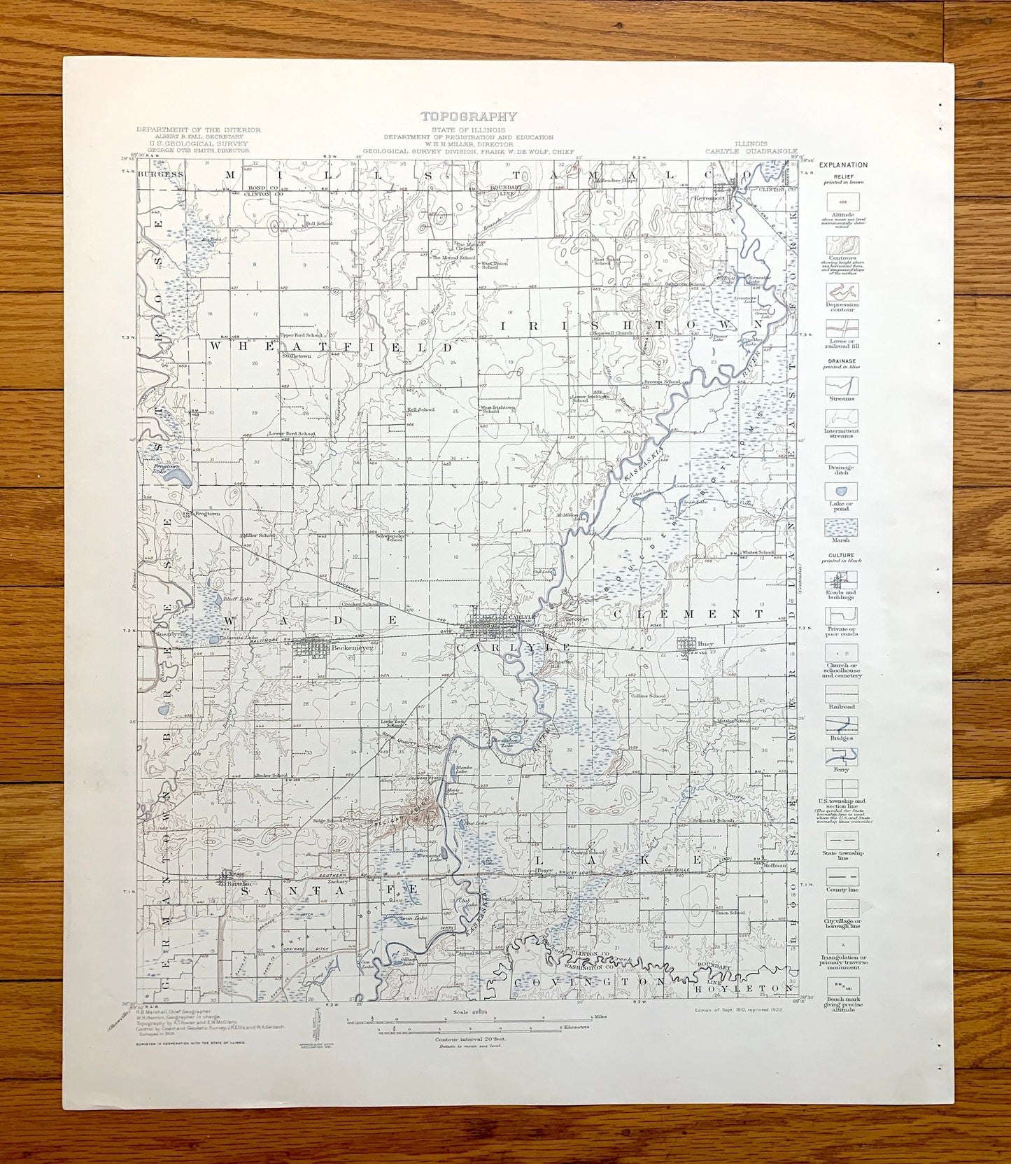
Antique Carlyle, Illinois 1910 US Geological Survey Topographic Map – Kaskaskia River, Lake, Wade, Huey, Washington, Clinton, Bond County IL
Antique Carlyle, Illinois 1910 US Geological Survey Topographic Map – Kaskaskia River, Lake, Wade, Huey, Washington, Clinton, Bond County IL
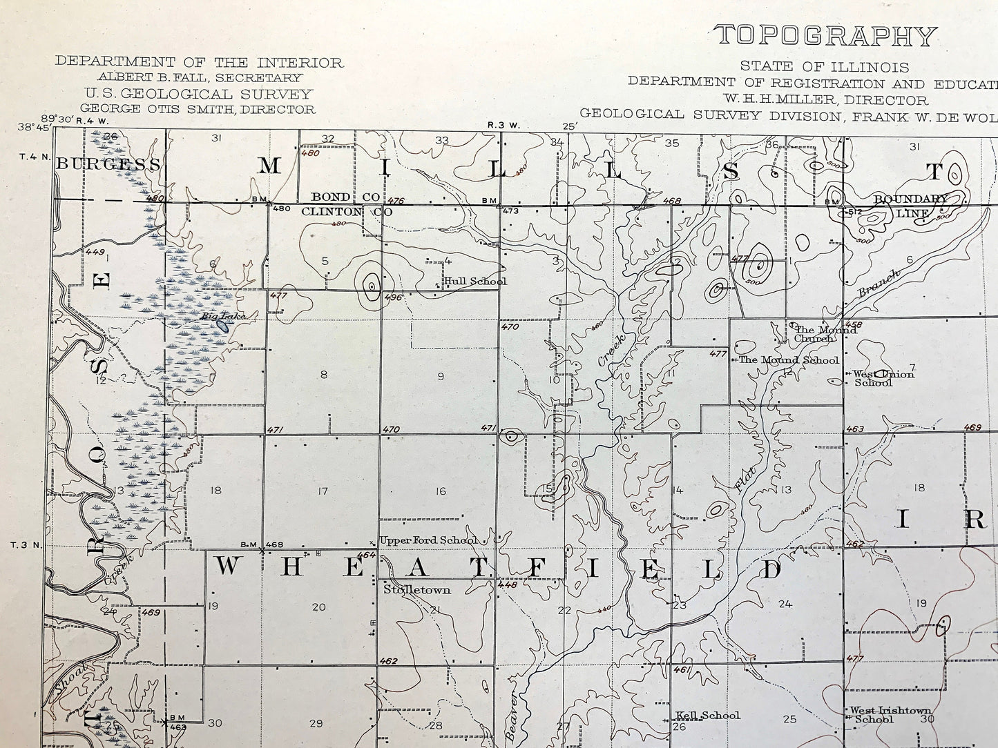
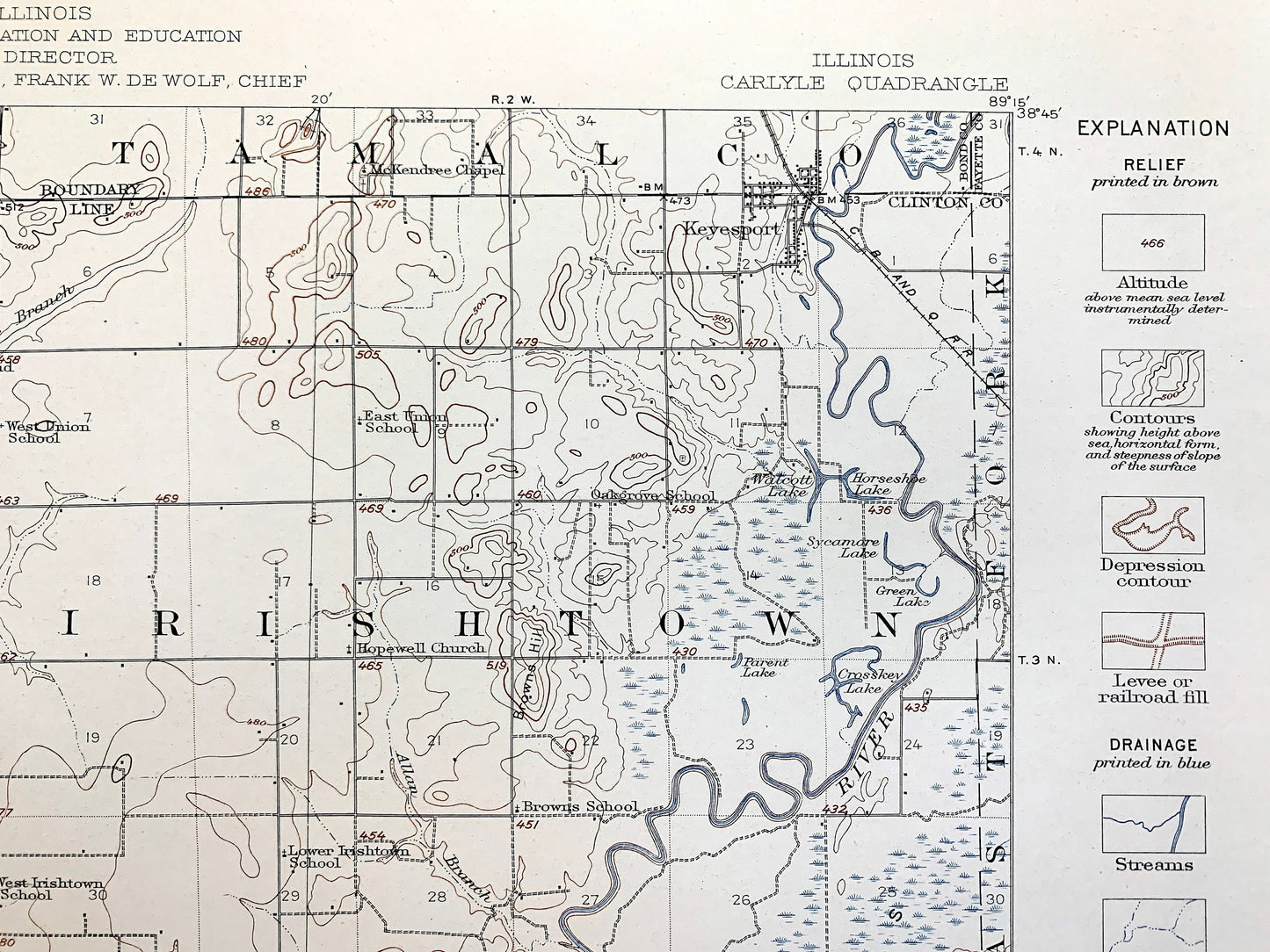
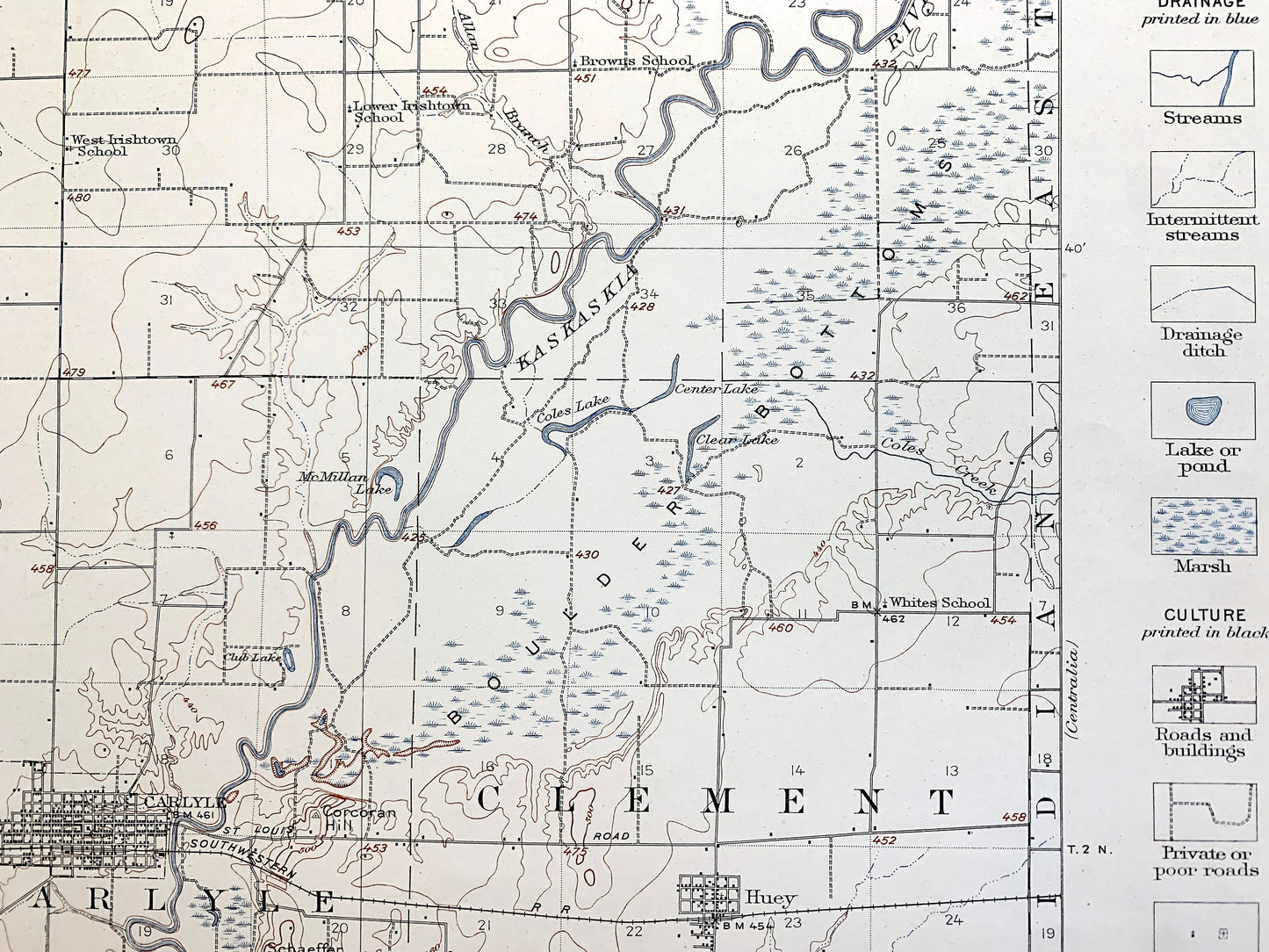
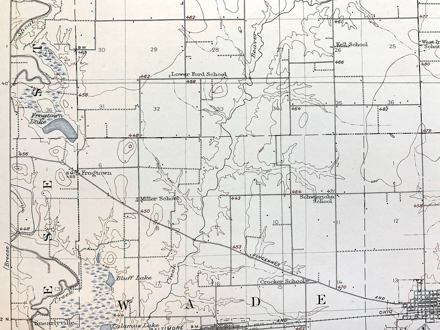
Beautiful, antique map of Carlyle, Illinois and surrounding Washington, Clinton & Bond County areas. This map shows the site of the current Carlyle Lake, the largest man-made lake in Illinois, and the largest lake wholly contained within the state, which was completed in 1967 by damming the Kaskaskia River (as seen on the map). This is an authentic 1910 edition, 1922 print from the U.S. Geological Survey and is NOT a computer reproduction. It is from a Geologic Atlas folio.
See what Illinois looked like over 110 years ago. Lots of intricate details and geological contours. Map even has little squares for every house that existed at the time. The USGS cartographers were very thorough back then! This is one of the rare maps where the topographic symbols and map guide are on the front.
Perfect for the historian, map-lover, the curious or just as a conversation starter. Wonderful and rare. Vintage maps such as these make great gifts.
Edition of 1910, printed 1922
Dimensions: 18 1/2" width x 22" height
----
Features
Cities & Towns: Carlyle, Germantown, Beckenmeyer, Wade, Burgess, Keyesport, Huey, Bartelso, Hoffman, Covington, Hoyleton, Santa Fe, Lake, Brese, St. Rose, Wheatfield, Irishtown, Tamalco, Clement, Brookside, Meridian, East Fork, and many more.
Points of Interest: Washington County, Clinton County, Bond County, Kaskaskia River, Future site of Carlyle Lake, Crooked Creek, Boulder Bottoms, and lots more hills, mountains, rivers, lakes, creeks, roads, highways and railroads.
Condition: Very Good Vintage condition, commensurate with age. This map is in great shape for being over 100 years old. Has some edge-wear and staple holes in the margin, but this will add to the real vintage character when framed.
----
We will happily adjust shipping price for multiple purchases. Maps are rolled up and shipped in sturdy mailing tubes, never folded.
Couldn't load pickup availability
Share