My Store
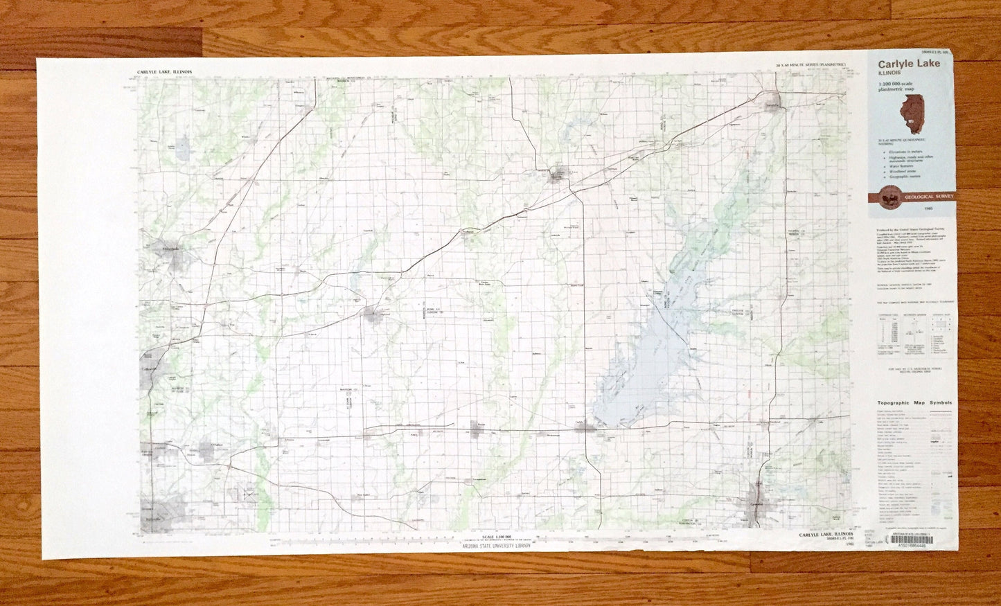
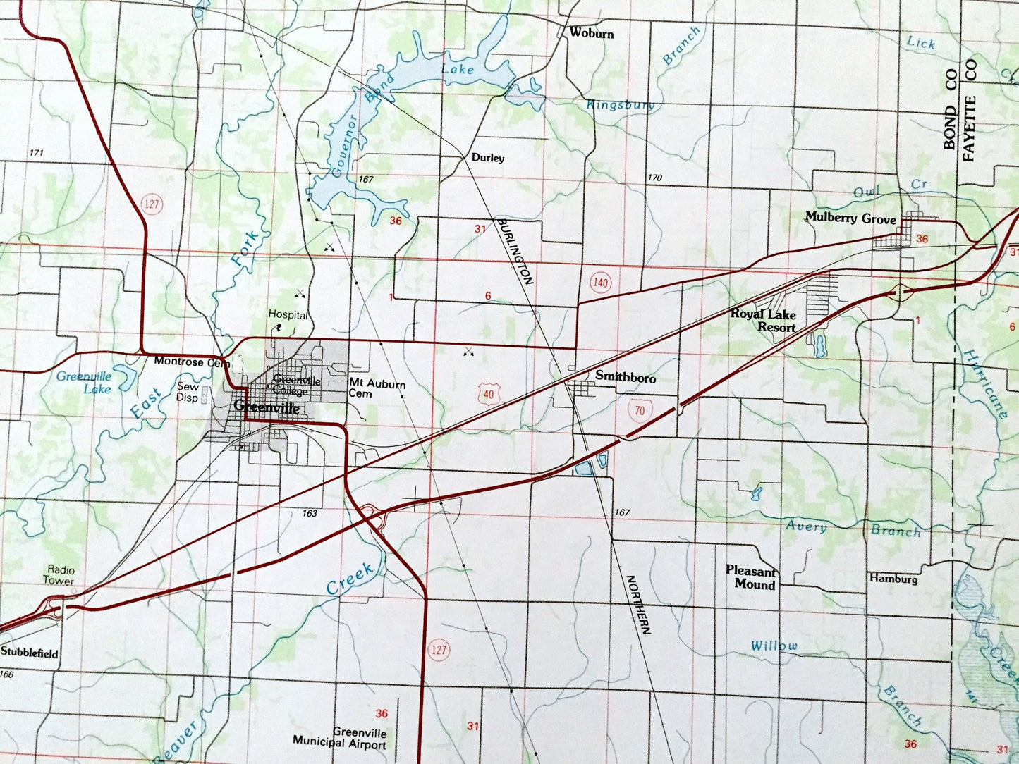
Antique Carlyle Lake, Illinois 1985 US Geological Survey Topographic Map – Madison, St Clair, Clinton, Bond, Fayette, Marion County, IL
Antique Carlyle Lake, Illinois 1985 US Geological Survey Topographic Map – Madison, St Clair, Clinton, Bond, Fayette, Marion County, IL
Beautiful, antique map of Carlyle Lake, Illinois and surrounding Madison, St Clair, Clinton, Bond, Fayette & Marion County areas. This is an authentic 1985 print from the U.S. Geological Survey and is NOT a computer reproduction.
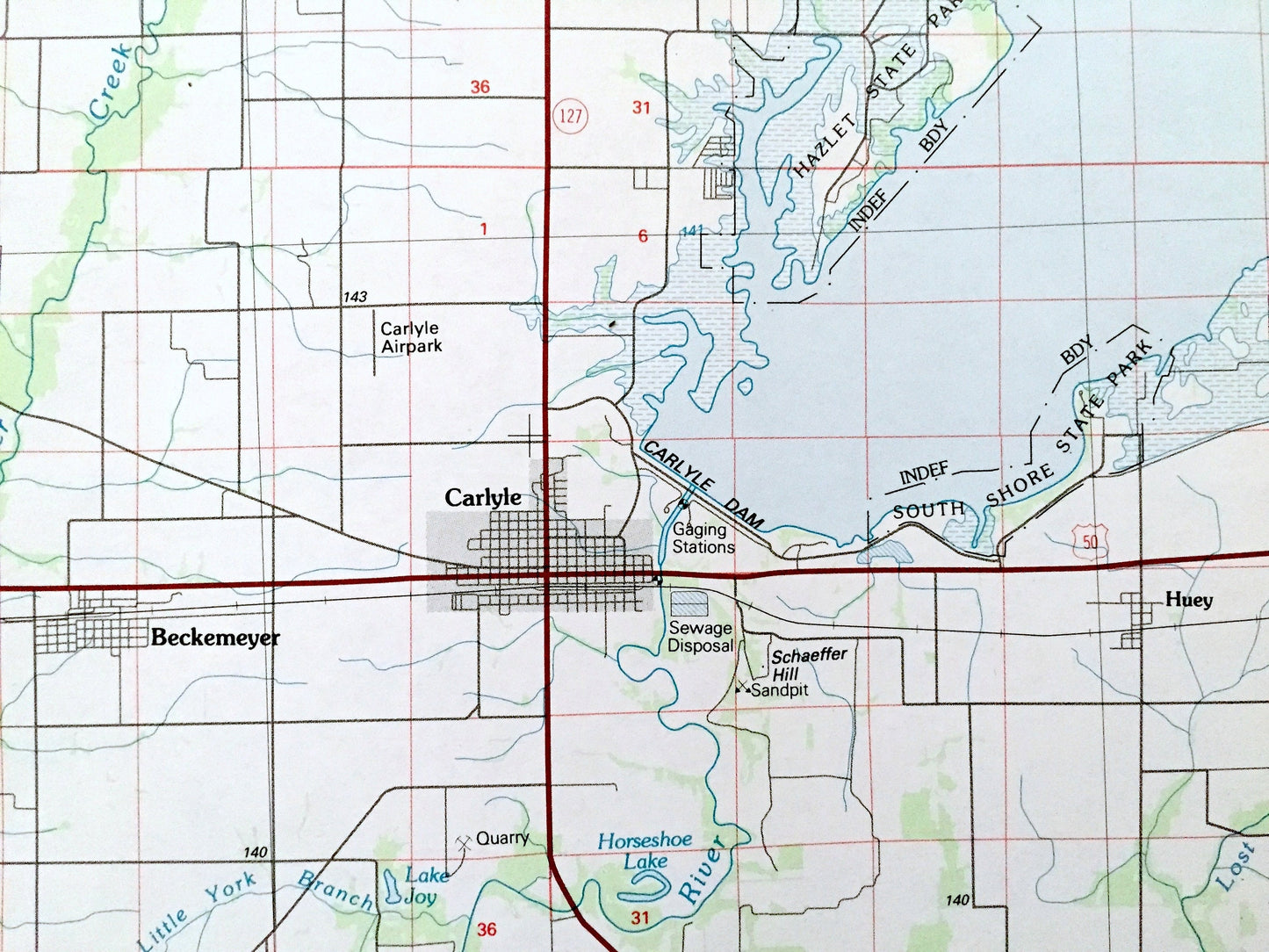
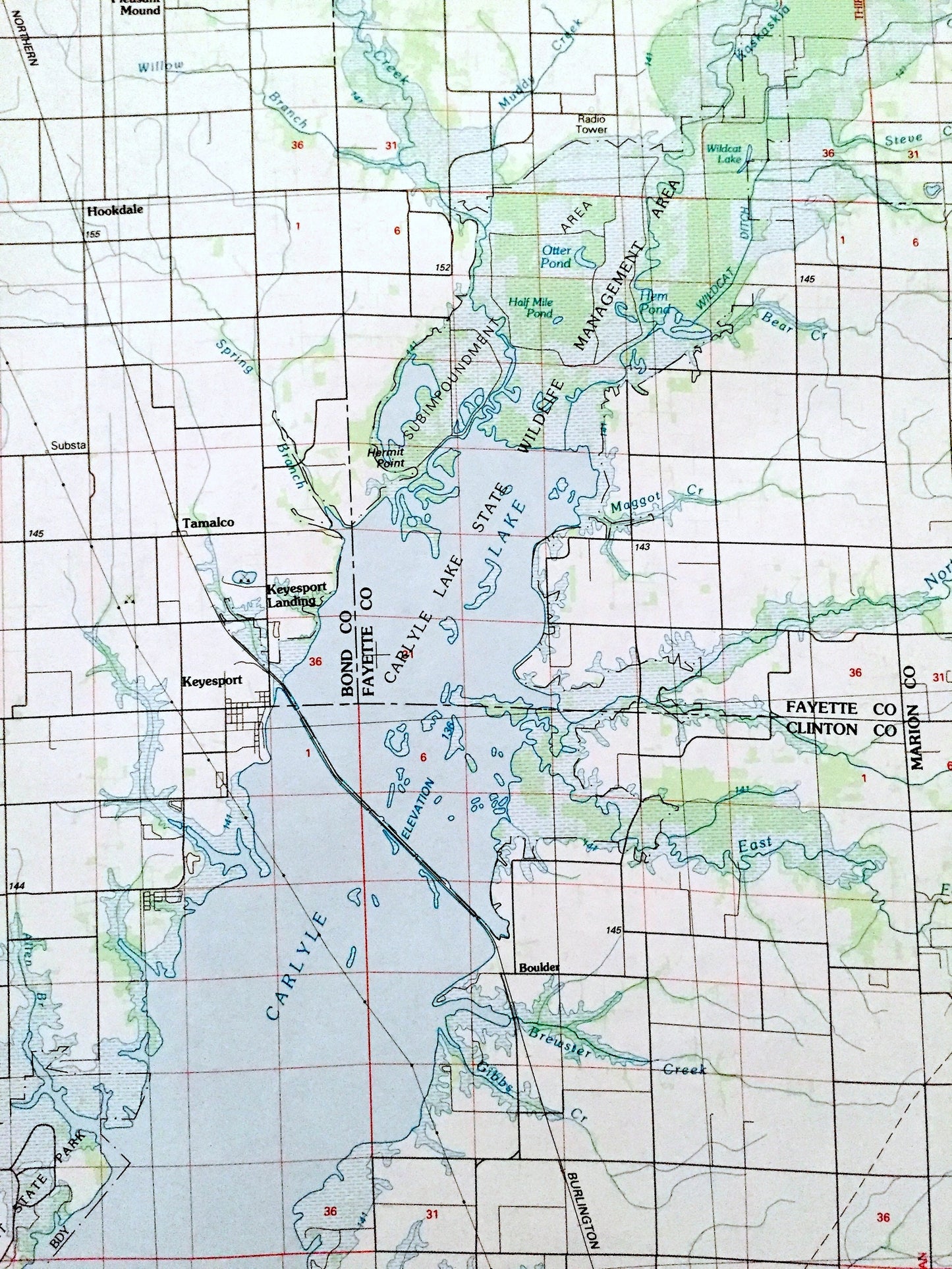
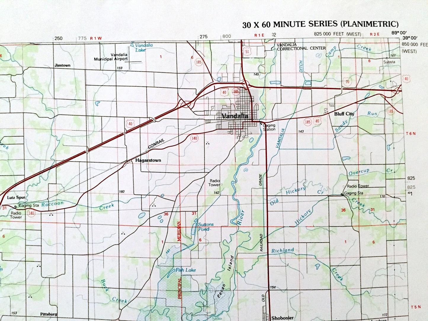
See what Illinois looked like over 35 years ago. Lots of intricate details and geological contours. Map is large and in the grand 1:100,000 scale. Has detailed renderings of all roads and streets. The USGS cartographers were very thorough back then!
Perfect for the historian, map-lover, the curious or just as a conversation starter. Wonderful and rare. Vintage maps such as these make great gifts.
Edition of 1985, printed 1985
Dimensions: 44" width x 24" height
----
Features
Cities & Towns: Carlyle Lake, Edwardsville, Worden, Holiday Shores, Livingston, Collinsville, O'Fallon, Fairview Heights, Swansea, Belleville, Highland, Breese, St Jacob, Marine, Lebanon, Summerfield, Trenton, Aviston, New Baden, Albers, Beckemeyer, Germantown, Carlyle, Alhambra, New Douglas, Greenville, Centralia, Vandalia, Royal Lake Resort, Vernon, Sandoval, Keyesport, Smithboro, Mulberry Grove, Pocahontas, and many more.
Points of Interest: Madison County, St Clair County, Clinton County, Bond County, Fayette County, Marion County, Carlyle Lake, Carlyle Lake State Wildlife Management Area, Hazlet State Park, South Shore State Park, Carlyle Dam, Centralia Reservoir, Highland Silver Lake, Governor Bend Lake, Holiday Lake, Scott Air Force Base, and lots more hills, mountains, rivers, lakes, creeks, roads, highways and railroads.
Condition: Good Vintage condition, commensurate with age. This map is in great shape for being over 35 years old. Has some edge-wear, mostly along bottom, and ex-libris markings in margin, all of which will read as vintage character when framed.
----
We will happily adjust shipping price for multiple purchases. Maps are rolled up and shipped in sturdy mailing tubes, never folded.
Couldn't load pickup availability
Share