My Store
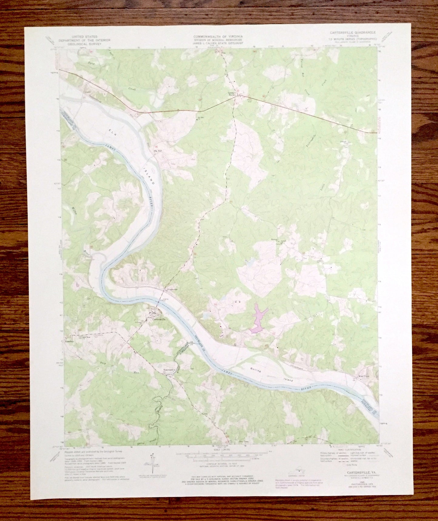
Antique Cartersville, Virginia 1969 US Geological Survey Topographic Map – Goochland, Cumberland County, Elk Island, James River, Fife VA
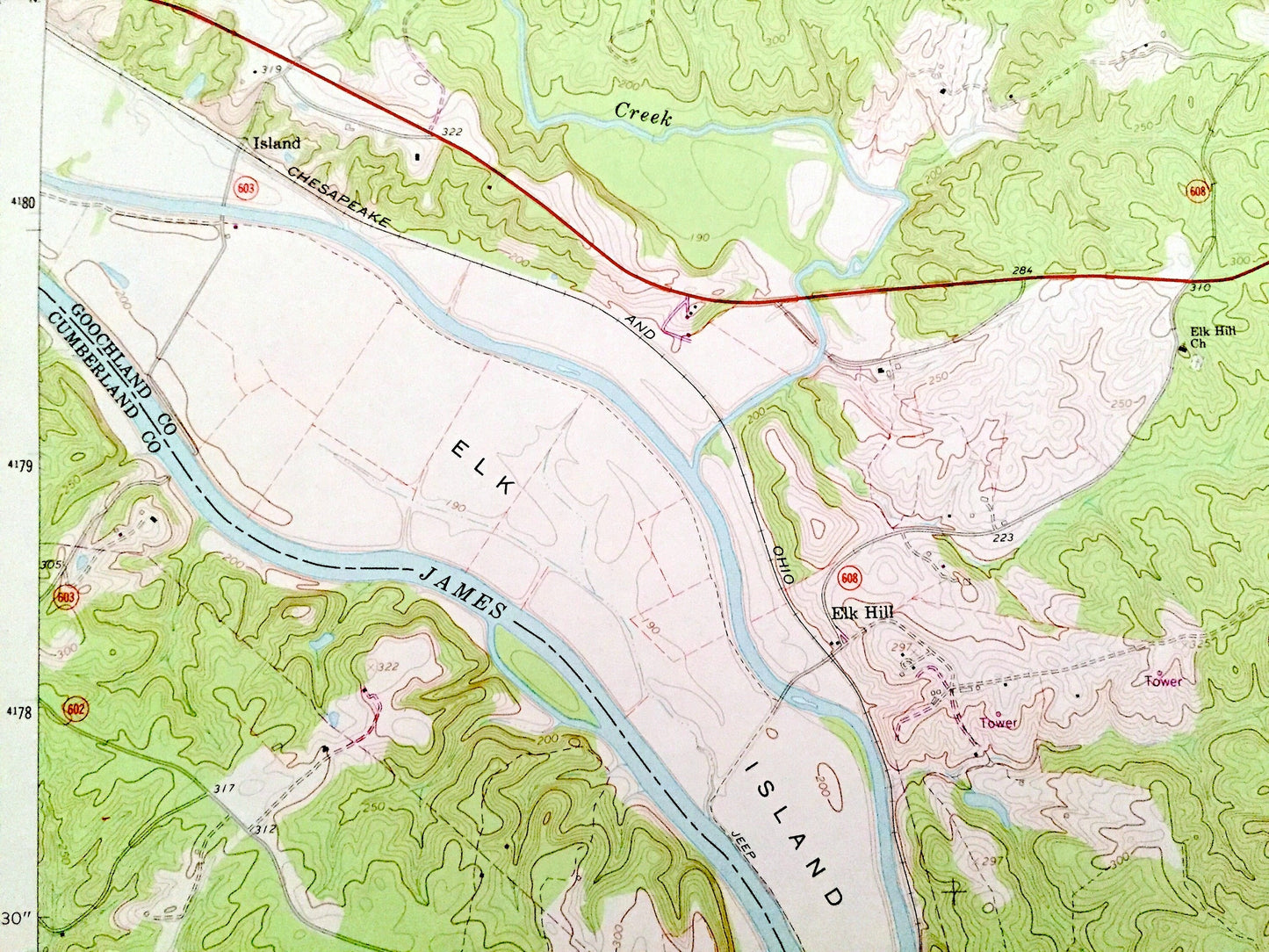
Antique Cartersville, Virginia 1969 US Geological Survey Topographic Map – Goochland, Cumberland County, Elk Island, James River, Fife VA
Beautiful, antique map of Cartersville, Virginia and surrounding Goochland County & Cumberland County area. This is an authentic 1969 edition, 1976 print from the U.S. Geological Survey and NOT a computer reproduction.
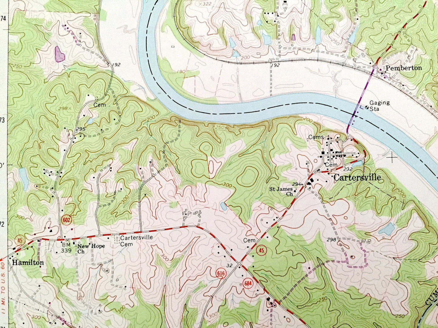
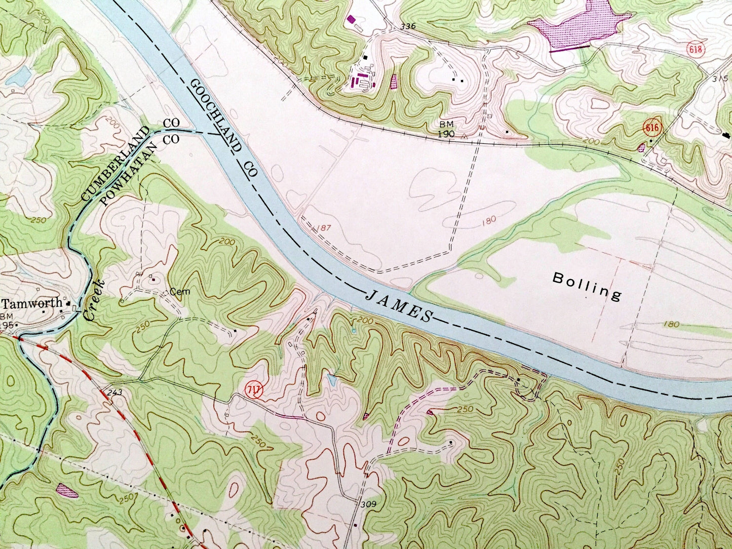
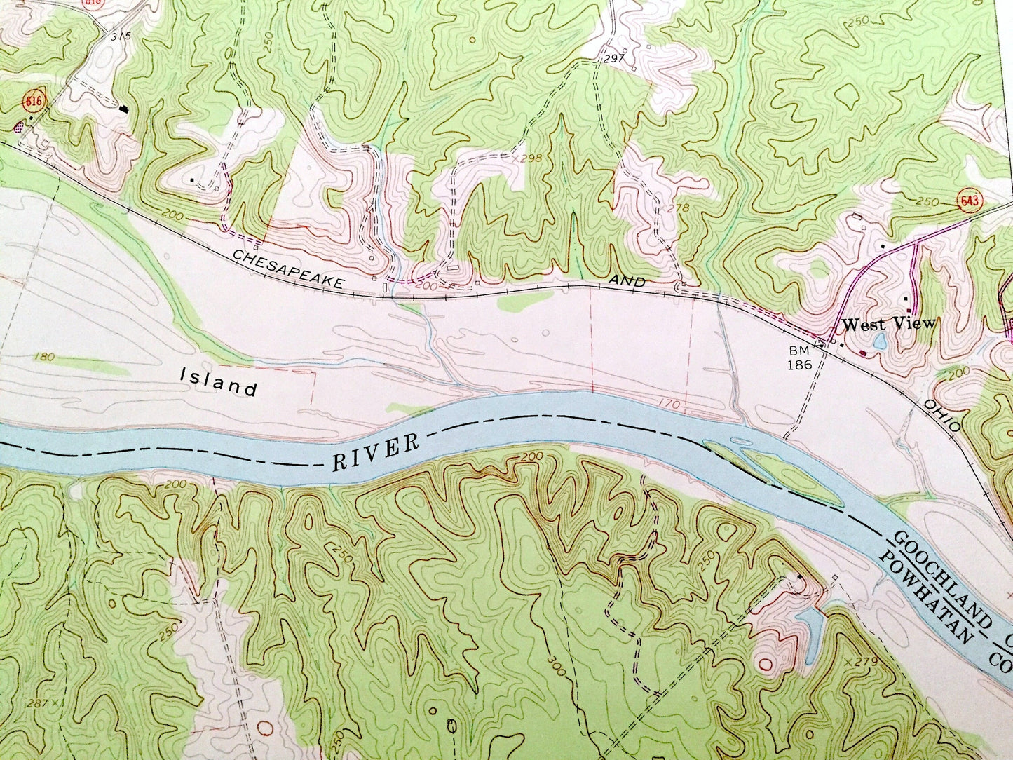
See what Virginia looked like over 50 years ago. Lots of intricate details and geological contours. Map even has little squares for every house that existed at the time. The USGS cartographers were very thorough back then!
Perfect for the historian, map-lover, the curious or just as a conversation starter. Wonderful and rare. Vintage maps such as these make great gifts.
Edition of 1969, printed 1976
Dimensions: 22" width x 27" height
----
Features
Cities & Towns: Cartersville, Fife, Georges Tavern, Island, Elk Hill, Pemberton, Hamilton, Tamworth, West View, Pine Tree.
Points of Interest: Goochland County, Cumberland County, James River, Elk Island, Bolling Island, Lickinghole Creek, Deep Run, Muddy Creek, Byrd Creek, Willis River, Picketts Creek Reservoir, Queensmere Lake, Ampthill Farm and many more hills, streams, ponds, houses, schools, churches and roads.
Condition: Good Vintage condition, commensurate with age. This map is in great shape for being over 45 years old. Has light wear but this will add to vintage character when framed.
----
We will happily adjust shipping price for multiple purchases. Maps are rolled up and shipped in sturdy mailing tubes, never folded.
Couldn't load pickup availability
Share