My Store
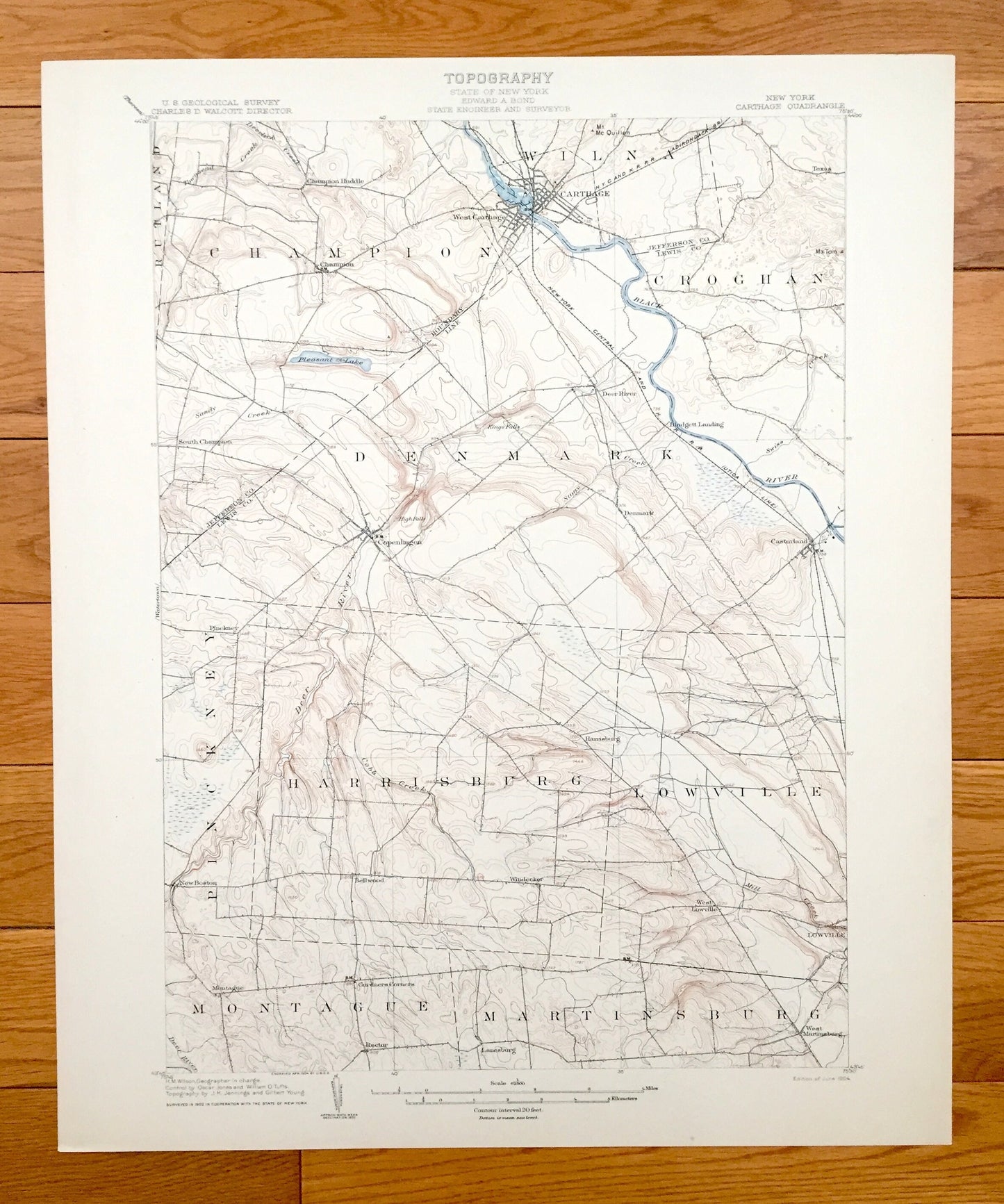
Antique Carthage, New York 1904 US Geological Survey Topographic Map – Jefferson, Lewis County, Champion, Denmark, Montague, Castorland, NY
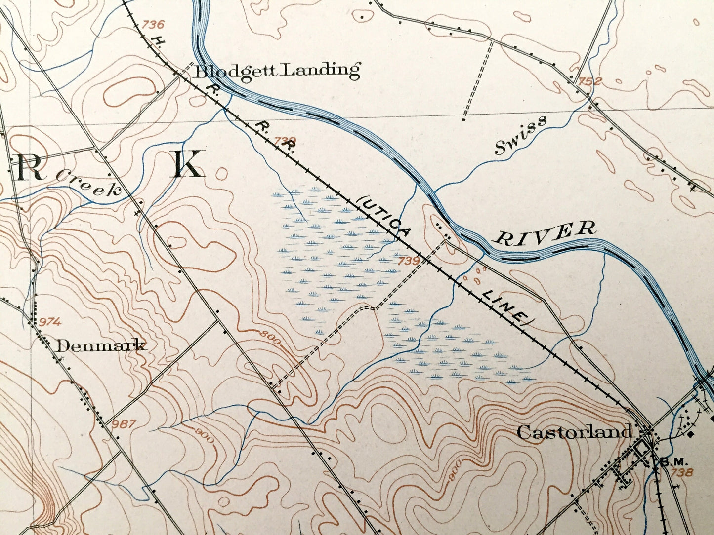
Antique Carthage, New York 1904 US Geological Survey Topographic Map – Jefferson, Lewis County, Champion, Denmark, Montague, Castorland, NY
Beautiful, antique map of Carthage, New York and surrounding Jefferson & Lewis area. This is an authentic 1904 print from the U.S. Geological Survey and NOT a computer reproduction.
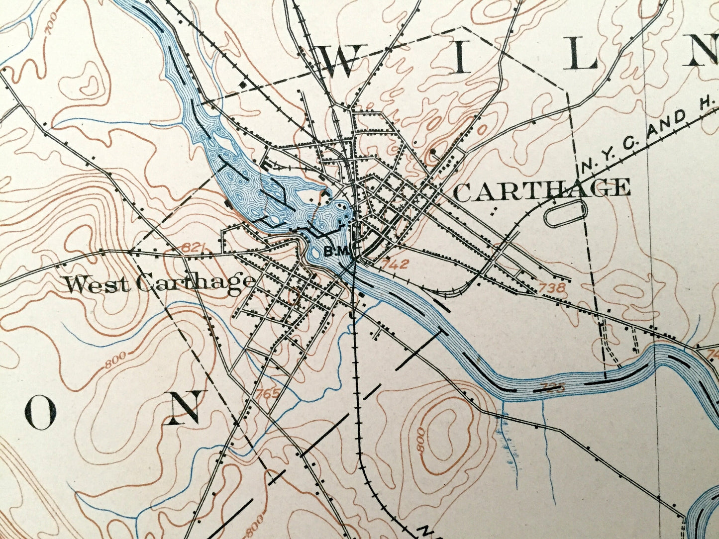
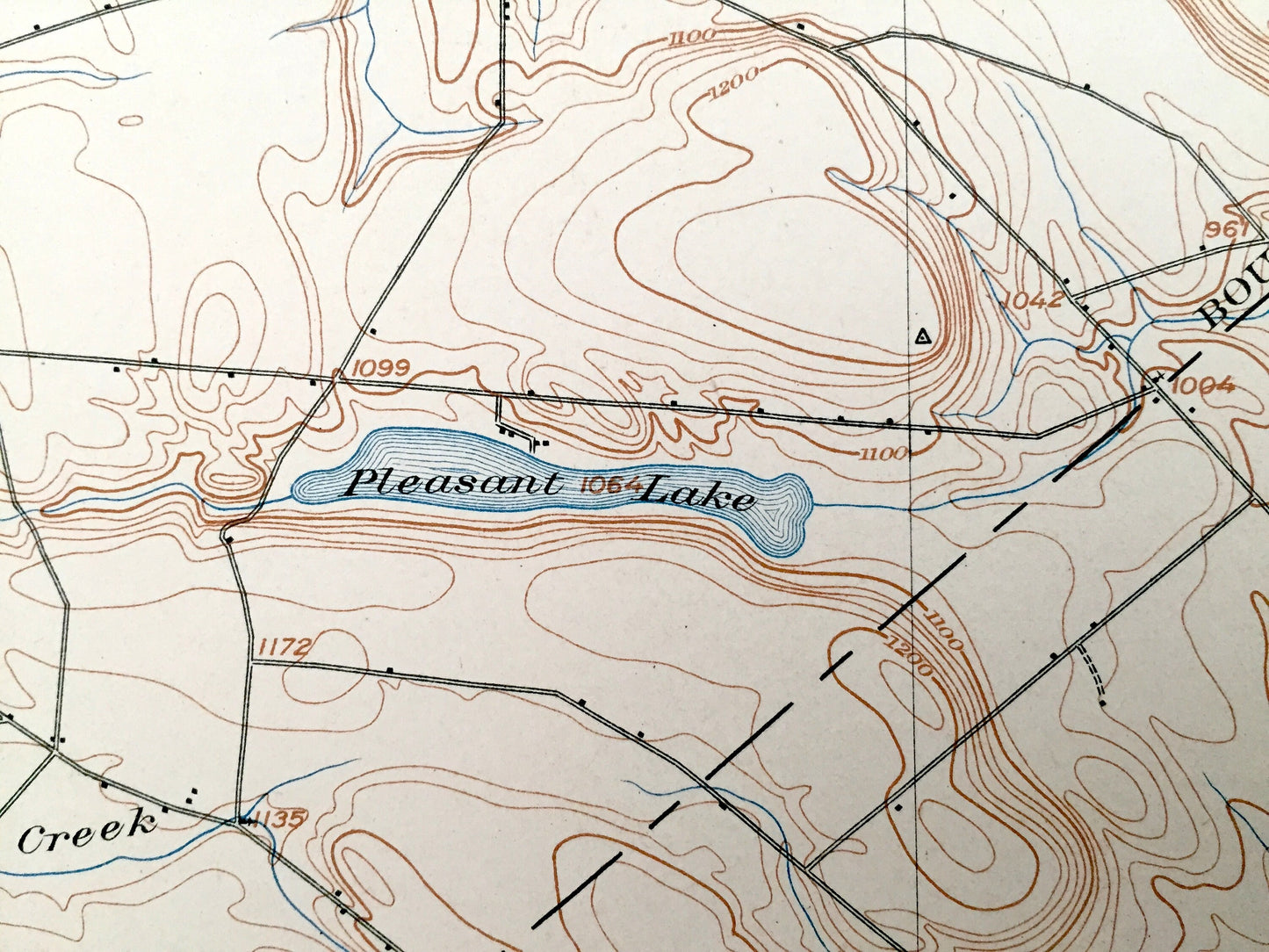
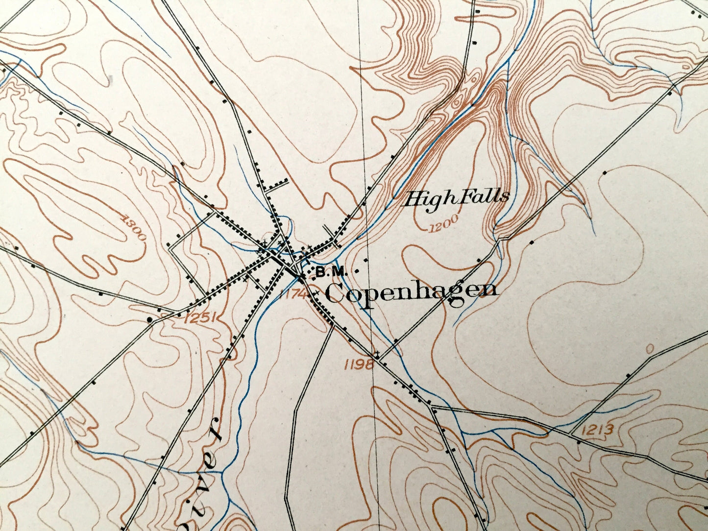
See what New York looked like over 115 years ago. Lots of intricate details and geological contours. Map even has little squares for every house that existed at the time. The USGS cartographers were very thorough back then! On the back is a description of topographic symbols and map guide.
Perfect for the historian, map-lover, the curious or just as a conversation starter. Wonderful and rare. Vintage maps such as these make great gifts.
Edition of 1904, printed 1904
Dimensions: 16 1/2" width x 20" height
----
Features
Cities & Towns: Carthage, Rutland, Champion, Croghan, Denmark, Pinckney, Harrisburg, Lowville, Montague, Martinsburg, Champion Huddle, West Carthage, Deer River, Texas, Castorland, Copenhagen, Bellwood, Rector, New Boston, Windecker, Lanesburg.
Points of Interest: Jefferson County, Lewis County, Black River, Deer River, Mill Creek, Mt McQuillen, Pleasant Lake, High Falls, Cobb Creek, and many more towns, ponds, hills, mountains, hollows, creeks, houses, and roads.
Condition: Very Good Vintage condition, commensurate with age. This map is in great shape for being over 115 years old. An exceedingly well-preserved print.
----
We will happily adjust shipping price for multiple purchases. Maps are rolled up and shipped in sturdy mailing tubes, never folded.
Couldn't load pickup availability
Share