My Store
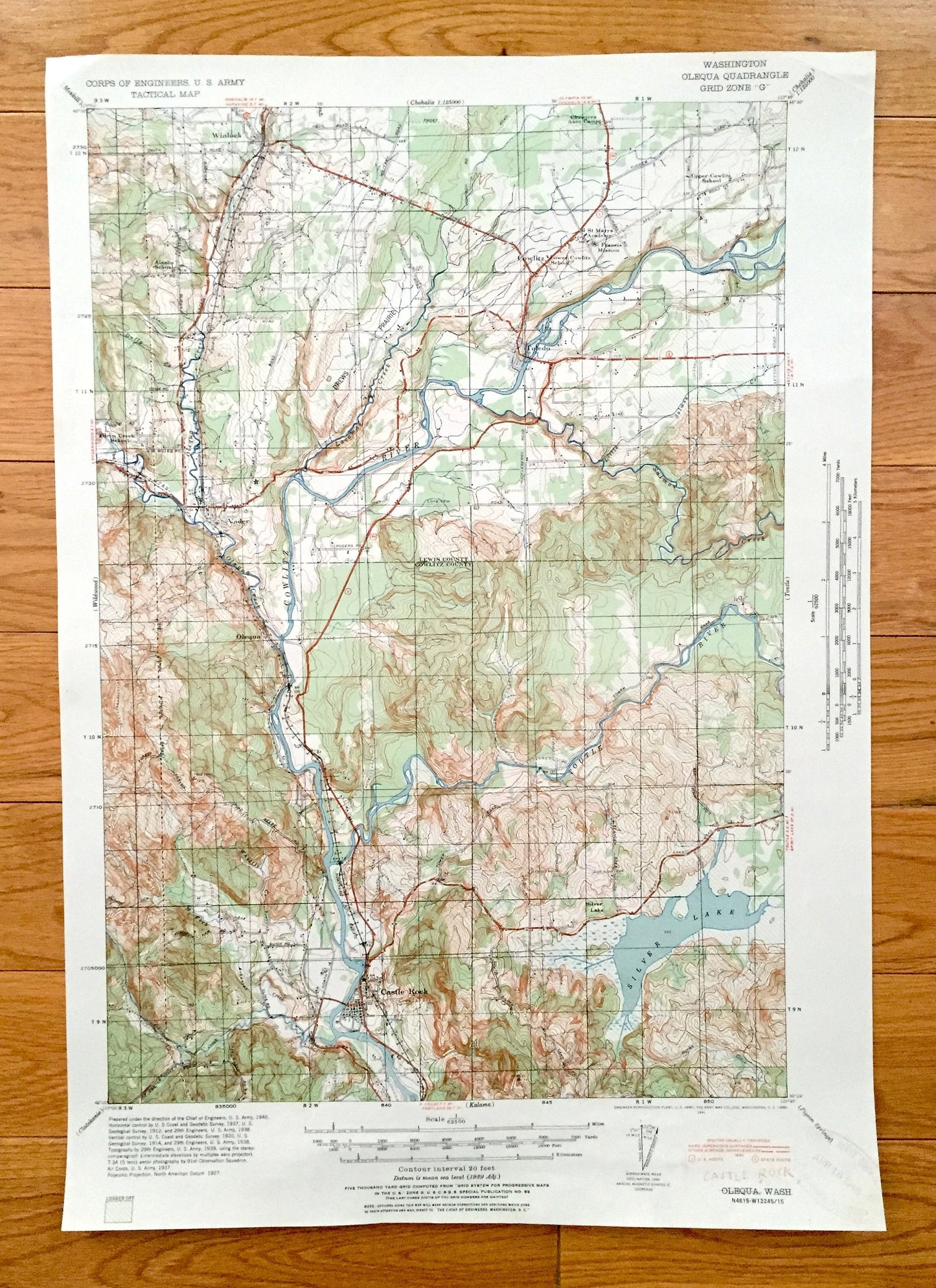
Antique Castle Rock, Washington 19341 US Geological Survey Topographic Map – Cowlitz, Lewis County, Vader, Olequa, Toledo, Winlock Toutle WA
Antique Castle Rock, Washington 19341 US Geological Survey Topographic Map – Cowlitz, Lewis County, Vader, Olequa, Toledo, Winlock Toutle WA
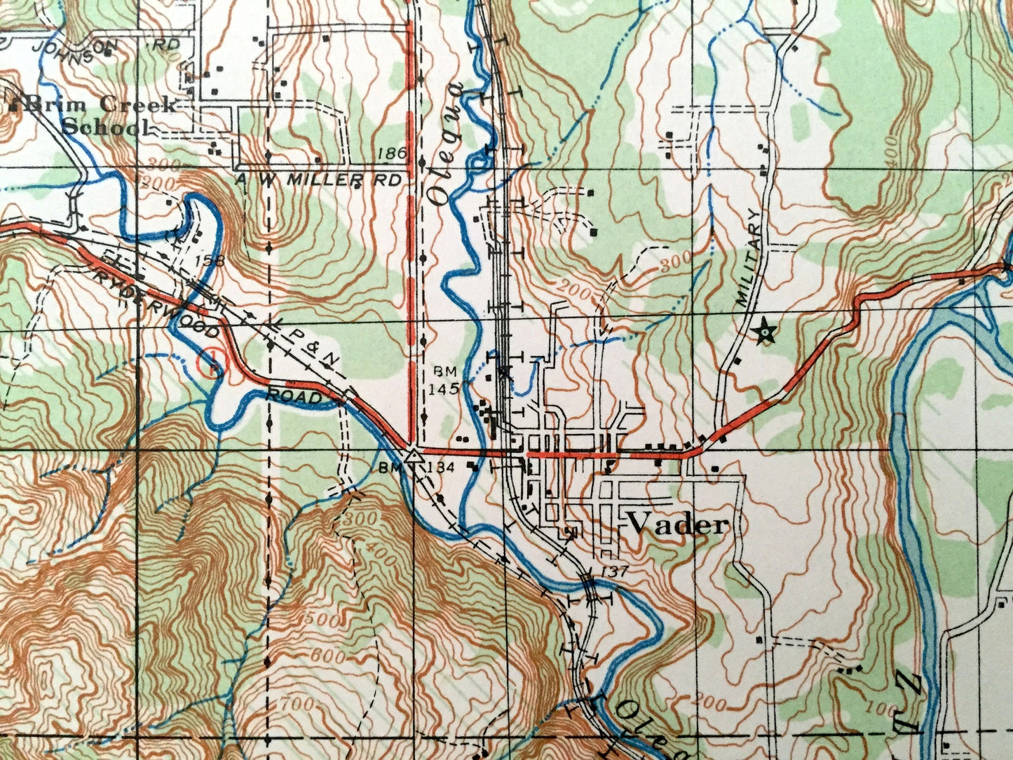
Beautiful, antique map of Castle Rock, Washington and surrounding Lewis & Cowlitz County. This is an authentic 1941 print from the U.S. Army Corps of Engineers and NOT a computer reproduction.
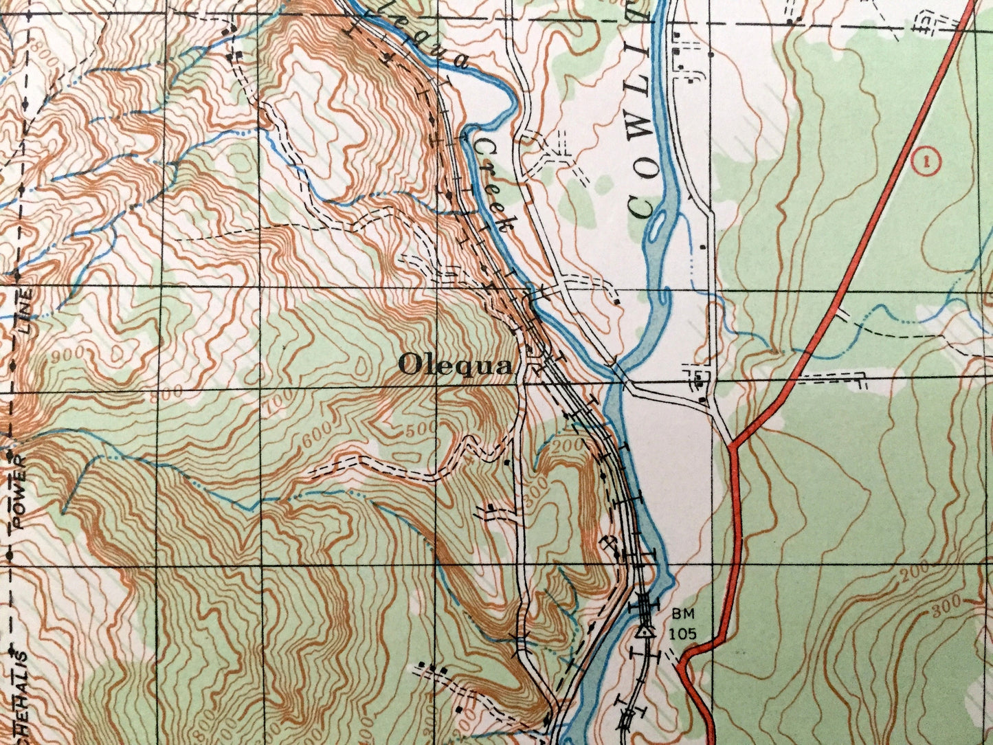
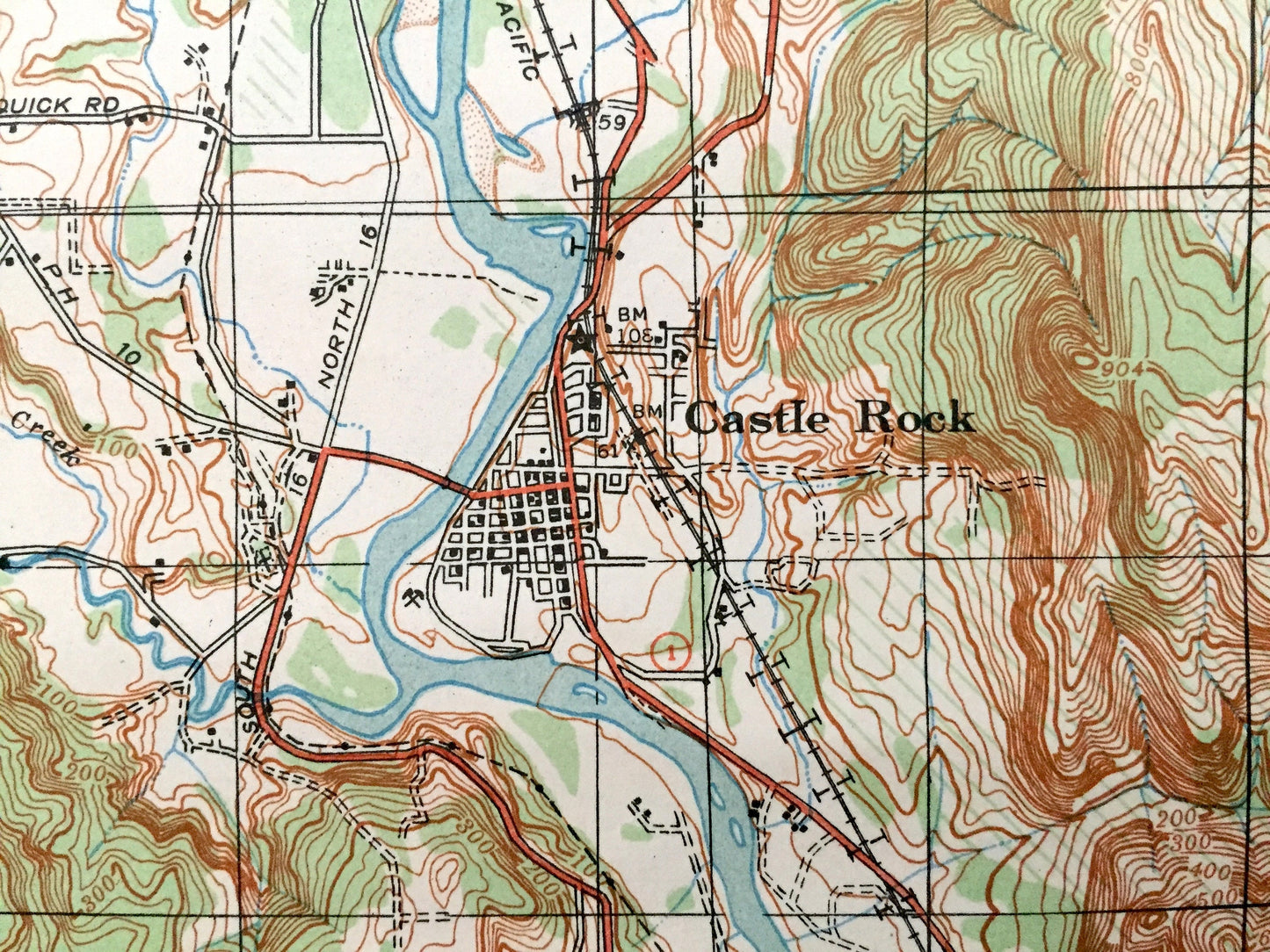
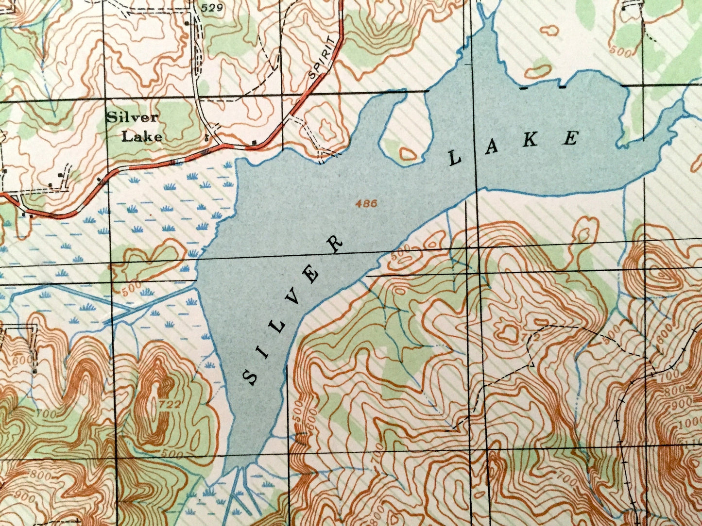
See what Washington state looked like 80 years ago. Lots of intricate details and geological contours. Map even has little squares for every house that existed at the time. The USGS cartographers were very thorough back then!
Perfect for the historian, map-lover, the curious or just as a conversation starter. Wonderful and rare. Vintage maps such as these make great gifts.
Edition of 1941, printed 1941
Dimensions: 14 1/4" width x 20 1/2" height
----
Features
Cities & Towns: Olequa, Castle Rock, Winlock, Cowlitz, Toledo, Vader, Silver Lake.
Points of Interest: Lewis County, Cowlitz County, Cowlitz River, Olequa Creek, Toutle River, Silver Lake, Salmon Creek, Drews Prairie and lots more hills, mountains, creeks, towns, houses, churches, schools, ranches, roads and train tracks.
Condition: Very Good Vintage condition, commensurate with age. This map is in great shape for being about 80 years old. Has light edge-wear and some margin trimming, but this will all add to vintage character when framed.
----
We will happily adjust shipping price for multiple purchases. Maps are rolled up and shipped in sturdy mailing tubes, never folded.
Couldn't load pickup availability
Share