My Store
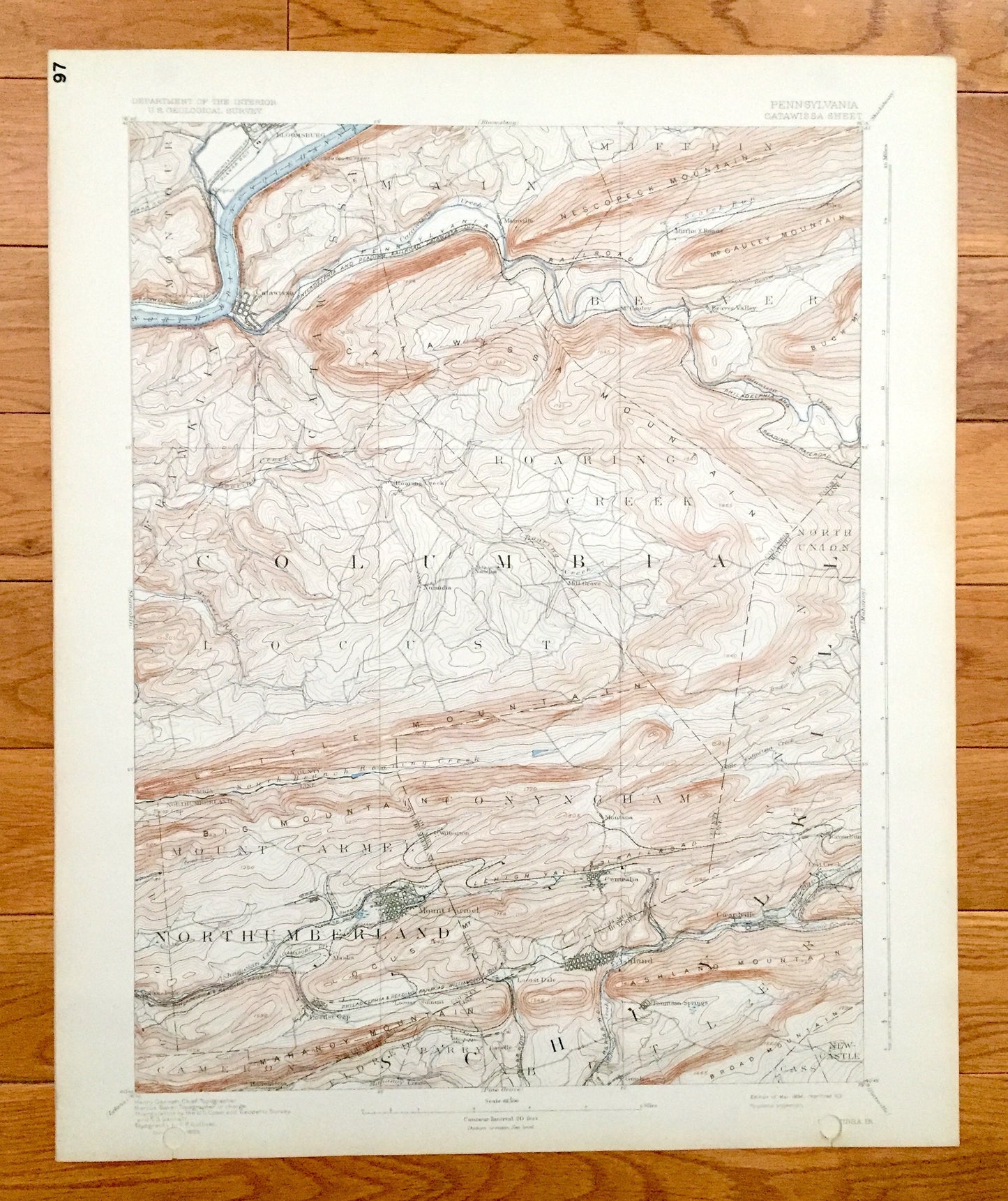
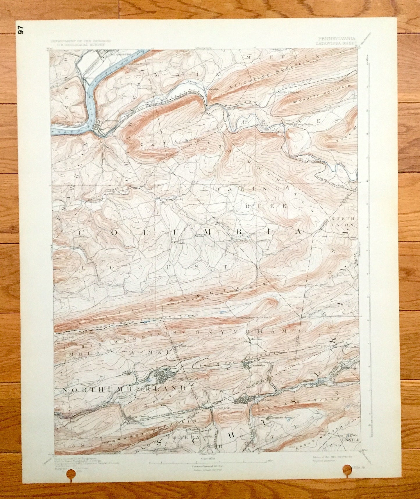
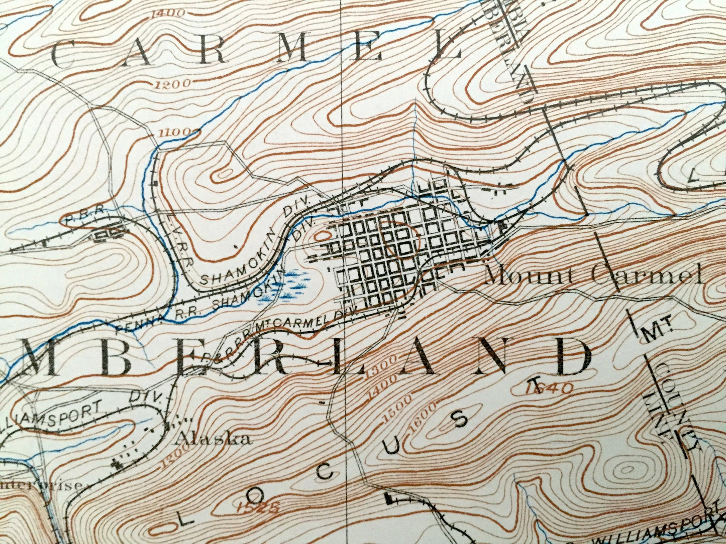
Antique Catawissa, Pennsylvania 1894 US Geological Survey Topographic Map – Columbia, Northumberland, Schuylkill County, Mount Carmel, PA
Antique Catawissa, Pennsylvania 1894 US Geological Survey Topographic Map – Columbia, Northumberland, Schuylkill County, Mount Carmel, PA
Beautiful, antique map of Catawissa, Pennsylvania and surrounding Columbia, Northumberland, & Schuylkill County areas. This is an authentic 1894 edition, 1931 print from the U.S. Geological Survey and NOT a computer reproduction.
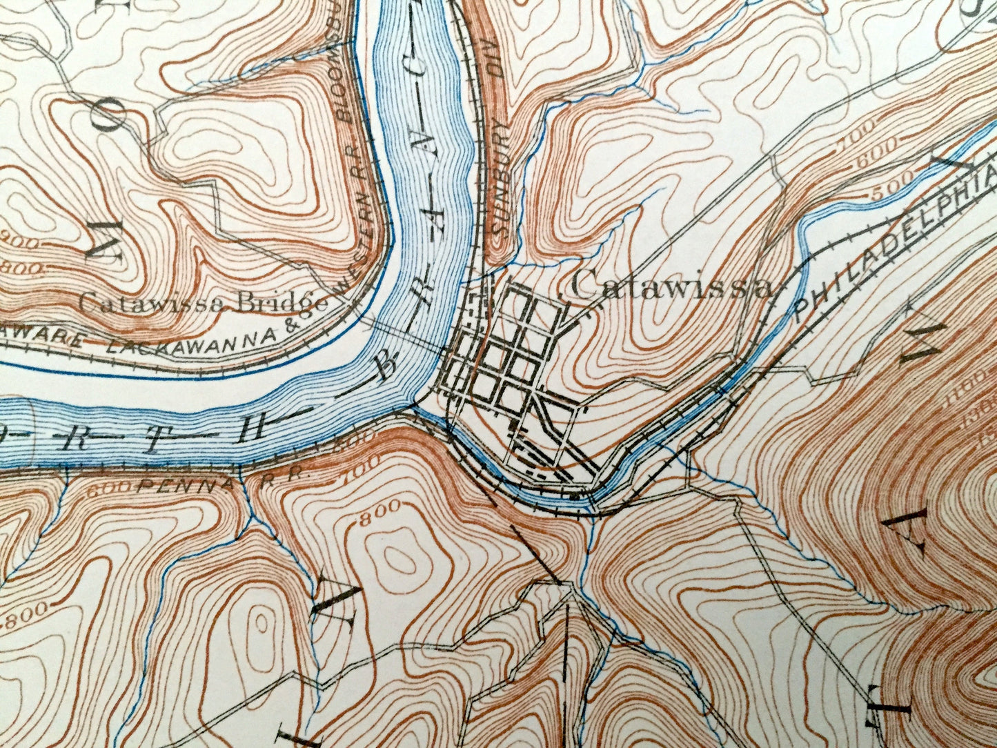
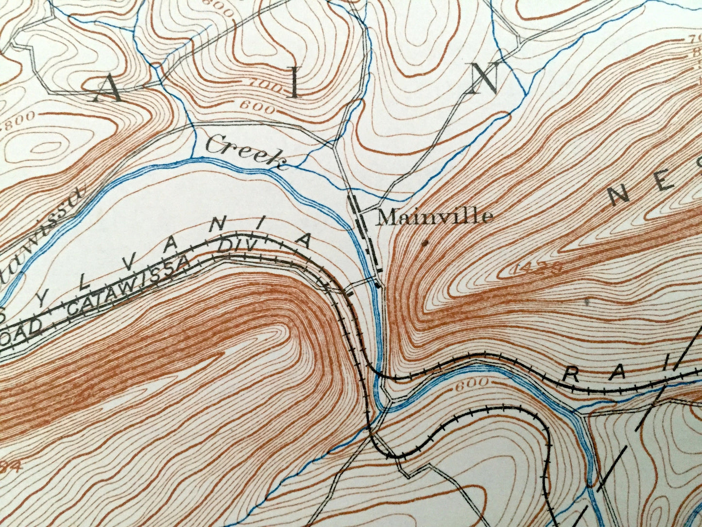
See what Pennsylvania looked like over 125 years ago. Lots of intricate details and geological contours. Map even has little squares for every house that existed at the time. The USGS cartographers were very thorough back then! On the back is a description of topographic symbols and map guide.
Perfect for the historian, map-lover, the curious or just as a conversation starter. Wonderful and rare. Vintage maps such as these make great gifts.
Edition of 1894, printed 1931
Dimensions: 16 1/2" width x 20" height
----
Features
Cities & Towns: Catawissa, Main, North Union, Locust, Mount Carmel, Conygham, Union, Coal, Cameron, Eldred, Cass, New Castle, Bloomsburg, Mainville, Mifflin Crossroads, Beaver Valley, Numidia, Newlin, Mill Grove, Excelsior, Enterprise, Locust Gap, Helfenstein, Alaska, Wilburton, Locust Dale, Locust Summit, Lavelle, Montana, Centralia, Ashland, Gordon, Fountain Springs, Girardville, Raven Run, Lost Creek, Franklin, Montour, Columbia, Beaver, Mifflin, Roaring Creek.
Points of Interest: Columbia County, Northumberland County, Schuylkill County, Susquehanna River, Catawissa Creek, Roaring Creek, Catawissa Mountain, McCauley Mountain, Nescopeck Mountain, Little Mountain, Big Mountain, Mahanoy Mountain, Ashland Mountain, Broad Mountain, Philadelphia & Reading Railroad, Lehigh Valley Railroad and more roads, railroads, houses, ponds, hills, creeks, and lakes.
Condition: Good Vintage condition, commensurate with age. This map is in great shape for being over 85 years old. This map has punch holes towards the bottom. This is easily concealed by placing a similar piece of paper behind it as shown in the above photos. Also has light edge-wear, but this will add to vintage character when framed.
----
We will happily adjust shipping price for multiple purchases. Maps are rolled up and shipped in sturdy mailing tubes, never folded.
Couldn't load pickup availability
Share