My Store
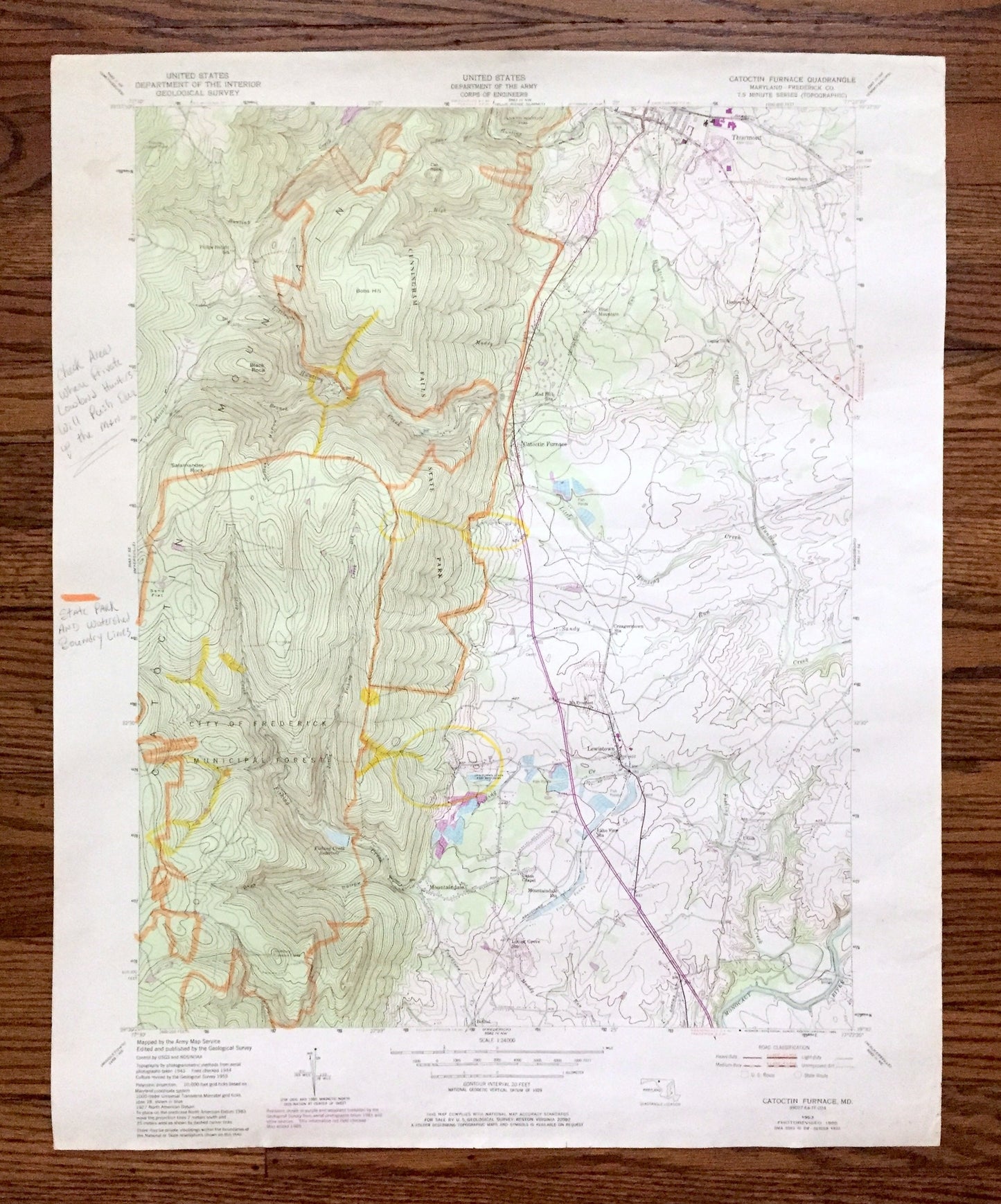
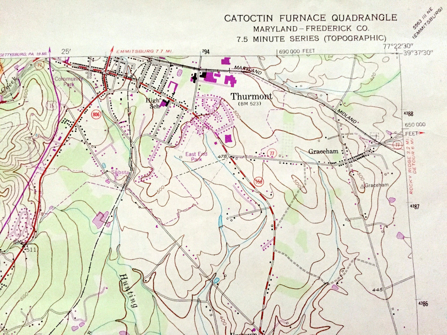
Antique Catoctin Furnace, Maryland 1953 US Geological Survey Topographic Map – Frederick County, Cunningham Falls, Lewiston, Thurmont, MD
Antique Catoctin Furnace, Maryland 1953 US Geological Survey Topographic Map – Frederick County, Cunningham Falls, Lewiston, Thurmont, MD
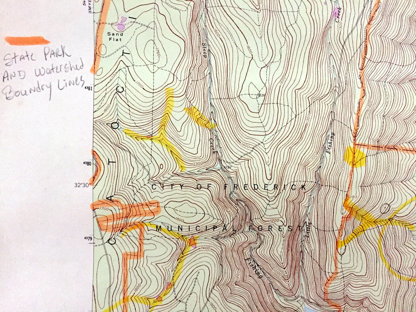
Beautiful, antique map of Catoctin Furnace, Maryland and surrounding Frederick County area. This is an authentic 1953 edition, 1985 print from the U.S. Geological Survey and NOT a computer reproduction.
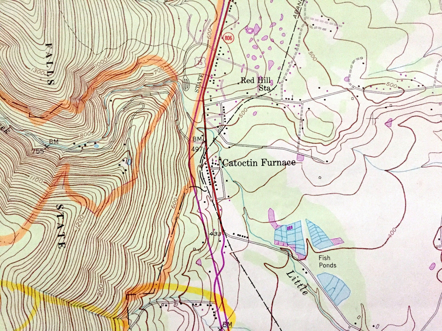
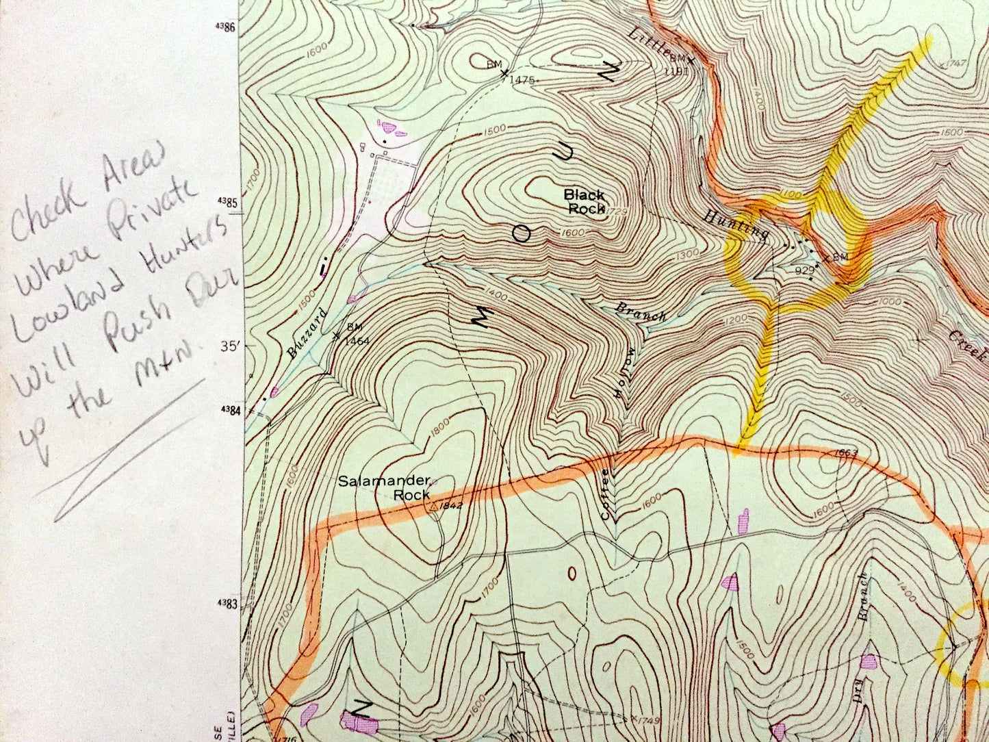
See what Maryland looked 70 years ago. Lots of intricate details and geological contours. Map even has little squares for every house that existed at the time. The USGS cartographers were very thorough back then!
Perfect for the historian, map-lover, the curious or just as a conversation starter. Wonderful and rare. Vintage maps such as these make great gifts.
Edition of 1953, printed 1985
Dimensions: 22" width x 27" height
----
Features
Cities & Towns: Thurmont, Catoctin Furnace, Blue Mountain, Graceham, Mountaindale, Lewistown, Bethel.
Points of Interest: Frederick County, Catoctin Mountain, Cunningham Falls State Park, City of Frederick Municipal Forest, Fishing Creek, Hamburg Lookout, Hunting Creek, Monocacy River and many more hills, mountains, streams, lakes, ponds, houses, and roads.
Condition: Good or "Very Vintage" condition, commensurate with age. This map is in great shape for being over 35 years old. Has some wear, toning and lots of writing and markings, but this will all add to vintage character when framed. This map was most likely used in the field.
----
We will happily adjust shipping price for multiple purchases. Maps are rolled up and shipped in sturdy mailing tubes, never folded.
Couldn't load pickup availability
Share