My Store
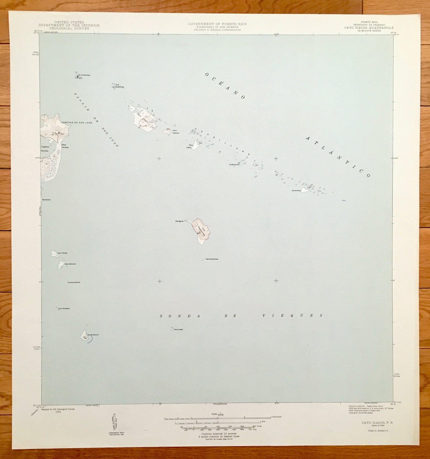
Antique Cayo Icacos, Puerto Rico 1945 US Geological Survey Topographic Map – Fajardo, La Cardillera, Pasaje de San Juan, Cabezas, Vieques PR
Antique Cayo Icacos, Puerto Rico 1945 US Geological Survey Topographic Map – Fajardo, La Cardillera, Pasaje de San Juan, Cabezas, Vieques PR
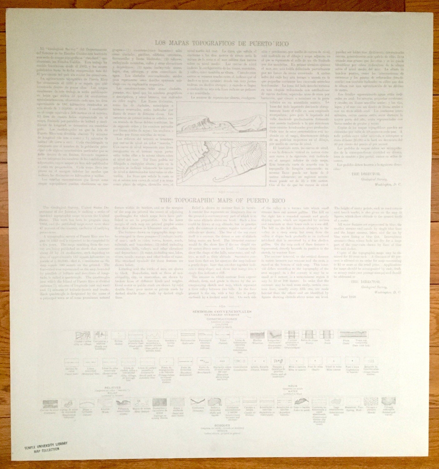
Beautiful, antique map of Cayo Icacos, Puerto Rico and surrounding municipalities. This is an authentic 1945 print from the U.S. Geological Survey and NOT a computer reproduction.
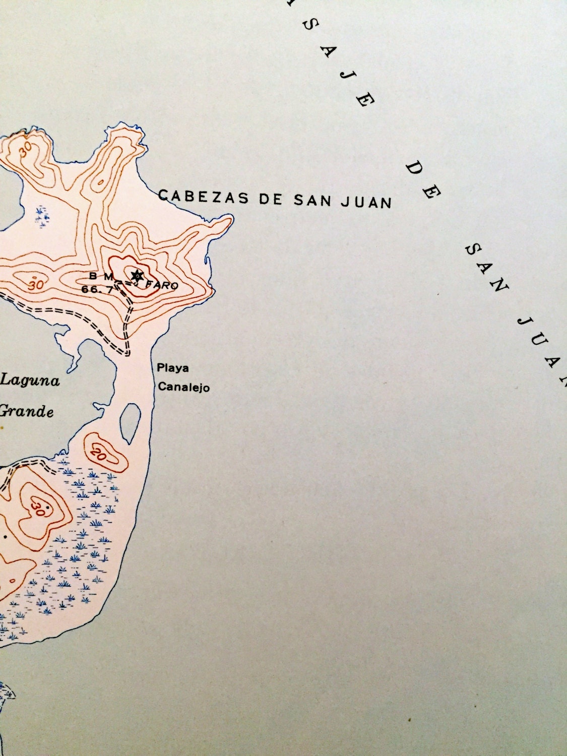
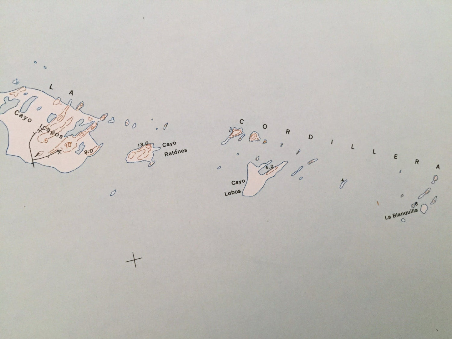
See what Puerto Rico looked like more than 75 years ago. Lots of intricate details and geological contours. Map even has little squares for every house that existed at the time. The USGS cartographers were very thorough back then! On the back is a description of topographic symbols and map guide in both English and Spanish.
Perfect for the historian, map-lover, the curious or just as a conversation starter. Wonderful and rare. Maps such as these make great gifts.
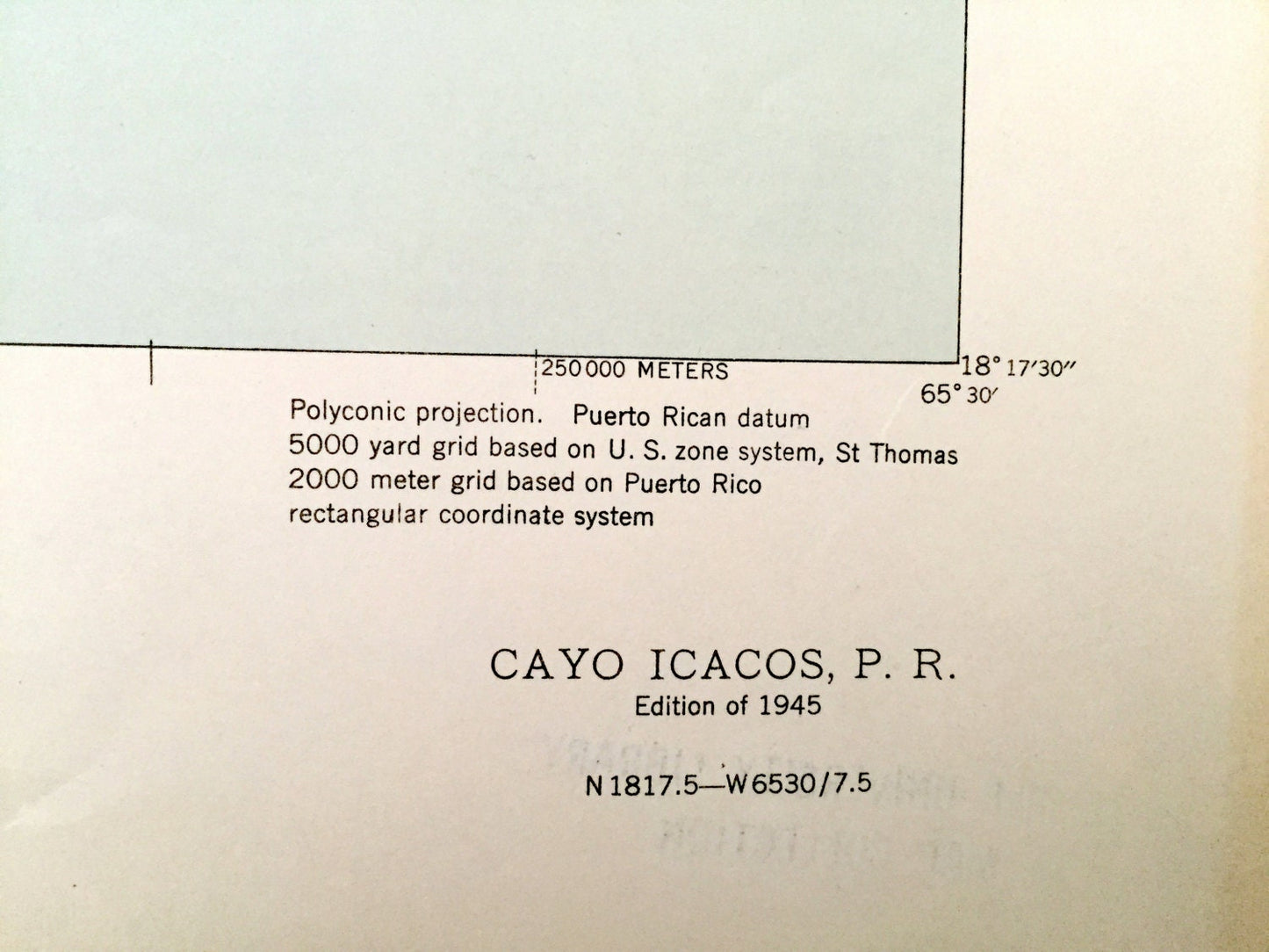
Edition of 1945, printed 1945
Dimensions: 20" width x 21" height
----
Features
Cities, Towns & Municipios: Municipio De Fajardo.
Points of Interest: Mar Caribe, Caribbean Sea, Oceano Atlantico, Sonda De Vieques, Pasaje De San Juan, La Cordillera, Laguna Grande, Cabezas De San Juan, Playa Canalejo, Punta Gorda, Cayo Icacos, Las Cucaraches, Isa Palominos, Cayo Obispo, Cayo Zancudo, Isla de Ramos, Cayo Largo, Isla de Aves, Cayo Lobos, Cayo Ratones, La Blanquilla and many more roads, railroads, houses, hills, mountains and lighthouses.
Condition: Very Good Vintage condition, commensurate with age. This map is in great shape for being over 75 years old.
----
We will happily adjust shipping price for multiple purchases. Maps are rolled up and shipped in sturdy mailing tubes, never folded.
Couldn't load pickup availability
Share