My Store
Antique Central Aguirre, Puerto Rico 1945 US Geological Survey Topographic Map – Salinas, Guayama, Coquí, Jobos, Las Mareas, Infierno PR
Antique Central Aguirre, Puerto Rico 1945 US Geological Survey Topographic Map – Salinas, Guayama, Coquí, Jobos, Las Mareas, Infierno PR
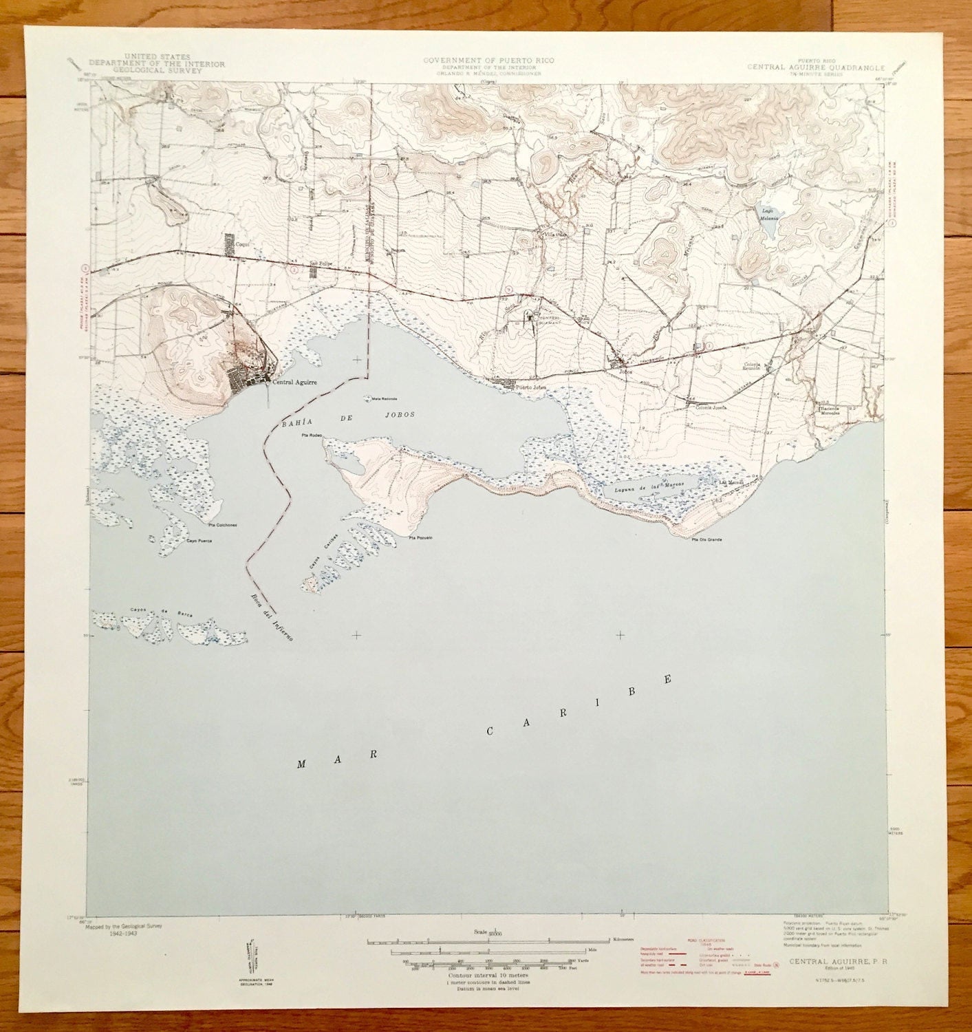
Beautiful, antique map of Central Aguirre, Puerto Rico and surrounding municipalities. This is an authentic 1945 print from the U.S. Geological Survey and NOT a computer reproduction.
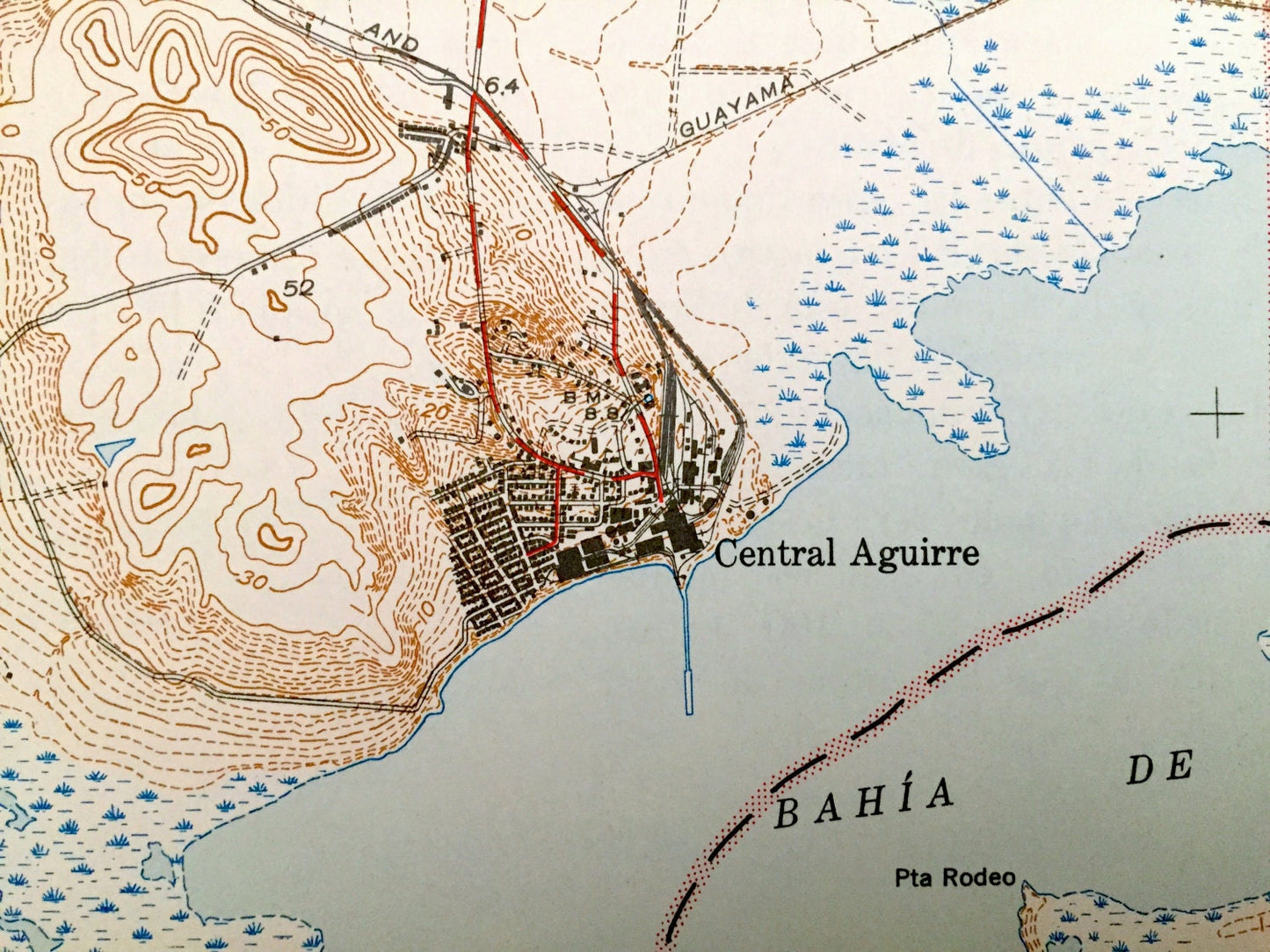
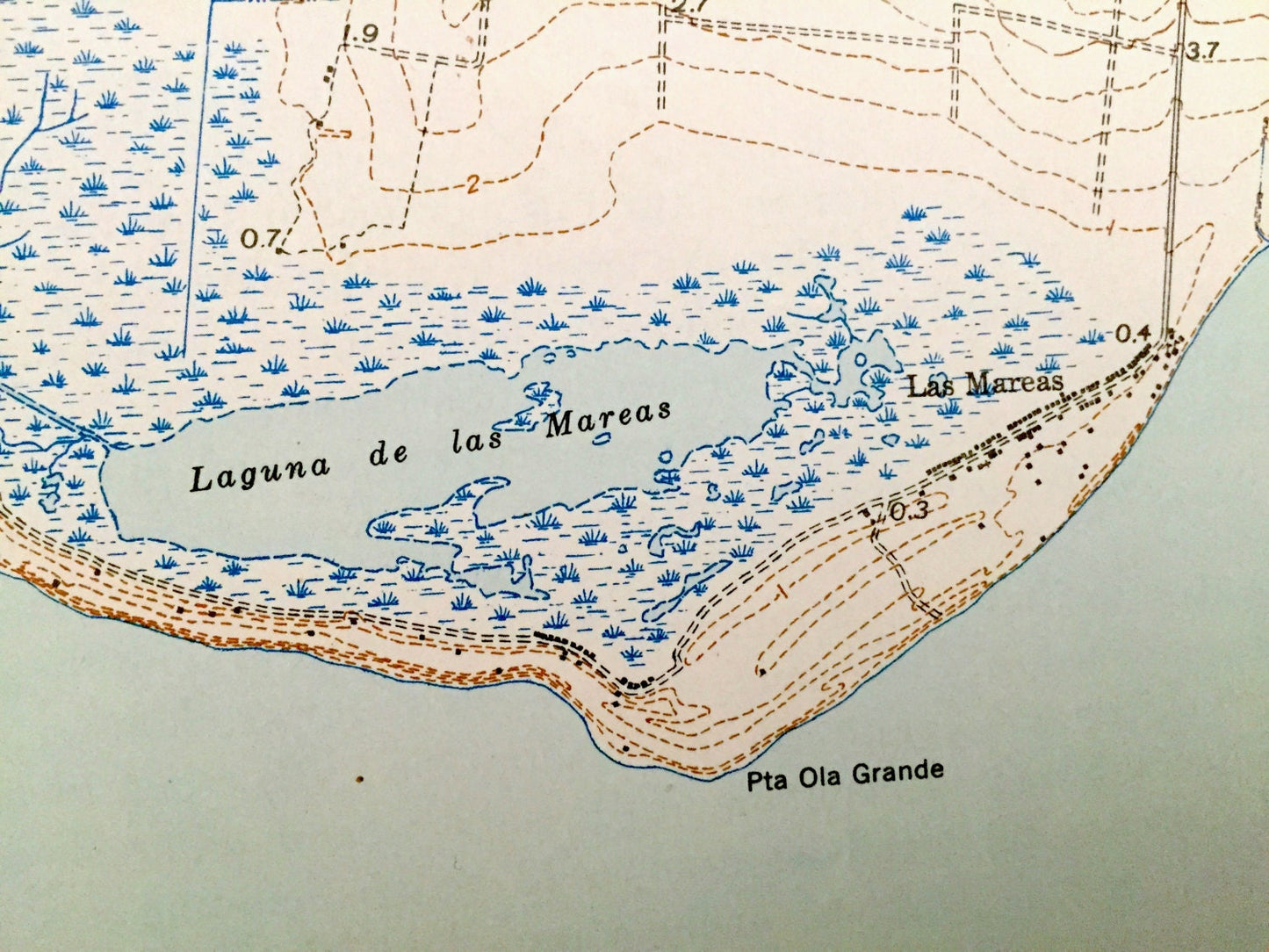
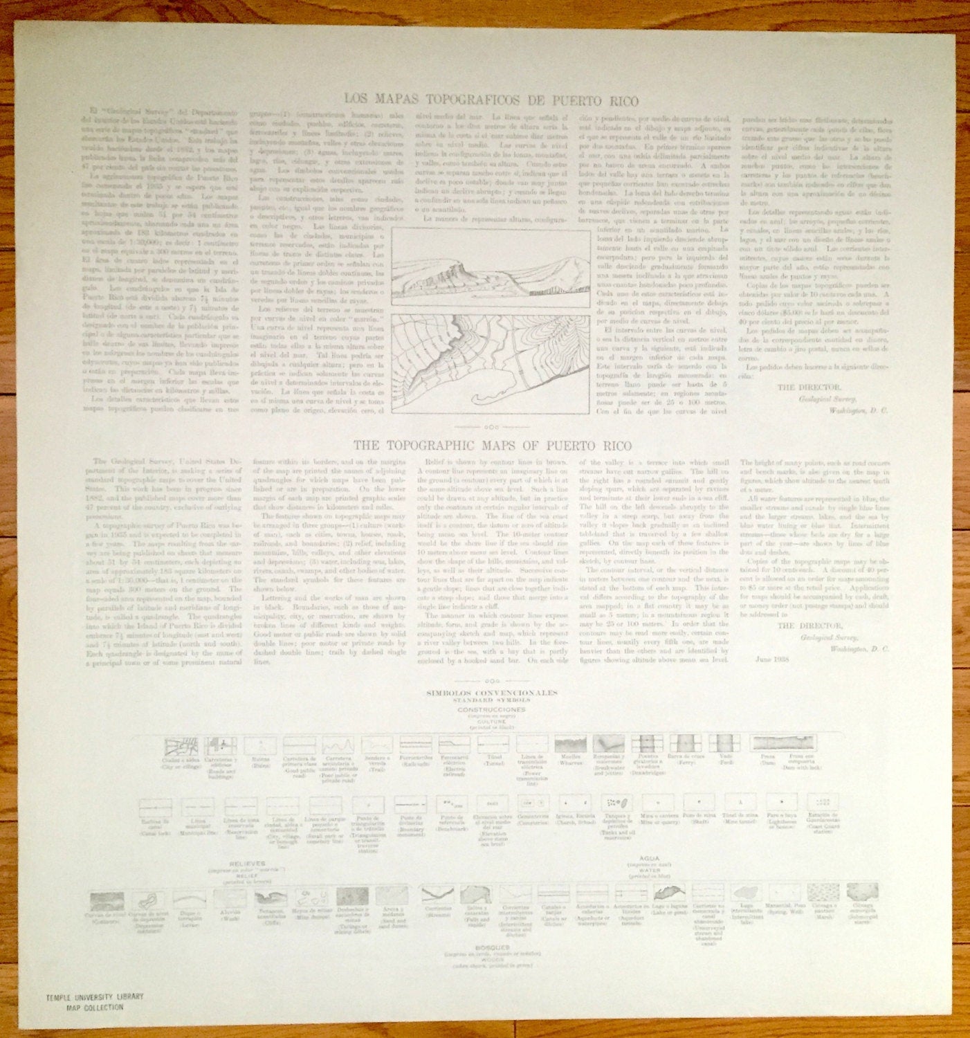
See what Puerto Rico looked like more than 70 years ago. Lots of intricate details and geological contours. Map even has little squares for every house that existed at the time. The USGS cartographers were very thorough back then! On the back is a description of topographic symbols and map guide in both English and Spanish.
Perfect for the historian, map-lover, the curious or just as a conversation starter. Wonderful and rare. Maps such as these make great gifts.
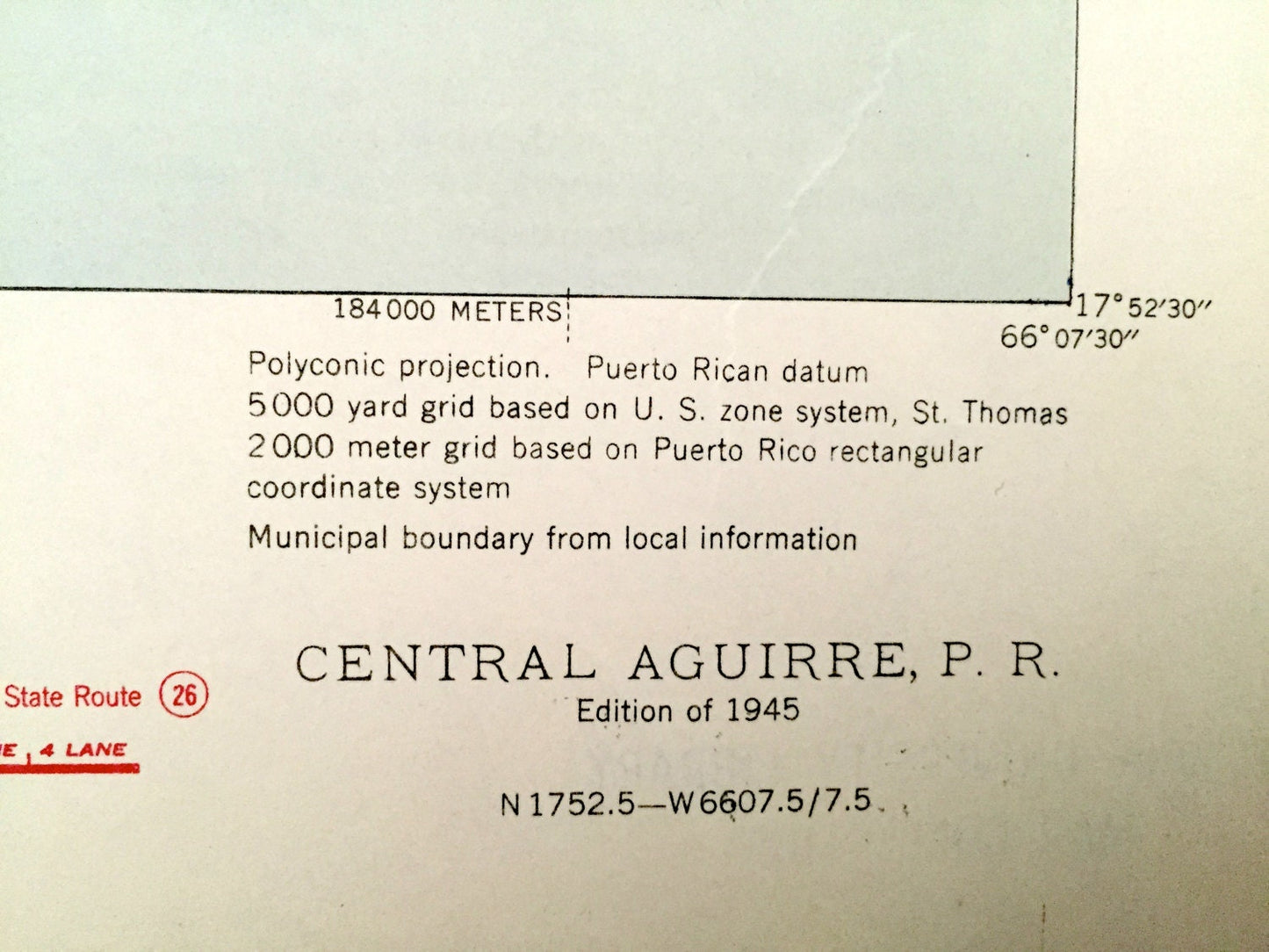
Edition of 1945, printed 1945
Dimensions: 20" width x 21" height
----
Features
Cities, Towns & Municipios: Municipio De Salinas, Municipio De Guayama, Coquí, San Felipe, Central Aguirre, Besosa, Villa Odas, Puerto Jobos, Jobos, Colonia Josefa, Las Marreas, Colonia Reunion, Hacienda Mercedes.
Points of Interest: Mar Caribe, Caribbean Sea, Bahia De Jobos, Rio Seco, Rio Guamaní, Laguna de las Mareas, Boca del Infernio, Cayos Caribes, Cayos de Barca, Punta Colchones, Cayo Puerca, Mata Redonda, Punta Ola Grande, Lago Melania, Canal De Guamani, Rio Melania, Ponce & Guayama Railroad and many more roads, railroads, houses, hills, valleys, mountains and rivers.
Condition: Very Good Vintage condition, commensurate with age. This map is in incredible shape for being over 70 years old.
----
We will happily adjust shipping price for multiple purchases. Maps are rolled up and shipped in sturdy mailing tubes, never folded.
Couldn't load pickup availability
Share