My Store
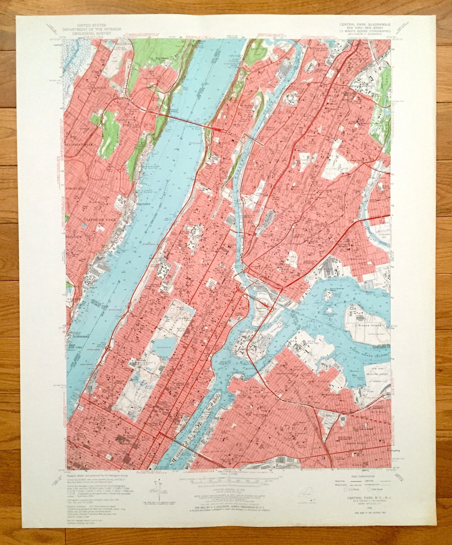
Antique Central Park, Manhattan, New York 1956 US Geological Survey Topographic Map – New Jersey, Hudson River, Bronx, Queens, Harlem
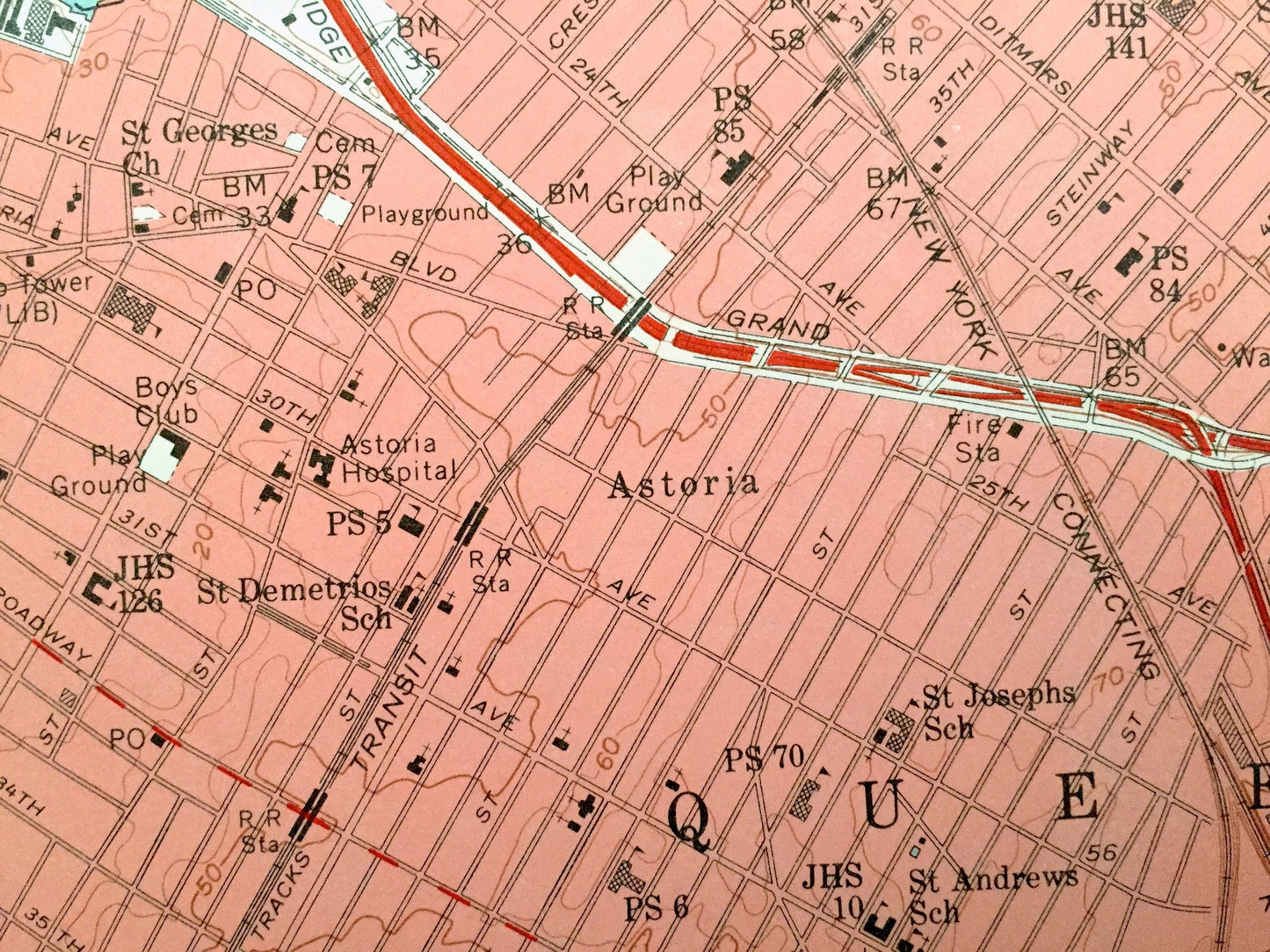
Antique Central Park, Manhattan, New York 1956 US Geological Survey Topographic Map – New Jersey, Hudson River, Bronx, Queens, Harlem
Beautiful, antique map of Central Park, New York showing New Jersey, Queens and the Bronx. This is an authentic 1956 print from the U.S. Geological Survey and NOT a computer reproduction.
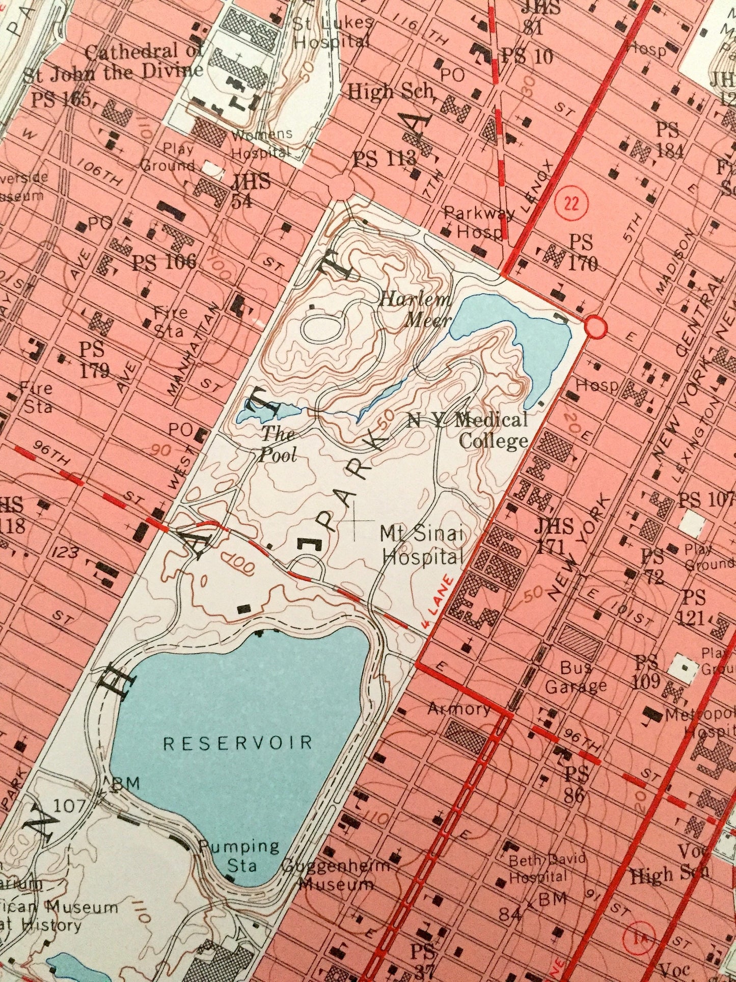
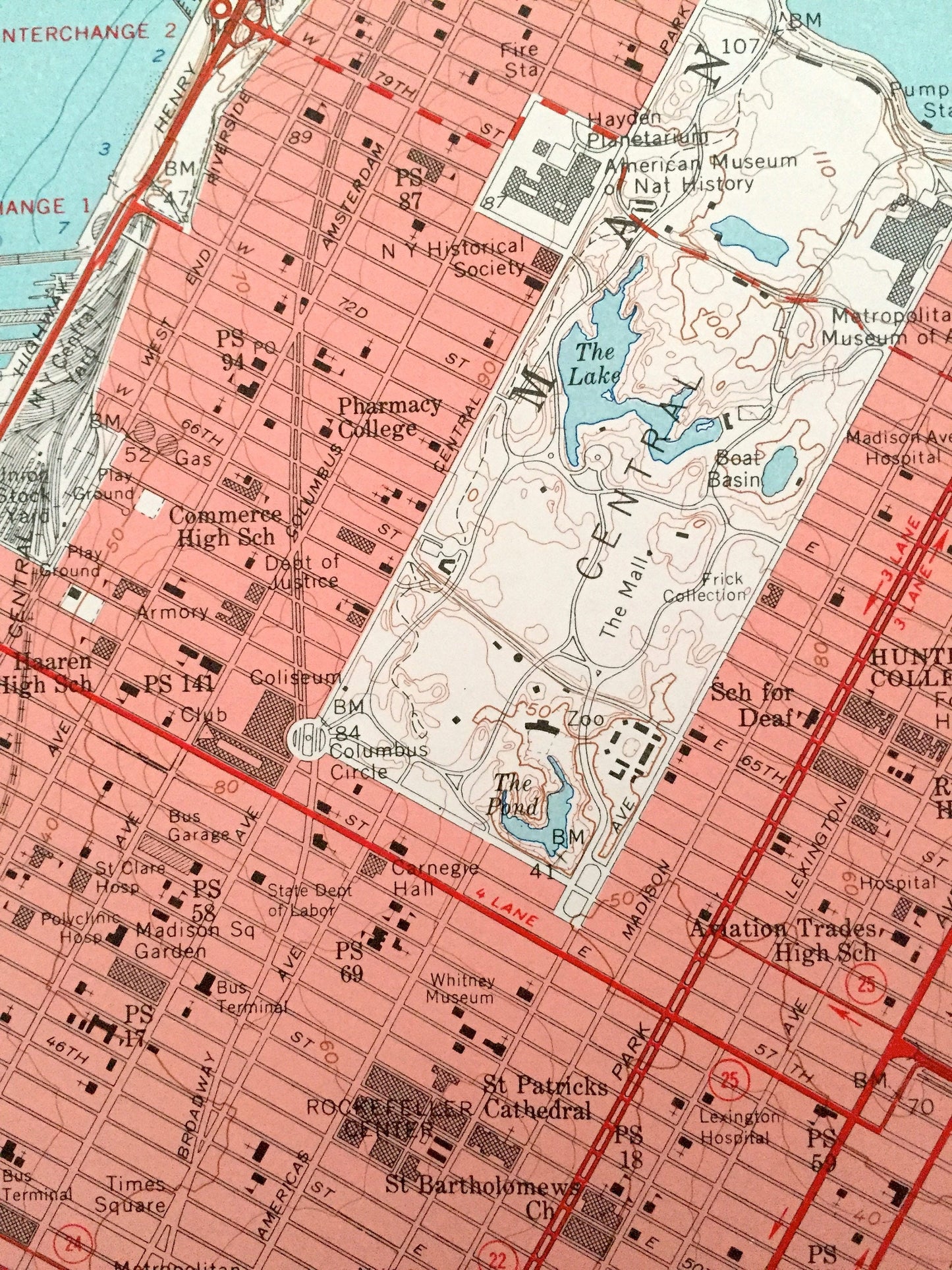
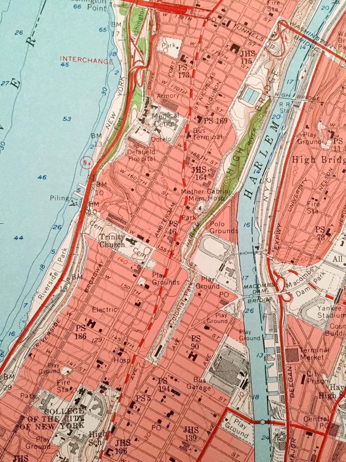
See what the New York area looked like over 60 years ago. Lots of intricate details and geological contours. Map even has little squares for every house that existed at the time. The USGS cartographers were very thorough back then!
Perfect for the historian, map-lover, the curious or just as a conversation starter. Wonderful and rare. Vintage maps such as these make great gifts.
Edition of 1956, printed 1956
Dimensions: 22" width x 27" height
----
Features
Cities & Towns: NEW YORK: Manhattan Neighborhoods: Midtown, Upper East Side, Upper West Side, Central Park, Harlem, Morningside Heights, Inwood, Washington Heights, Sugar Hill, Spanish Harlem, Rikers Island, Wards Island. Queens Neighborhoods: Astoria, Jackson Heights, Long Island City, Steinway.
NEW JERSEY: North Bergen, Fairview, Cliffside Park, Ridgefield, Palisades Park, Leonia, Fort Lee, Edgewater.
Points of Interest: Central Park, Hunter College, Yeshiva University, Columbia University, CUNY, Hudson River, East River, Harlem River, American Museum of Natural History, The Cloisters, and many more landmarks, schools, houses, buildings and streets.
Condition: Very Good condition, commensurate with age. This map is in incredible shape for being over 60 years old.
----
We will happily adjust shipping price for multiple purchases. Maps are rolled up and shipped in sturdy mailing tubes, never folded.
Couldn't load pickup availability
Share