My Store
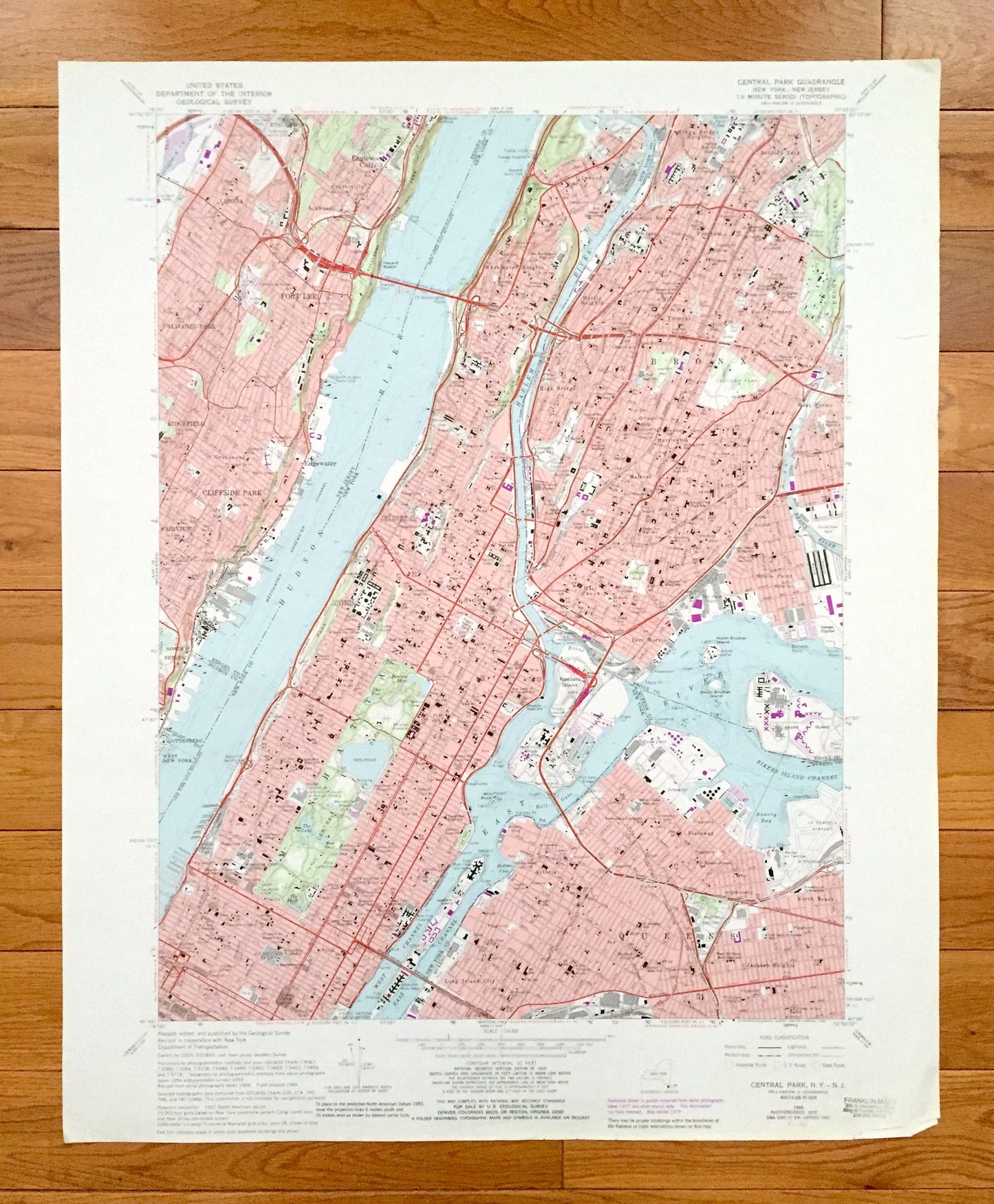
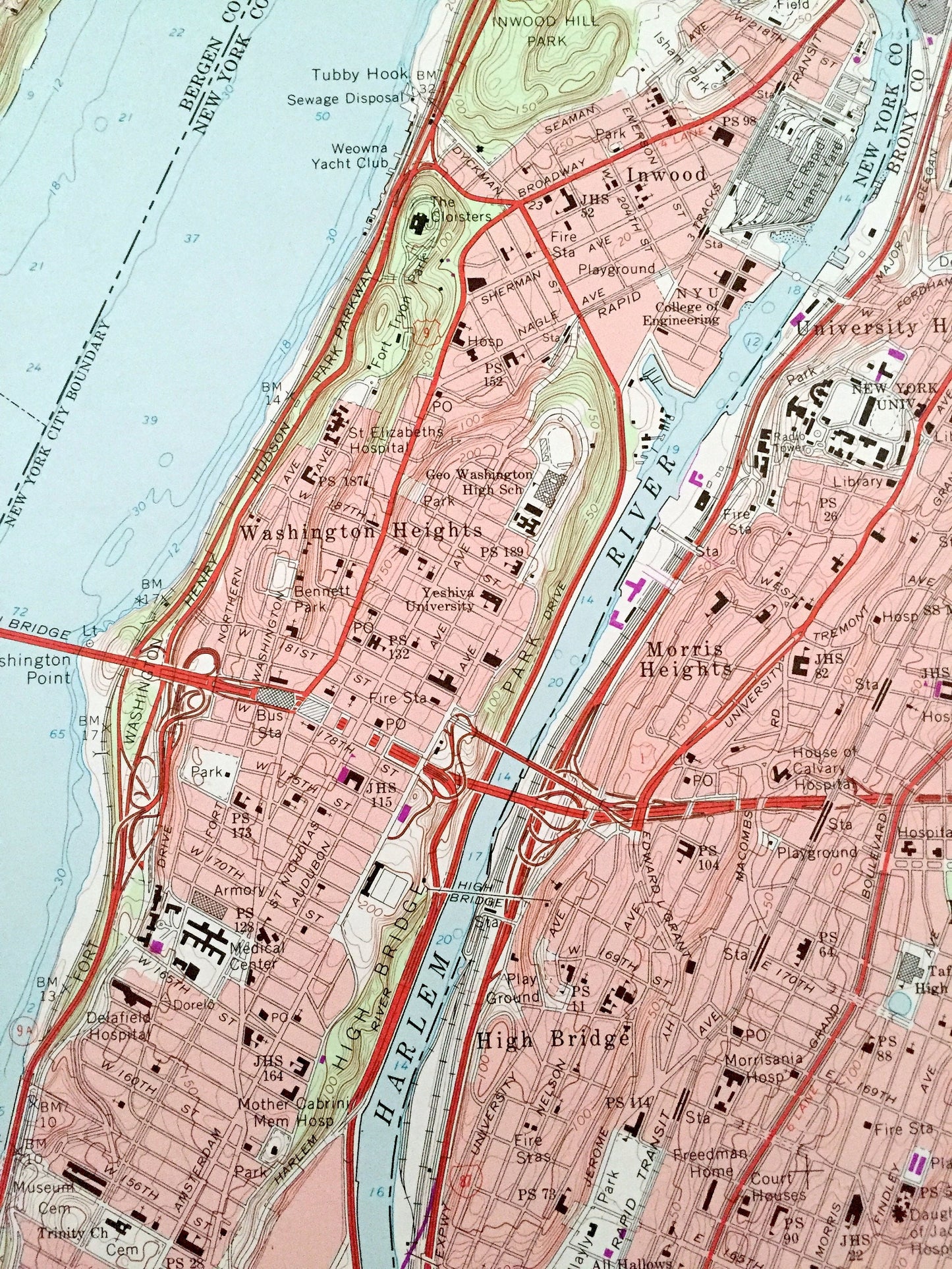
Antique Central Park, New York 1966 US Geological Survey Topographic Map – Bronx County, Washington Heights, NY, Bergen, Hudson County, NJ
Antique Central Park, New York 1966 US Geological Survey Topographic Map – Bronx County, Washington Heights, NY, Bergen, Hudson County, NJ
Beautiful, antique map of Central Park, New York and surrounding New York County, Bronx County, and Queens County areas, including New Jersey’s Bergen County and Hudson County. This is an authentic 1966 edition, 1988 print from the U.S. Geological Survey and NOT a computer reproduction.
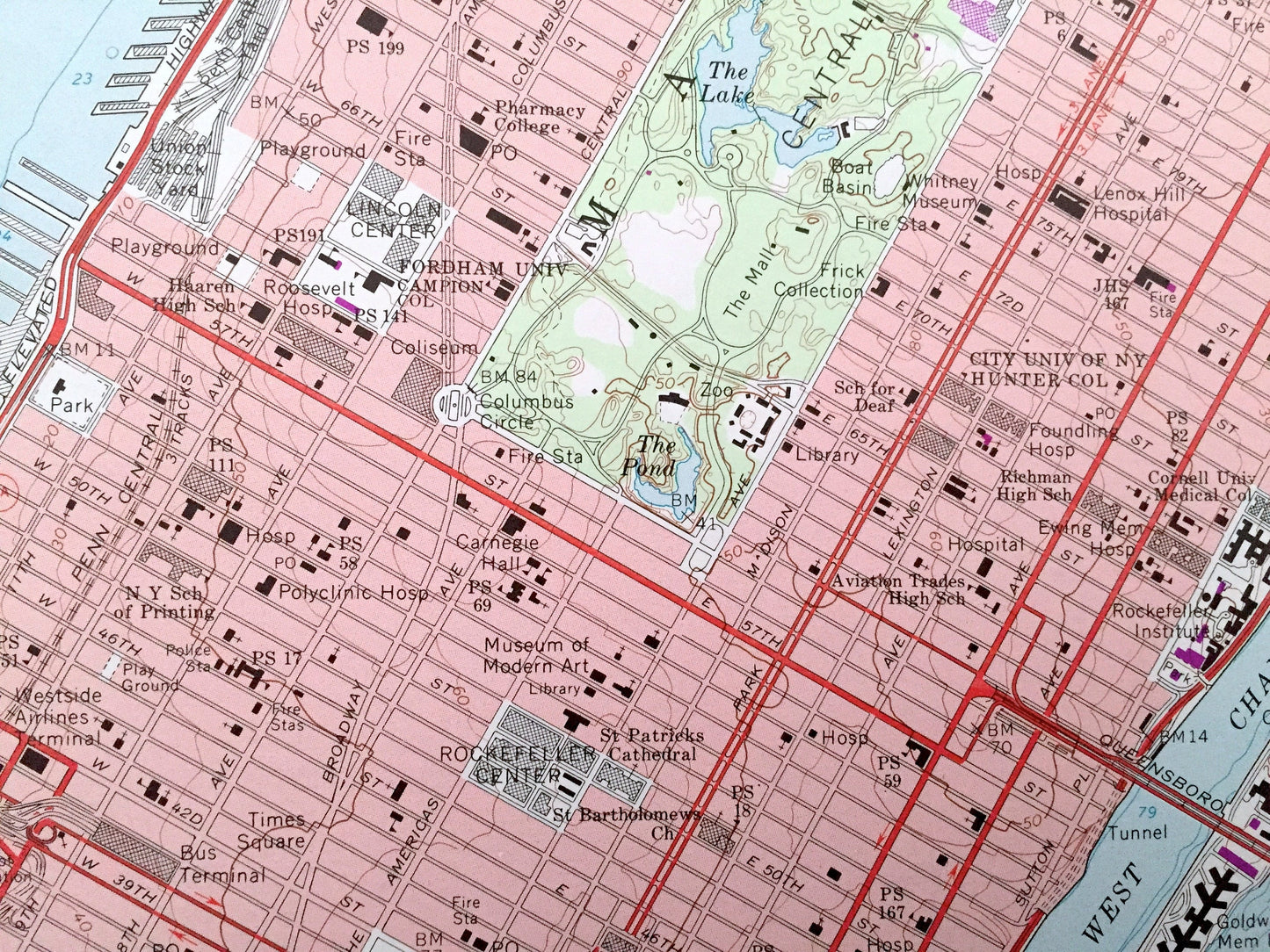
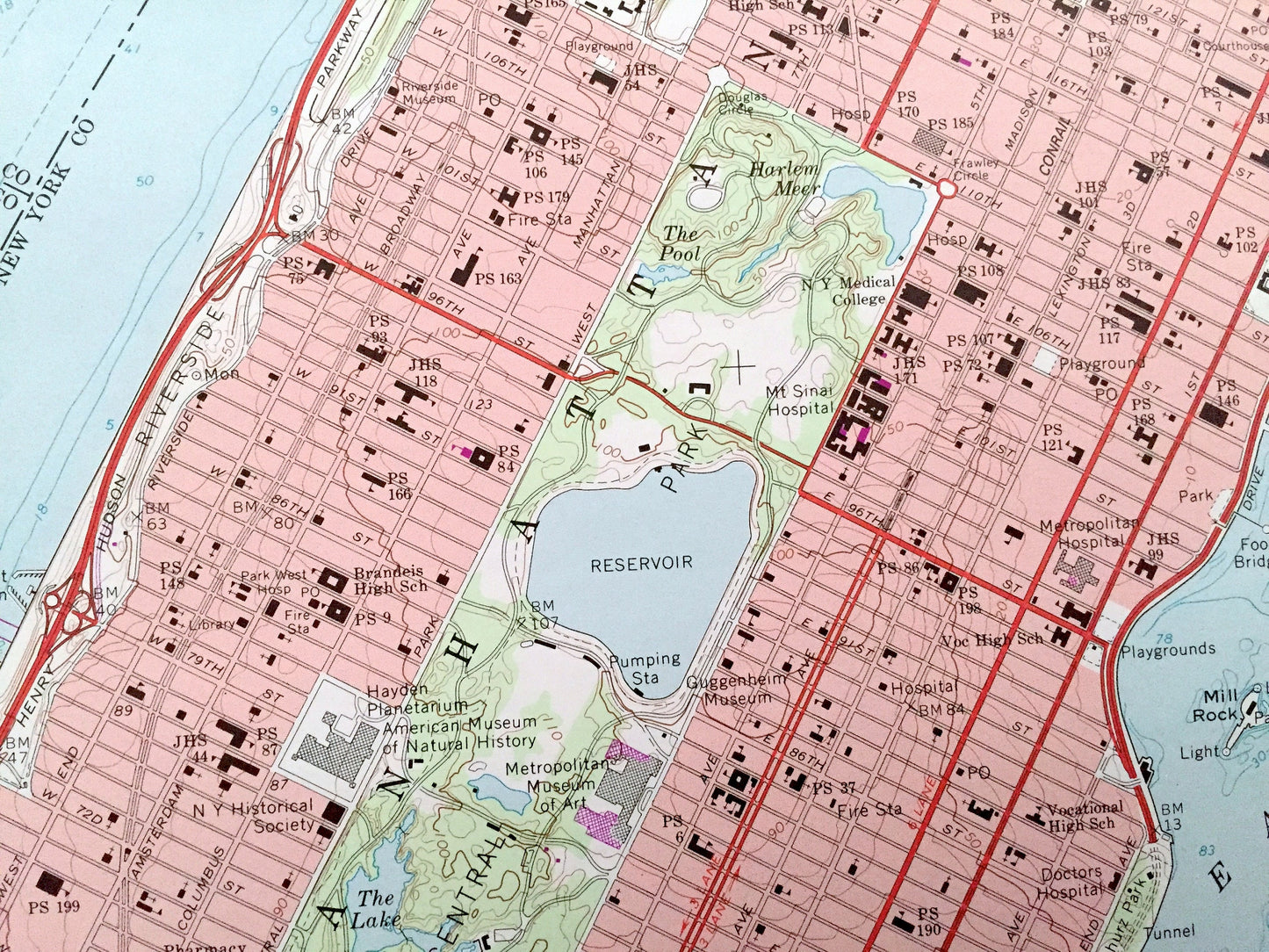
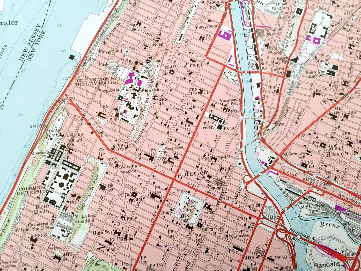
See what New York looked like over 55 years ago. Lots of intricate details and geological contours. Map even has little squares for every house that existed at the time. The USGS cartographers were very thorough back then!
Perfect for the historian, map-lover, the curious or just as a conversation starter. Wonderful and rare. Vintage maps such as these make great gifts.
Edition of 1966, printed 1988
Dimensions: 22" width x 27" height
----
Features
Cities & Towns: NEW YORK: Manhattan Neighborhoods: Midtown, Upper East Side, Upper West Side, Central Park, Harlem, Morningside Heights, Inwood, Washington Heights, Sugar Hill, Spanish Harlem, Rikers Island, Wards Island. Queens Neighborhoods: Astoria, Jackson Heights, Long Island City, Steinway.
NEW JERSEY: Englewood, Englewood Heights, North Bergen, Fairview, Cliffside Park, Ridgefield, Palisades Park, Leonia, Fort Lee, Edgewater, Guttenberg, Teaneck.
Points of Interest: United Nations Headquarters, Columbia University, City University of New York Hunter College, Fordham University, New York University, Manhattan State Hospital, Bronx Park, Inwood Hill Park, Crotona Park, George Washington Bridge, Rivers Island, Randalls Island, La Guardia Airport, Hazard Beach, Riverside Park, Overpeck Creek, Harlem River, Hudson River, East River, Bowery Bay, and many more hills, streams, ponds, houses, schools, railroads, churches and roads.
Condition: Very Good Vintage condition, commensurate with age. This map is in great shape for being over 30 years old. Has some edge-wear that includes tears and fold creases on the right hand side, all of which will read as character when framed.
----
We will happily adjust shipping price for multiple purchases. Maps are rolled up and shipped in sturdy mailing tubes, never folded.
Couldn't load pickup availability
Share