My Store
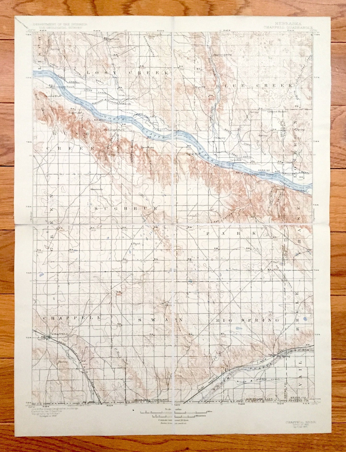
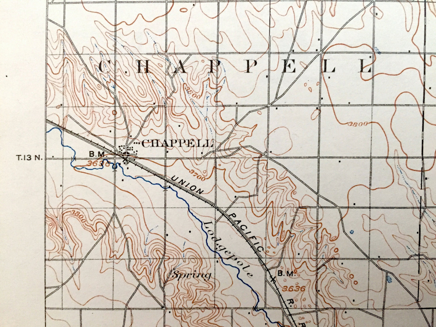
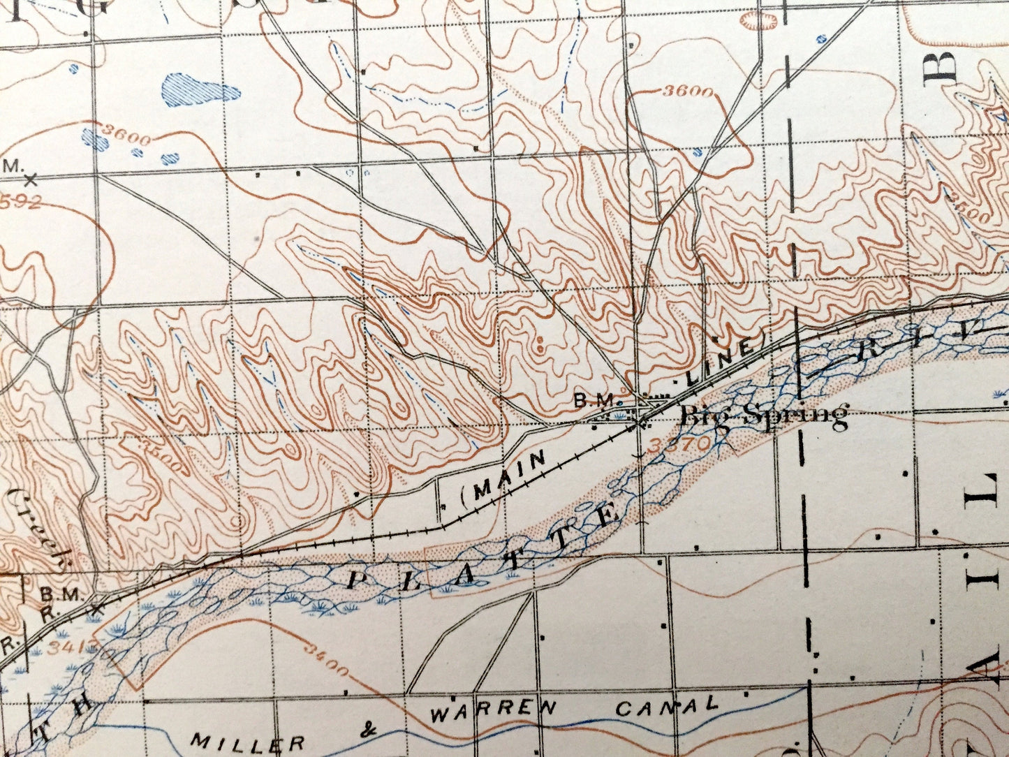
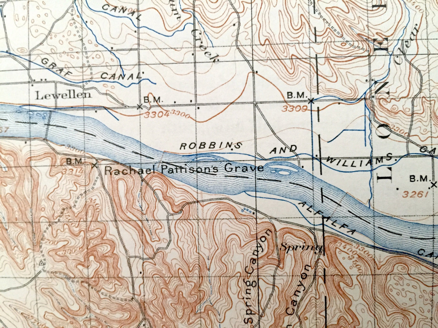
Antique Chappell, Nebraska 1900 US Geological Survey Topographic Map – Swan, Big Spring, Vail, Brule, Park, Green, Blue Creek Lisco Chase NE
Antique Chappell, Nebraska 1900 US Geological Survey Topographic Map – Swan, Big Spring, Vail, Brule, Park, Green, Blue Creek Lisco Chase NE
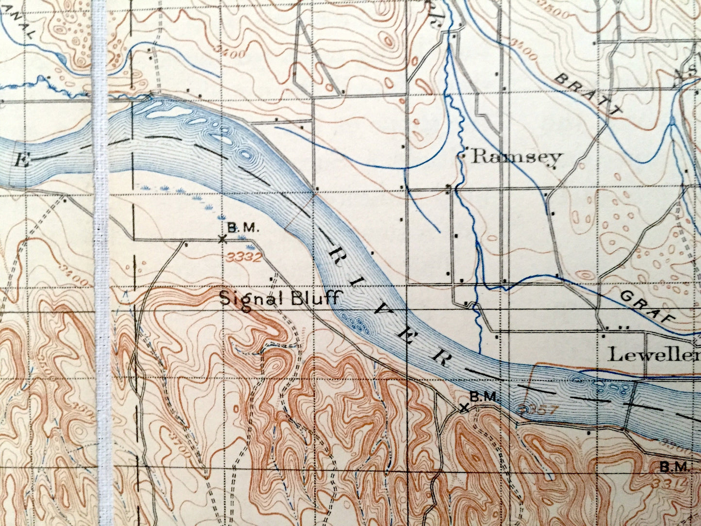
Beautiful, antique map of Chappell, Nebraska and surrounding Deuel, Keith & Perkins County areas. This is an authentic 1900 edition, 1925 print from the U.S. Geological Survey and NOT a computer reproduction.
See what Nebraska looked like more than 120 years ago. Lots of intricate details and geological contours. Map even has little squares for every house that existed at the time. The USGS cartographers were very thorough back then! At some point the map was canvas-backed and split into quadrants, perhaps for field work.
Perfect for the historian, map-lover, the curious or just as a conversation starter. Wonderful and rare. Maps such as these make great gifts.
Edition of 1900, printed 1925
Dimensions: 14 1/2" width x 19 1/2" height
----
Features
Cities & Towns: Chappell, Lonergan, Ramsey, Oshkosh, Hartman, Kowanda, Sughrue, Rush Creek, Lost Creek, Lewellen, Swan, Big Spring, Vail, Brule, Park, Green, Blue Creek, Lisco, Chase.
Points of Interest: Deuel County, Keith County, Perkins County, North Platte River, South Platte River, Grapevine Canyon, Brush Canyon, Rachel Pattison's Grave, Ash Hollow, Signal Bluff, and lots more hills, creeks, lakes, towns, schools, churches, roads and train tracks.
Condition: Very Good Vintage condition, commensurate with age. This map is in incredible shape for being over 95 years old. Has light wear and folds as-issued, but these will flatten easily and all will add to vintage character when framed.
----
We will happily adjust shipping price for multiple purchases. Map will be shipped folded to preserve integrity.
Couldn't load pickup availability
Share