My Store
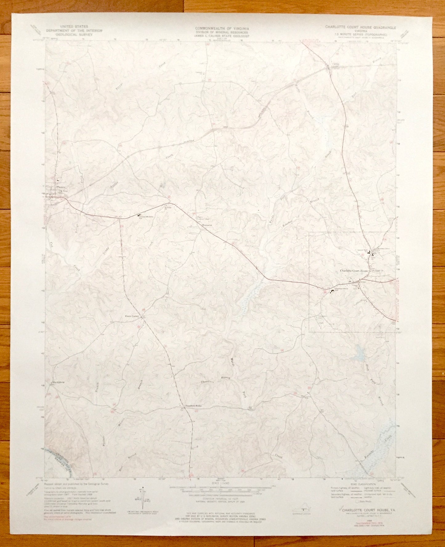
Antique Charlotte Court House, Virginia 1968 US Geological Survey Topographic Map – Chandlers Forks, Phenix, Cullen, Harrisburg, Womacks
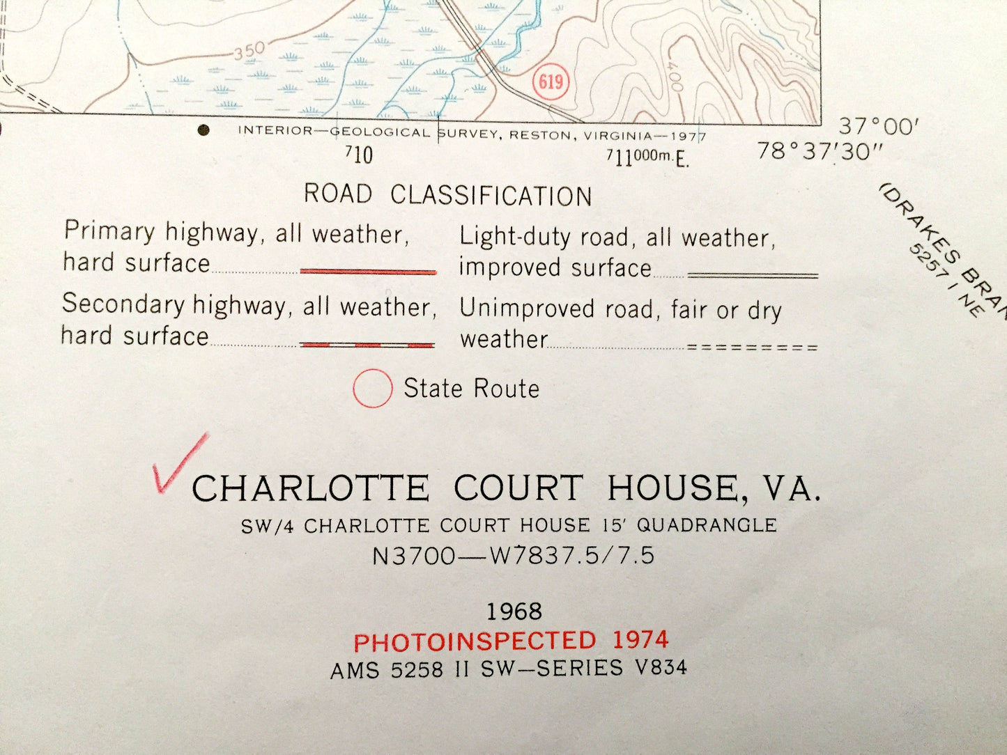
Antique Charlotte Court House, Virginia 1968 US Geological Survey Topographic Map – Chandlers Forks, Phenix, Cullen, Harrisburg, Womacks
Beautiful, antique map of Charlotte Court House, Chandlers Forks, Phenix, Cullen, Harrisburg, Womacks, Virginia. This is an authentic 1968 edition, 1974 print from the U.S. Geological Survey and NOT a computer reproduction.
See what Charlotte County of Virginia looked like almost 50 years ago. Lots of intricate details and geological contours. Map even has little squares for every house that existed at the time. The USGS cartographers were very thorough back then!
Perfect for the historian, map-lover, the curious or just as a conversation starter. Wonderful and rare. Vintage maps such as this make great gifts.
Edition of 1968, printed 1974
Dimensions: 23" width x 27" height
----
Features
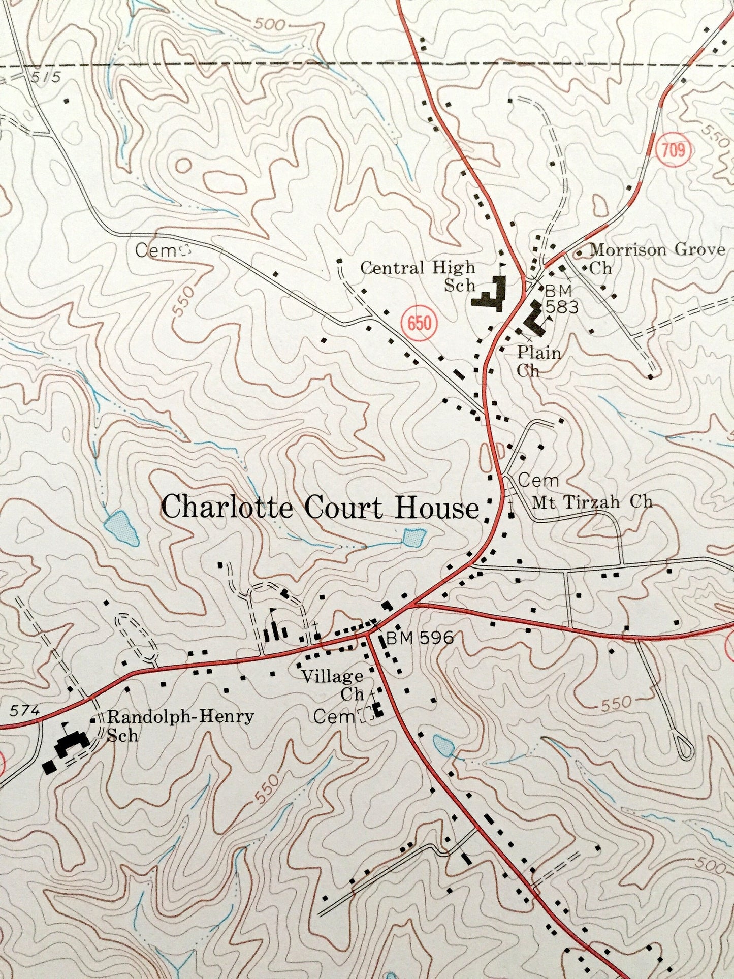
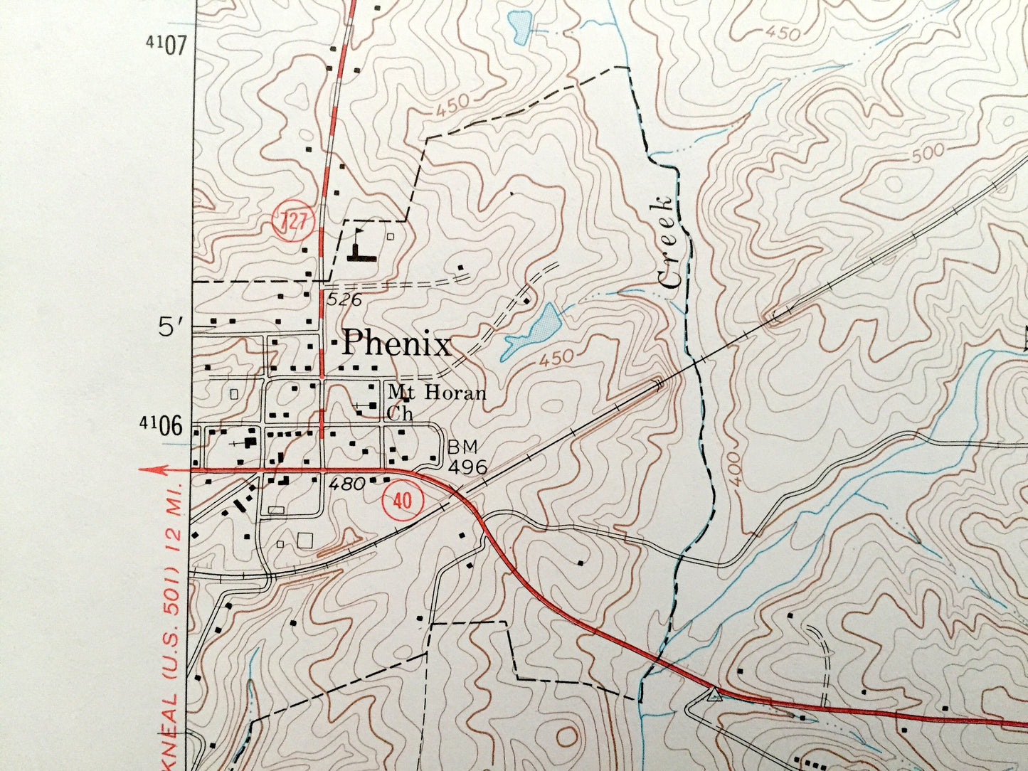
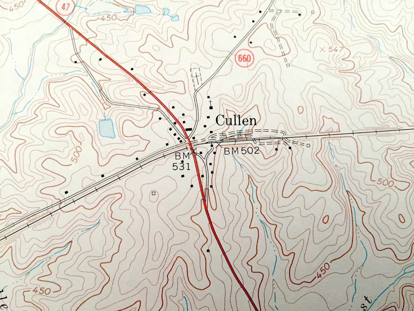
Cities & Towns: Charlotte Court House, Fears Corner, Chandlers Forks, Phenix, Cullen, Harrisburg, Womacks.
Points of Interest: Norfolk and Western Railroad, Roanoke River, Randolph-Henry School, Mt Tirzgah Church, Charlotte Court House Central High School, Phenix Lookout tower, Wards Fork Creek, and many more roads, creeks, churches and houses.
Condition: Very Good condition, commensurate with age. This map is in incredible shape for being almost 45 years old.
----
We will happily adjust shipping price for multiple purchases. Maps are rolled up and shipped in sturdy mailing tubes, never folded.
Couldn't load pickup availability
Share