My Store
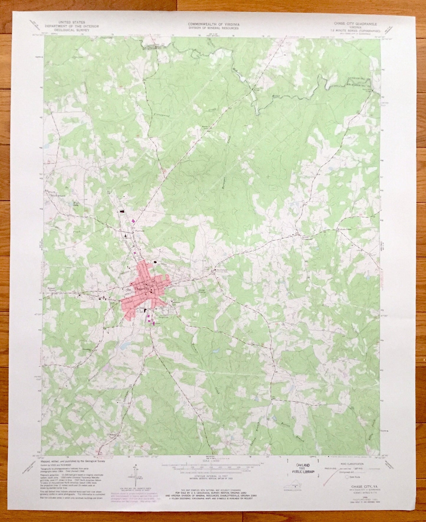
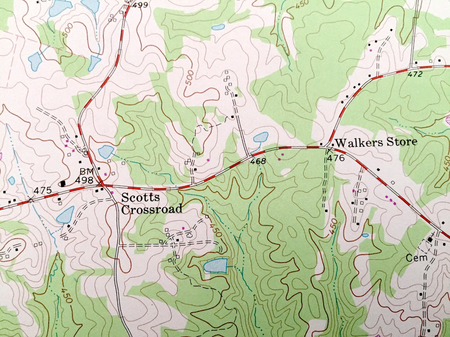
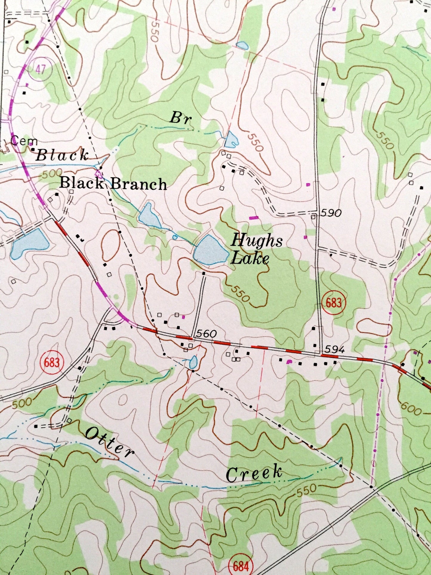
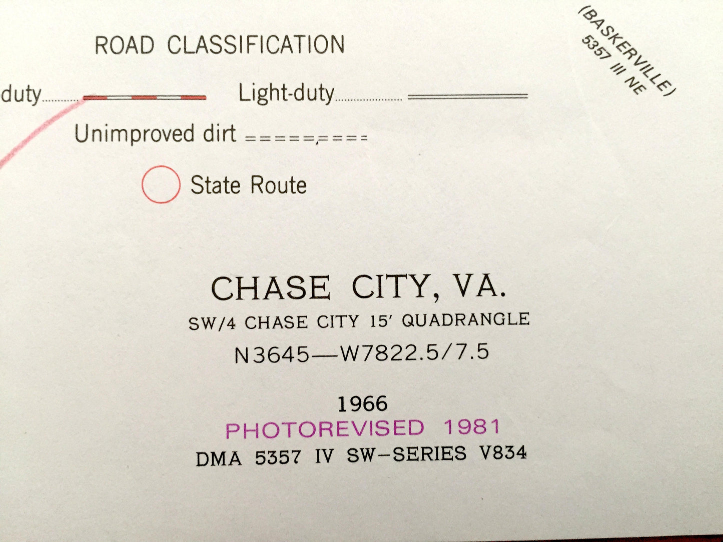
Antique Chase City, Virginia 1966 US Geological Survey Topographic Map – Fairview, Black Branch, Scotts Crossroad, Bynum Store, Finneywood
Antique Chase City, Virginia 1966 US Geological Survey Topographic Map – Fairview, Black Branch, Scotts Crossroad, Bynum Store, Finneywood
Beautiful, antique map of Chase City, Fairview, Black Branch, Scotts Crossroad, Bynum Store, Finneywood and Walkers Store, Virginia. This is an authentic 1966 edition, 1981 print from the U.S. Geological Survey and NOT a computer reproduction.
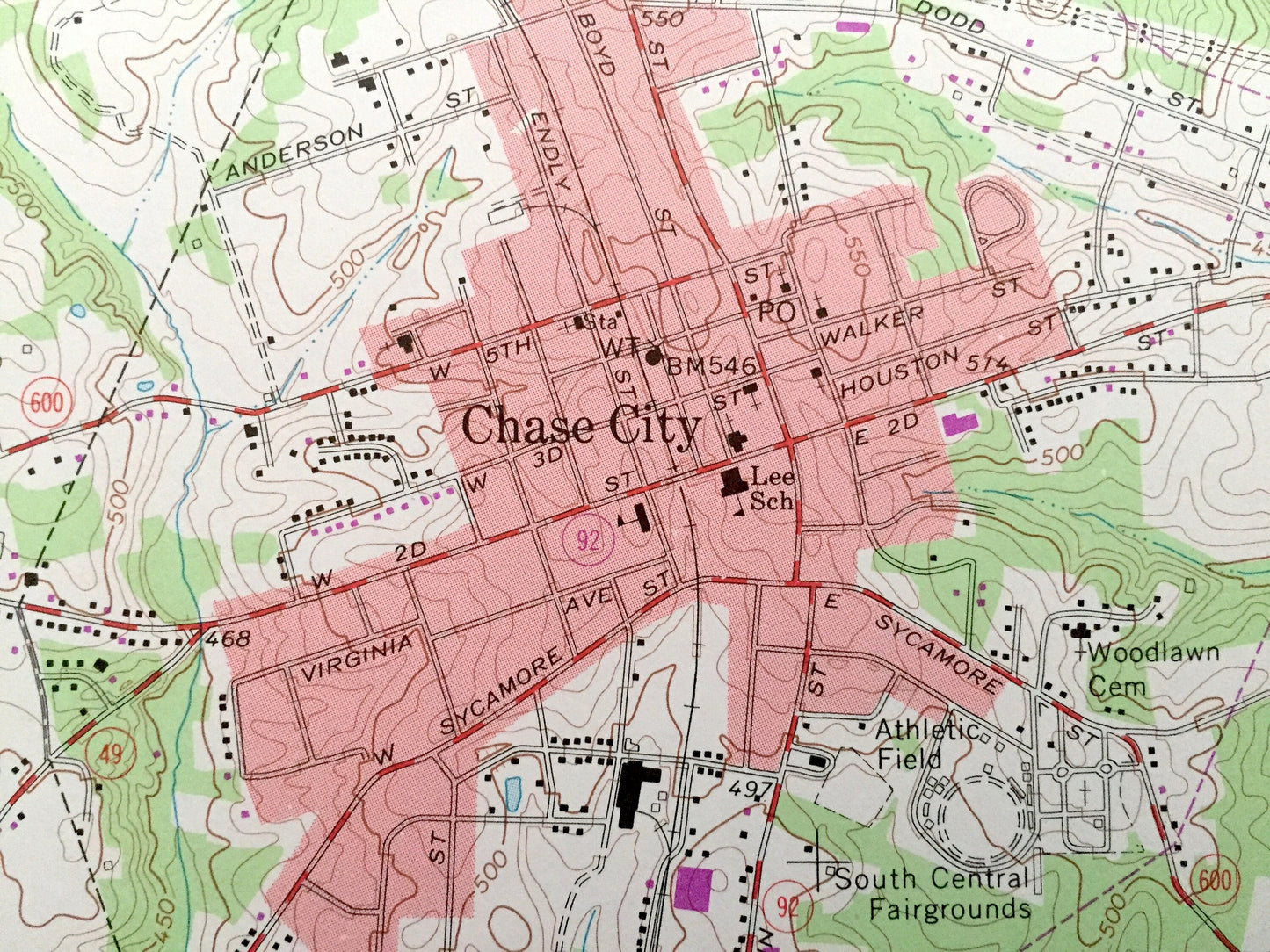
See what Mecklenburg and Lunenburg Counties of Virginia looked like over 55 years ago. Lots of intricate details and geological contours. Map even has little squares for every house that existed at the time. The USGS cartographers were very thorough back then!
Perfect for the historian, map-lover, the curious or just as a conversation starter. Wonderful and rare. Vintage maps such as this make great gifts.
Edition of 1966, printed 1981
Dimensions: 22" width x 27" height
----
Features
Cities & Towns: Chase City, Esnon, Fairview, Black Branch, Scotts Crossroad, Bynum Store, Finneywood, Walkers Store.
Points of Interest: Chase City South Central Fairgrounds, Athletic Field, Thyne School, Mecklenburg Country Club, Drive-in Theater, Friendship Church, Finneywood Church, Tucker Mill Bridge, Southern Railroad and many more roads, creeks, churches and houses.
Condition: Good Vintage condition, commensurate with age. This map is in great shape for being over 40 years old. Has light wear but this will add to character when framed.
----
We will happily adjust shipping price for multiple purchases. Maps are rolled up and shipped in sturdy mailing tubes, never folded.
Couldn't load pickup availability
Share