My Store
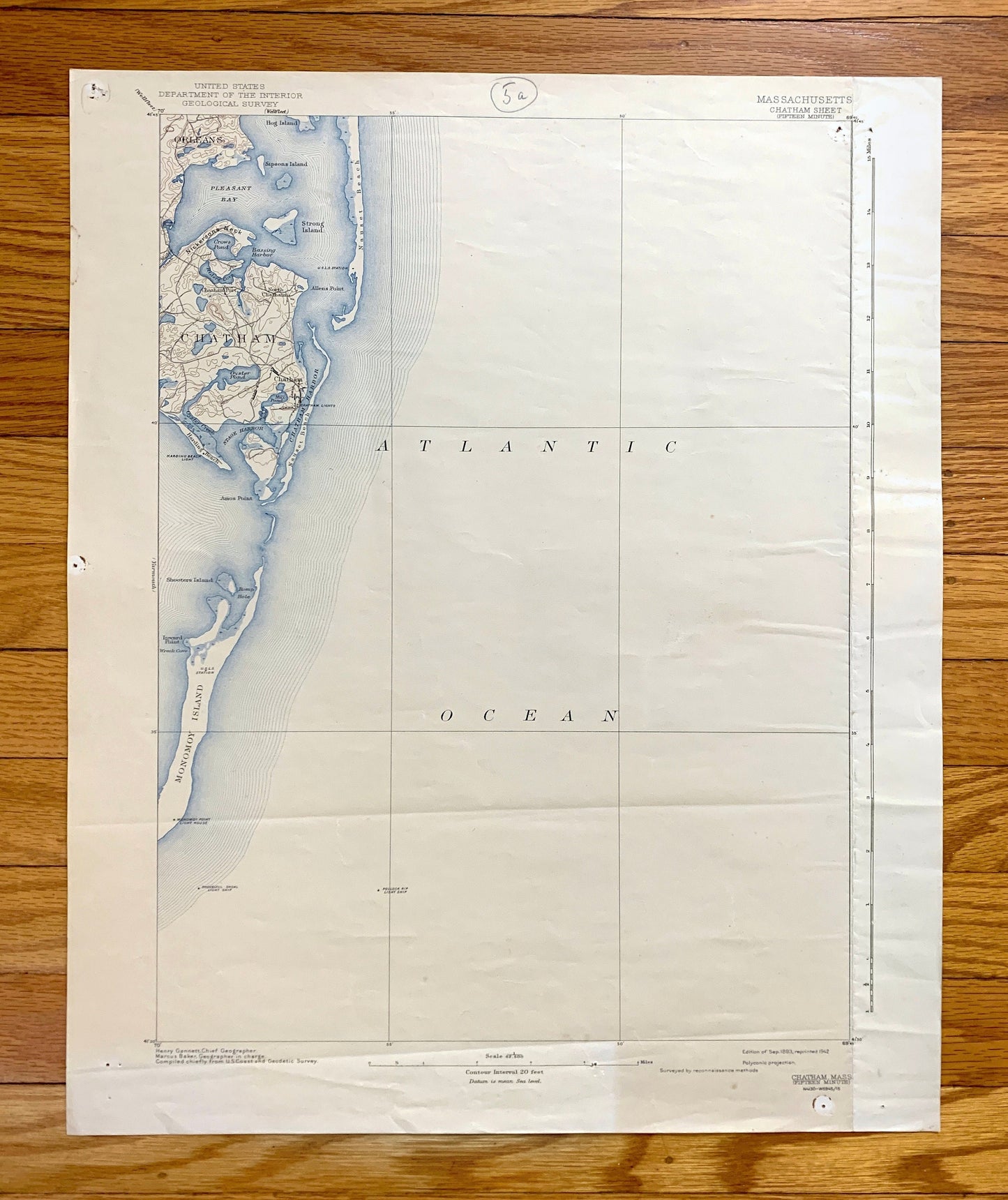
Antique Chatham, Massachusetts 1893 US Geological Survey Topographic Map – Cape Cod, Barnstable County, Brewster, Harwich, South Orleans, MA
Antique Chatham, Massachusetts 1893 US Geological Survey Topographic Map – Cape Cod, Barnstable County, Brewster, Harwich, South Orleans, MA
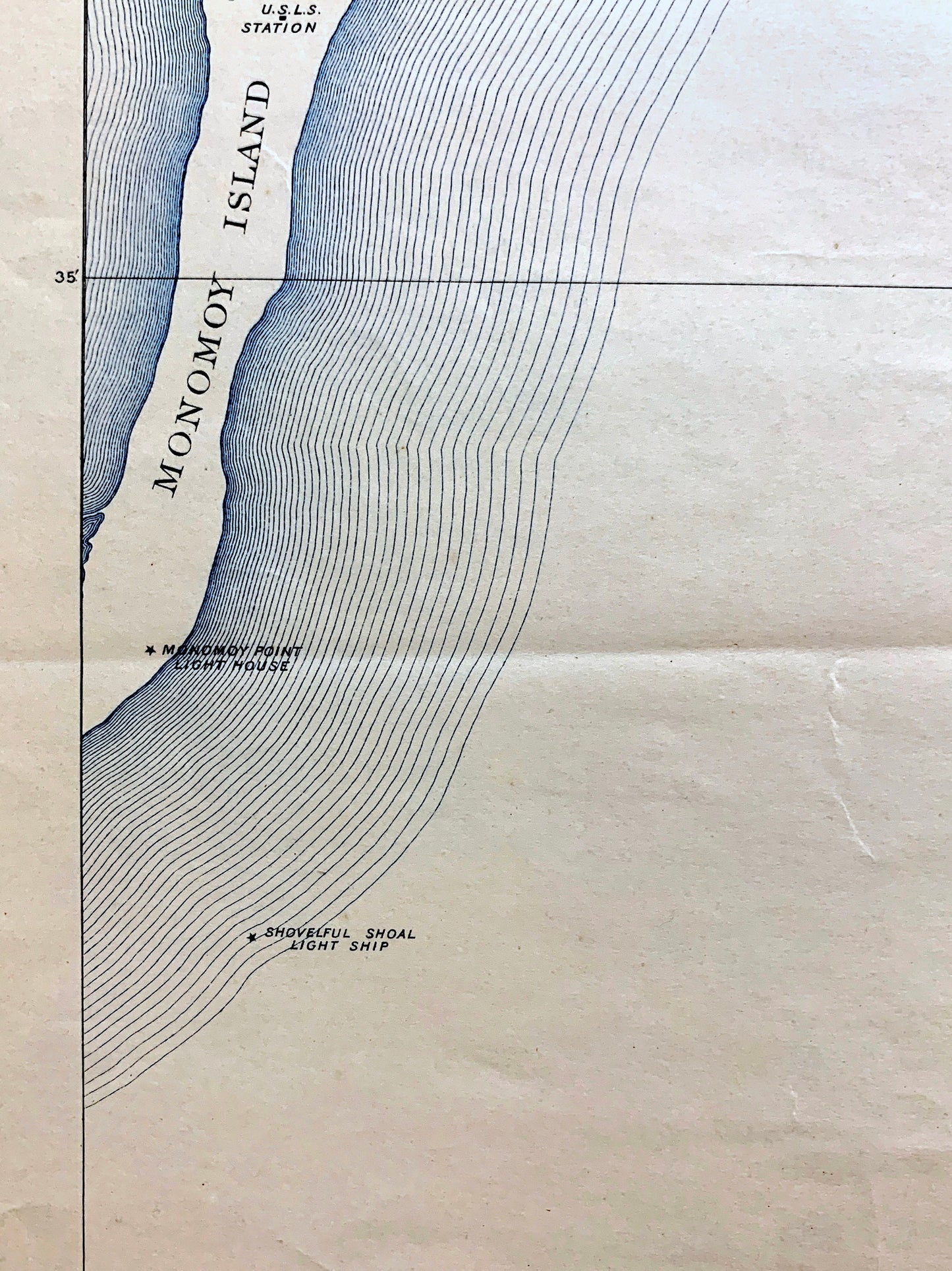
Beautiful, antique map of Chatham, Massachusetts and surrounding Barnstable County area. This is an authentic edition of a 1893 edition, 1942 print from the U.S. Geological Survey and NOT a computer reproduction.
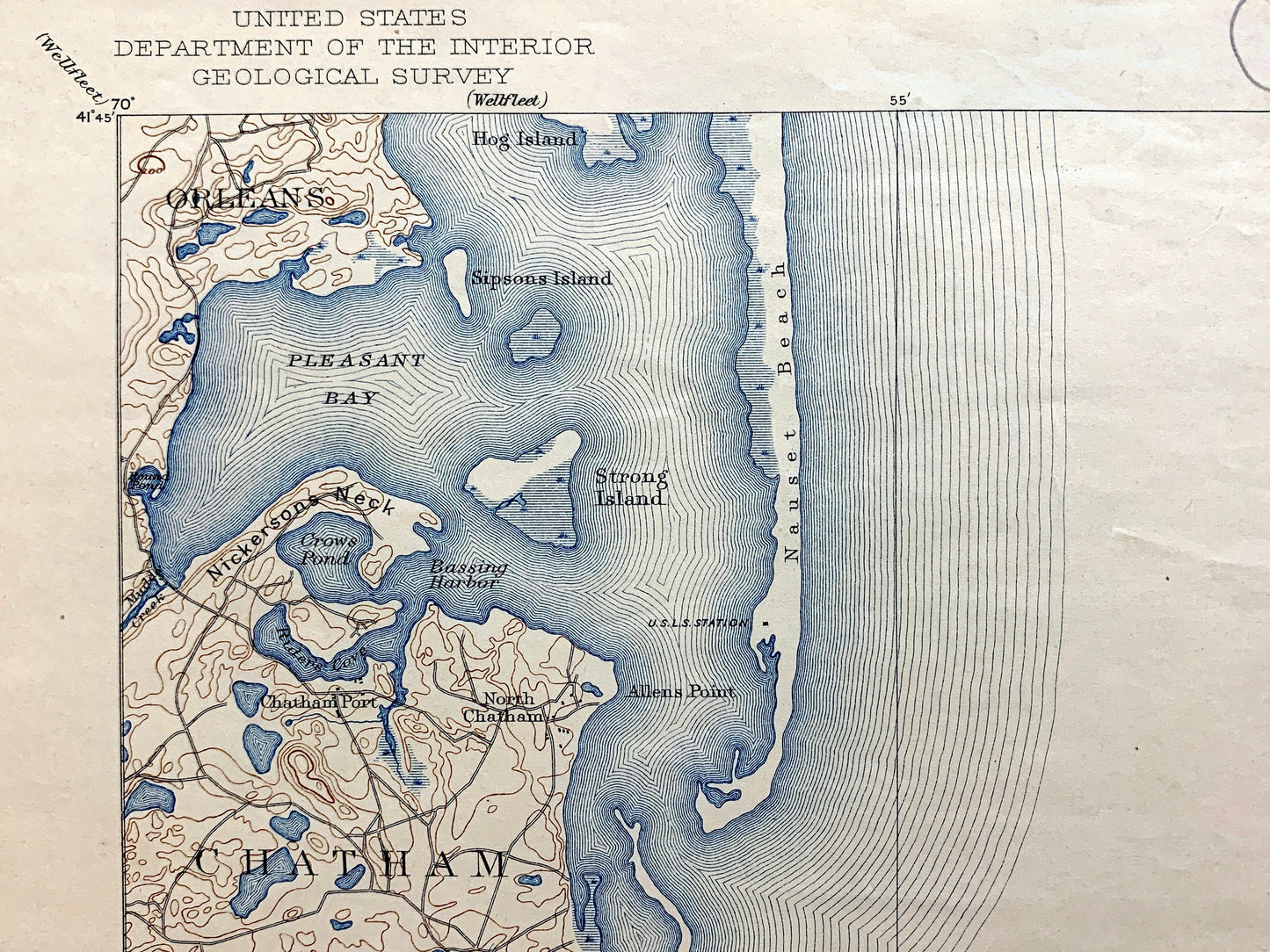
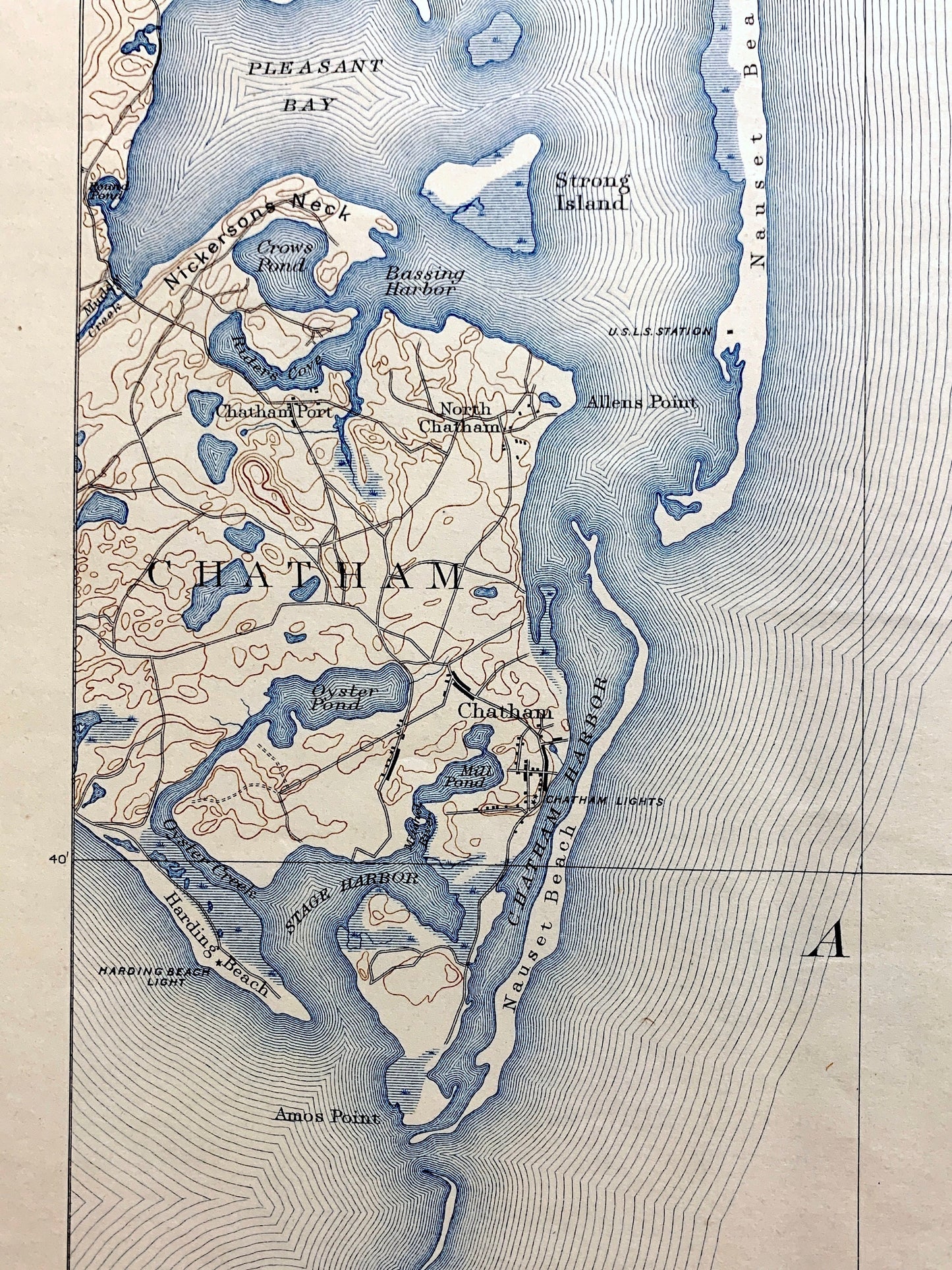
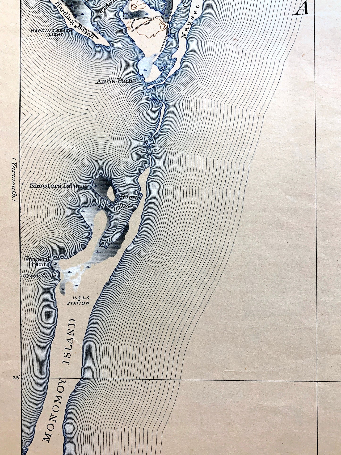
See what Cape Cod looked like over 125 years ago. Lots of intricate details and geological contours. Map even has little squares for every house that existed at the time. The USGS cartographers were very thorough back then! On the back is a description of topographic symbols and map guide.
Perfect for the historian, map-lover, the curious or just as a conversation starter. Wonderful and rare. Vintage maps such as these make great gifts.
Edition of 1893, printed 1942
Dimensions: 16 1/2" width x 20" height
----
Features
Cities & Towns: Chatham, Brewster, Orleans, South Orleans, Harwich, Chatham Port, North Chatham, West Chatham.
Points of Interest: Barnstable County, Atlantic Ocean, Cape Cod, Nauset Beach, Nantucket Sound, Pleasant Bay, Chatham Harbor, Chatham Airport, Monomoy National Wildlife Refuge, Morris Island, Crows Pond, and many more roads, houses, reservoirs, ponds, and hills.
Condition: Good or "Very Vintage" condition, commensurate with age. This map is in great shape for being over 80 years old. Has light edge-wear, pencil in margin, toning, discoloration in places, but this will read as vintage character when framed.
----
We will happily adjust shipping price for multiple purchases. Maps are rolled up and shipped in sturdy mailing tubes, never folded.
Couldn't load pickup availability
Share