My Store
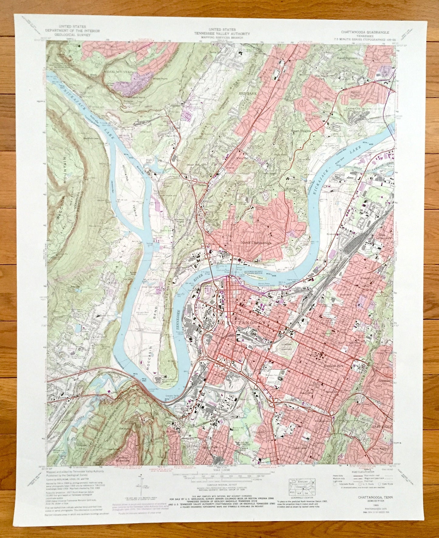
Antique Chattanooga, Tennessee 1969 US Geological Survey Topographic Map – Hamilton County, Tiftonia, Brainerd, Alton Park, Oakgrove, TN
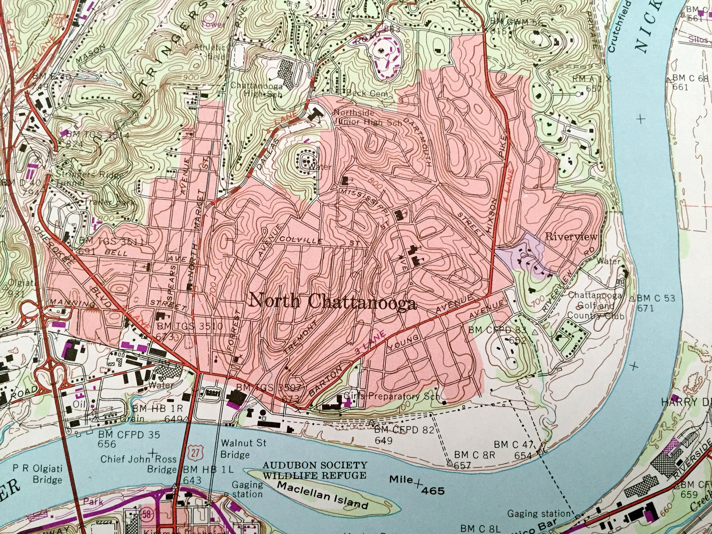
Antique Chattanooga, Tennessee 1969 US Geological Survey Topographic Map – Hamilton County, Tiftonia, Brainerd, Alton Park, Oakgrove, TN
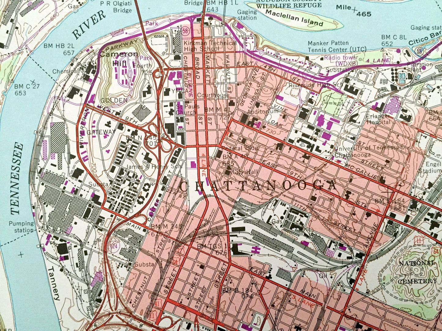
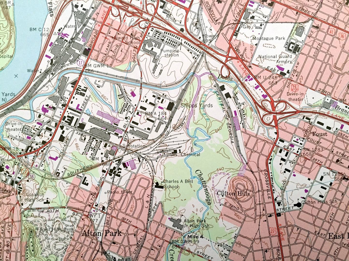
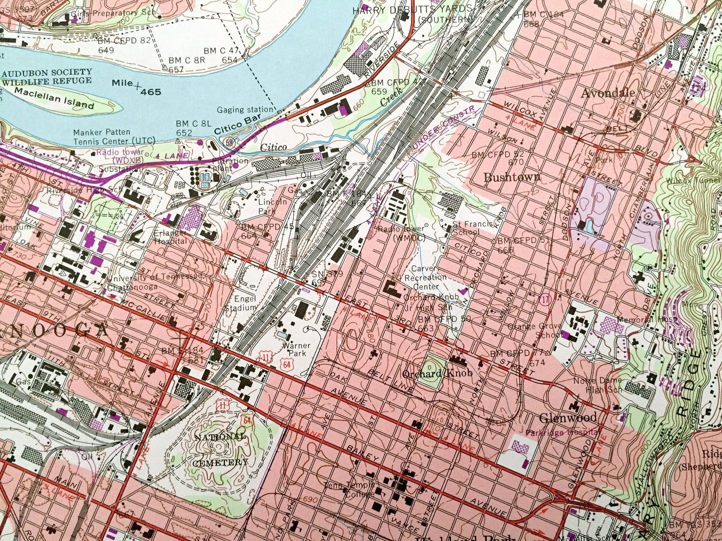
Beautiful, antique map of Chattanooga, Tennessee and surrounding Hamilton and Marion County area. This is an authentic 1969 edition, 1976 print from the U.S. Geological Survey and NOT a computer reproduction.
See what Tennessee looked like over 50 years ago. Lots of intricate details and geological contours. Map even has little squares for every house that existed at the time. The USGS cartographers were very thorough back then!
Perfect for the historian, map-lover, the curious or just as a conversation starter. Wonderful and rare. Vintage maps such as these make great gifts.
Edition of 1969, printed 1976
Dimensions: 22" width x 27" height
----
Features
Cities & Towns: Chattanooga, Tiftonia, Lookout Mountain, St Elmo, Alton Park, East Lake, East Ridge, Brainerd, Highland Park, Oakgrove, Avondale, Bushtown, Carriage Hill, Lupton City, Stuart Heights, White Oak, Red Bank, North Chattanooga, East Chattanooga.
Points of Interest: Nickajack Lake, Tennessee River, Williams Island, Raccoon Mountain, Elder Mountain, Moccasin Bend, Lookout Valley, Godsey Ridge, Cumberland Escarpment, Wilder Point, Stringers Ridge, Missionary Ridge, Chickamauga and Chattanooga National Military Park, Audobon Society Wildlife Refuge, and many more hills, streams, ponds, houses, schools, churches and roads.
Condition: Very Good Vintage condition, commensurate with age. This map is in great shape for being over 45 years old.
----
We will happily adjust shipping price for multiple purchases. Maps are rolled up and shipped in sturdy mailing tubes, never folded.
Couldn't load pickup availability
Share