My Store
Antique Cheboygan, Michigan 1955 US Geological Survey Topographic Map – Petoskey, Bayne City, East Jordan, Onaway, Charleveix, St Ignace, MI
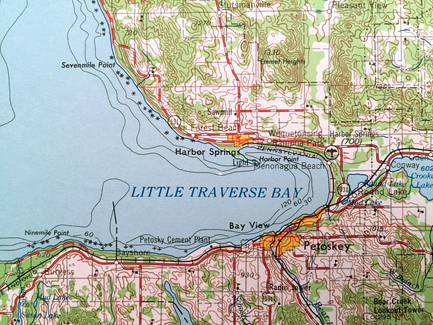
Antique Cheboygan, Michigan 1955 US Geological Survey Topographic Map – Petoskey, Bayne City, East Jordan, Onaway, Charleveix, St Ignace, MI
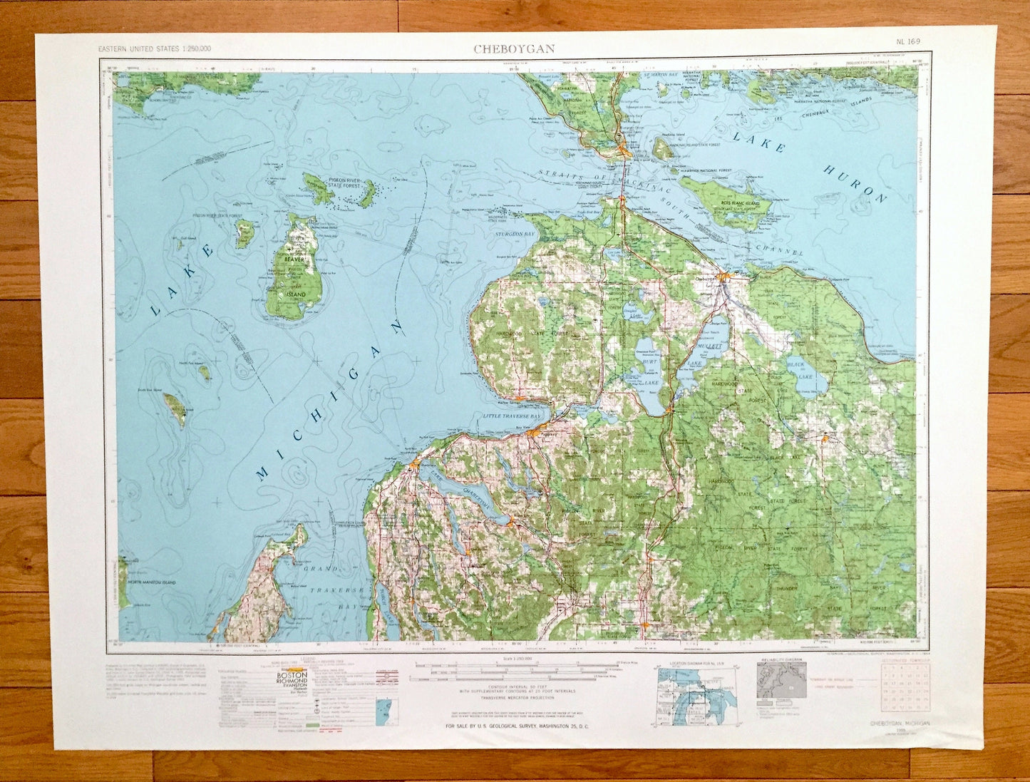
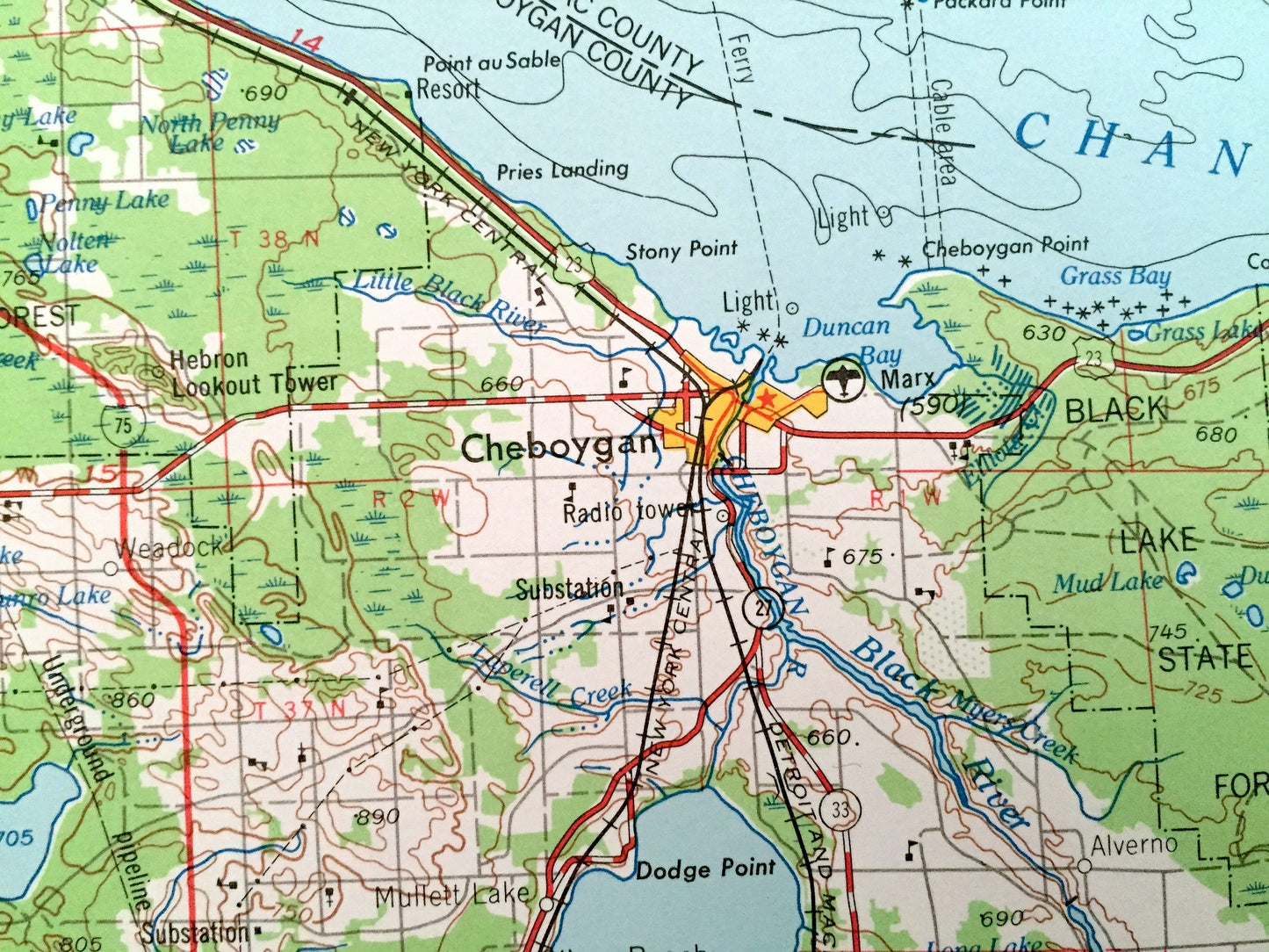
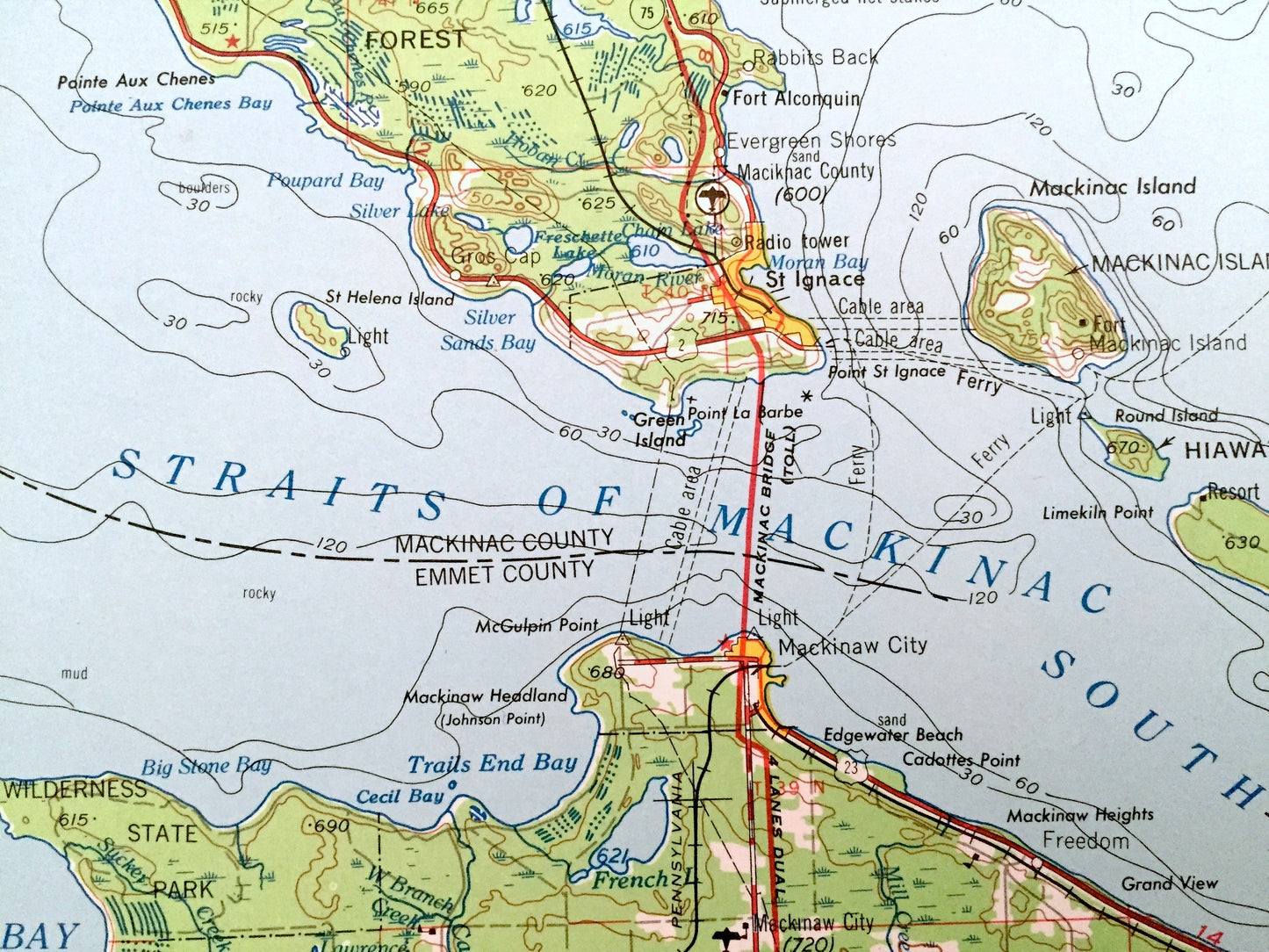
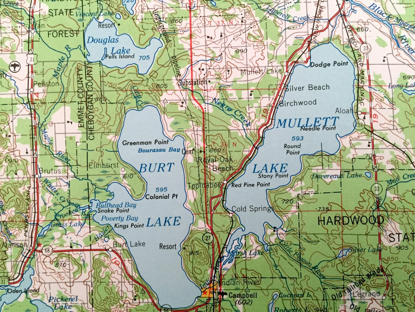
Beautiful, antique map of Cheboygan, Michigan and surrounding area. This is an authentic 1955 edition, 1964 print from the U.S. Geological Survey and NOT a computer reproduction.
See what Michigan looked like over 65 years ago. Lots of intricate details and geological contours. Map is incredibly large and in the grand 1:250,000 scale. The USGS cartographers were very thorough back then!
Perfect for the historian, map-lover, the curious or just as a conversation starter. Wonderful and rare. Vintage maps such as these make great gifts.
Edition of 1955, printed 1964
Dimensions: 32" width x 22 1/2" height
----
Features
Cities & Towns: Cheyboygan, Mackinaw City, Leland, Gaylord, Eastport, Vanderbilt, Peshawbestown, Petoskey, Bayne City, East Jordan, Onaway, Charleveix, St. Ignace.
Points of Interest: Lake Michigan, Lake Huron, Mullett Lake, Lake Charlevoix, Grand Traverse Bay, Sturgeon Bay, St. Martin Bay, Straits of Mackinac, South Channel, Beaver Island, North Manitou Island, Cheneaux Islands, Bois Blanc Islands, Hardwood State Forest, Black Lake State Forest, Pigeon River State Forest, Thunder Bay River State Forest, Cheboygan River, Black River, Jordan River and lots more hills, mountains, lakes, rivers, creeks, roads, highways and railroads.
Condition: Good Vintage condition, commensurate with age. This map is in incredible shape for being over 55 years old. Has some light edge-wear, all of which will read as vintage character when framed.
----
We will happily adjust shipping price for multiple purchases. Maps are rolled up and shipped in sturdy mailing tubes, never folded.
Couldn't load pickup availability
Share