My Store
Antique Cherryfield, Maine 1902 US Geological Survey Topographic Map – Steuben, Millbridge, Harrington, Columbia, Addison, Pleasant Bay, ME
Antique Cherryfield, Maine 1902 US Geological Survey Topographic Map – Steuben, Millbridge, Harrington, Columbia, Addison, Pleasant Bay, ME
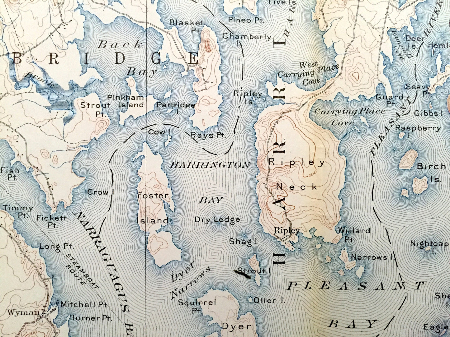
Beautiful, antique map of historic Steuben, Millbridge & Harrington, Maine and surrounding Washington County area on the Maine Coast. This is an authentic 1902 edition, 1962 print from the U.S. Geological Survey and NOT a computer reproduction.
See what the Maine Coast looked like more than a century ago, when large parts of Maine were still unnamed, like "Township No. 19." Lots of intricate details and geological contours. Map even has little squares for every house that existed at the time. The USGS cartographers were very thorough back then!
Perfect for the historian, map-lover, the curious or just as a conversation starter. Wonderful and rare. Vintage maps such as these make great gifts.
Edition of 1904, printed 1962
Dimensions: 17" width x 21" height
----
Features
Cities & Towns: Deblois, Township No. 18, Township No. 19, Columbia Falls, Cherryfield, Columbia, Gouldsboro, Steuben, Millbridge, Harrington, Addison, Epping, Dorman, Marshville, West Harrington, Smithville, Wyman, Unionville, Dewey.
Points of Interest: Narraguagus River, Narraguagus Bay, Flat Bay, Harrington River, Harrington Bay, Pleasant Bay, Pleasant River, Schoodic Lake, Blueberry Barrens, Pineo Ridge, Burke Hill, Tunk Stream, Steuben Harbor, Foster Island, Ripley Neck, Mill River, Tumbledown Dick Head, Carrying Place Cove Dyer Island, Dyer Narrows, Turner Hill, Oliver Lord Point, Back Bay, Kemps Folly, Strout Point, Cole Mill River, Washington County Railroad, and lots more hills, streams, ponds, marshes, houses, islands, coves and roads.
Condition: Good Vintage condition, commensurate with age. This map is in great shape for being almost 60 years old. Map has some wear, toning and fold lines as-issued, but will flatten nicely and read as vintage character when framed.
----
We will happily adjust shipping price for multiple purchases. Maps are rolled up and shipped in sturdy mailing tubes, never folded.
Couldn't load pickup availability
Share