My Store
Antique Cherryfield, Maine 1950 US Geological Survey Topographic Map – Hancock, Washington County, Steuben, Milbridge, Gouldsboro, ME
Antique Cherryfield, Maine 1950 US Geological Survey Topographic Map – Hancock, Washington County, Steuben, Milbridge, Gouldsboro, ME
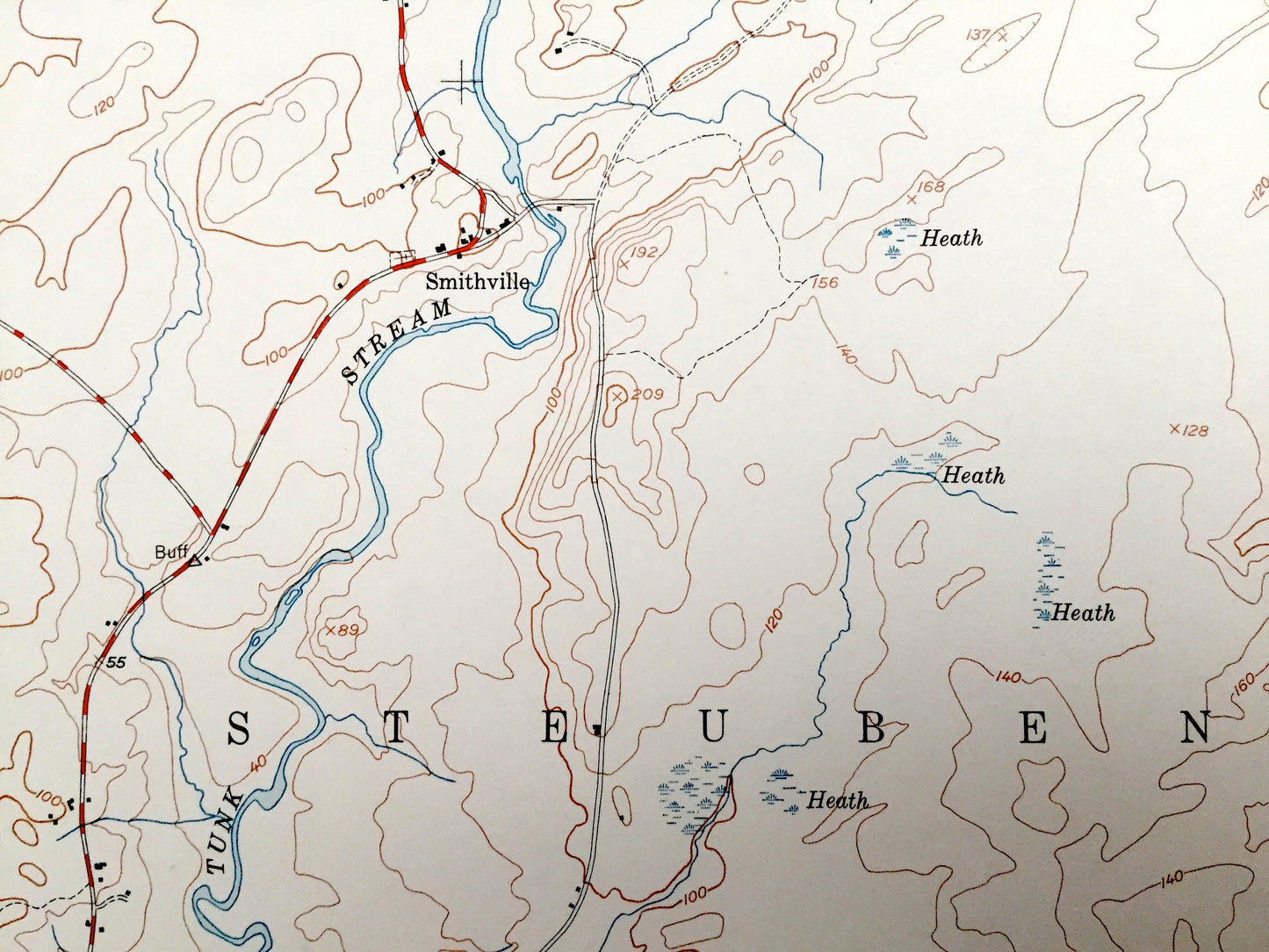
Beautiful, antique map of Cherryfield, Maine and surrounding Washington County and Hancock County areas. This is an authentic 1950 edition, 1950 print from the U.S. Geological Survey and NOT a computer reproduction.
See what Maine looked like over 70 years ago. Lots of intricate details and geological contours. Map even has little squares for every house that existed at the time. The USGS cartographers were very thorough back then!
Perfect for the historian, map-lover, the curious or just as a conversation starter. Wonderful and rare. Vintage maps such as these make great gifts.
Edition of 1950, printed 1950
Dimensions: 22" width x 27" height
----
Features
Cities & Towns: Steuben, Milbridge, Harrington, Gouldsboro, Unionville, Smithville, East Steuben.
Points of Interest: Burke Hill, Steuben Harbor, Joy Cove, Downing Pond, West Branch, Narraguagus River, Tunk Stream, Mill River, Beaver Meadow Brook, Baker Cove, Whitten Parritt Stream, and many more hills, streams, ponds, houses, schools, railroads, churches and roads.
Condition: Very Good Vintage condition, commensurate with age. This map is in great shape for being over 70 years old. Has some staining and a four-hole-punch on the left hand margin, all of which will read as character when framed.
----
We will happily adjust shipping price for multiple purchases.
Couldn't load pickup availability
Share