My Store
Antique Chesapeake Bay 1979 US Coast Guard Nautical Map – Cape Charles to Norfolk Harbor, Virginia Beach, Newport News, York River, Henry VA
Antique Chesapeake Bay 1979 US Coast Guard Nautical Map – Cape Charles to Norfolk Harbor, Virginia Beach, Newport News, York River, Henry VA
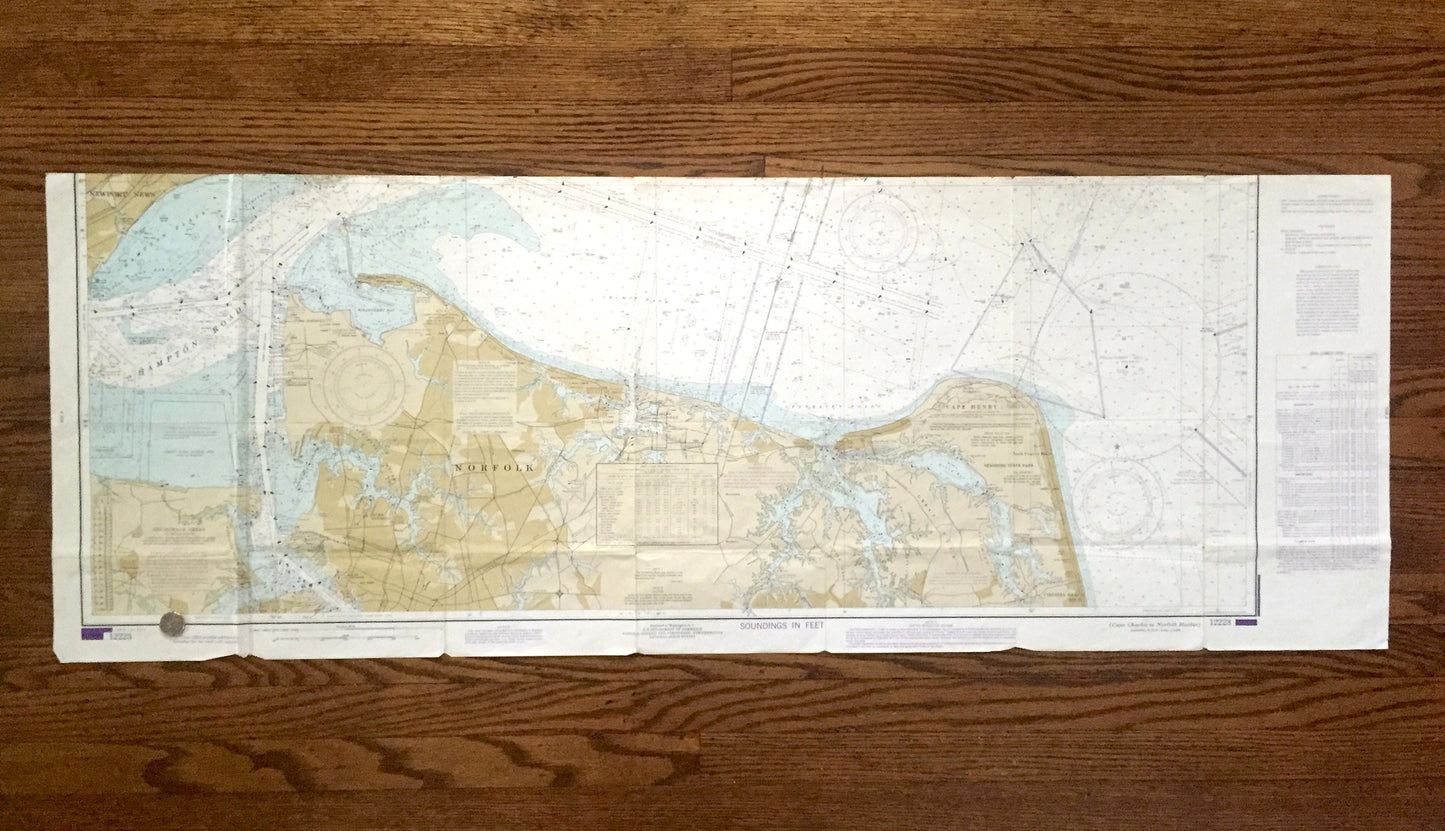
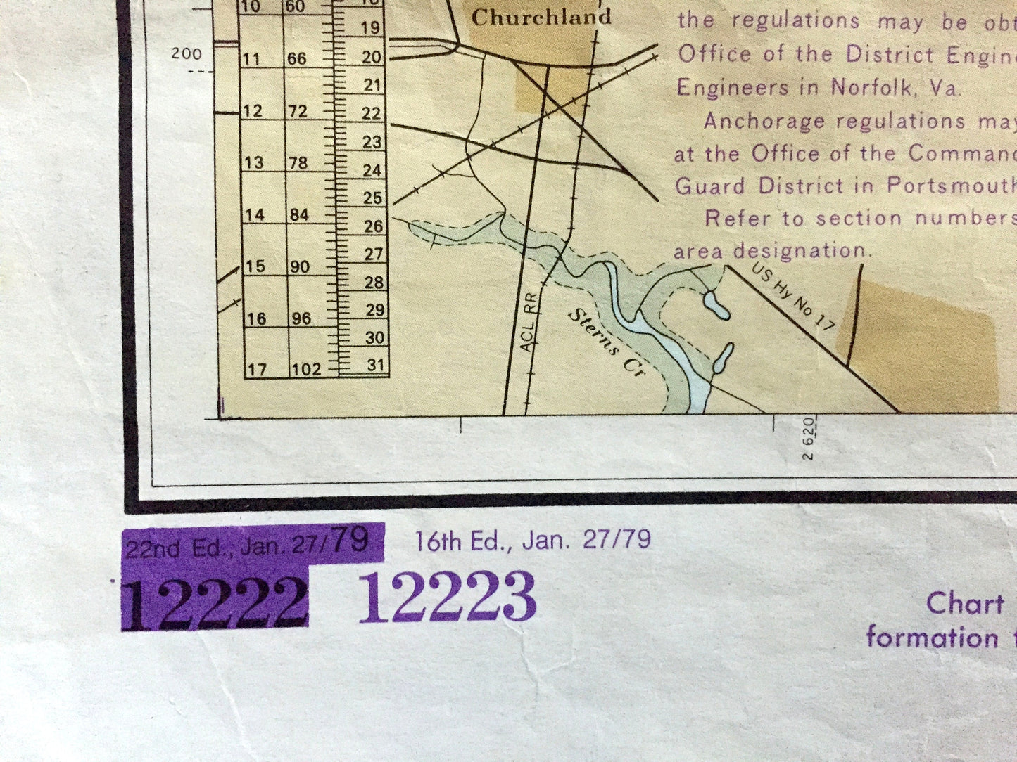
Beautiful, antique double-sided nautical chart of Chesapeake Bay, from Cape Charles to Norfolk Harbor. This is an authentic 1979 print from the United States Coast Guard & Geodetic Survey and is NOT a computer reproduction. Map is double-sided for ease of navigation while boating.
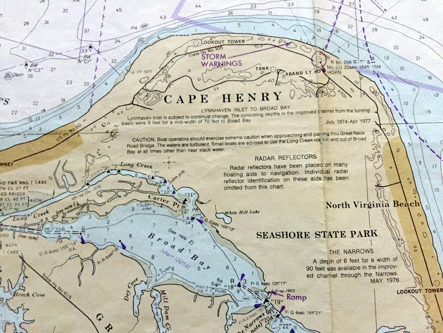
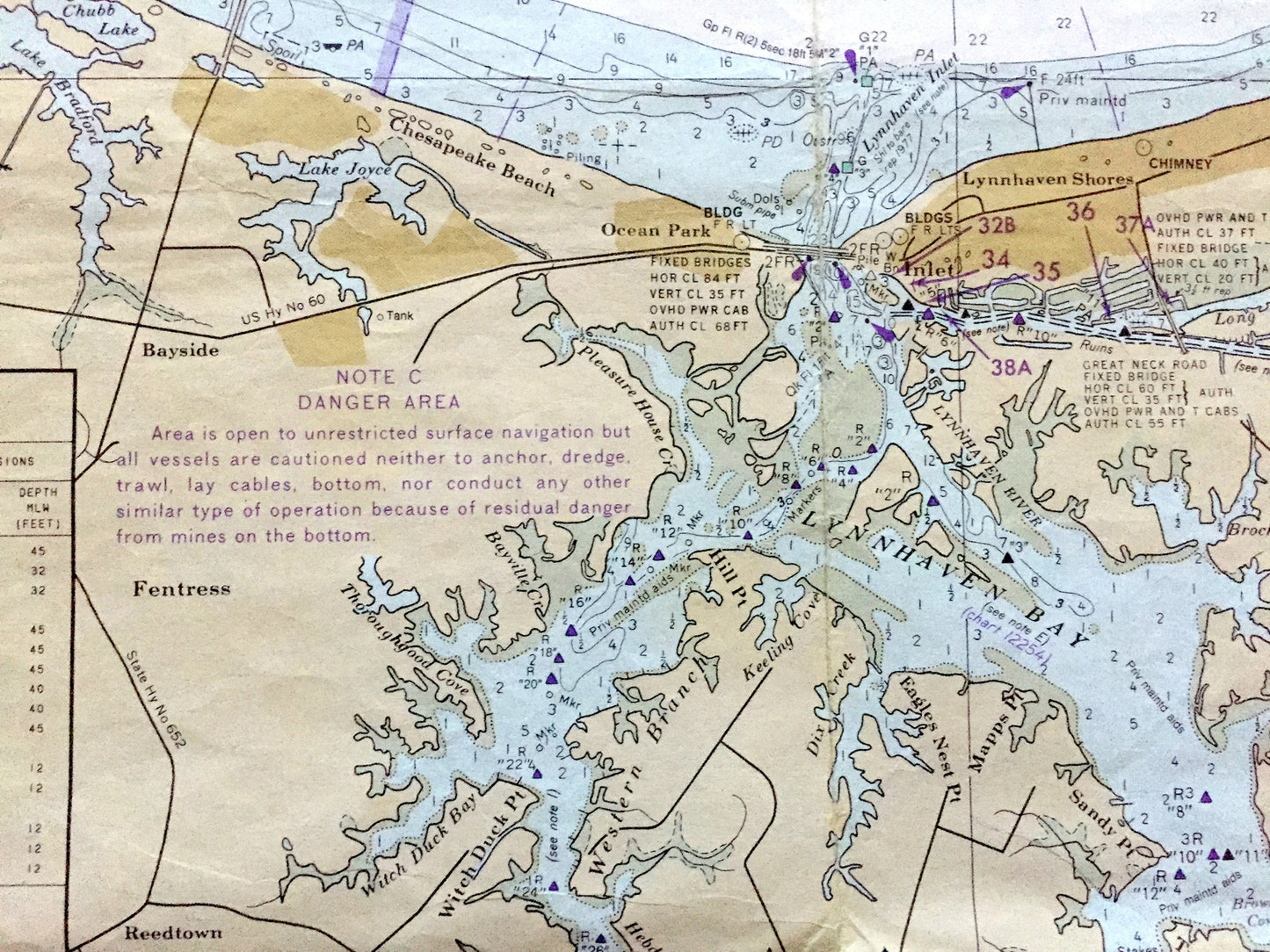
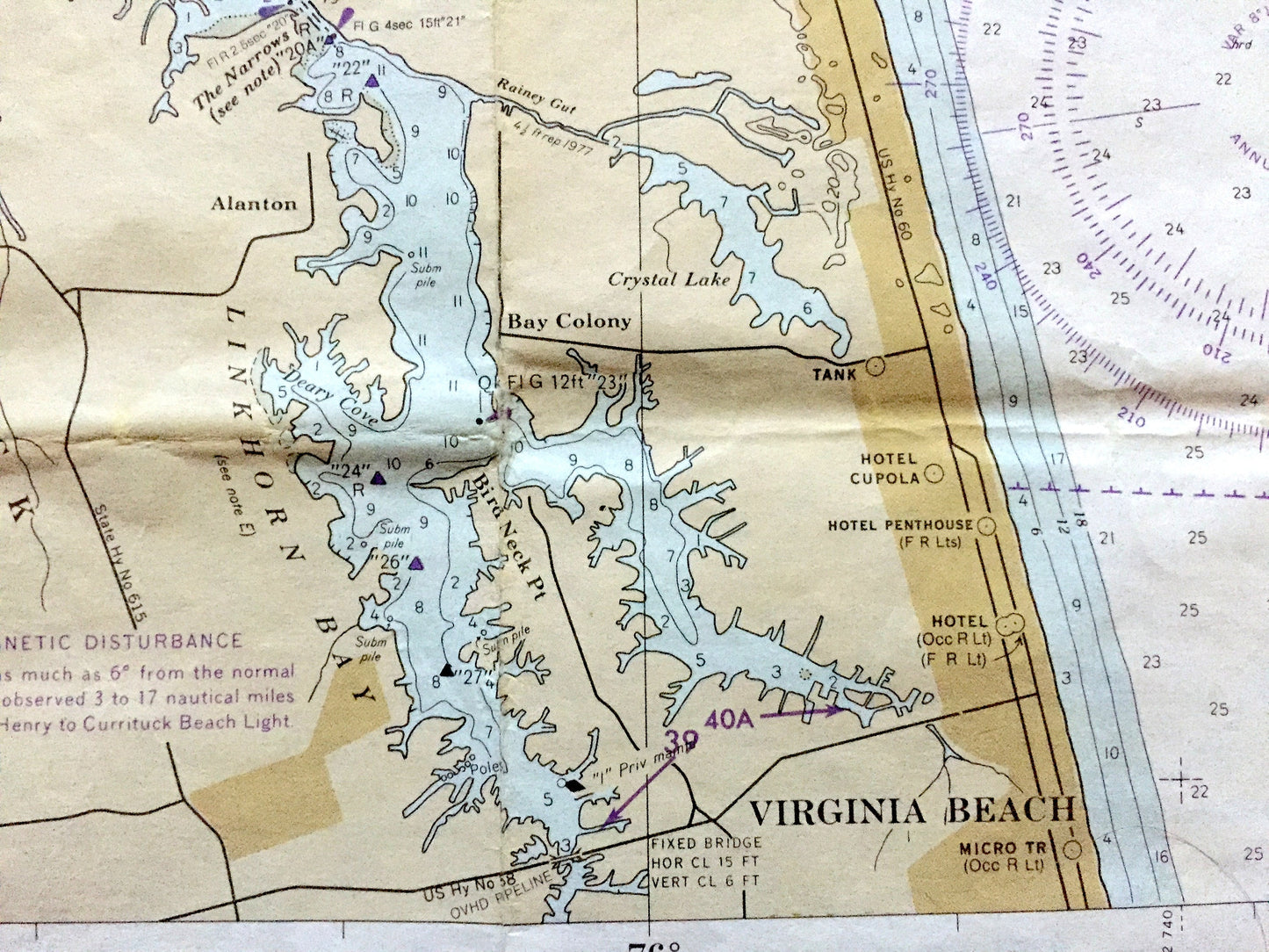
See what The Chesapeake looked like more than 40 years ago. Lots of charming, intricate details and contours, including depth soundings, cities, streets, rivers, anchorages, magnetic anomaly areas and other points of nautical interest. Map is very large and would be the focal point in whatever room it is hung.
Perfect for the historian, boater, map-lover, the curious or just as a conversation starter. Wonderful and rare. Vintage maps such as these make great gifts.
Edition of 1979, printed 1979
Dimensions: 51" width x 18 1/4" height
----
Condition: Good or "Very Vintage" condition, commensurate with age. This map is in great shape for being over 40 years old. Has some wear, toning, foxing, as well as a fold line as-issued, but this will flatten easily and all will read as honest vintage character when framed. This maps has most likely seen some voyages!
----
We will happily adjust shipping price for multiple purchases. Maps are rolled up and shipped in sturdy mailing tubes, never folded.
Couldn't load pickup availability
Share