My Store
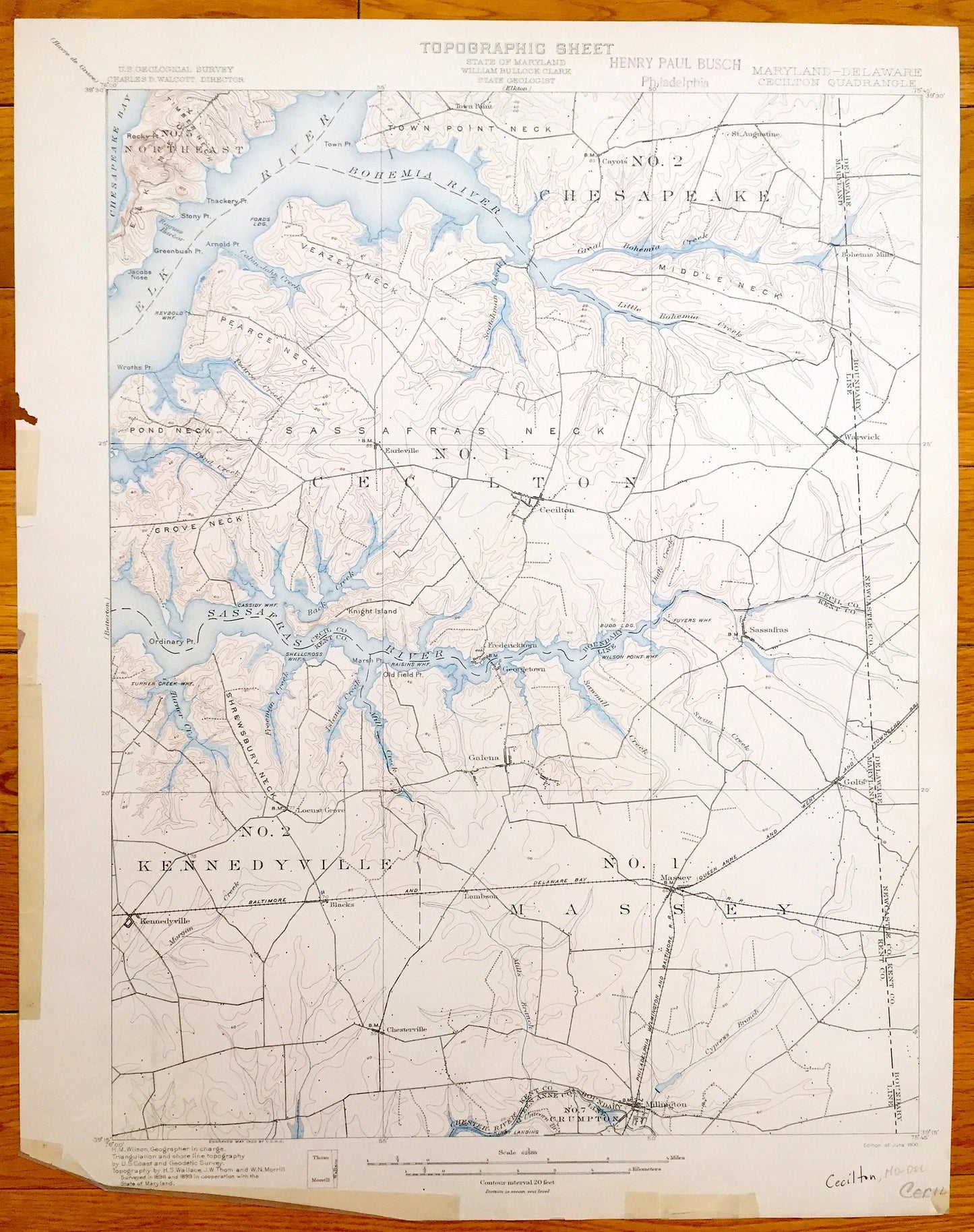
Antique Chesapeake Bay, Maryland 1900 US Geological Survey Topographic Map – Sassafras River, Crystal Beach, Cecilton, Hack Point, Elk Neck
Antique Chesapeake Bay, Maryland 1900 US Geological Survey Topographic Map – Sassafras River, Crystal Beach, Cecilton, Hack Point, Elk Neck
Beautiful, antique map of upper Chesapeake Bay, Maryland and the Sassafras River and Bohemia River. This is an original authentic 1900 print from the U.S. Geological Survey and is NOT a computer reproduction.
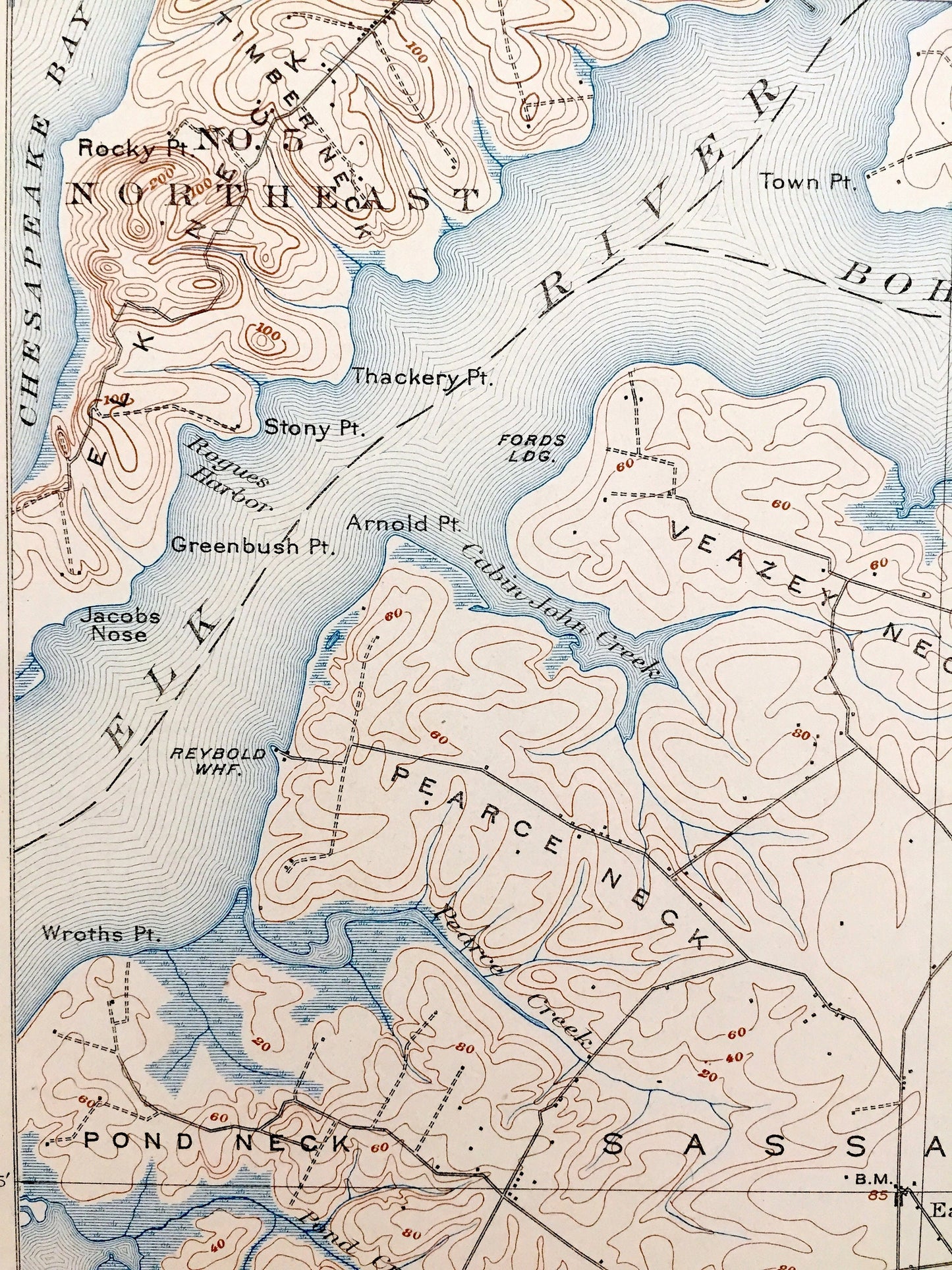
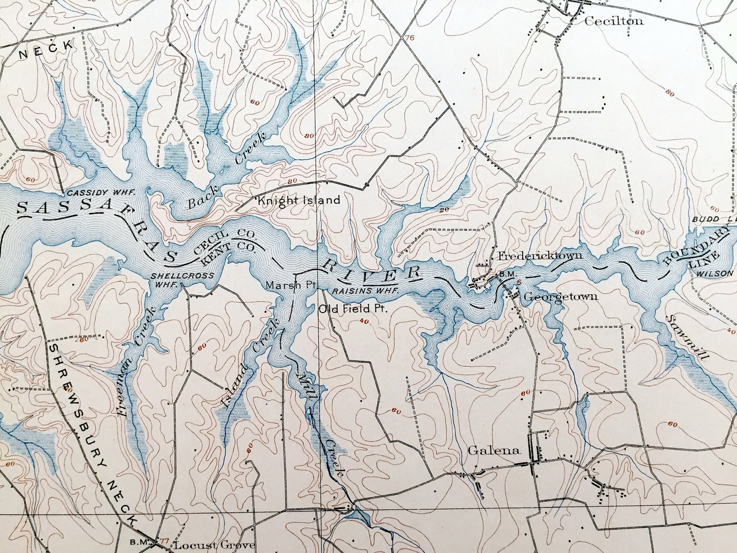
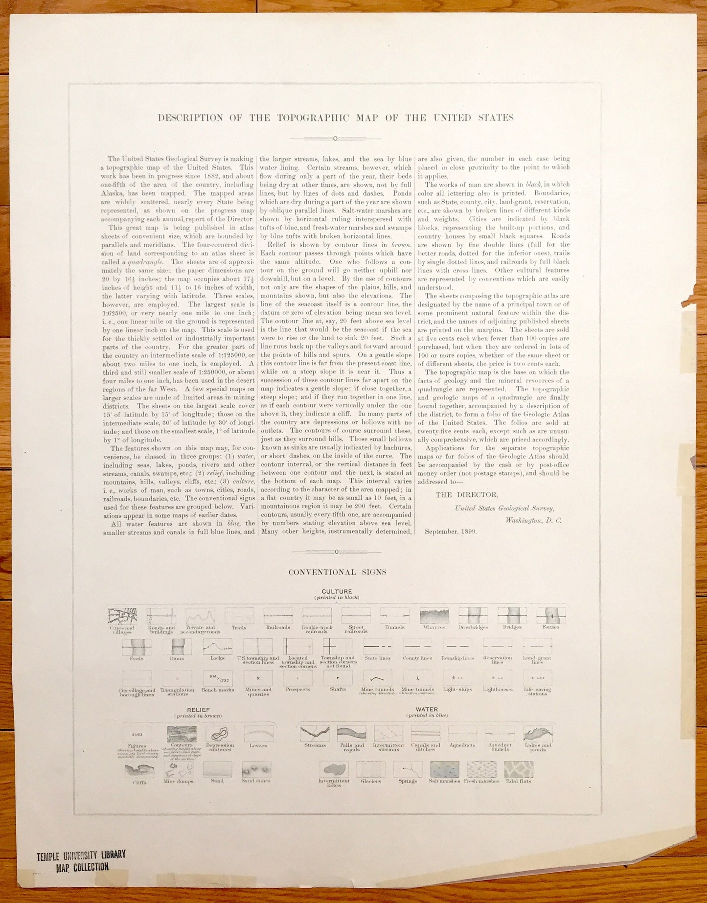
See what Cecil County, Kent County, Elk Neck and Sassafras Neck looked like over 120 years ago before a lot of towns were built. Lots of intricate details and geological contours. Map even has little squares for every house that existed at the time. The USGS cartographers were very thorough back then! On the back is a description of topographic symbols and map guide.
Perfect for the historian, map-lover, the curious or just as a conversation starter. Wonderful and rare. Vintage maps such as these make great gifts.
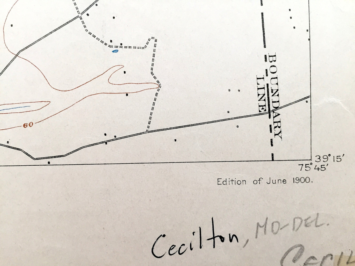
Edition of 1900, printed 1900
Dimensions: 15 3/4" width x 20" height
----
Features
Cities & Towns: Elk Neck, Town Point, Cayots, St. Augustine, Ford Landing, Hack Point, Crystal Beach, Bohemia Mills, Earleville, Cecilton, Ginns Corners, Sassafras, Kentmore Park, Georgetown, Fredericktown, Locust Grove, Daves Hill, Galenna, Olivet Hill, Golts, Kennedyville, Lambson, Massey, Chesterville, Millington, Peacock Corners, Morgnec.
Points of Interest: Chesapeake Bay, Elk River, Bohemia River, Pearce Creek, Veazy Cove, Town Point Neck, Elk Neck, Middle Neck, Veazey Neck, Pearce Neck, Sassafras Neck, Pond Neck, Wrath Point, Maryland State Park, Grove Neck, Sassafras River, Turner Creek, Shrewsbury Neck, Shellcross Neck, Chester River, Millington Wildlife Demonstration Area, and more roads, houses, ponds, hills, streams, islands and coves.
Condition: Good or "Very Vintage" condition, commensurate with age. This map is in great shape for being over 120 years old. Has some real edge-wear, toning, tape repair, cropping in bottom left margin and writing in margin, but this will all add to vintage character when framed.
----
We will happily adjust shipping price for multiple purchases. Maps are rolled up and shipped in sturdy mailing tubes, never folded.
Couldn't load pickup availability
Share