My Store
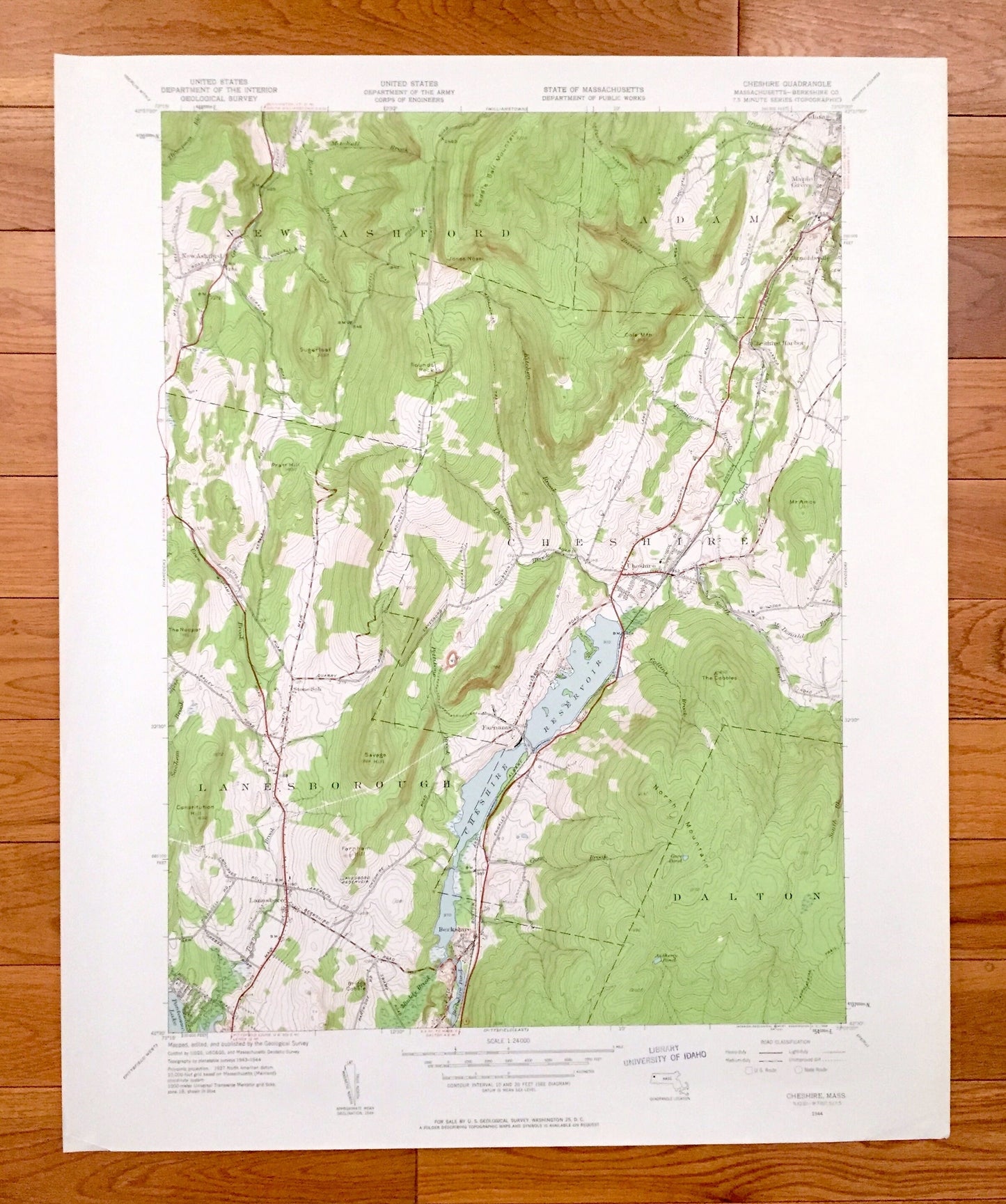
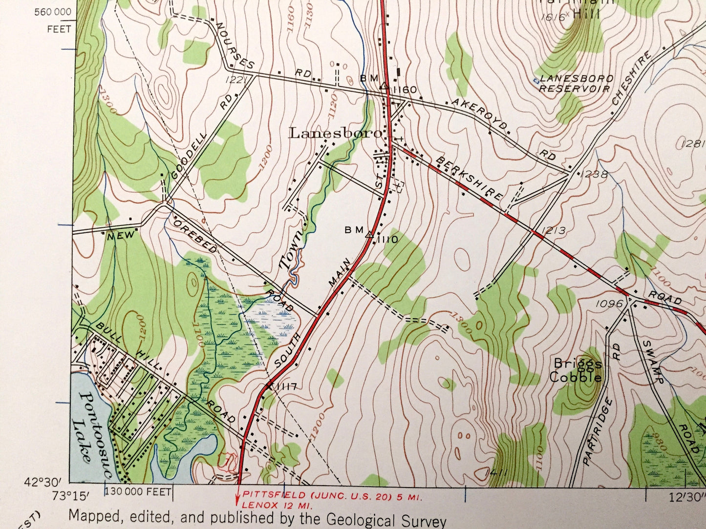
Antique Cheshire, Massachusetts 1944 US Geological Survey Topographic Map – Berkshire County, New Ashford, Adams, Lanesborough, Dalton, MA
Antique Cheshire, Massachusetts 1944 US Geological Survey Topographic Map – Berkshire County, New Ashford, Adams, Lanesborough, Dalton, MA
Beautiful, antique map of Cheshire, Massachusetts surrounding Berkshire County area. This is an authentic 1944 edition, 1958 print from the U.S. Geological Survey and NOT a computer reproduction.
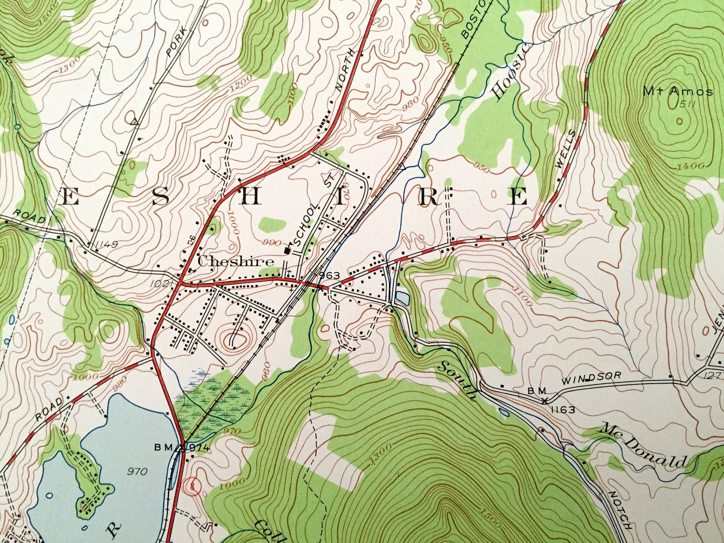
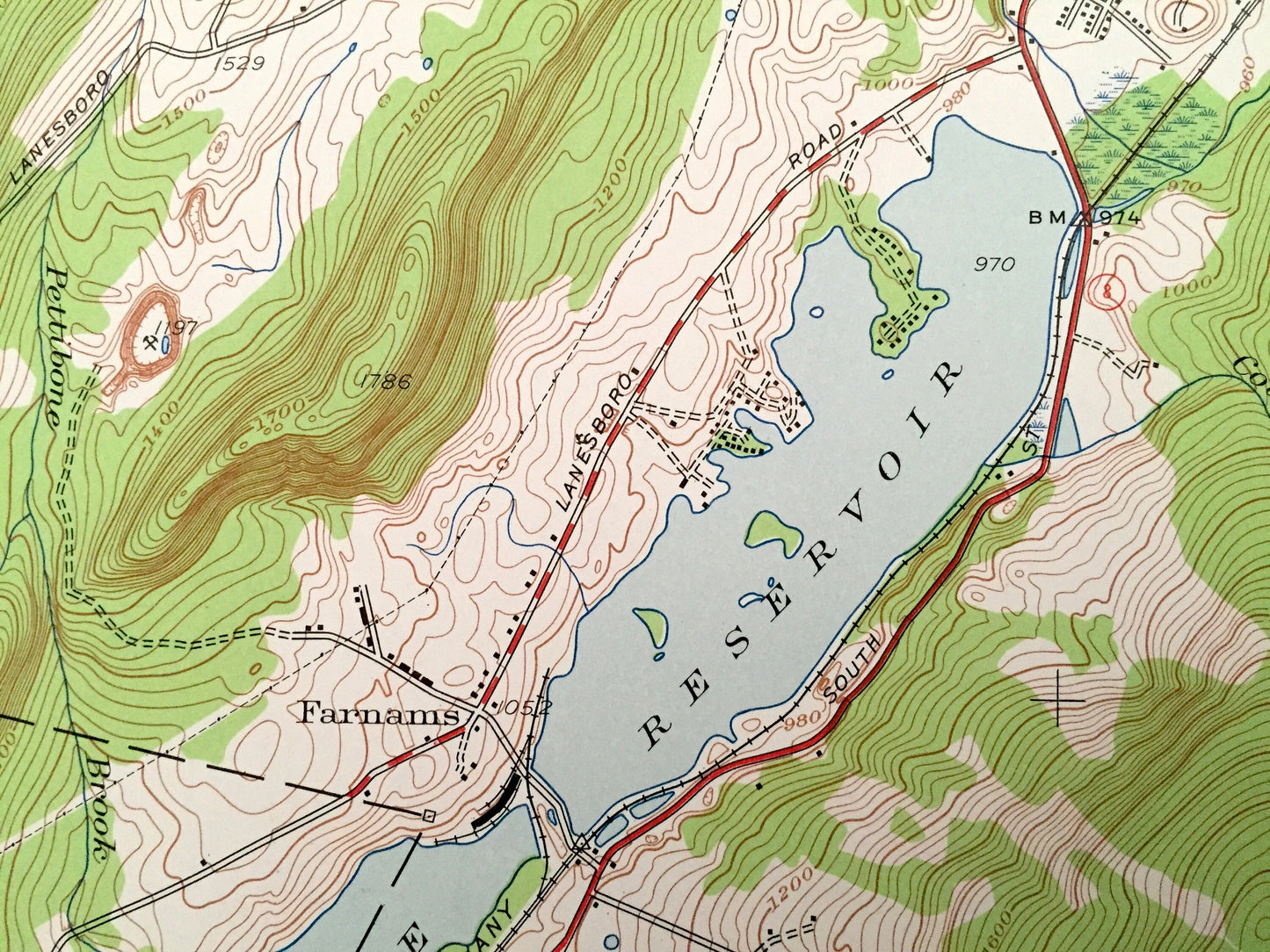
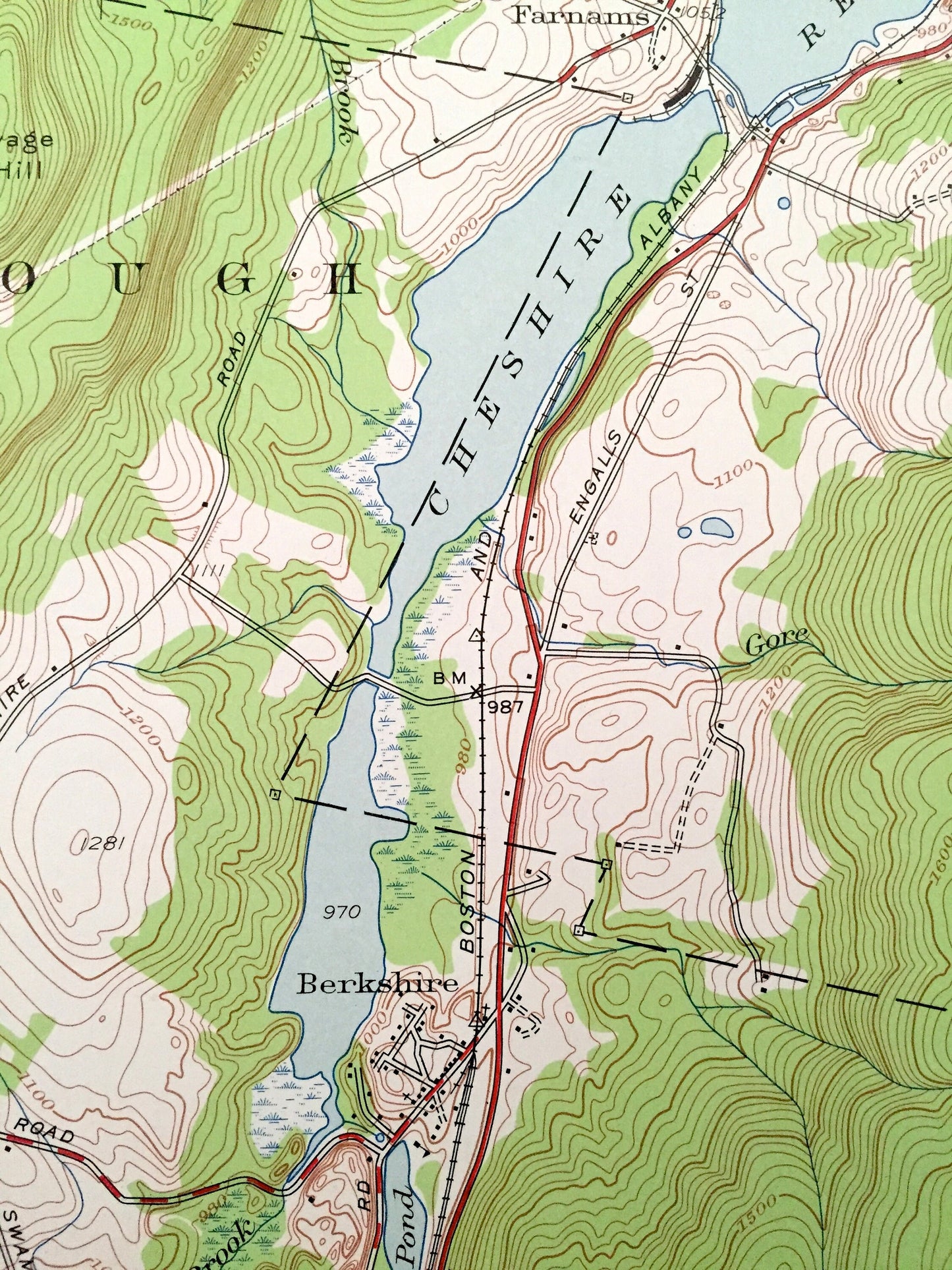
See what Massachusetts looked like over 75 years ago. Lots of intricate details and geological contours. Map even has little squares for every house that existed at the time. The USGS cartographers were very thorough back then!
Perfect for the historian, map-lover, the curious or just as a conversation starter. Wonderful and rare. Vintage maps such as these make great gifts.
Edition of 1944, printed 1958
Dimensions: 22" width x 27" height
----
Features
Cities & Towns: New Ashford, Adams, Lanesborough, Dalton, Maple Grove, Arnoldsville, Cheshire Harbor, Berkshire, Farnams.
Points of Interest: Saddle Ball Mountain, Cole Mountain, Pratt Hill, Round Rocks, Mt Amos, Savage Hill, Constitution Hill, Briggs Cobble, The Cobbles, North Mountain, Cheshire Reservoir, Pontoosuc Lake, Lanesboro Reservoir, Berkshire Pond, Appalachian Trail, Kitchen Brook, Pecks Brook, Thunder Brook, Muddy Brook, and many more hills, streams, ponds, houses, schools, railroads, churches and roads.
Condition: Very Good Vintage condition, commensurate with age. This map is in great shape for being over 60 years old. Has subtle edge-wear but will read as character when framed.
----
We will happily adjust shipping price for multiple purchases. Maps are rolled up and shipped in sturdy mailing tubes, never folded.
Couldn't load pickup availability
Share