My Store
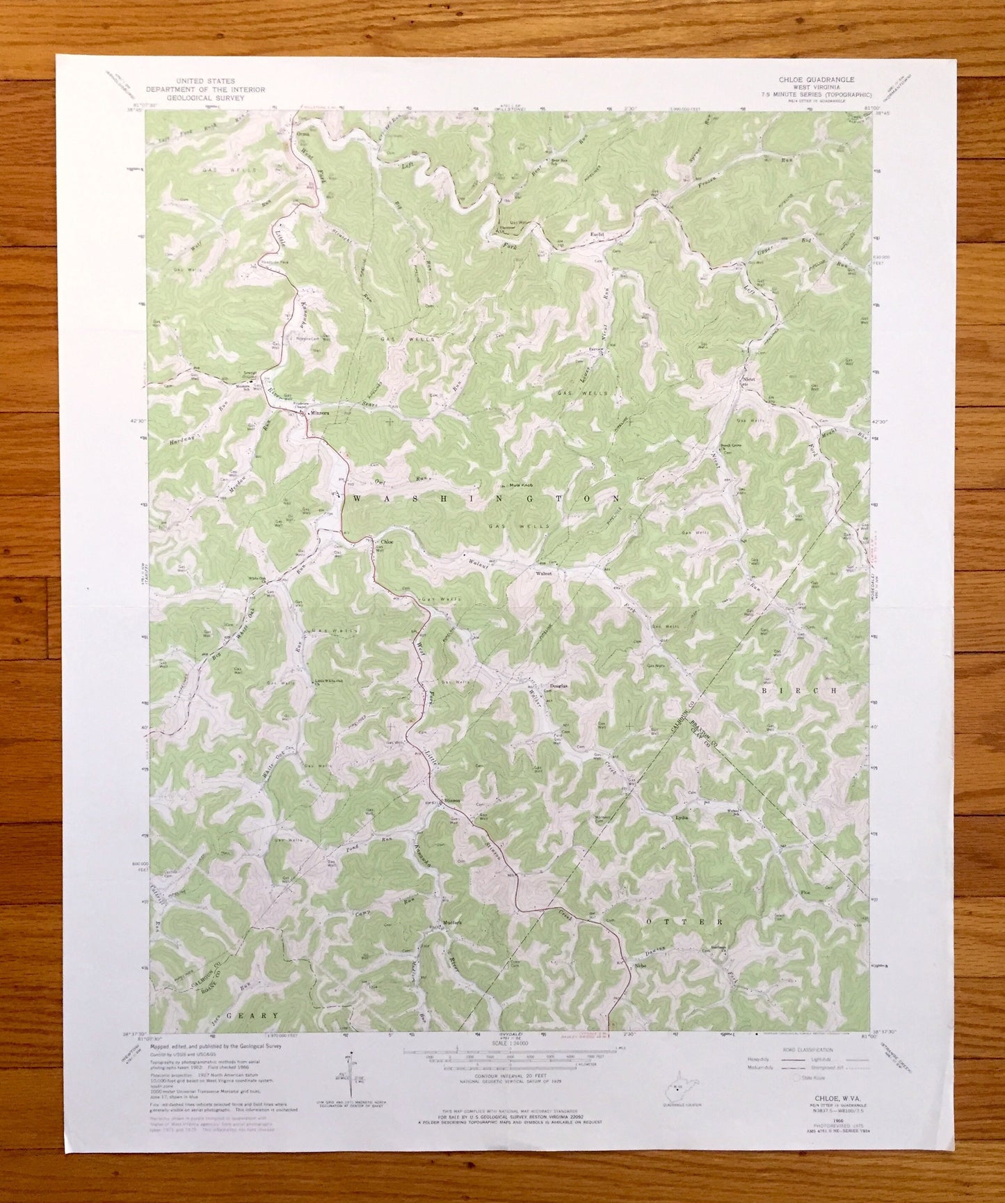
Antique Chloe, West Virginia 1966 US Geological Survey Topographic Map — Calhoun, Braxton, Clay, Roane County, Washington, Birch, Geary, WV
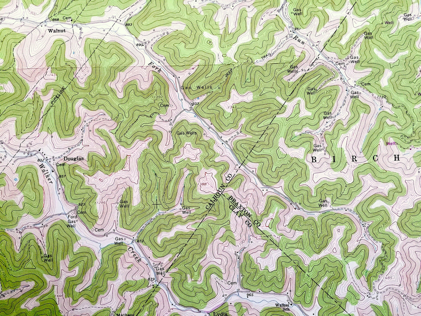
Antique Chloe, West Virginia 1966 US Geological Survey Topographic Map — Calhoun, Braxton, Clay, Roane County, Washington, Birch, Geary, WV
Beautiful, antique map of Chloe, West Virginia and surrounding Calhoun County, Roane County, Braxton County and Clay County areas. This is an authentic 1966 edition, 1976 print from the U.S. Geological Survey and NOT a computer reproduction.
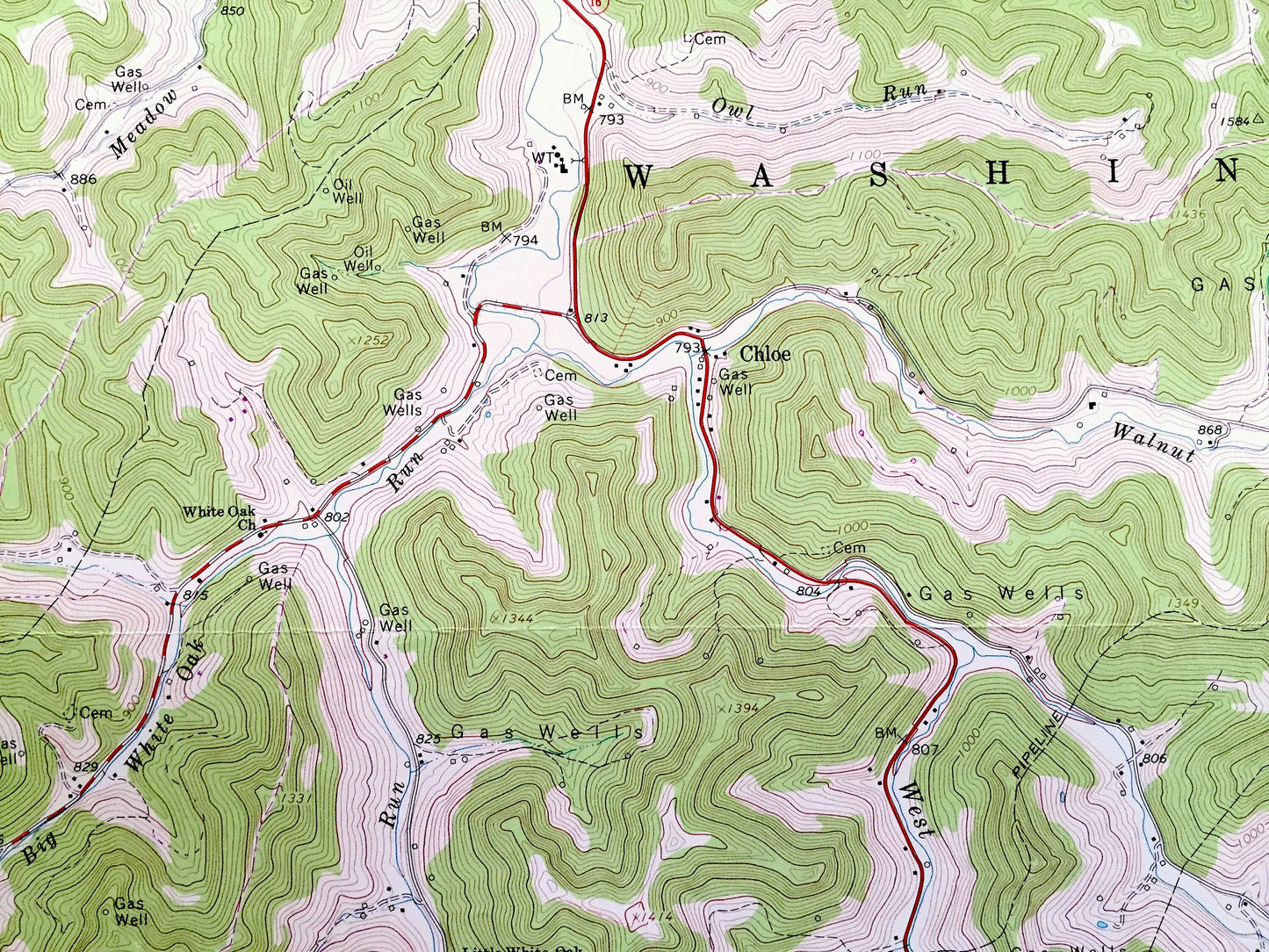
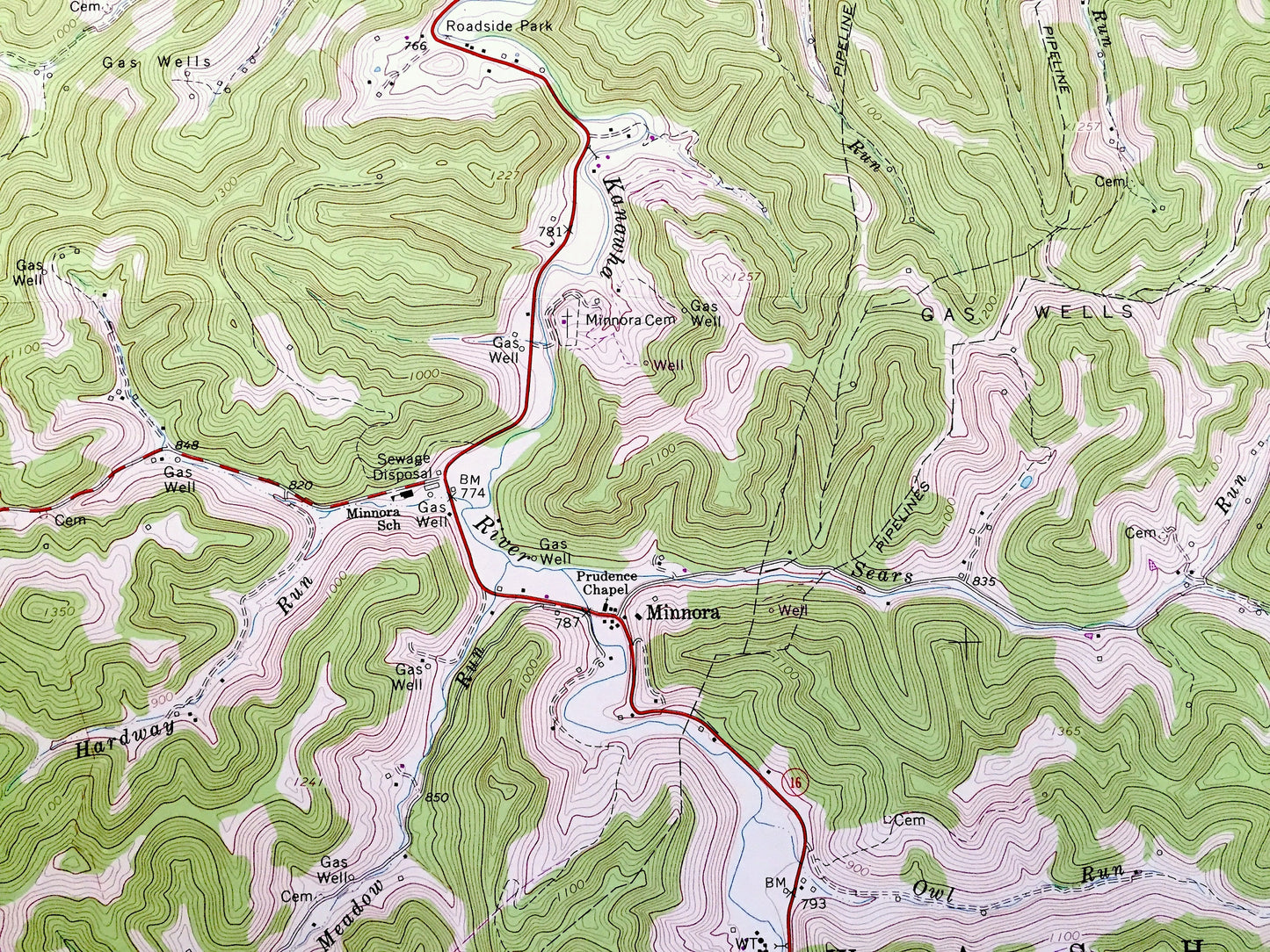
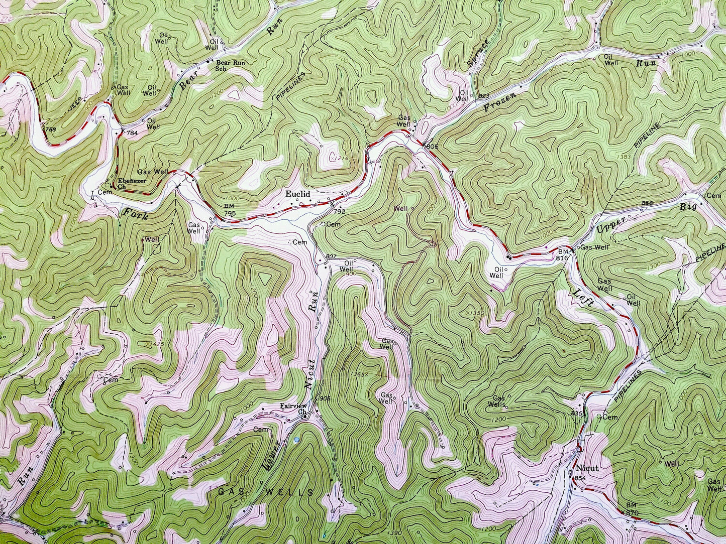
See what West Virginia looked like over 55 years ago. Lots of intricate details and geological contours. Map even has little squares for every house that existed at the time. The cartographers were very thorough back then!
Perfect for the historian, map-lover, the curious or just as a conversation starter. Wonderful and rare. Vintage maps such as these make great gifts.
Edition of 1966, printed 1976
Dimensions: 22" width x 27" height
----
Features
Cities & Towns: Washington, Geary, Birch, Otter, Orma, Minnora, Euclid, Nicut, Walnut, Douglas, Stinson, Mudfork, Nebo, Lydia, Floe.
Points of Interest: Mule Knob, West Fork, Left Fork, Little Stinson Creek, Walker Creek, Walnut Fork, White Oak Run, Dawson Fork, Walker Creek, Nicut Run, Frozen Run, gas wells,and many more hills, streams, ponds, houses, schools, railroads, churches and roads.
Condition: Very Good Vintage condition, commensurate with age. This map is in great condition for being over 45 years old. Has light edge-wear and fold creases but will read as character when framed.
----
We will happily adjust shipping price for multiple purchases. Maps are rolled up and shipped in sturdy mailing tubes, never folded.
Couldn't load pickup availability
Share