My Store
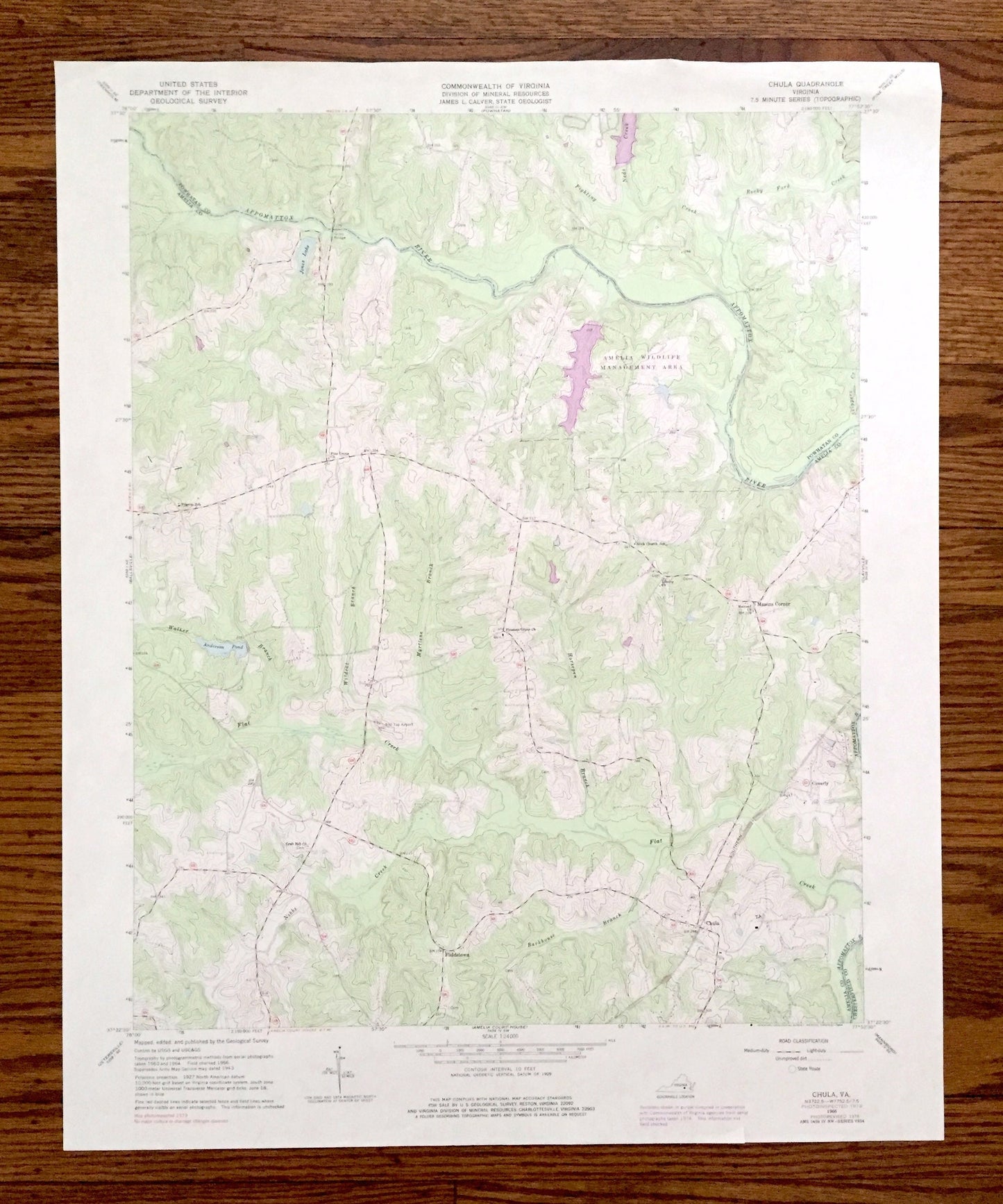
Antique Chula, Virginia 1966 US Geological Survey Topographic Map – Powhatan, Amelia County, Wildlife Management Area, Appomattox River VA
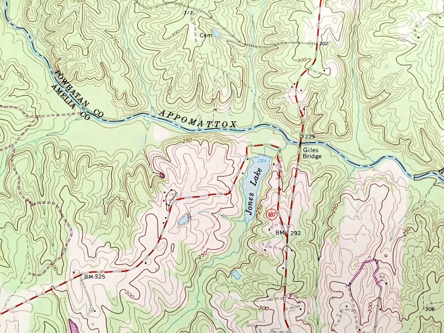
Antique Chula, Virginia 1966 US Geological Survey Topographic Map – Powhatan, Amelia County, Wildlife Management Area, Appomattox River VA
Beautiful, antique map of Chula, Virginia and surrounding Powhatan County & Amelia County area. This is an authentic 1966 edition, 1984 print from the U.S. Geological Survey and NOT a computer reproduction.
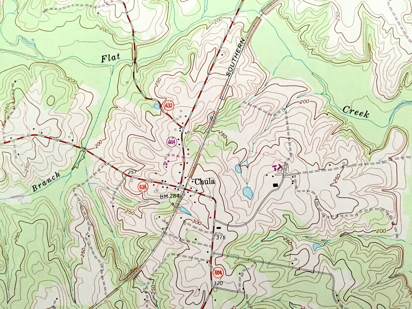
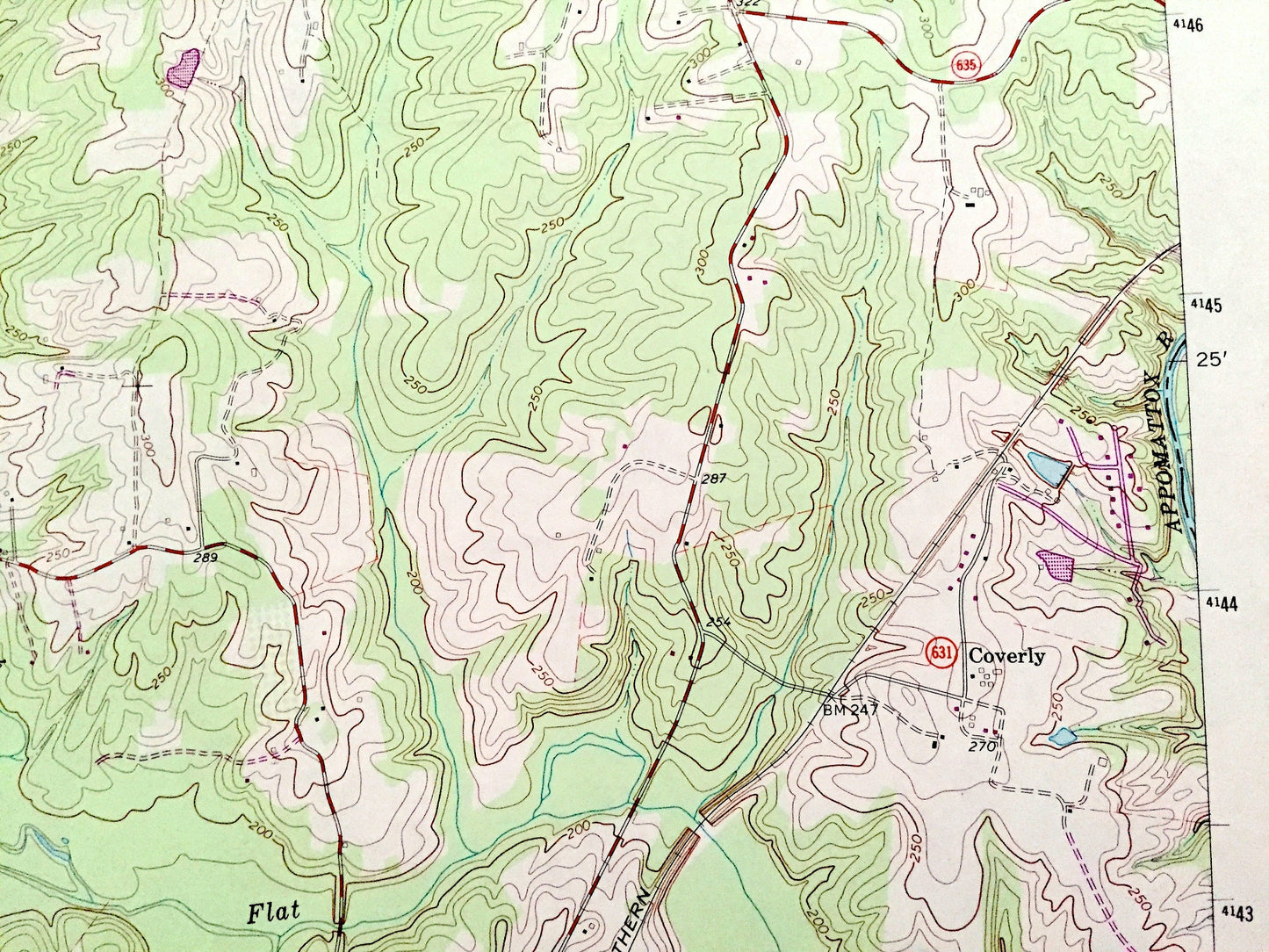
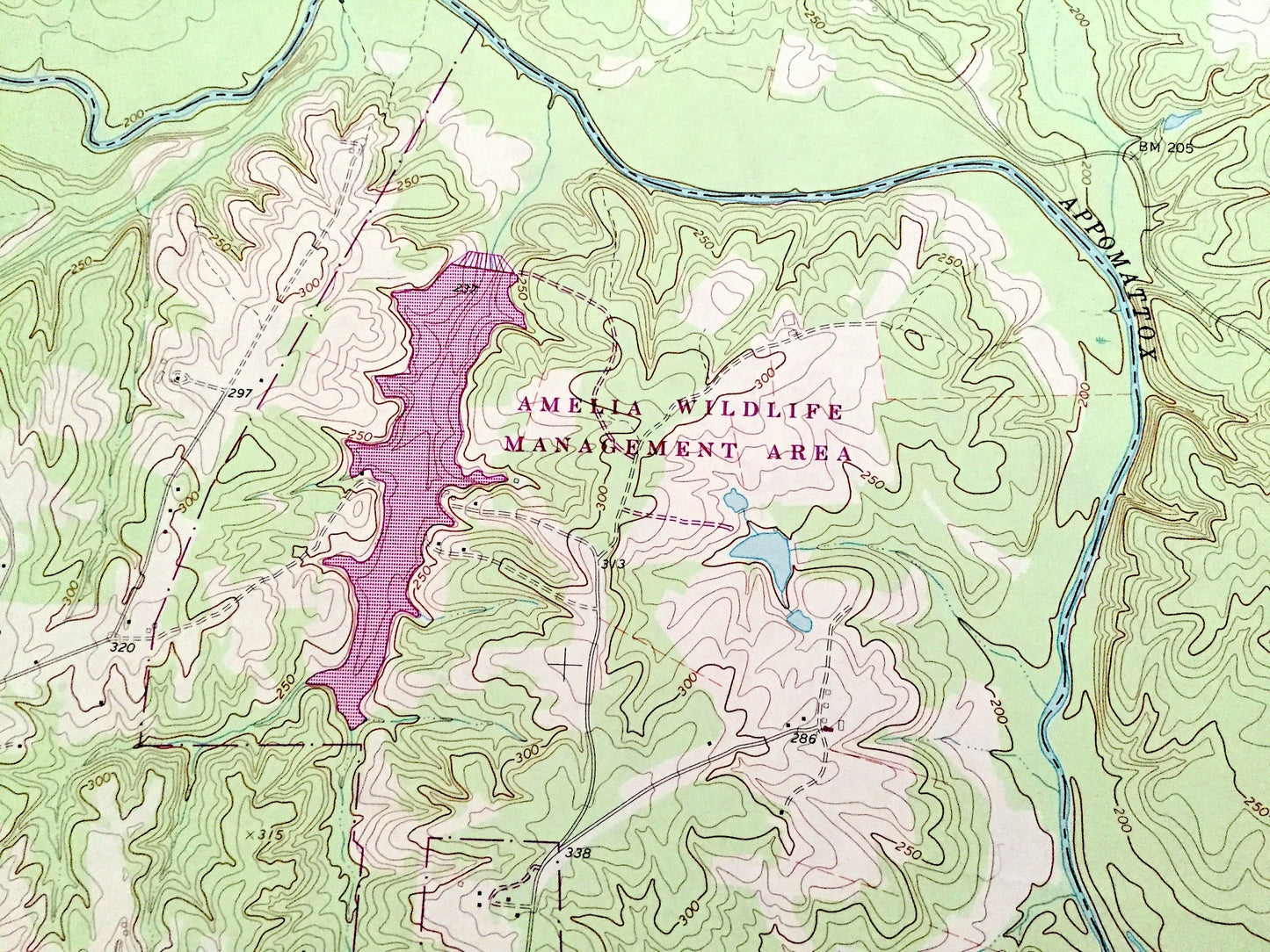
See what Virginia looked like over 55 years ago. Lots of intricate details and geological contours. Map even has little squares for every house that existed at the time. The USGS cartographers were very thorough back then!
Perfect for the historian, map-lover, the curious or just as a conversation starter. Wonderful and rare. Vintage maps such as these make great gifts.
Edition of 1966, printed 1984
Dimensions: 22" width x 27" height
----
Features
Cities & Towns: Chula, Masons Corner, Fieldstown, Coverly.
Points of Interest: Powhatan County, Amelia County, Chesterfield County, Amelia Wildlife Management Area, Appomattox River, Anderson Pond, Amelia Lake, Nibbs Creek, Barkhouse Branch, Jones Lake, Rocky Ford Creek, Neds Creek, and many more hills, streams, ponds, houses, schools, churches and roads.
Condition: Good Vintage condition, commensurate with age. This map is in great shape for being almost 50 years old. Some edge-wear, but this will add to vintage character when framed.
----
We will happily adjust shipping price for multiple purchases. Maps are rolled up and shipped in sturdy mailing tubes, never folded.
Couldn't load pickup availability
Share