My Store
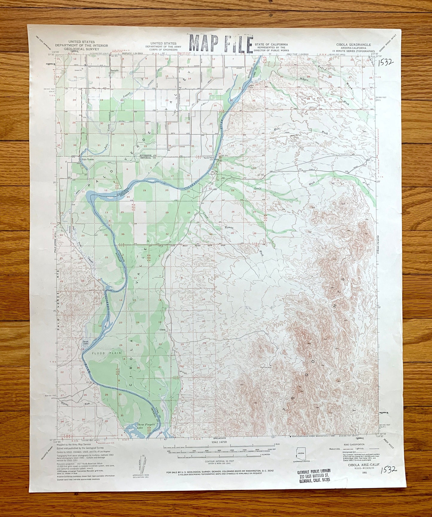
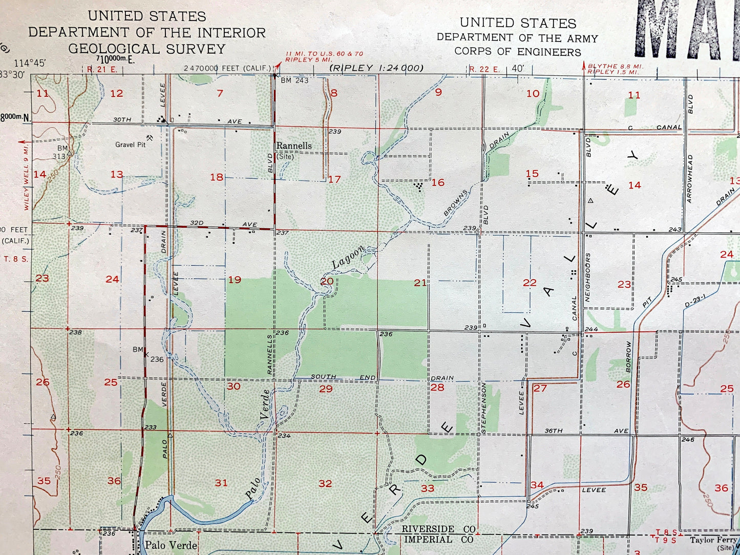
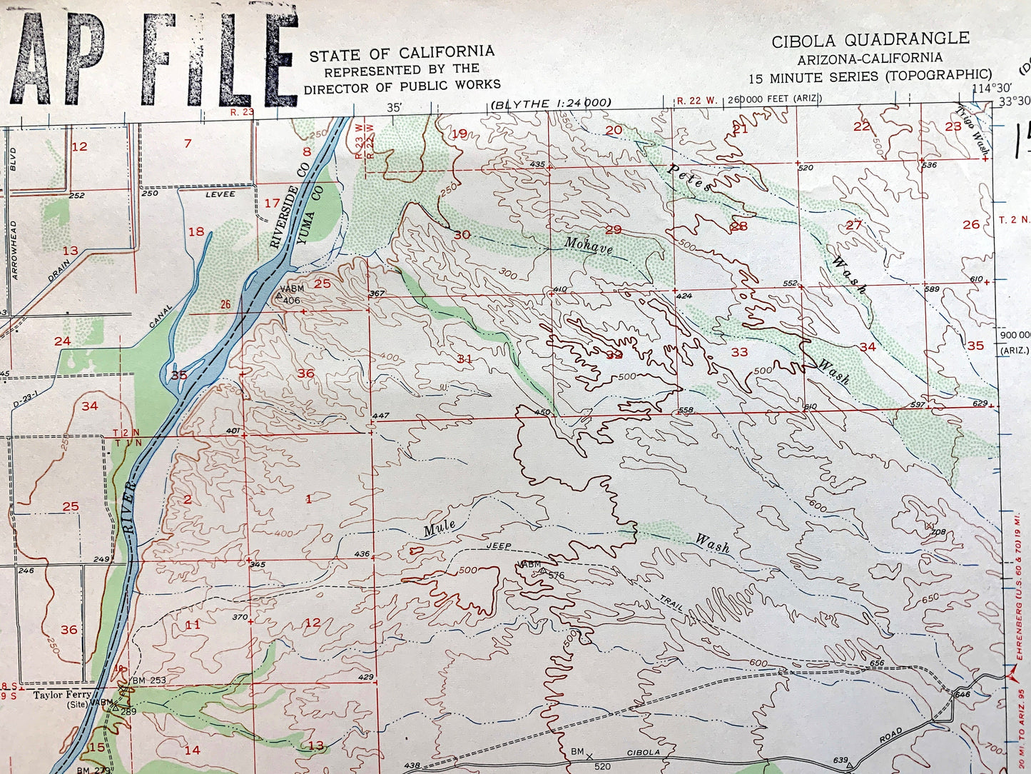
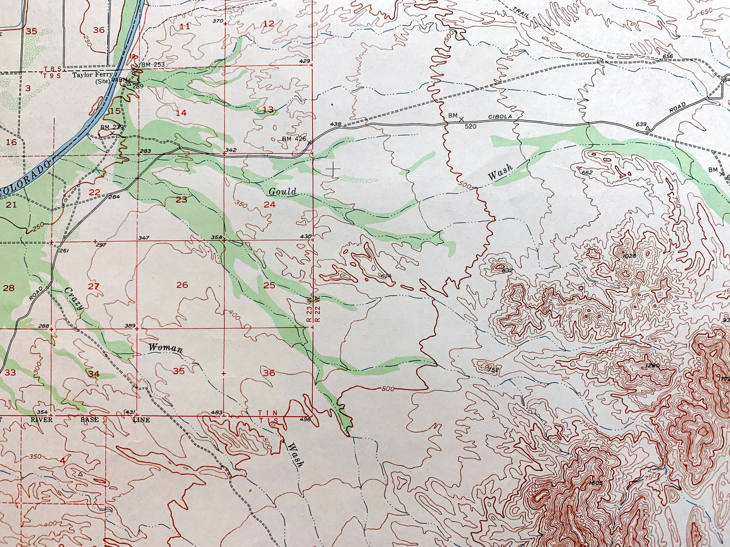
Antique Cibola, Arizona 1951 US Geological Survey Topographic Map – Palo Verde, Colorado River, Yuma Imperial County California, AZ, CA
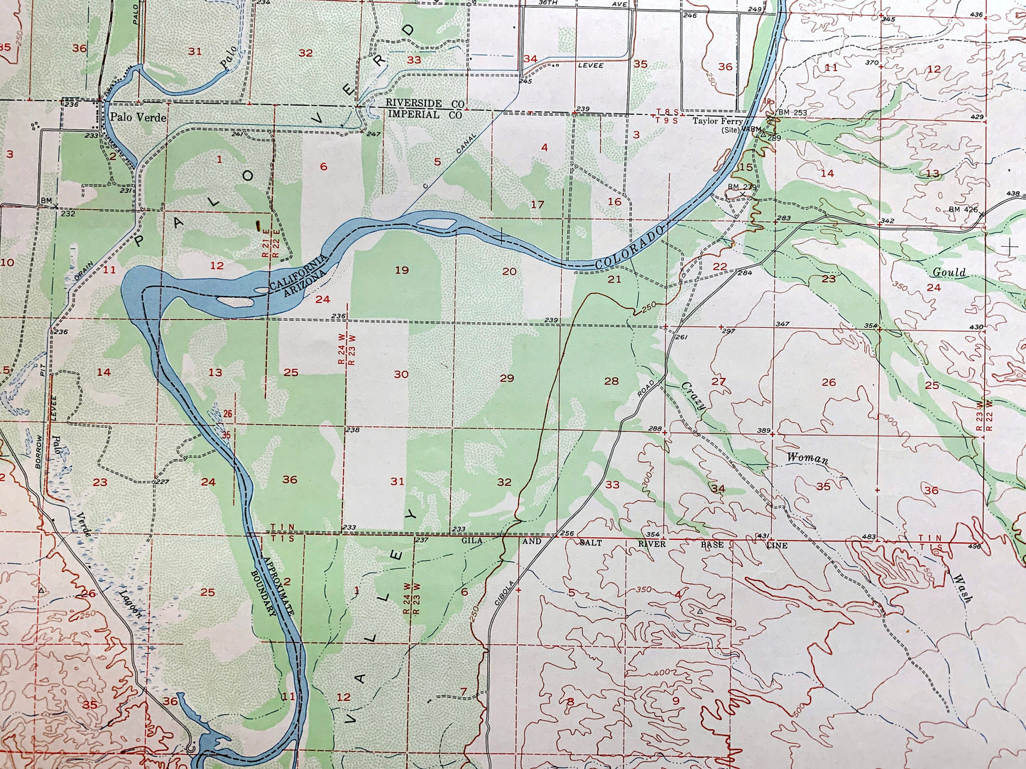
Antique Cibola, Arizona 1951 US Geological Survey Topographic Map – Palo Verde, Colorado River, Yuma Imperial County California, AZ, CA
Beautiful, antique topographic map of Cibola Valley in Arizona and California and surrounding counties of Imperial, Yuma and Riverside. This is an authentic 1951 edition, 1951 print from the U.S. Army Corps of Engineers and NOT a computer reproduction.
See what California looked like over 70 years ago. Map is incredibly large and in the grand 1:250,000 scale. Lots of intricate details and geological contours. The cartographers were very thorough back then!
Perfect for the historian, map-lover, the curious or just as a conversation starter. Wonderful and rare. Vintage maps such as these make great gifts.
Edition of 1951, printed 1951
Dimensions: 17" width x 21" height
----
Features
Cities and Towns: Palo Verde (CA), Cibola (AZ).
Points of Interest: Palo Verde Valley, Palo Verde Mountains, Trigo Mountains, Three Fingers Lake, Davis Lake, and lots more mountains, canyons, rivers, creeks, valleys, ranches and roads.
Condition: Good Vintage condition, commensurate with age. This map is in great shape for being over 70 years old. Has light edge-wear, pen marks and ex-libris stamps but this will all add to vintage character when framed.
----
We will happily adjust shipping price for multiple purchases. Maps are rolled up and shipped in sturdy mailing tubes, never folded.
Couldn't load pickup availability
Share