My Store
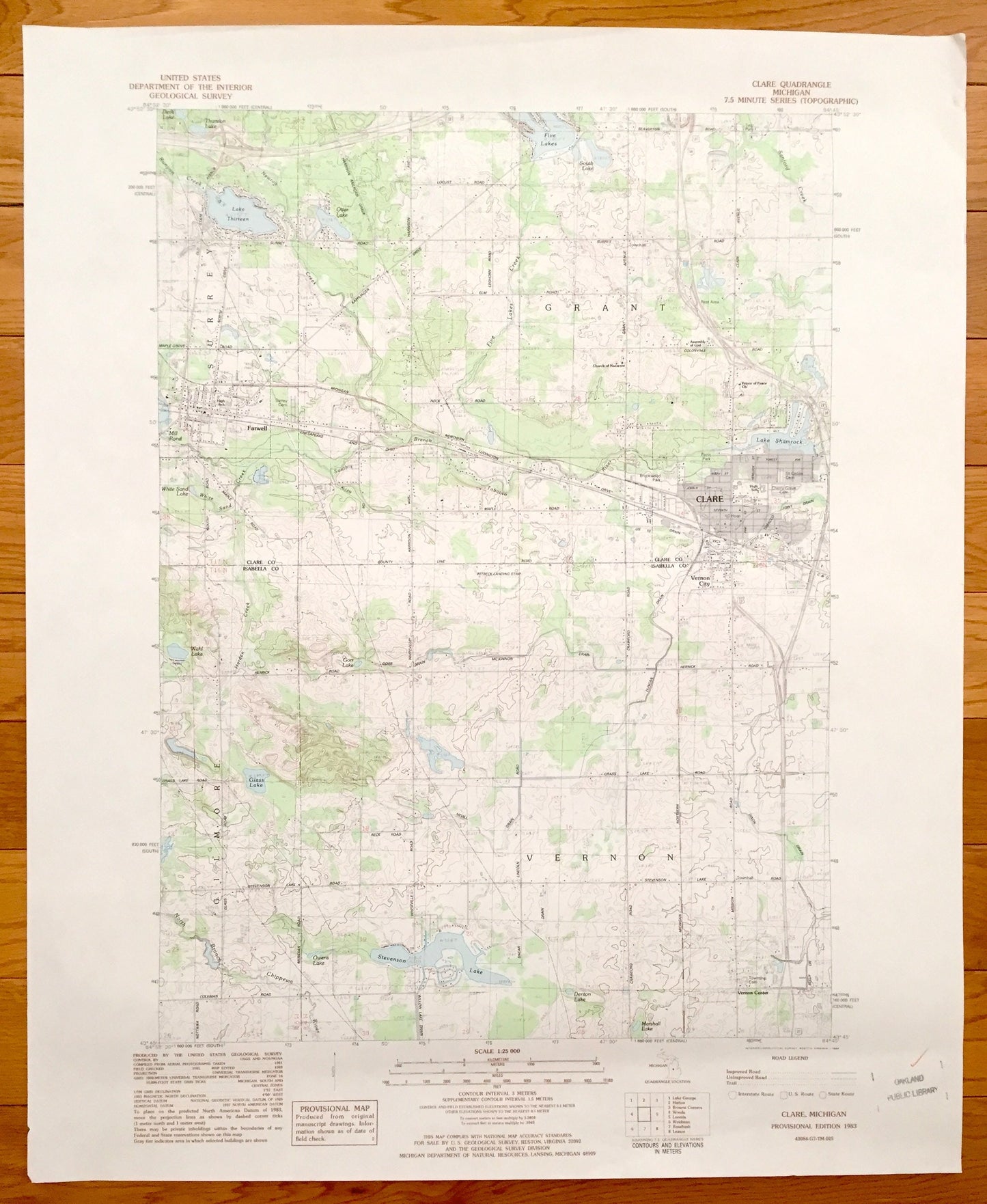
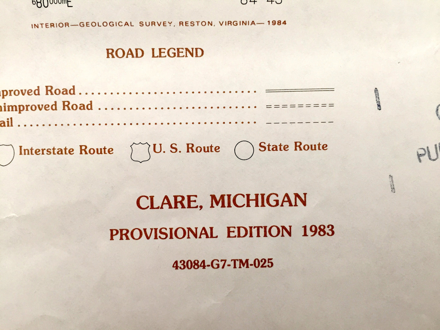
Antique Clare, Michigan 1983 US Geological Survey Topographic Map – Vernon, Grant, Farwell, Gilmore, Surrey, Lake Shamrock, Lake Thirteen MI
Antique Clare, Michigan 1983 US Geological Survey Topographic Map – Vernon, Grant, Farwell, Gilmore, Surrey, Lake Shamrock, Lake Thirteen MI
Beautiful, antique map of Clare, Vernon City, Grant, Surrey, Gilmore and Farwell, Michigan. This is an authentic 1983 print from the U.S. Geological Survey and NOT a computer reproduction.
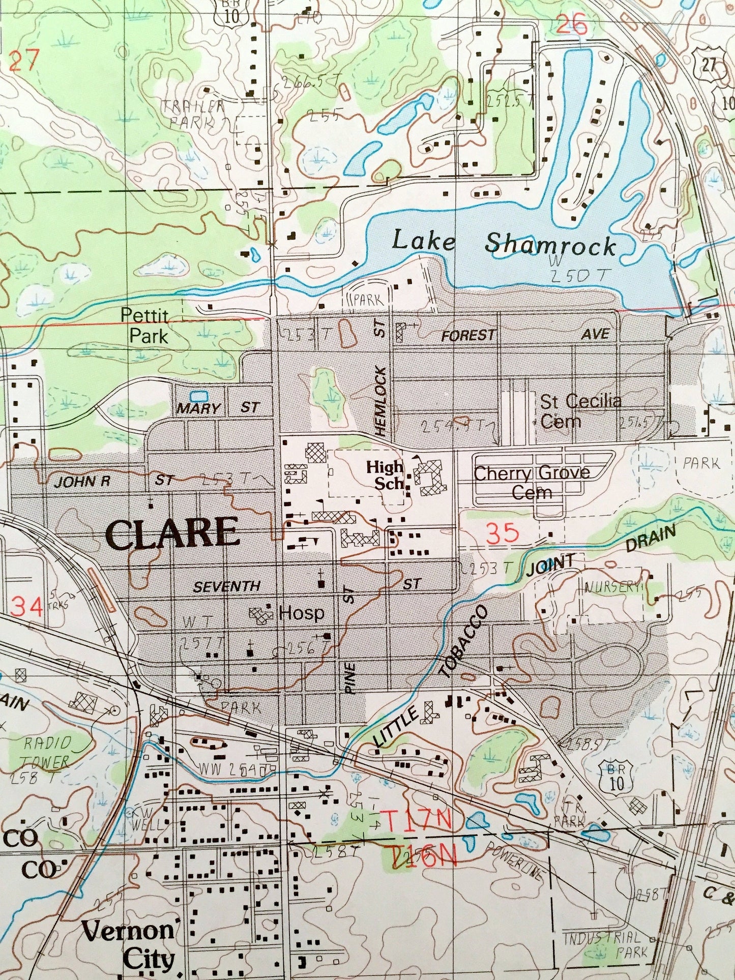
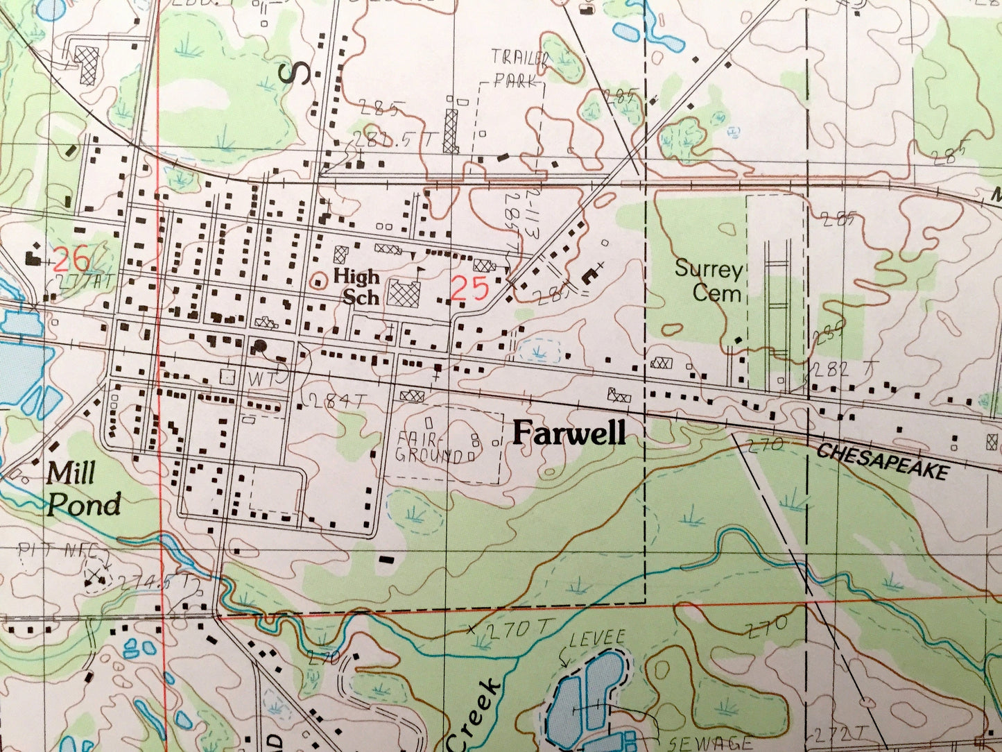
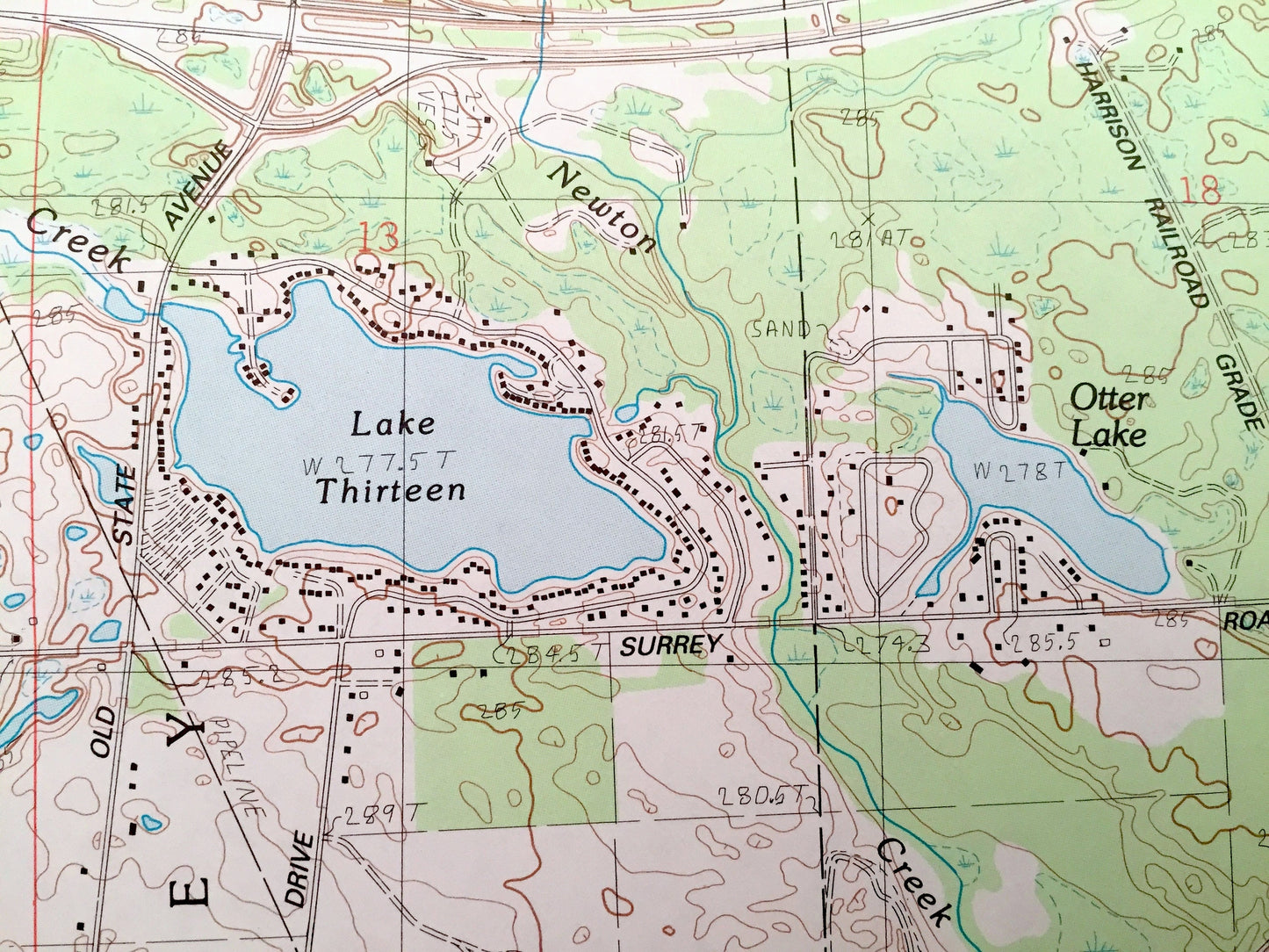
See what Isabella and Clare Counties of Michigan looked like 35 years ago. Lots of intricate details and geological contours. Map even has little squares for every house that existed at the time. The USGS cartographers were very thorough back then!
Perfect for the historian, map-lover, the curious or just as a conversation starter. Wonderful and rare. Vintage maps such as this make great gifts.
Edition of 1983, printed 1983
Dimensions: 22" width x 27" height
----
Features
Cities & Towns: Clare, Vernon Center, Vernon, Vernon City, Farwell, Surrey, Grant, Gilmore.
Points of Interest: Lake Thirteen, Five Lakes, Lake Shamrock, Clare High School, Denton Lake, Stevenson Like, Owens Lake, Glass Lake, Brookwood Park, Michigan Northern Railroad, and many more roads, towns and rivers and Lakes.
Condition: Very Good condition, commensurate with age. This map is in incredible shape for being 35 years old.
----
We will happily adjust shipping price for multiple purchases. Maps are rolled up and shipped in sturdy mailing tubes, never folded.
Couldn't load pickup availability
Share