My Store
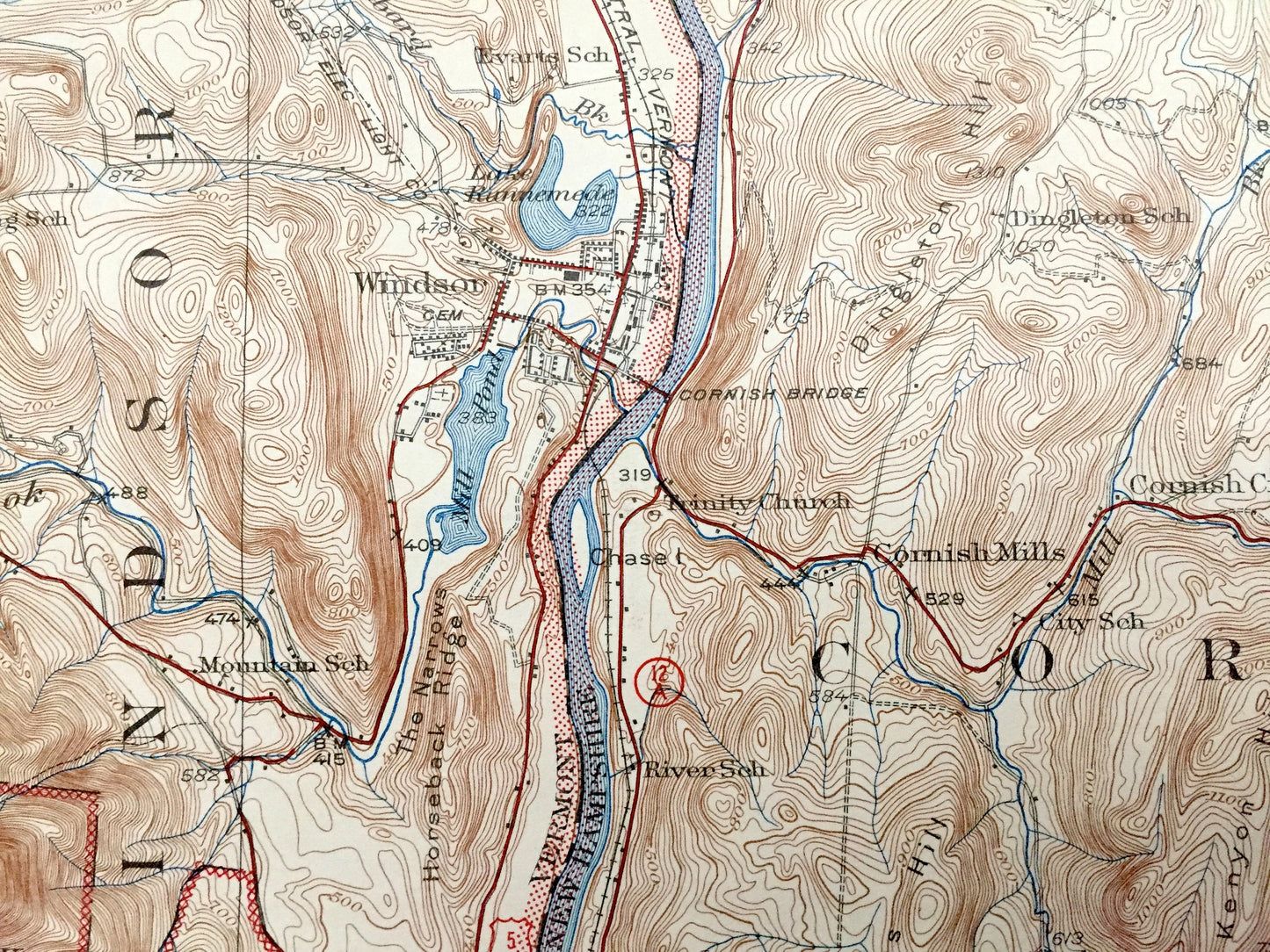
Antique Claremont, New Hampshire 1929 US Geological Survey Topographic Map – Sullivan County, Windsor, Cornish, Charlestown, Vermont, NH, VT
Antique Claremont, New Hampshire 1929 US Geological Survey Topographic Map – Sullivan County, Windsor, Cornish, Charlestown, Vermont, NH, VT
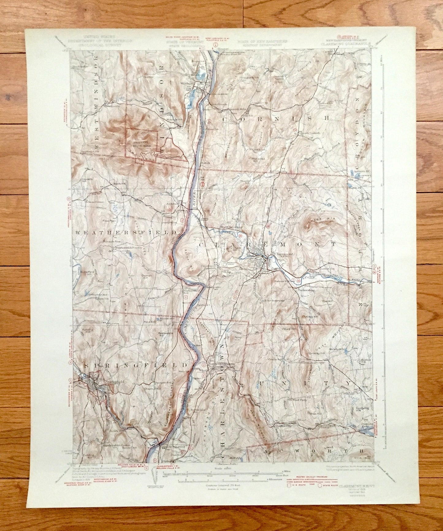
Beautiful, antique map of Claremont, Charlestown, Unity, Acworth Newport and Cornish, New Hampshire, including surrounding West Windsor, Windsor, Wethersfield and Springfield, Vermont. This is an authentic 1929 edition, 1944 print from the U.S. Geological Survey and NOT a computer reproduction.
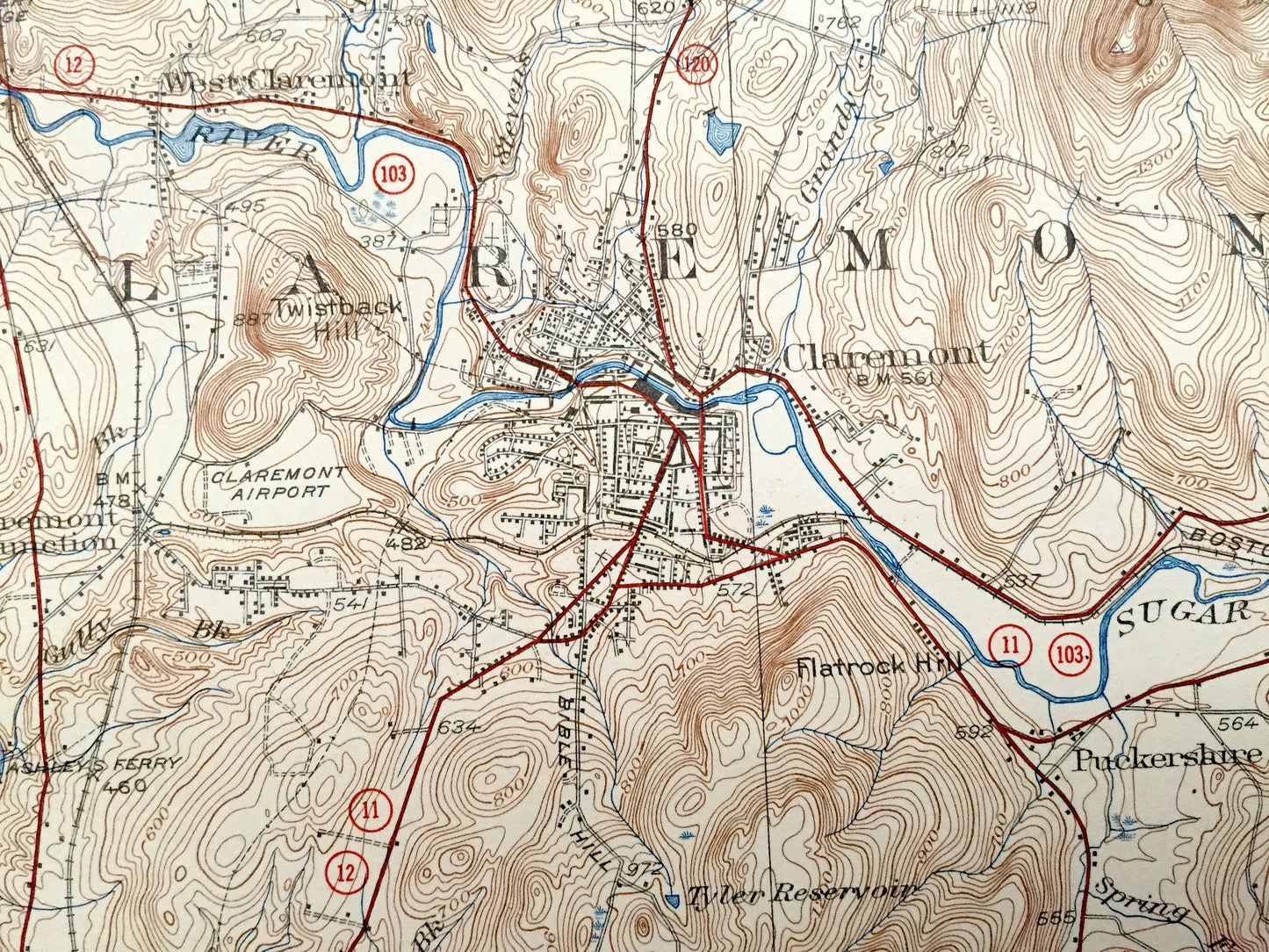
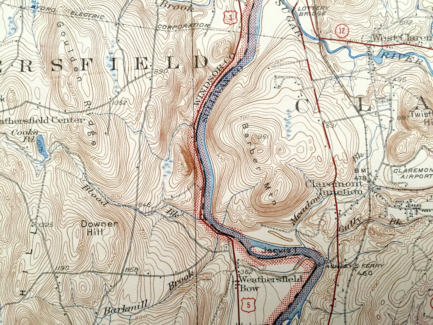
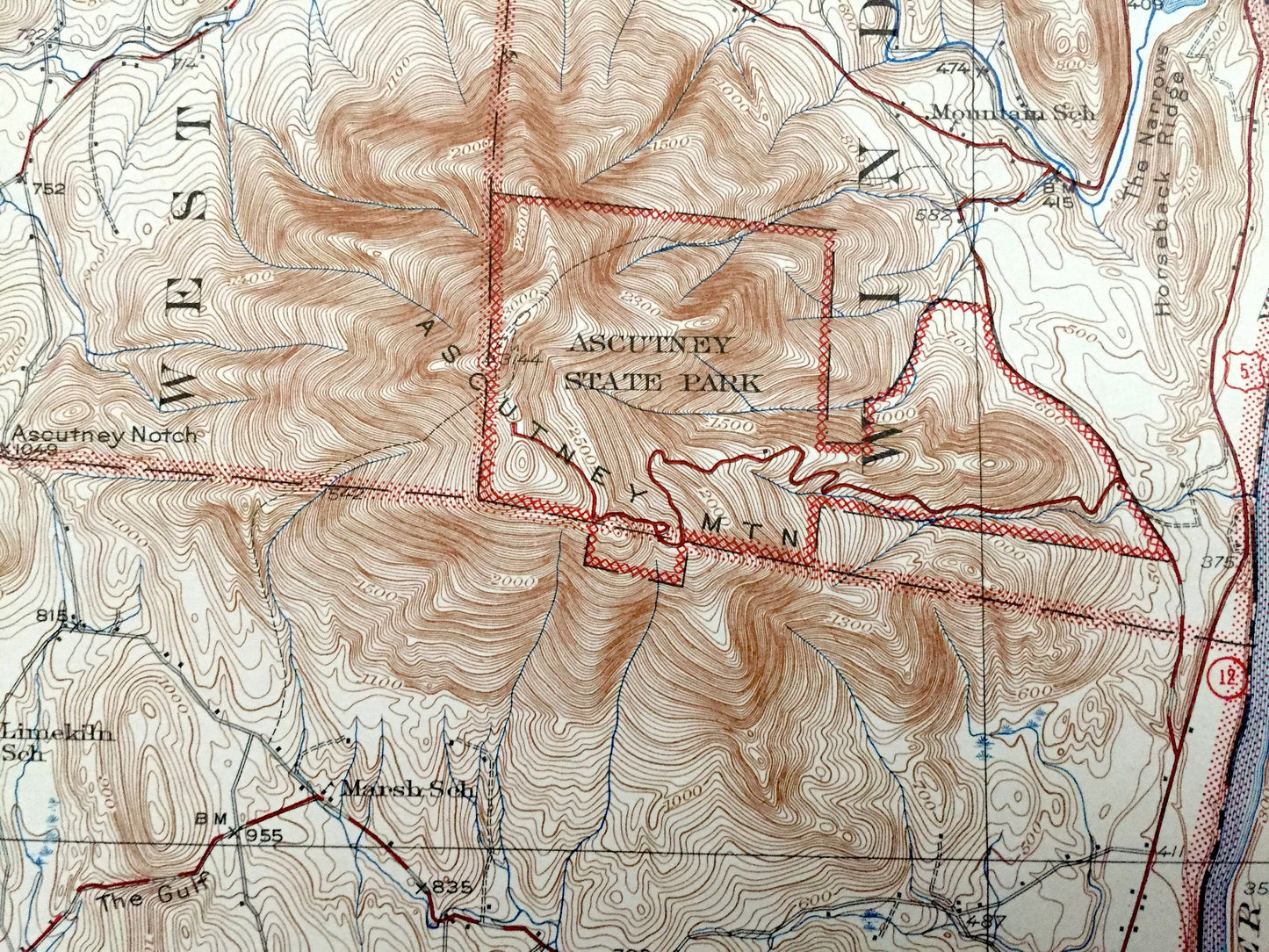
See what Sullivan and Windsor Counties looked like over 90 years ago. Lots of intricate details and geological contours. Map even has little squares for every house that existed at the time. The USGS cartographers were very thorough back then! On the back is a description of topographic symbols and map guide.
Perfect for the historian, map-lover, the curious or just as a conversation starter. Wonderful and rare. Vintage maps such as these make great gifts.
Edition of 1929, printed 1944
Dimensions: 16 1/2" width x 20" height
----
Features
Cities & Towns: New Hampshire: Cornish Mills, Cornish City, South Cornish, Cornish Center, Cryodon, Newport, Claremont, West Claremont, Claremont Junction, North Charlestown, Charlestown, Unity, Butcherknife Corner, Acworth, Puckershire, Quaker City.
Vermont: West Windsor, Brownsville, Windsor, Weathersfield, Weathersfield Center, Springfield, Goulds Mill, Ascutney, Sheddsville, Weathersfield Bow, Walcott.
Points of Interest: Flag School, Everts School, Cornish Bridge, Trinity Church, River School, Claremont Airport, Ashleeys Ferry, Bartlet School, Connecticut River, Marsh School, Ascutney Mountain, The Narrows, Horseback Ridge, Mill Pond, Lake Runnenede, Singleton School, Governors Pond, Sullivan County Farm, County School, Perry Mountain, Cheshire Toll Bridge, Lottery Bridge, Central Vermont Railroad, Boston & Maine Railroad, and lots more hills, mountains, streams, ponds, houses, schools and roads.
Condition: Very Good Vintage condition, commensurate with age. This map is in great shape for being over 75 years old. Light wear but this will add to vintage character when framed.
----
We will happily adjust shipping price for multiple purchases. Maps are rolled up and shipped in sturdy mailing tubes, never folded.
Couldn't load pickup availability
Share