My Store
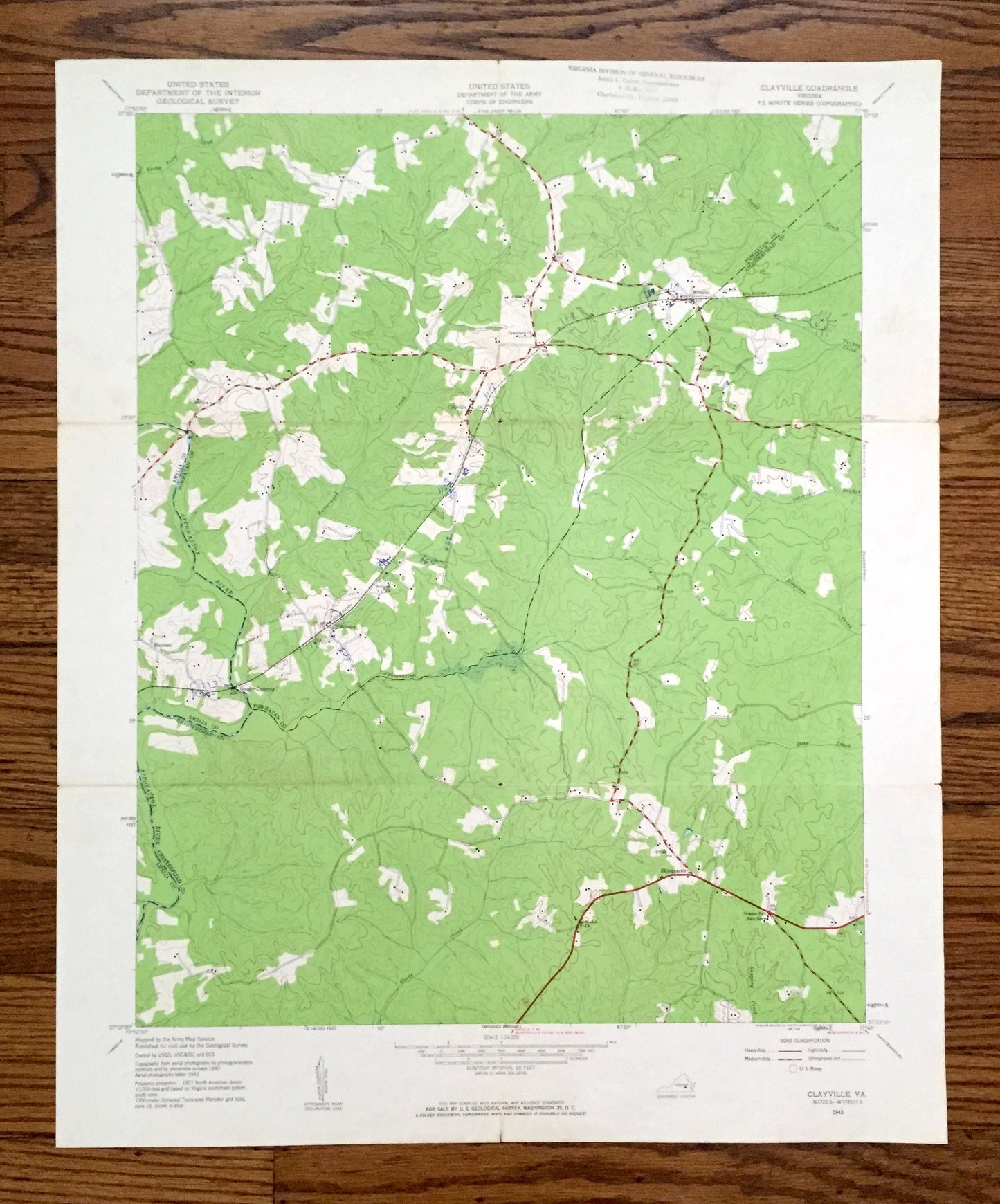
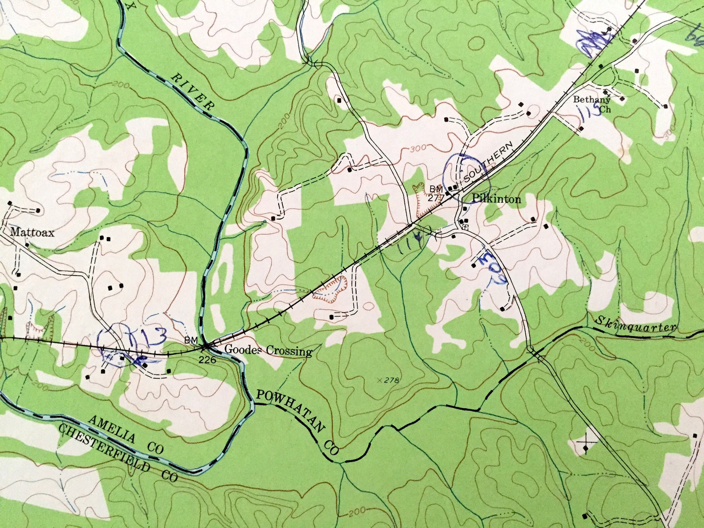
Antique Clayville, Virginia 1943 US Geological Survey Topographic Map – Amelia, Powhatan, Chesterfield County, Moseley, Skinquarter Creek VA
Antique Clayville, Virginia 1943 US Geological Survey Topographic Map – Amelia, Powhatan, Chesterfield County, Moseley, Skinquarter Creek VA
Beautiful, antique map of Clayville, Virginia and surrounding Amelia, Powhatan & Chesterfield County area. This is an authentic 1943 edition, 1961 print from the U.S. Geological Survey and NOT a computer reproduction.
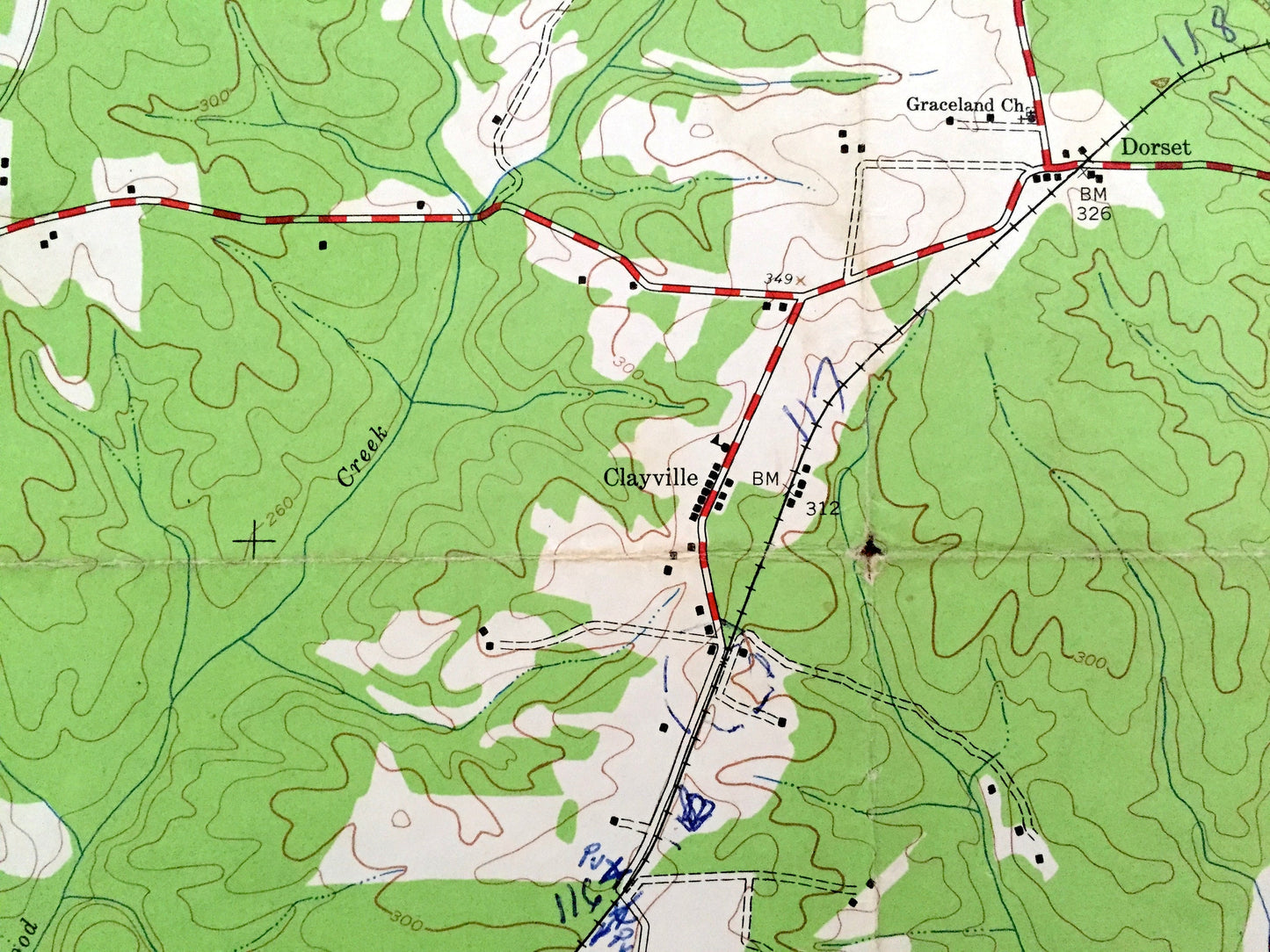
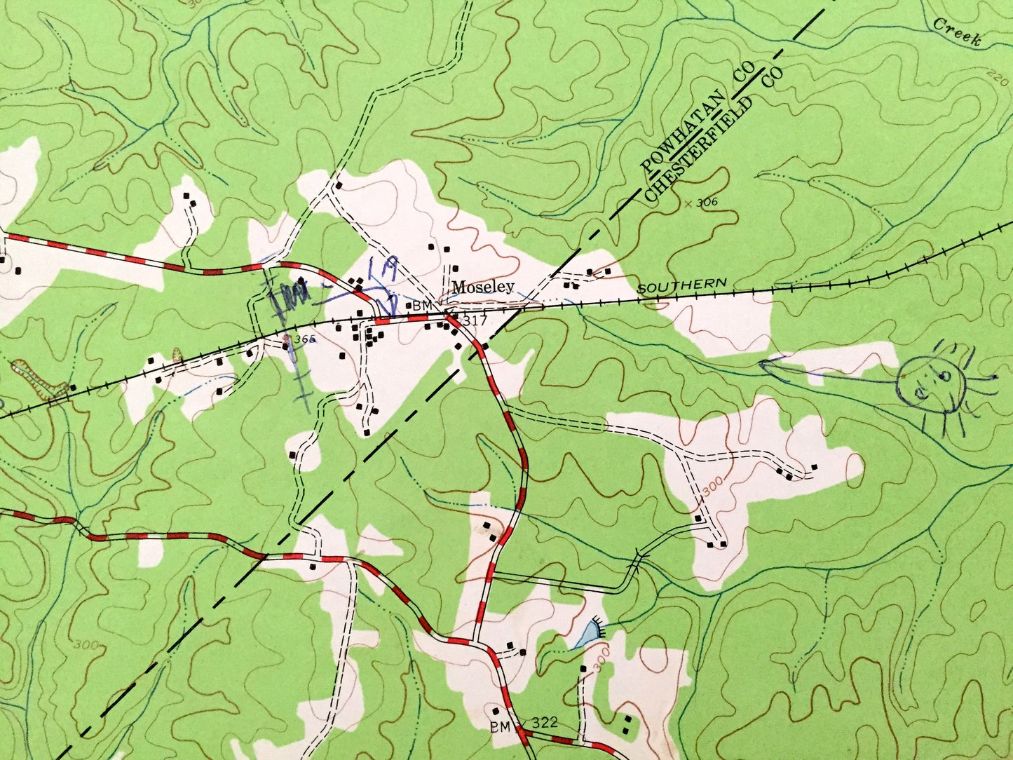
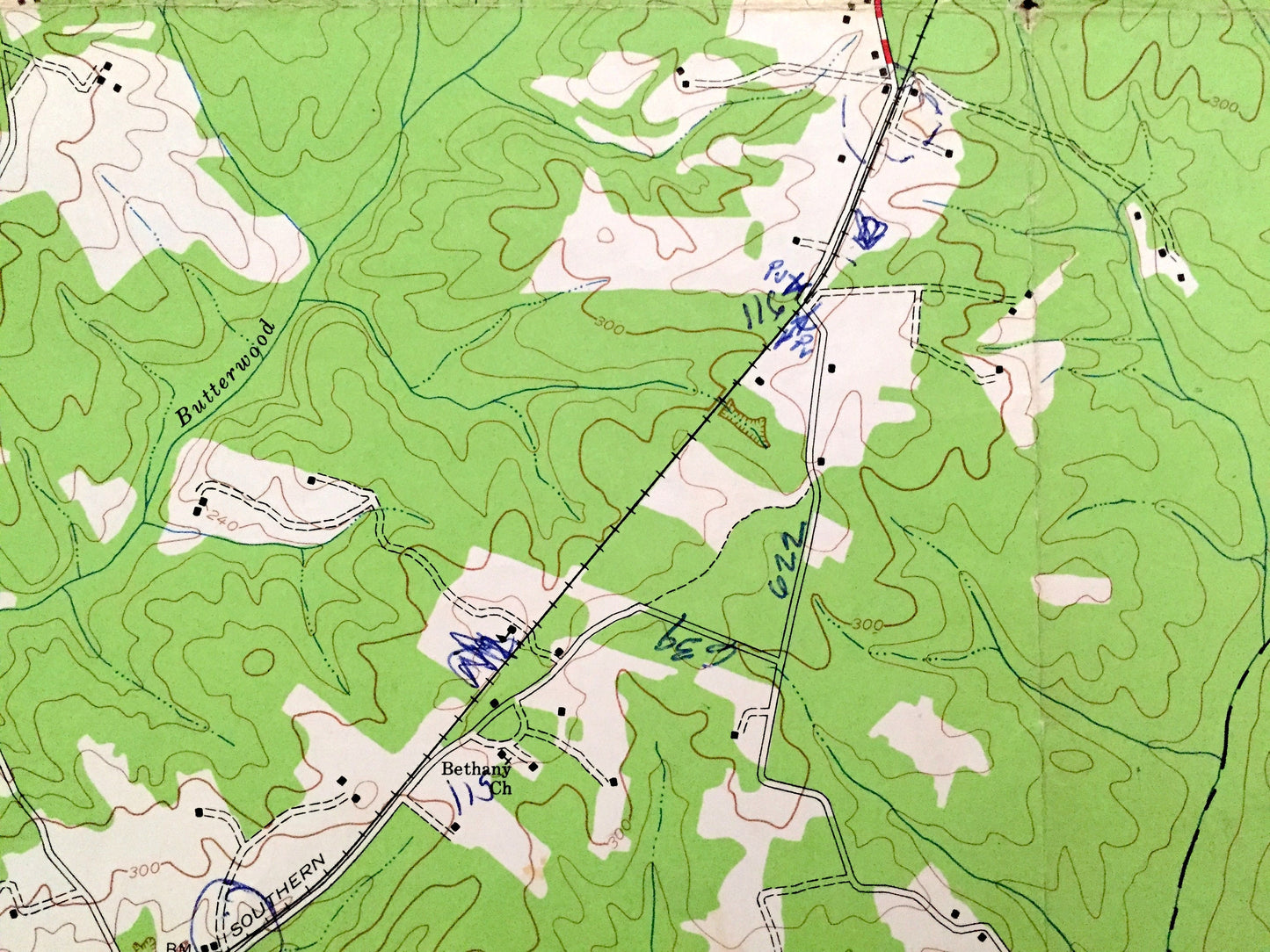
See what Virginia looked like almost 80 years ago. Lots of intricate details and geological contours. Map even has little squares for every house that existed at the time. The USGS cartographers were very thorough back then!
Perfect for the historian, map-lover, the curious or just as a conversation starter. Wonderful and rare. Vintage maps such as these make great gifts.
Edition of 1943, printed 1961
Dimensions: 22" width x 27" height
----
Features
Cities & Towns: Clayville, Genito, Moseley, Mattoax, Goodes Crossing, Pilkington, Skinquarter, Dorset.
Points of Interest: Amelia County, Powhatan County, Chesterfield County, Skinquarter Creek, Otterdale Branch, Butterwood Creek, Rocky Ford Creek, Goode Creek, Deep Creek, Sappony Creek, site of Tates Pond, and lots more hills, creeks, ponds, houses, churches, schools and roads.
Condition: Good Vintage condition, commensurate with age. This map is in great shape for being over 60 years old. Has some wear, toning, a bit of pen markings, and folds as-issued, but these will flatten easily and all will read as vintage character when framed.
----
We will happily adjust shipping price for multiple purchases. Maps are rolled up and shipped in sturdy mailing tubes, never folded.
Couldn't load pickup availability
Share