My Store
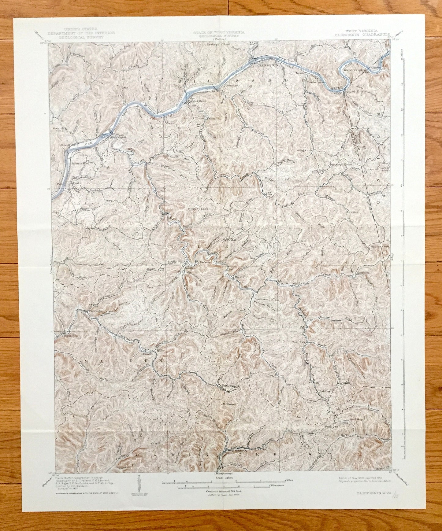
Antique Clendenin, West Virginia 1909 US Geological Survey Topographic Map – Kanawha County, Blue Creek, Putney, Union, Heatherman, Pond Gap
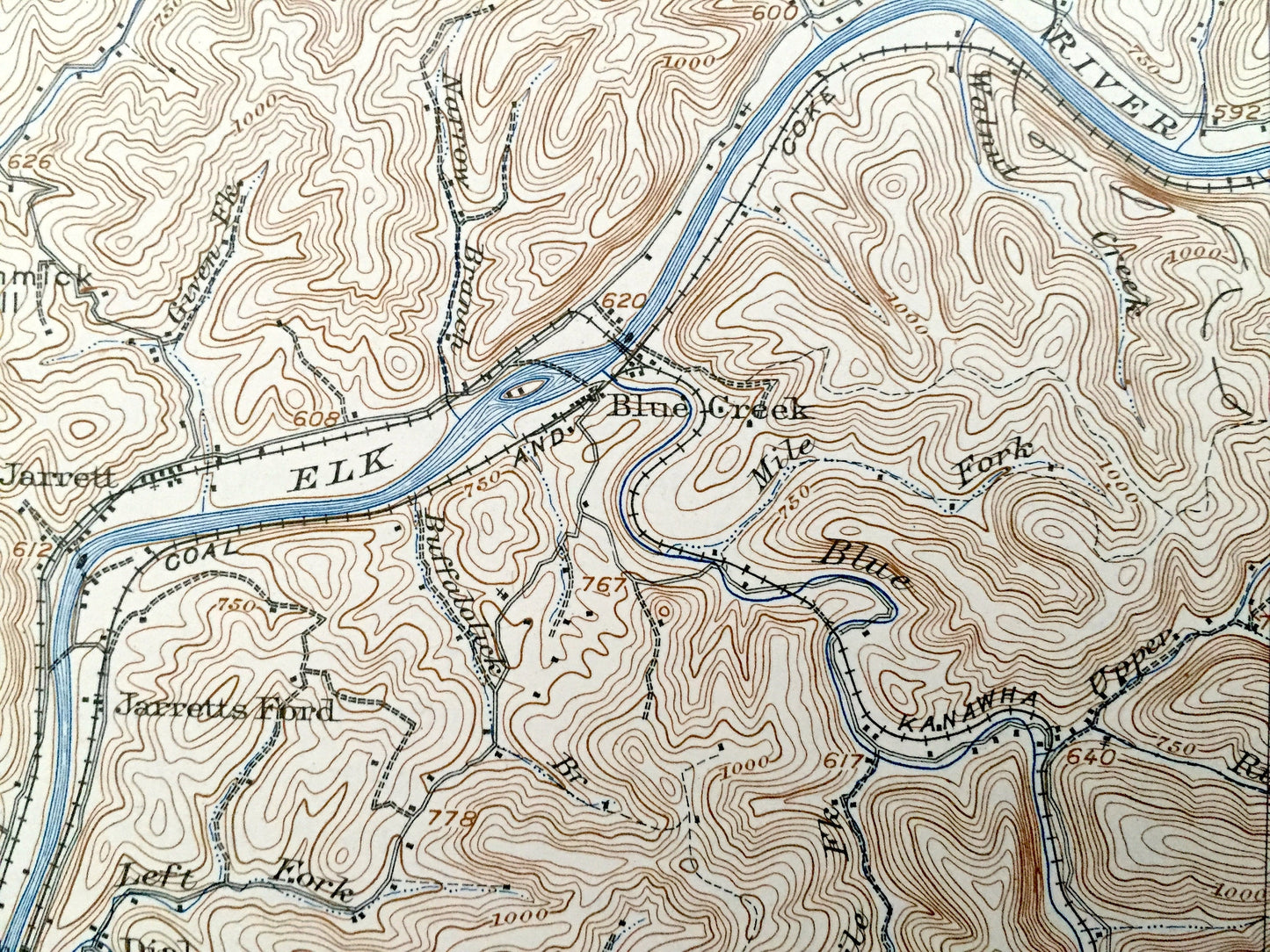
Antique Clendenin, West Virginia 1909 US Geological Survey Topographic Map – Kanawha County, Blue Creek, Putney, Union, Heatherman, Pond Gap
Beautiful, antique map of Clendenin, West Virginia and surrounding Kanawha and Clay County area. This is an authentic 1909 edition, 1942 print from the U.S. Geological Survey and NOT a computer reproduction.
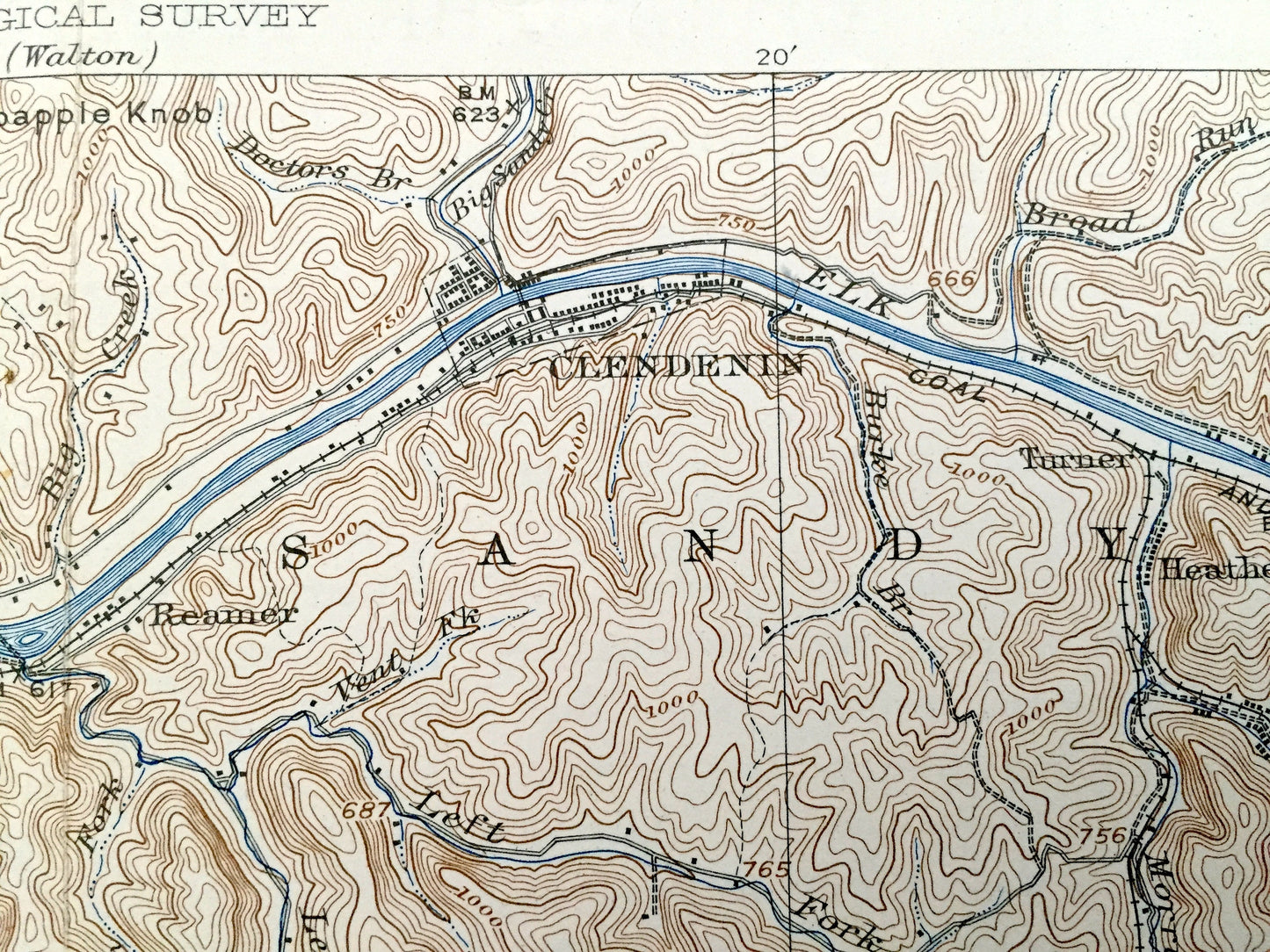
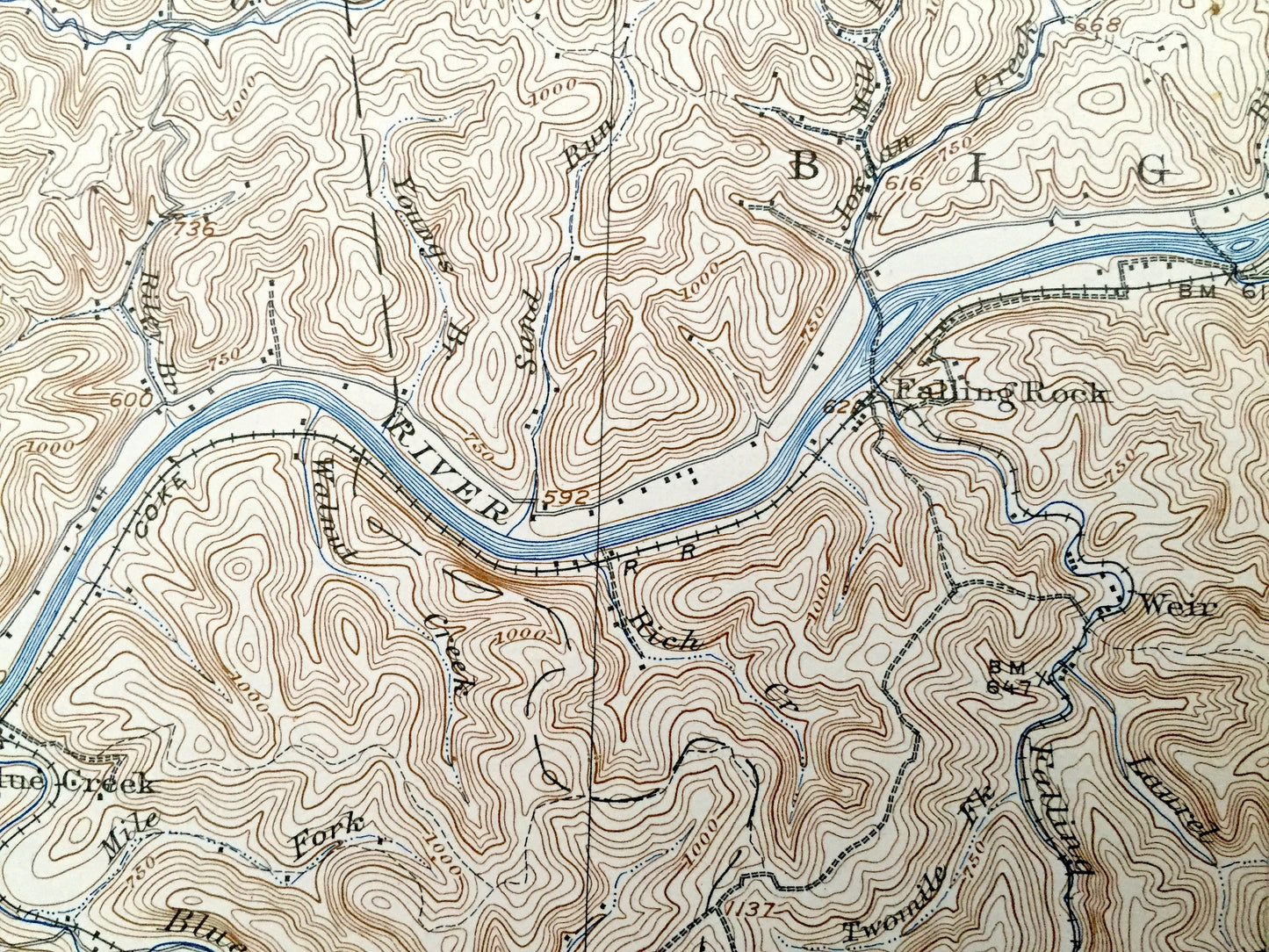
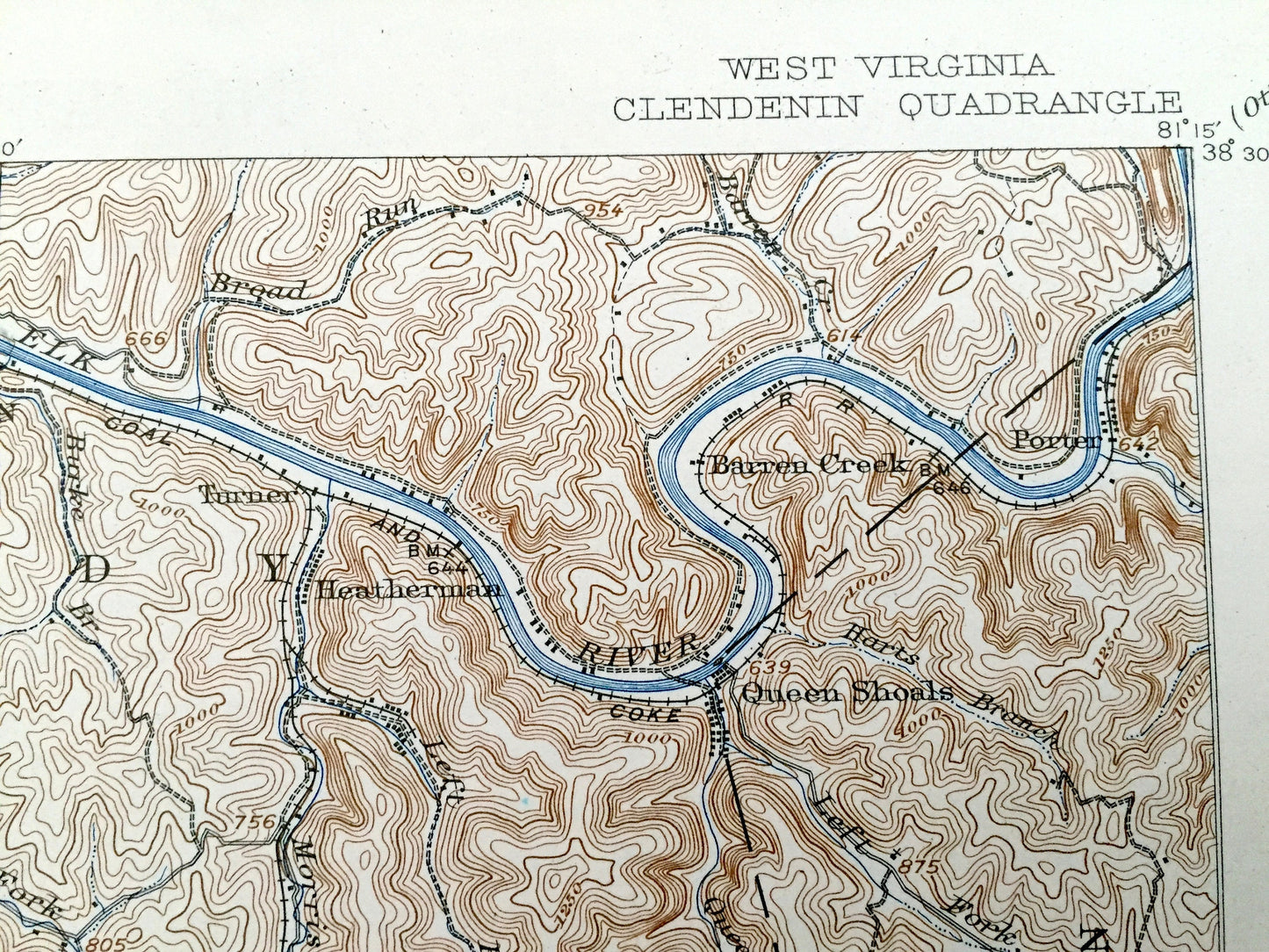
See what West Virginia looked like over 100 years ago. Lots of intricate details and geological contours. Map even has little squares for every house that existed at the time. The USGS cartographers were very thorough back then! On the back is a description of topographic symbols and map guide.
Perfect for the historian, map-lover, the curious or just as a conversation starter. Wonderful and rare. Vintage maps such as these make great gifts.
Edition of 1909, printed 1942
Dimensions: 16 1/2" width x 20" height
----
Features
Cities & Towns: Clendenin, Jarrett, Jarretts Ford, Dial, Blue Creek, Big Sandy, Weir, Falling Rock, Reamer, Turner, Heatherman, Barren Creek, Porter, Queen Shoals, Fivemile, Elk, Quick, Roderic, Odell, Coco, Middle Fork, Rosina, Gazil, Kendalia, Malden, Cabin Creek, Putney, Eight, Mammoth, Pond Fork, Blakeley, Spangler, Pond Gap, Morris.
Points of Interest: Elk River, Belcher Hollow, Campbell Creek Railroad, Blue Creek, Leatherwood Creek, Kanawha & West Virginia Railroad, Hammick Hill, and lots more hills, mountains, creeks, towns, roads and train tracks.
Condition: Very Good condition, commensurate with age. This map is in incredible condition for being over 70 years old. Has some light fold marks, but these will read as vintage character when framed.
----
We will happily adjust shipping price for multiple purchases. Maps are rolled up and shipped in sturdy mailing tubes, never folded.
Couldn't load pickup availability
Share