My Store
Antique Cleveland, Ohio 1962 US Geological Survey Topographic Map – Akron, Youngstown, Cuyahoga Falls, Lakewood Barberton Euclid Ontario OH
Antique Cleveland, Ohio 1962 US Geological Survey Topographic Map – Akron, Youngstown, Cuyahoga Falls, Lakewood Barberton Euclid Ontario OH
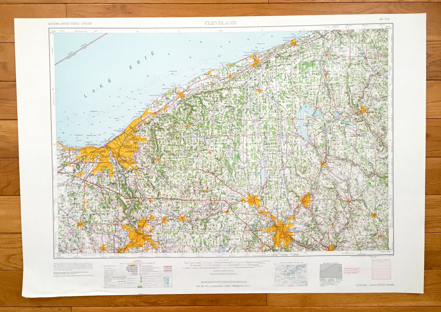
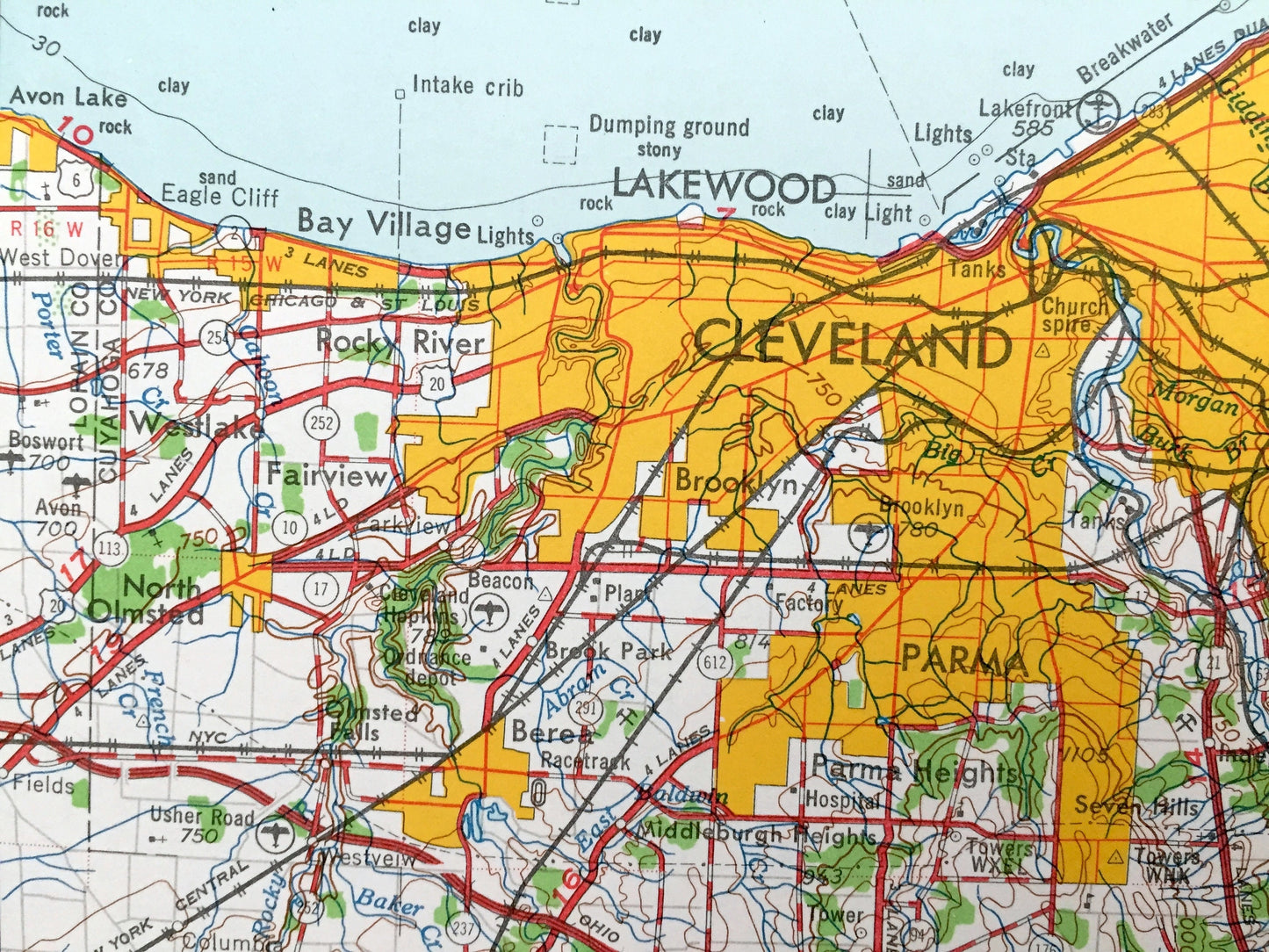
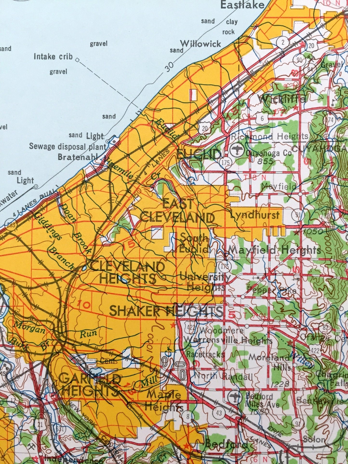
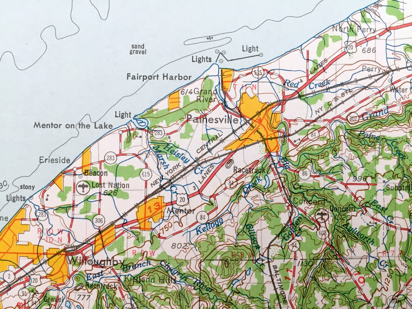
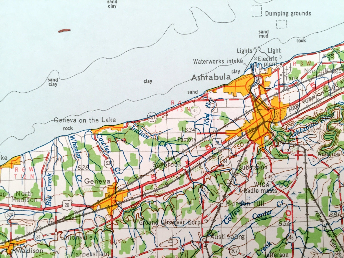
Beautiful, antique map of Cleveland, Ohio and surrounding Pennsylvania and Ontario, Canada areas. This is an authentic 1962 edition, 1962 print from the U.S. Geological Survey and NOT a computer reproduction.
See what Ohio, Pennsylvania and Ontario, Canada looked like over 55 years ago. Lots of intricate details and geological contours. Map is incredibly large and in the grand 1:250,000 scale. The USGS cartographers were very thorough back then!
Perfect for the historian, map-lover, the curious or just as a conversation starter. Wonderful and rare. Vintage maps such as these make great gifts.
Edition of 1962, printed 1962
Dimensions: 32" width x 22 1/2" height
----
Features
Cities & Towns: OHIO - Cleveland, East Cleveland, Cleveland Heights, Shaker Heights, Parma, Brooklyn, Berea, Rocky River, Bay Village, North Olmsted, Strongsville, Medina, Seville, Wadsworth, Barberton, Kent, Bedford, Mayfield Heights, Painesville, Eastlake, Ravenna, Newton Falls, Warren, Campbell, Struthers, Linesville, Andover, Middlefield, Conneaut, Ashtabula, Geneva, Chardon, Garrettsville.
PENNSYLVANIA - Sharon, Sharpsville, Greenville, Farrell, New Castle, Grove City, Mercer, Meadville, Cambridge Springs, Albion, Edinboro, New Wilmington.
Points of Interest: OHIO - Lake Erie, Chippewa Lake, Pymatuning Reservoir, Mosquito Creek Reservoir, Cuyahoga River, Baker Creek, Kellogg Creek, Raccoon Creek and Ontario, Canada and lots more hills, mountains, lakes, rivers, creeks, roads, highways and railroads.
PENNSYLVANIA - Shenango River, Edinboro Lake, Conneaut Lake, Lake Erie, Pymatuning Reservoir, Keystone Ordnance Works, French Creek and lots more hills, mountains, lakes, rivers, creeks, roads, highways and railroads.
Condition: Very Good condition, commensurate with age. This map is in incredible shape for being over 55 years old. Has some light edge-wear, all of which will read as vintage character when framed.
----
We will happily adjust shipping price for multiple purchases. Maps are rolled up and shipped in sturdy mailing tubes, never folded.
Couldn't load pickup availability
Share