My Store
Antique Clinton County, New York 1941 Historical Atlas Map – Plattsburg, Lake Champlain, Dannemora, Rouse's Point, Morrisonville, Chazy, NY
Antique Clinton County, New York 1941 Historical Atlas Map – Plattsburg, Lake Champlain, Dannemora, Rouse's Point, Morrisonville, Chazy, NY
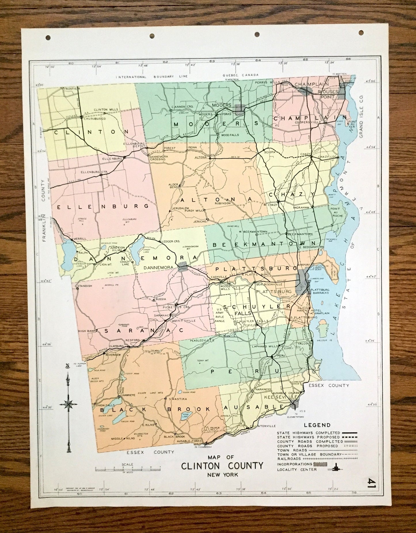
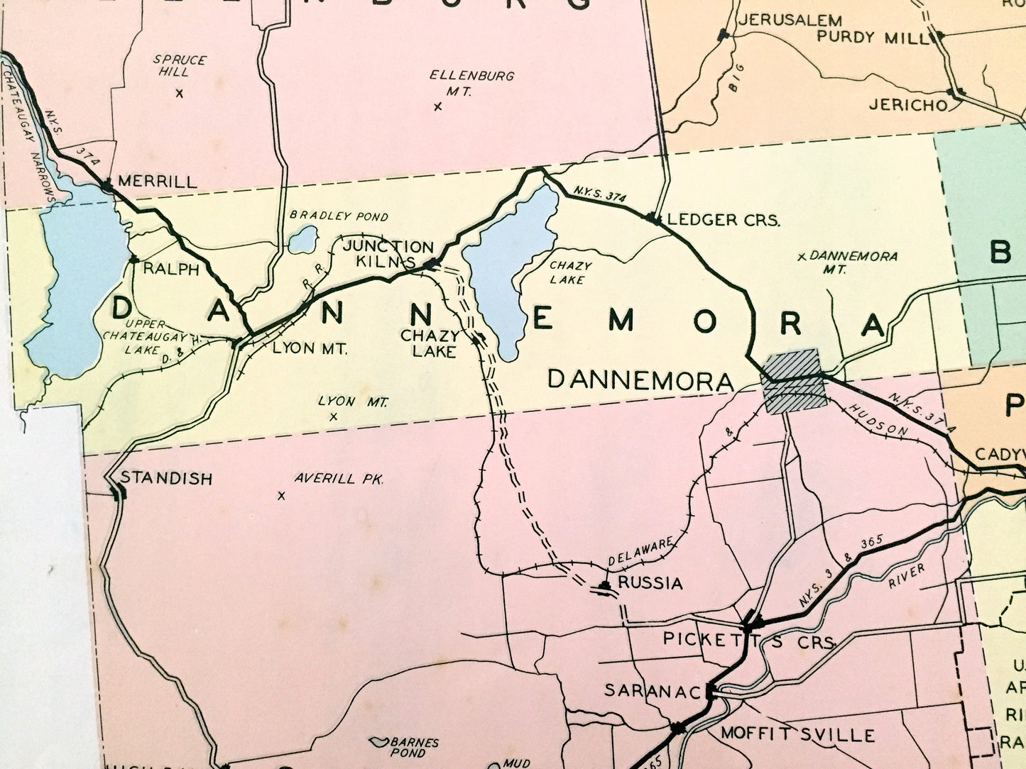
Beautiful, antique map of Clinton County, New York, including Plattsburg, Chazy, Morrisonville, Rouse's Point and Dannemora. This is an authentic map taken from the rare "Historical Atlas of New York State" by William P. Munger, published by Frank E. Richards Co. in 1941, and is NOT a computer reproduction.
See what Clinton County looked like more than 80 years ago. Lots of charming details and contours, major cities, towns and roads, as well as geographical points of interest. It is a large, colorful print and will be a showpiece wherever it is presented. Reverse side has an informative history of the county.
Perfect for the historian, map-lover, the curious or just as a conversation starter. Wonderful and rare. Vintage maps such as these make great gifts.
Edition of 1941, printed 1941
Dimensions: 16 1/2" width x 22" height
----
Features
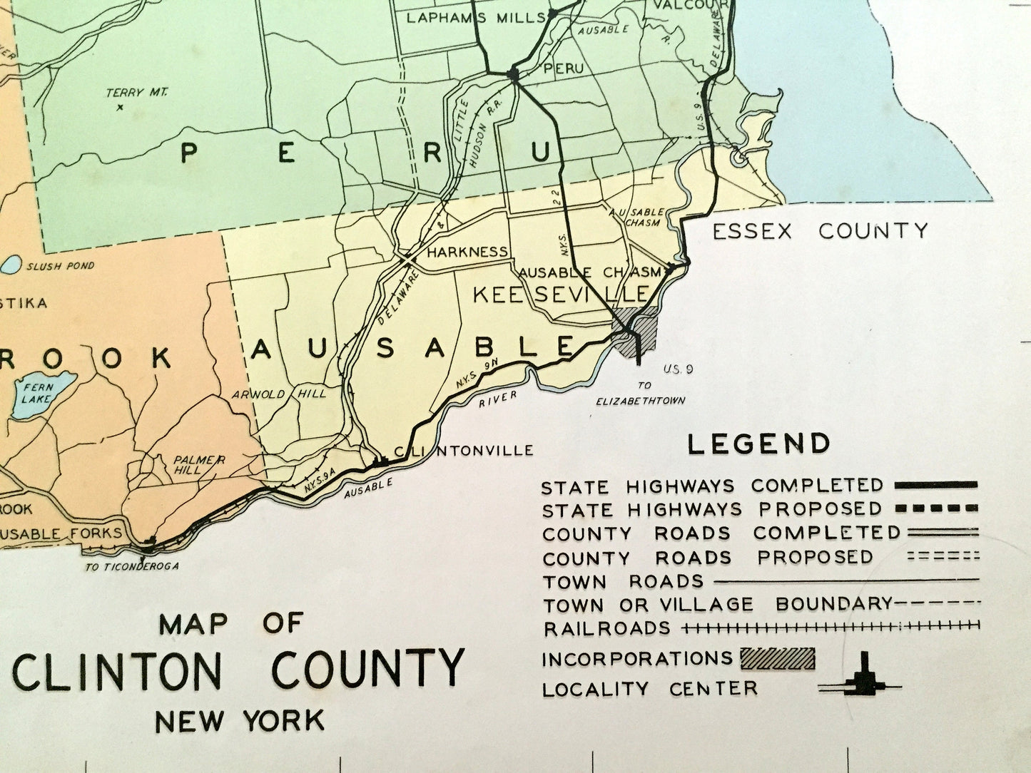
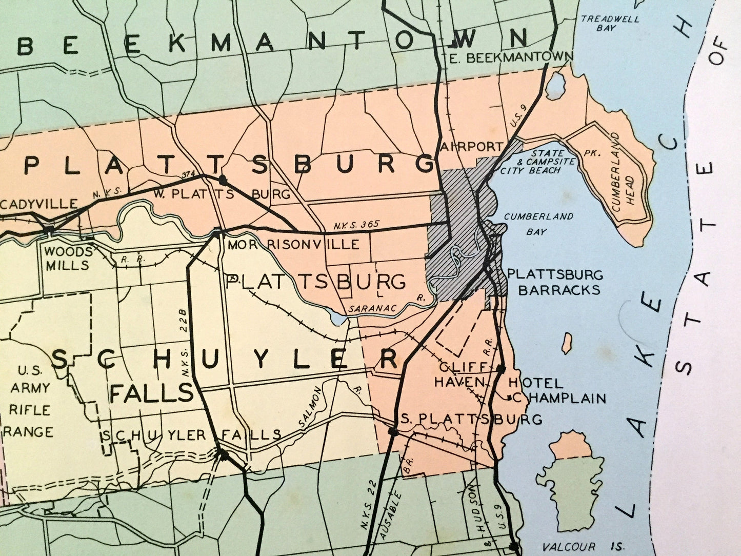
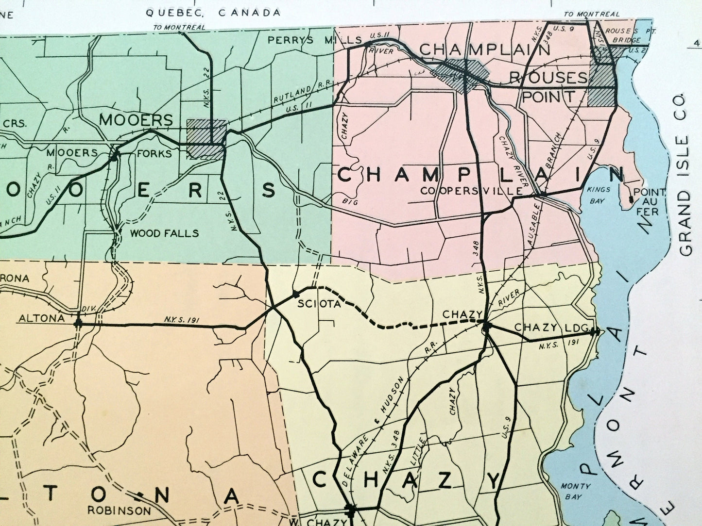
Cities & Towns: Clinton, Mooers, Champlain, Ellenburg, Altoona, Chazy, Dannemora, Beekmantown, Saranac, Plattsburg, Schuyler Falls, Black Brook, Peru, Ausable, Frontier, Cherebusco, Clinton Mills, Star, Brandy Brook, Merrill, Wood Falls, Mooers Forks, Thron, Rouse's Point, Fort Montgomery, Coopersville, Forest, Alder Bend, Jerusalem, Purdy Mill, Jericho, Robinson, Sciota, Ingraham, Chazy landing, Lyon Mountain, Whig Hollow, Spellmans, Point au Roche, Standish, Lobdell, Moffitsville, Irondale, Redford, Morrisonville, Plattsburg Barracks, Cliff Haven, Day, Salmon River, Clayburg, Williamsburg, Disco, East Kilns, Union Falls, Peasleeville, Ausable Forks, Harkness, Ferrona, Rogers, Clintonville, Valcour, Lapham, Ausable Chasm, more.
Points of Interest: Lake Champlain, Isle La Motte, North Hero Island, South Hero Island, Valcour Island, Monty Bay, Kings Bay, Treadwell Bay, Cumberland Bay, Point Au Fer, Cumberland Head, Hotel Champlain, Silver Lake Mountain, Silver Lake, Taylor Lake, Chateagay Lake, Lake Chazy, Saranac River, Canada & Nova Scotia Refugee Tract, Livingston's Patent, Plattsburg Old Patent, Delaware & Hudson Railroad and many more ponds, lakes, creeks, rivers, roads, highways, railroads, farms, school houses and elevations.
----
Condition: Good Vintage condition, commensurate with age. This map is in great shape for being over 80 years old. Has light wear, foxing, toning, and holes in margin where the print was removed from atlas, but this will all add to vintage character when framed.
(Images of atlas cover and frontispiece for information only and not included.)
----
We will happily adjust shipping price for multiple purchases. Maps are rolled up and shipped in sturdy mailing tubes, never folded.
Couldn't load pickup availability
Share