My Store
Antique Coatesville, Pennsylvania 1931 US Geological Survey Topographic Map – Oxford, Westgrove, Parkesburg, Lincoln Univ, Chester County
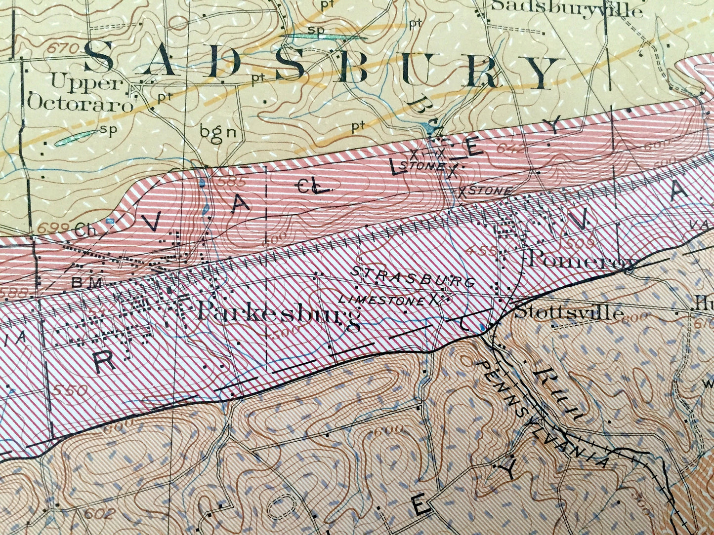
Antique Coatesville, Pennsylvania 1931 US Geological Survey Topographic Map – Oxford, Westgrove, Parkesburg, Lincoln Univ, Chester County
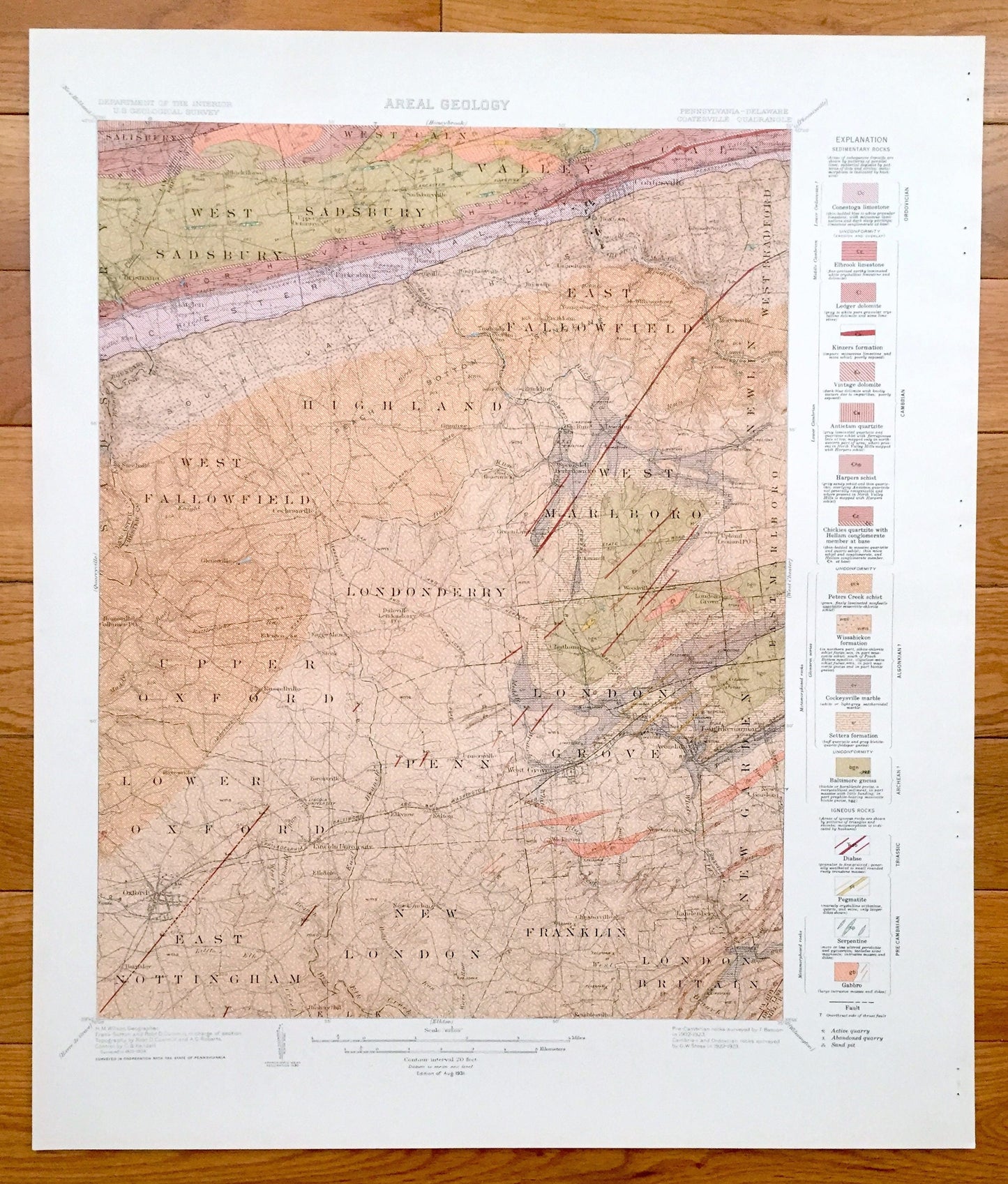
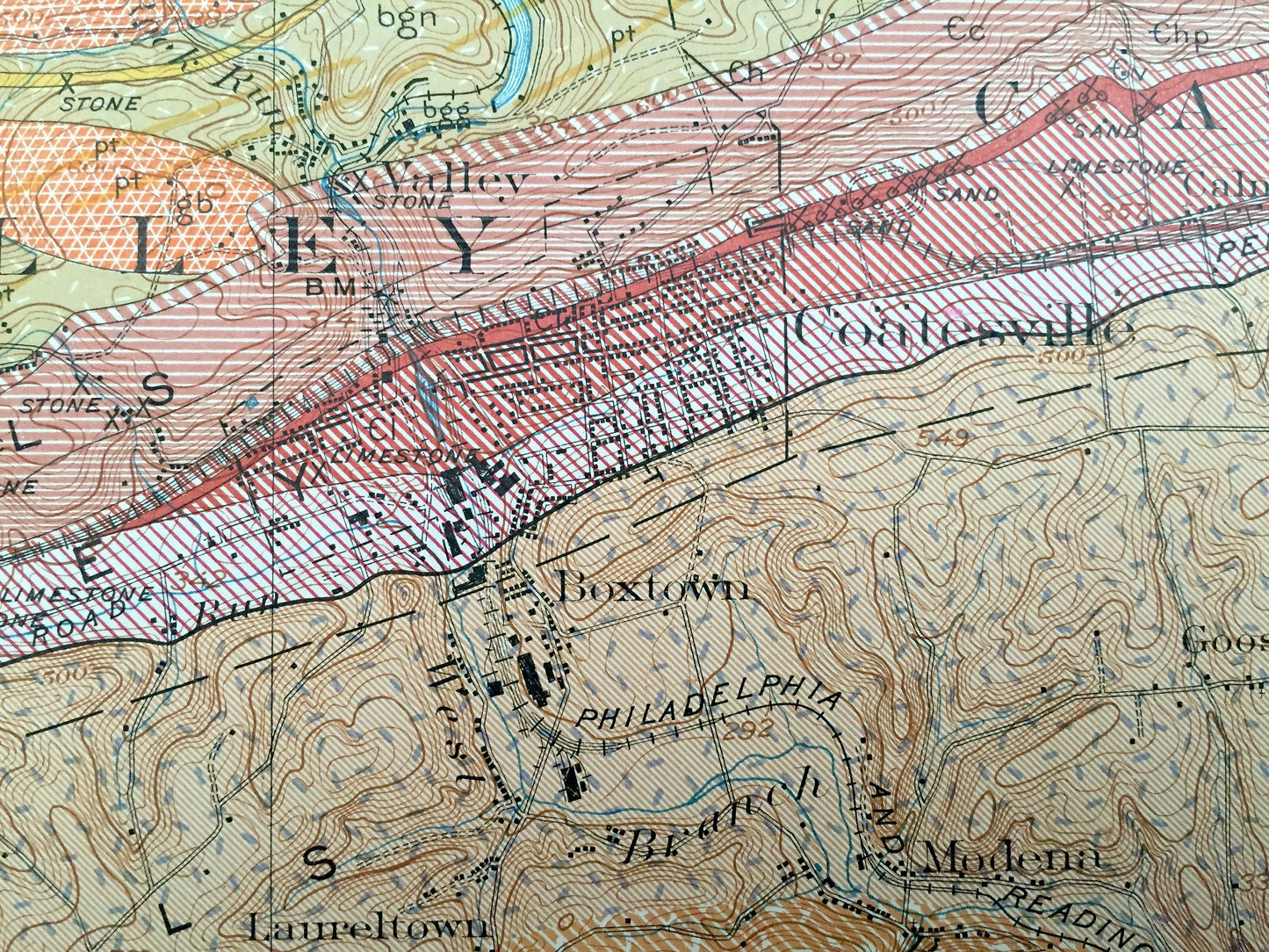
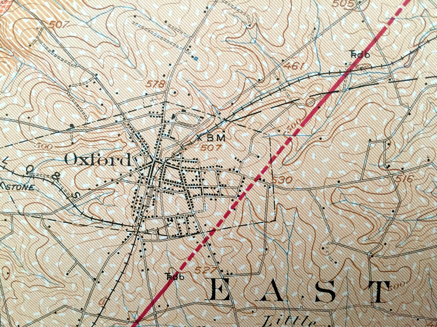
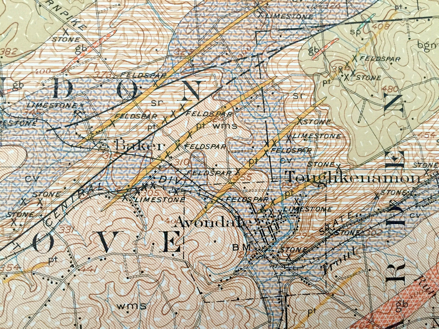
Beautiful, antique geological map of Coatesville, Oxford, Pomeroy, Parkesburg, Toughkenamon and surrounding Chester County area. This is an authentic 1931 print from the U.S. Geological Survey and NOT a computer reproduction. It is from a Geologic Atlas folio and is in very fine library condition.
See what historic Chester County looked like more than a century ago. Lots of intricate details and geological contours. Map even has little squares for every house that existed at the time. The USGS cartographers were very thorough back then! This is one of the rare maps where the topographic symbols and map guide are on the front.
Perfect for the historian, map-lover, the curious or just as a conversation starter. Wonderful and rare. Vintage maps such as these make great gifts.
Edition of 1931, printed 1931
Dimensions: 18 1/2" width x 22" height
----
Features
Cities & Towns: Salisbury, Sadsbury, West Sadsbury, West Caln, Valley, Caln, West Fallowfield, Highland, East Fallowfield, West Bradford, Newlin, Upper Oxford, Londonderry, West Marlboro, East Marlboro, Lower Oxford, Penny, London Grove, New Garden, East Nottingham, New London, Franklin, London Britain, Simmonstown, Black Horse, Upper Octoraro, Christiana, Atglen, Parkesburg, Sadsburyville, Pomeroy, Stottsville, Humphreyville, Briarton, Tinncula, Buck Run, Rosenvick, Green Lawn, Coatesville, Thorndale, Goosetown, Mortonsville, Laurel, Doe Run, Youngsburg, Ercildonn, Steelville, Glennville, Cochranville, Russelville, Eaggs Manor, Homeville, Edenton, Daleville, Springdell, Clonmell, Woodville, Chatham, Baker, Hayesville, Oxford, Barnsley, Hickory Hill, Lincoln University, Elkdale, Elkview, Kelton, Jennersville, Westgrove, Avondale, Toughkenamon, New Garden, Wickerton, Landednberg, Chesterville.
DELAWARE: Mill Creek.
Points of Interest: Chester County, Lancaster County, Philadelphia Baltimore & Washington Railroad, Octoraro Creek, Brandywine Creek, White Clay Creek, Big Elk Creek, Buck Run, Rock Run, Valley Run, Lincoln University, and lots more hills, small towns, roads, schools, churches and train tracks.
Condition: Very Fine condition, commensurate with age. This map is in great shape for being almost 90 years old.
----
We will happily adjust shipping price for multiple purchases. Maps are rolled up and shipped in sturdy mailing tubes, never folded.
Couldn't load pickup availability
Share