My Store
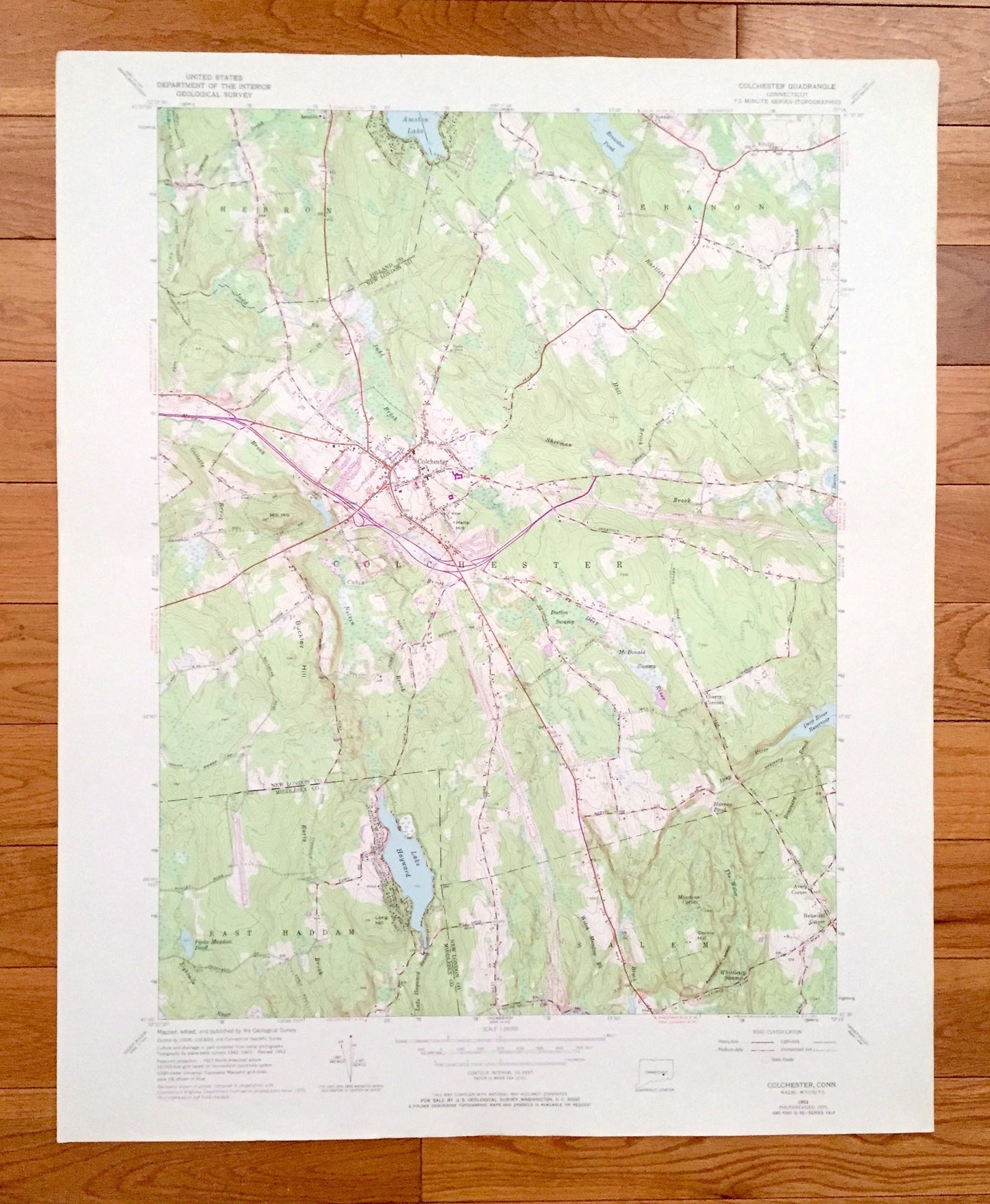
Antique Colchester, Connecticut 1953 US Geological Survey Topographic Map — Tolland, New London, Middlesex County, Hebron, Lebanon, Salem CT
Antique Colchester, Connecticut 1953 US Geological Survey Topographic Map — Tolland, New London, Middlesex County, Hebron, Lebanon, Salem CT
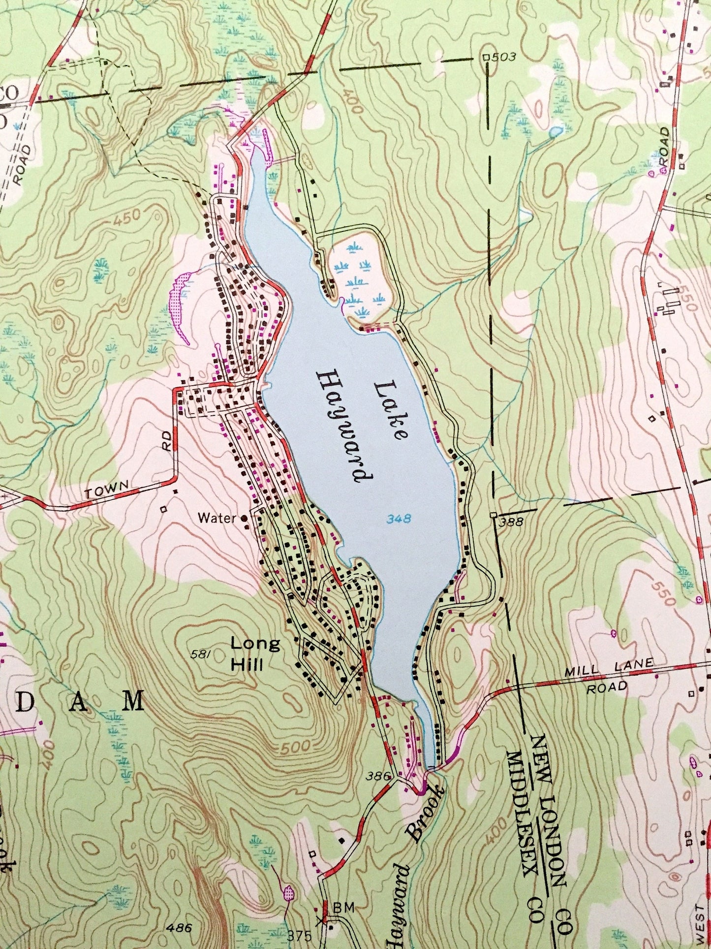
Beautiful, antique map of Colchester, Connecticut and surrounding Tolland County, New London County, and Middlesex County areas. This is an authentic 1953 edition, 1971 print from the U.S. Geological Survey and NOT a computer reproduction.
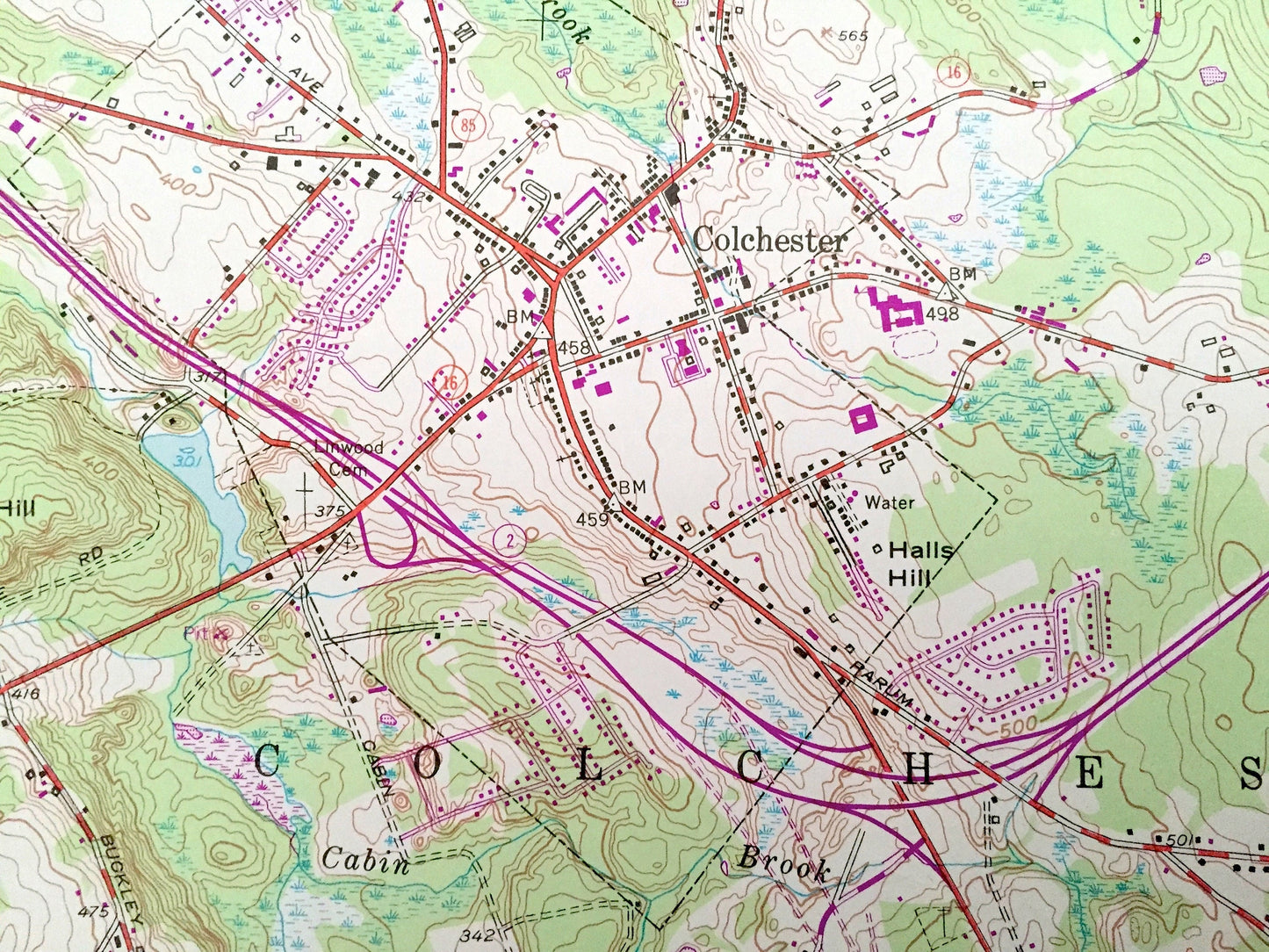
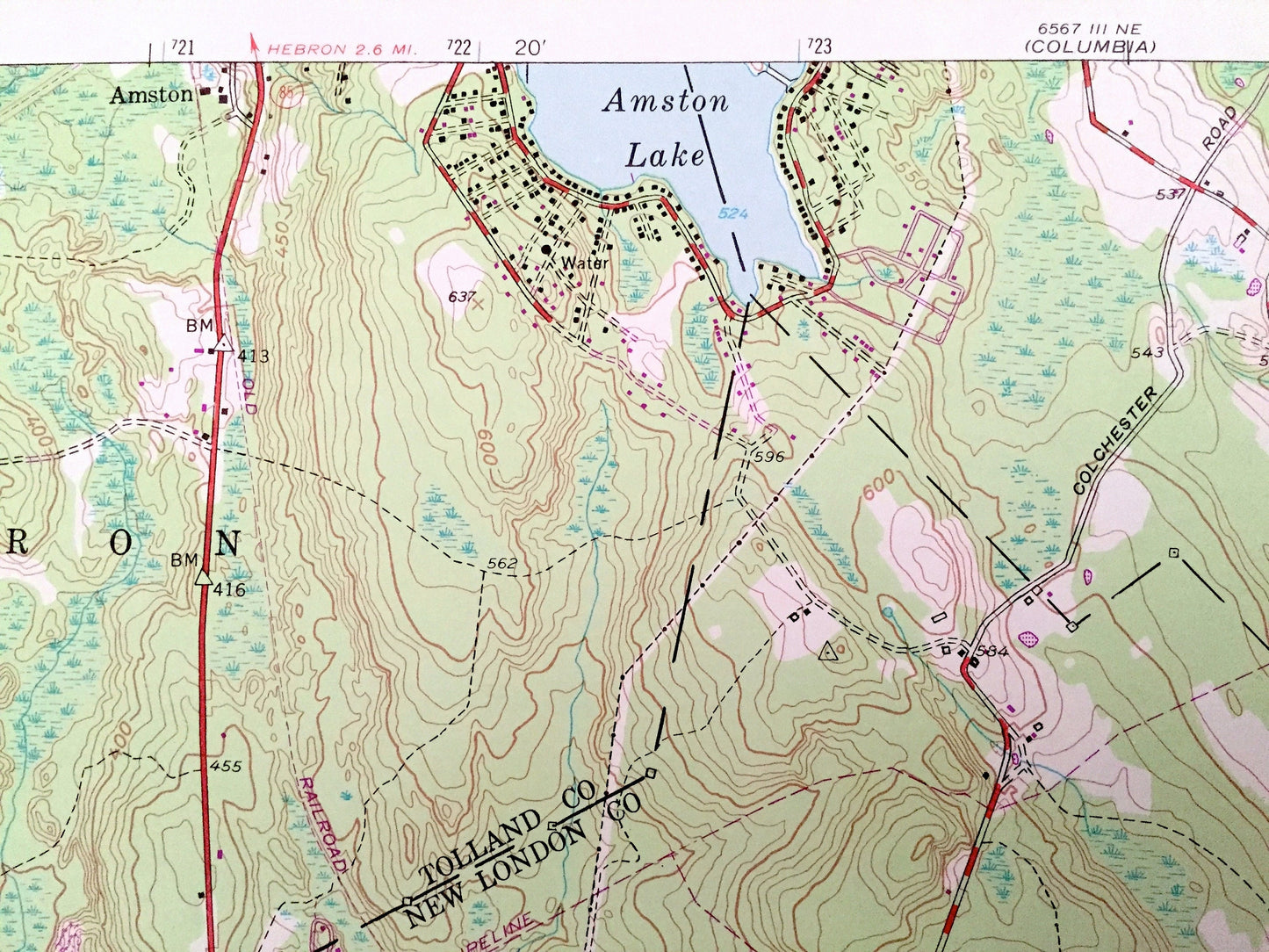
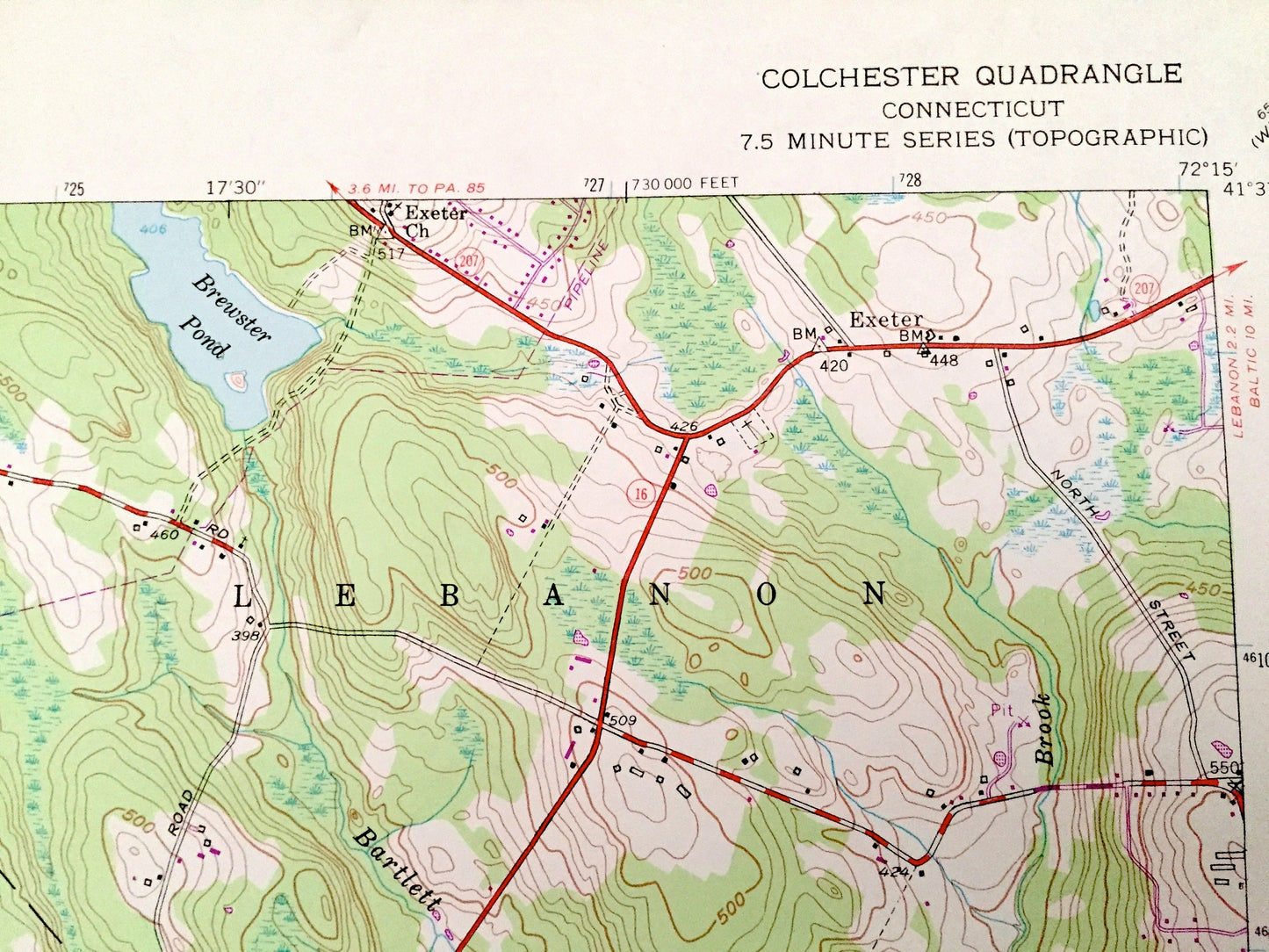
See what Connecticut looked like over 65 years ago. Lots of intricate details and geological contours. Map even has little squares for every house that existed at the time. The USGS cartographers were very thorough back then!
Perfect for the historian, map-lover, the curious or just as a conversation starter. Wonderful and rare. Vintage maps such as these make great gifts.
Edition of 1953, printed 1971
Dimensions: 22" width x 27" height
----
Features
Cities & Towns: East Haddam, Amston, Exeter, Milestone Corner, Heilwield Corner, Avery Corner, Cherry Corners.
Points of Interest: Salmon River State Park, Amston Lake, Brewster Pond, Lake Hayward, McDonald Swamp, Deep River Reservoir, Savin Lake, Mill Hill, Buckley Hill, Cockle Hill, Exeter Brook, Sherman Brook, Hall Brook, Early Brook, Deep River, Raywood Brook, and many more hills, streams, ponds, houses, schools, railroads, churches and roads.
Condition: Very Good Vintage condition, commensurate with age. This map is in great condition for being over 50 years old. Has light edge-wear but will read as character when framed.
----
We will happily adjust shipping price for multiple purchases. Maps are rolled up and shipped in sturdy mailing tubes, never folded.
Couldn't load pickup availability
Share