My Store
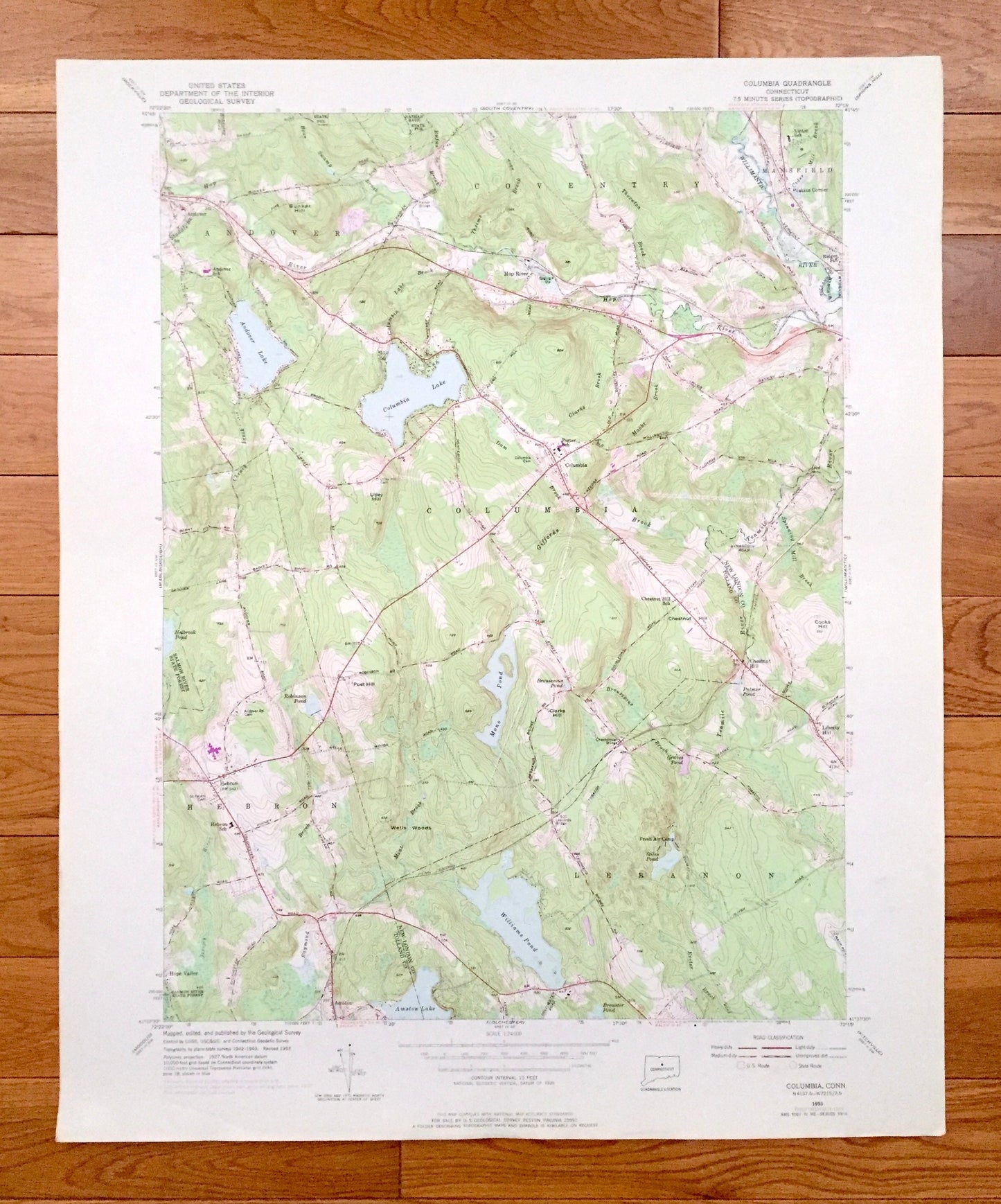
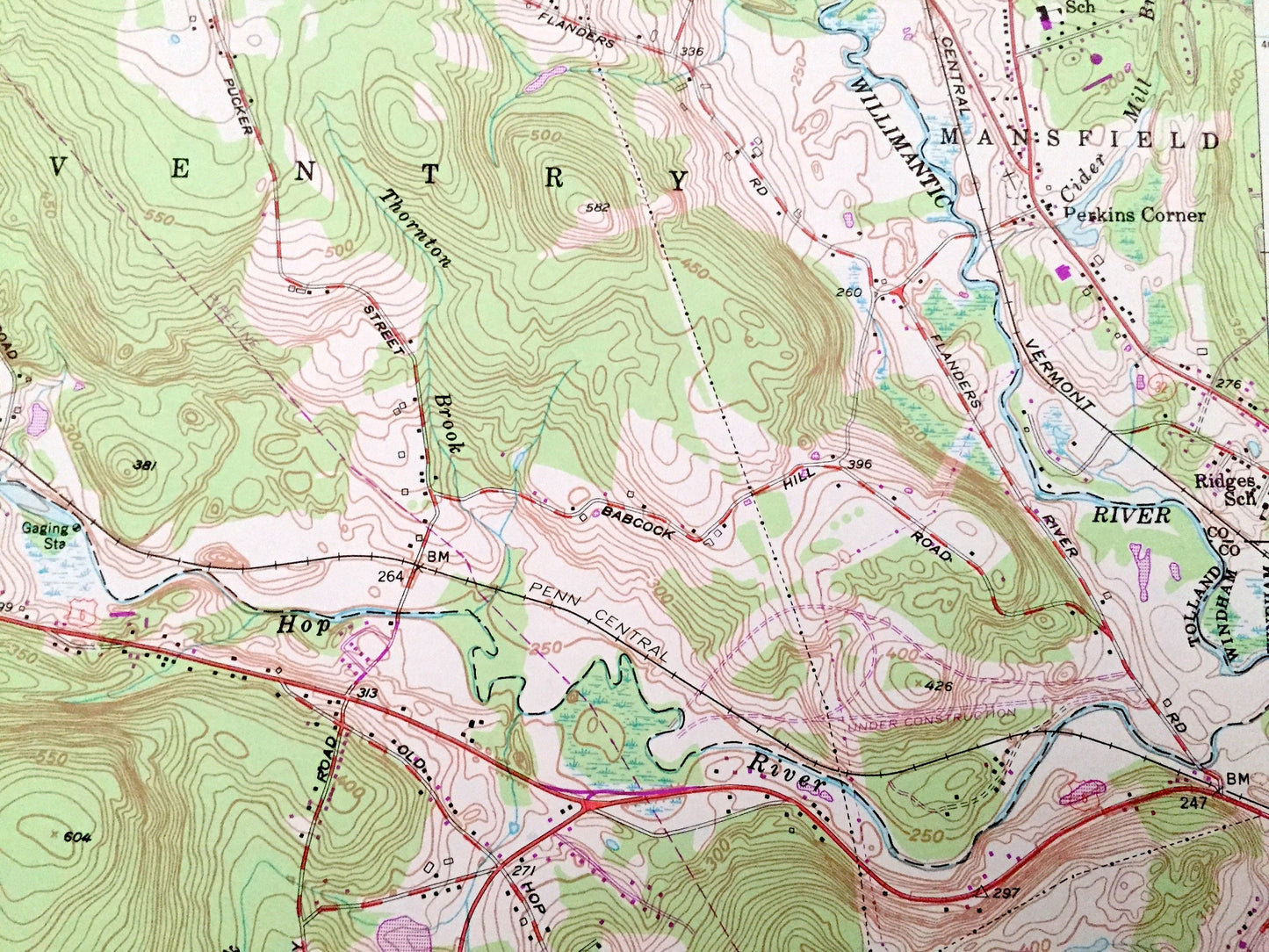
Antique Columbia, Connecticut 1953 US Geological Survey Topographic Map – Tolland, New London County, Andover, Coventry, Lebanon, Hebron, CT
Antique Columbia, Connecticut 1953 US Geological Survey Topographic Map – Tolland, New London County, Andover, Coventry, Lebanon, Hebron, CT
Beautiful, antique map of Columbia, Connecticut and surrounding Tolland & New London County areas. This is an authentic 1953 edition, 1976 print from the U.S. Geological Survey and NOT a computer reproduction.
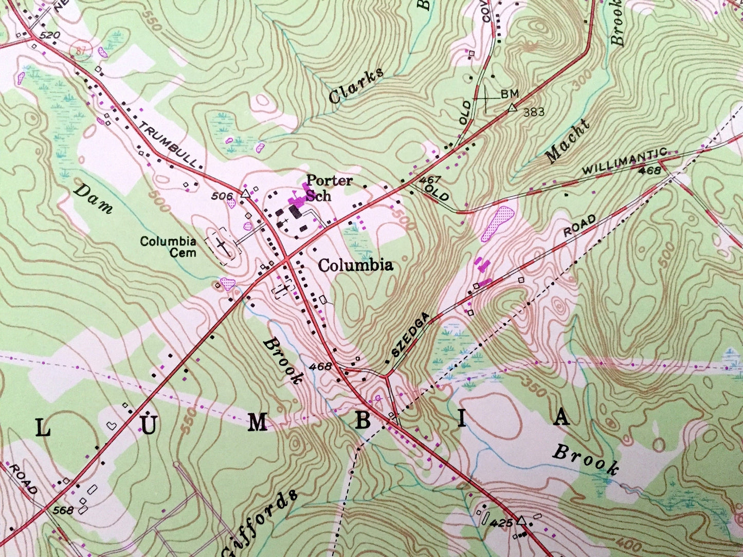
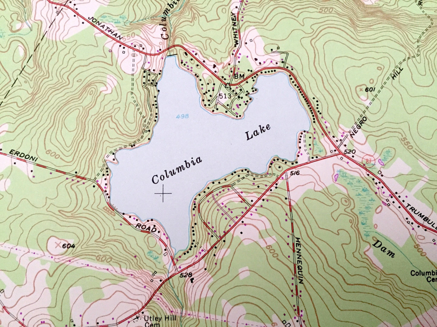
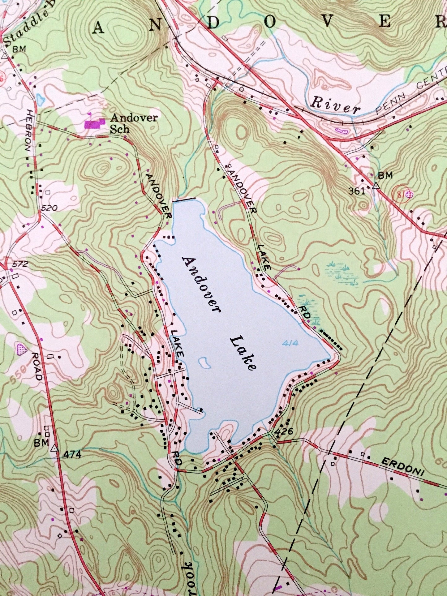
See what Connecticut looked like over 65 years ago. Lots of intricate details and geological contours. Map even has little squares for every house that existed at the time. The USGS cartographers were very thorough back then!
Perfect for the historian, map-lover, the curious or just as a conversation starter. Wonderful and rare. Vintage maps such as these make great gifts.
Edition of 1953, printed 1976
Dimensions: 22" width x 27" height
----
Features
Cities & Towns: Mansfield, Hop River, Perkins Corner, Windham, Chestnut Hill, Hope Valley, Amston, Liberty Hill.
Points of Interest: Chesborough Bridge, Fresh Air Camp, Nathan Hale State Forest, Salmon River State Forest, Bunker Hill, Utley Hill, Chestnut Hill, Cooks Hill, Wells Woods, Clarks Hill, Andover Lake, Columbia Lake, Holbrook Pond, Robinson Pond, Mono Pond, Williams Pond, Amston Lake, Willimantic River, Tenmile River, Giffords Brook, Exeter Brook, and many more hills, streams, ponds, houses, schools, railroads, churches and roads.
Condition: Very Good Vintage condition, commensurate with age. This map is in great shape for being over 45 years old. Has light edge-wear but will read as character when framed.
----
We will happily adjust shipping price for multiple purchases. Maps are rolled up and shipped in sturdy mailing tubes, never folded.
Couldn't load pickup availability
Share