My Store
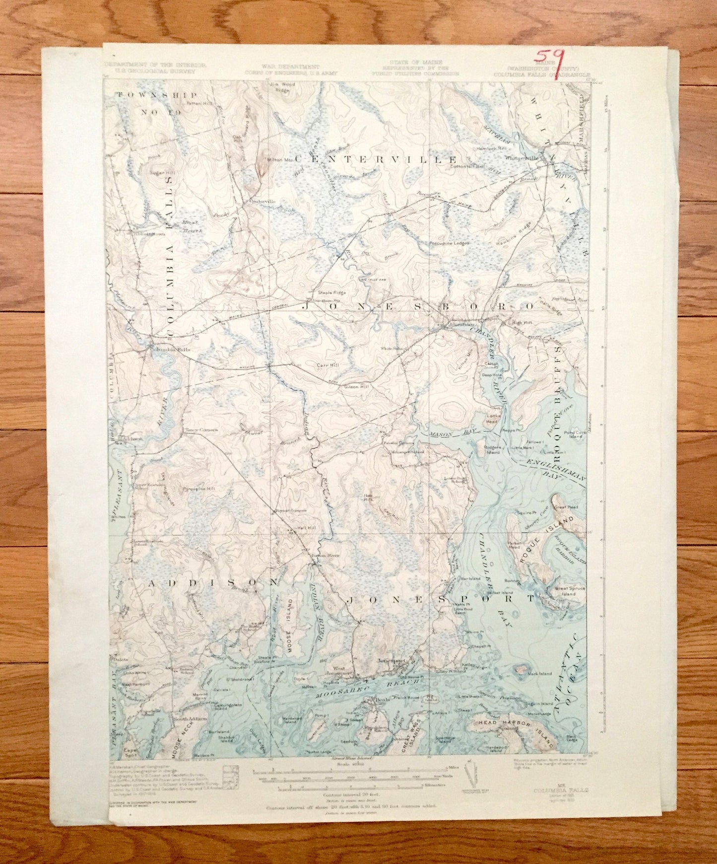
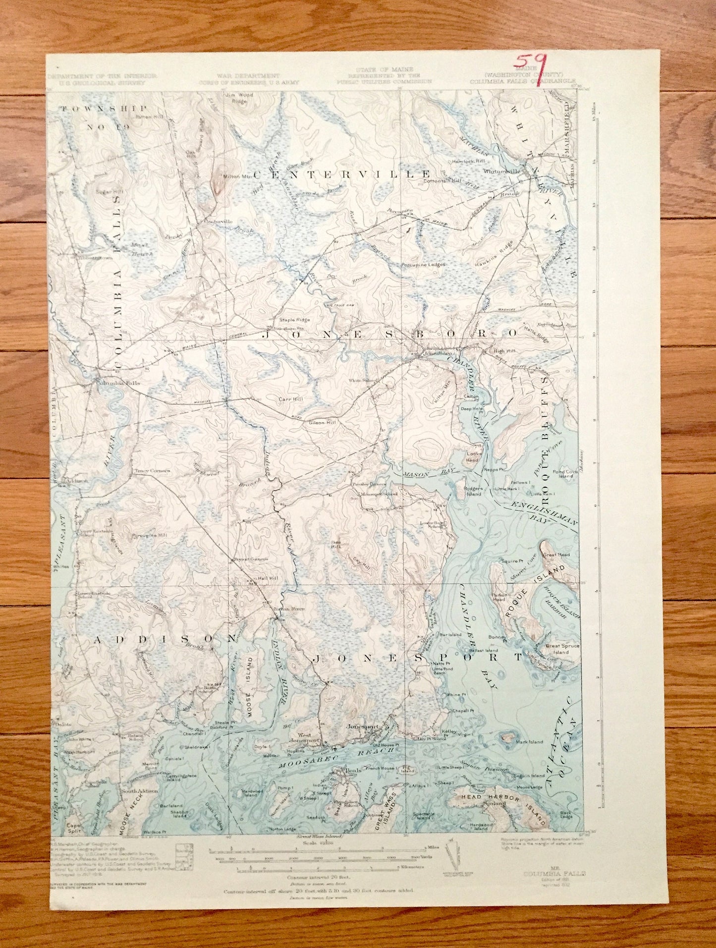
Antique Columbia Falls, Maine 1921 US Geological Survey Topographic Map – Jonesport, Jonesboro, Addison, Roque Bluffs, Marshfield Sealand ME
Antique Columbia Falls, Maine 1921 US Geological Survey Topographic Map – Jonesport, Jonesboro, Addison, Roque Bluffs, Marshfield Sealand ME
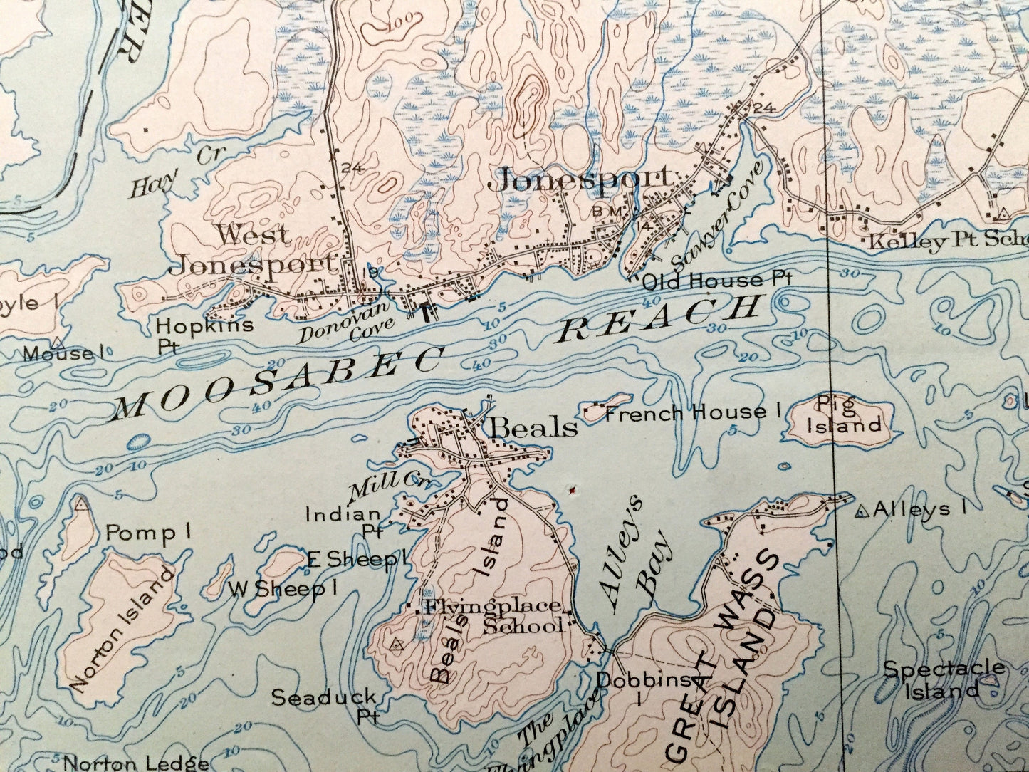
Beautiful, antique map of Jonesport, Jonesboro, Addison, Roque Bluffs & Columbia Falls, Maine and surrounding Washington County on the Maine Coast. This is an authentic 1931 edition, 1932 print from the United States Geological Survey, War Department & Army Corps of Engineers and is NOT a computer reproduction.
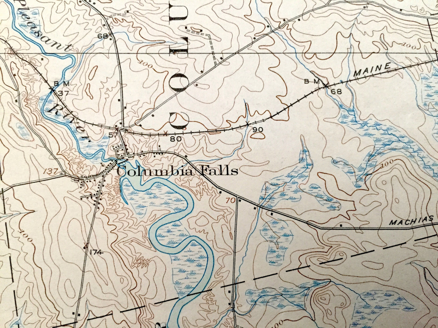
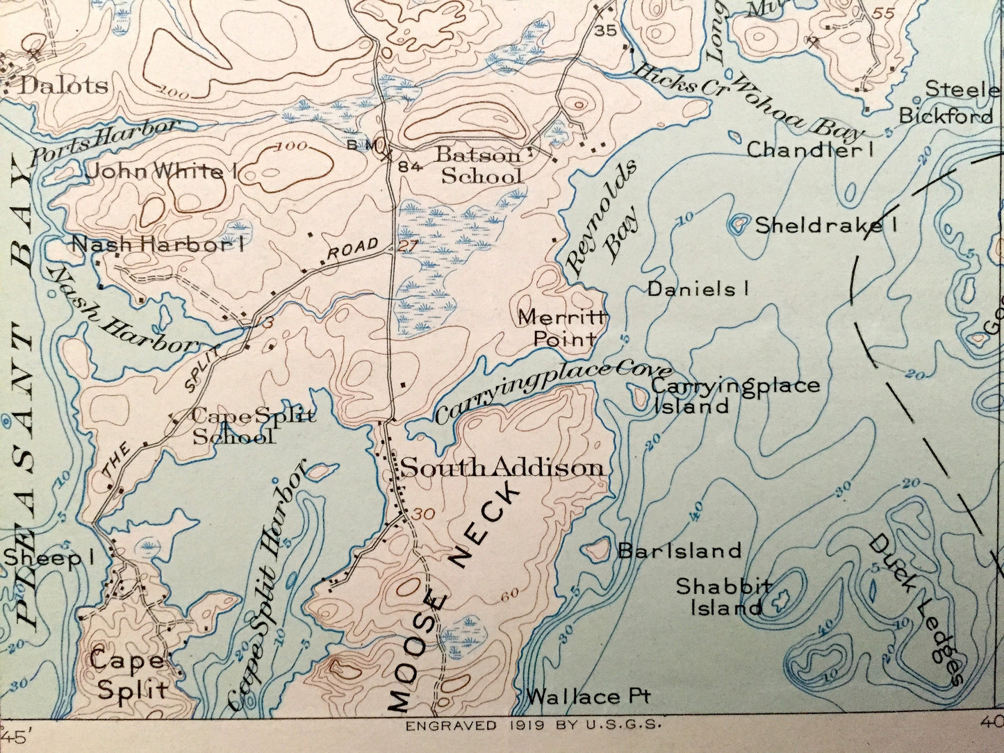
See what Coastal Maine looked like over 75 years ago, when large parts of Maine were still unnamed, like "Township No. 19" on this map. Lots of intricate details and geological contours. Map even has little squares for every house that existed at the time. The USGS cartographers were very thorough back then!
Perfect for the historian, map-lover, the curious or just as a conversation starter. Wonderful and rare. Vintage maps such as these make great gifts.
Edition of 1921, printed 1932
Dimensions: 14 1/2" width x 20" height
----
Features
Cities & Towns: Centerville, Whitneyville, Marshfield, Columbia, Columbia Falls, Jonesboro, Addison, Jonesport, Roque Bluffs, Tibbetstown, Tracy Corners, Peasley Corners, Dalots, South Addison, Indian River, West Jonesport, Beals, Sealand, Township No. 19.
Points of Interest: Atlantic Ocean, Maine Coast, Pleasant River, Pleasant Bay, Cape Split Harbor, West River, Indian River, Moosabec Reach, Alleys Bay, Chandler Bay, Mason Bay, Chandler River, Englishman Bay, Pond Cove, Shorey Cove, Roque Island Harbor, Roque Island, Great Spruce Island, Head Harbor Island, Great Wass Island, Beals Island, Moose Neck, Cape Split, Nash Harbor, The Highlands, Doyle Island, Goose Islands, Hardwood Island, Duck Ledges, Shabbit Island, Carryingplace Cove, Sand River Beach, Popplestone Beach, Rodgers Island, Looks Head, Pond Cove Island, Porcupine Ledges, Machias River, Jim Wood Ridge, Seward Ridge, Gilson Hill, Kilton Mountain, Deep Hole Point, Halls Ridge, French House Island and lots more hills, streams, ponds, marshes, houses, islands—a lot of islands—coves and roads.
Condition: Good or "Very Vintage" condition, commensurate with age. This map is in great shape for being over 85 years old. Has some edge-wear and red pencil mark, but this will add to vintage character when framed. Left margin has been trimmed. This is easily-concealed by placing similar-colored paper behind the map, as in photos.
----
We will happily adjust shipping price for multiple purchases. Maps are rolled up and shipped in sturdy mailing tubes, never folded.
Couldn't load pickup availability
Share