My Store
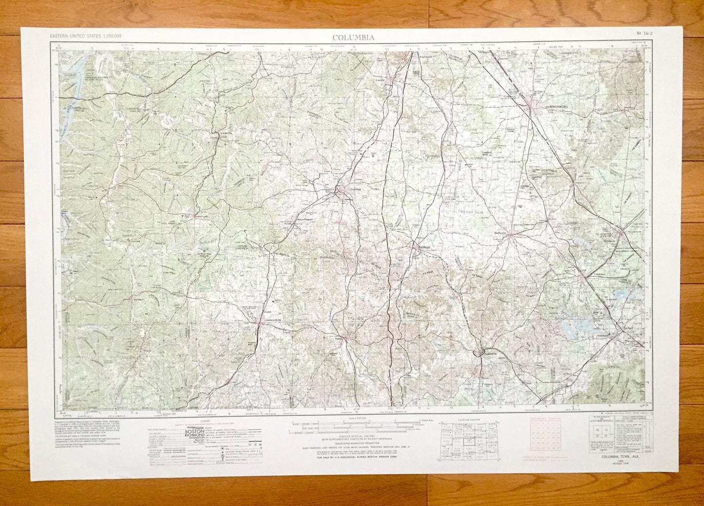
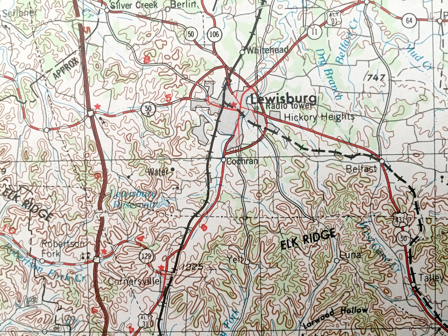
Antique Columbia, Tennessee 1956 US Geological Survey Topographic Map – Lawrenceburg, Fayetteville, Tullahoma, Shelbyville, Murfreesboro TN
Antique Columbia, Tennessee 1956 US Geological Survey Topographic Map – Lawrenceburg, Fayetteville, Tullahoma, Shelbyville, Murfreesboro TN
Beautiful, antique map of Columbia, Tennessee and surrounding Alabama areas. This is an authentic 1956 edition, 1979 print from the U.S. Geological Survey and NOT a computer reproduction.
See what Tennessee and Alabama looked like over 60 years ago. Lots of intricate details and geological contours. Map is incredibly large and in the grand 1:250,000 scale. The USGS cartographers were very thorough back then!
Perfect for the historian, map-lover, the curious or just as a conversation starter. Wonderful and rare. Vintage maps such as these make great gifts.
Edition of 1956, printed 1979
Dimensions: 32" width x 22 1/2" height
----
Features
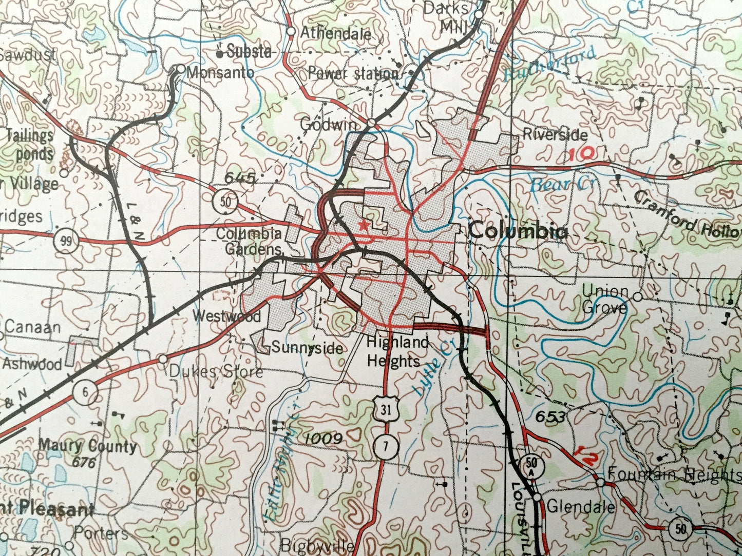
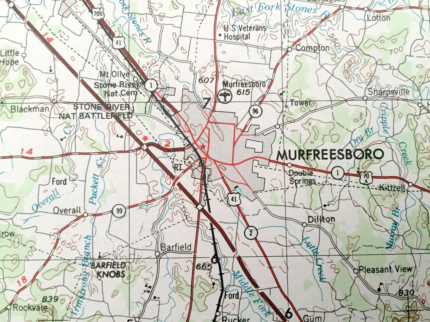
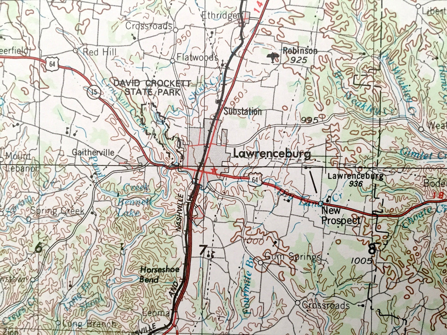
Cities & Towns: Columbia, Mount Pleasant, Franklin, Centerville, Hohenwald, Pulaski, Lewisburg, Winchester, Cowan, Decherd, Manchester, Smyrna, Bell Buckle, Clifton, Lawrenceburg, Fayetteville, Tullahoma, Shelbyville, Murfreesboro.
Points of Interest: Buffalo River, Duck River, Elk River, Tennessee River, Kentucky Lake, Woods Reservoir, Richland Creek, Duck River Ridge, Tennessee National Wildlife Refuge and Lauderdale County, Alabama and lots more hills, mountains, lakes, rivers, creeks, road, highways and railroads.
Condition: Very Good Vintage condition, commensurate with age. This map is in great shape for being over 40 years old. Has some light edge-wear, all of which will read as vintage character when framed.
----
We will happily adjust shipping price for multiple purchases. Maps are rolled up and shipped in sturdy mailing tubes, never folded.
Couldn't load pickup availability
Share