My Store
Antique Columbiana, Alabama 1940 US Geological Survey Topographic Map – Huntsville, Meridian, Coosa River, Shelby, Coosa, Chilton County, AL
Antique Columbiana, Alabama 1940 US Geological Survey Topographic Map – Huntsville, Meridian, Coosa River, Shelby, Coosa, Chilton County, AL
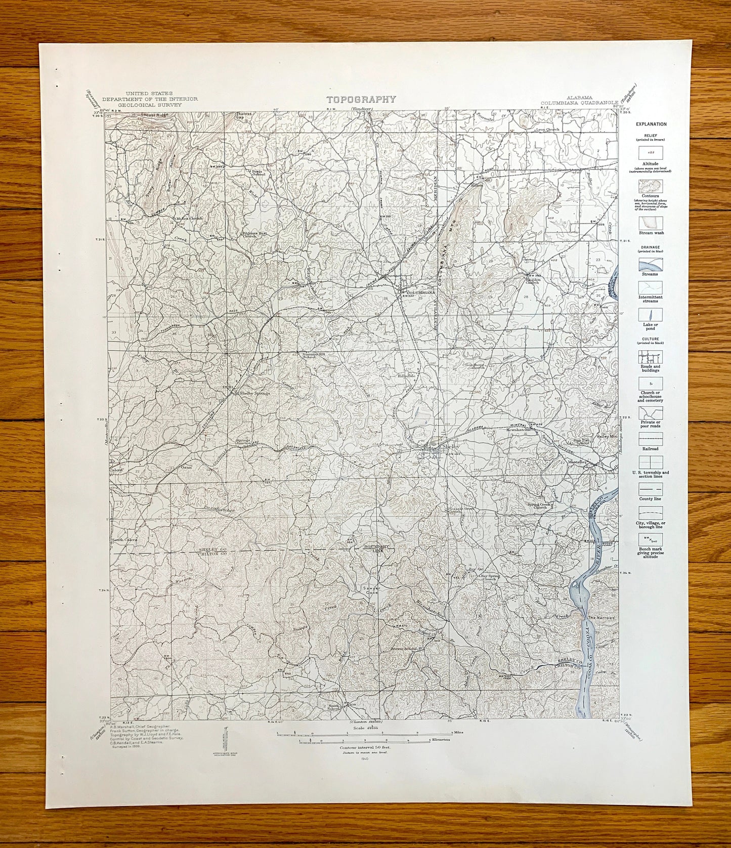
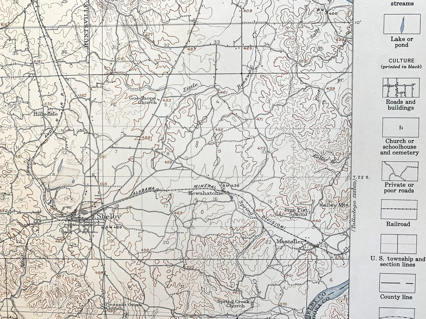
Beautiful, antique map of Columbiana, Alabama and surrounding Shelby County, Coosa County, and Chilton County areas. This is an authentic 1940 edition, 1940 print from the U.S. Geological Survey and is NOT a computer reproduction. It is from a Geologic Atlas folio.
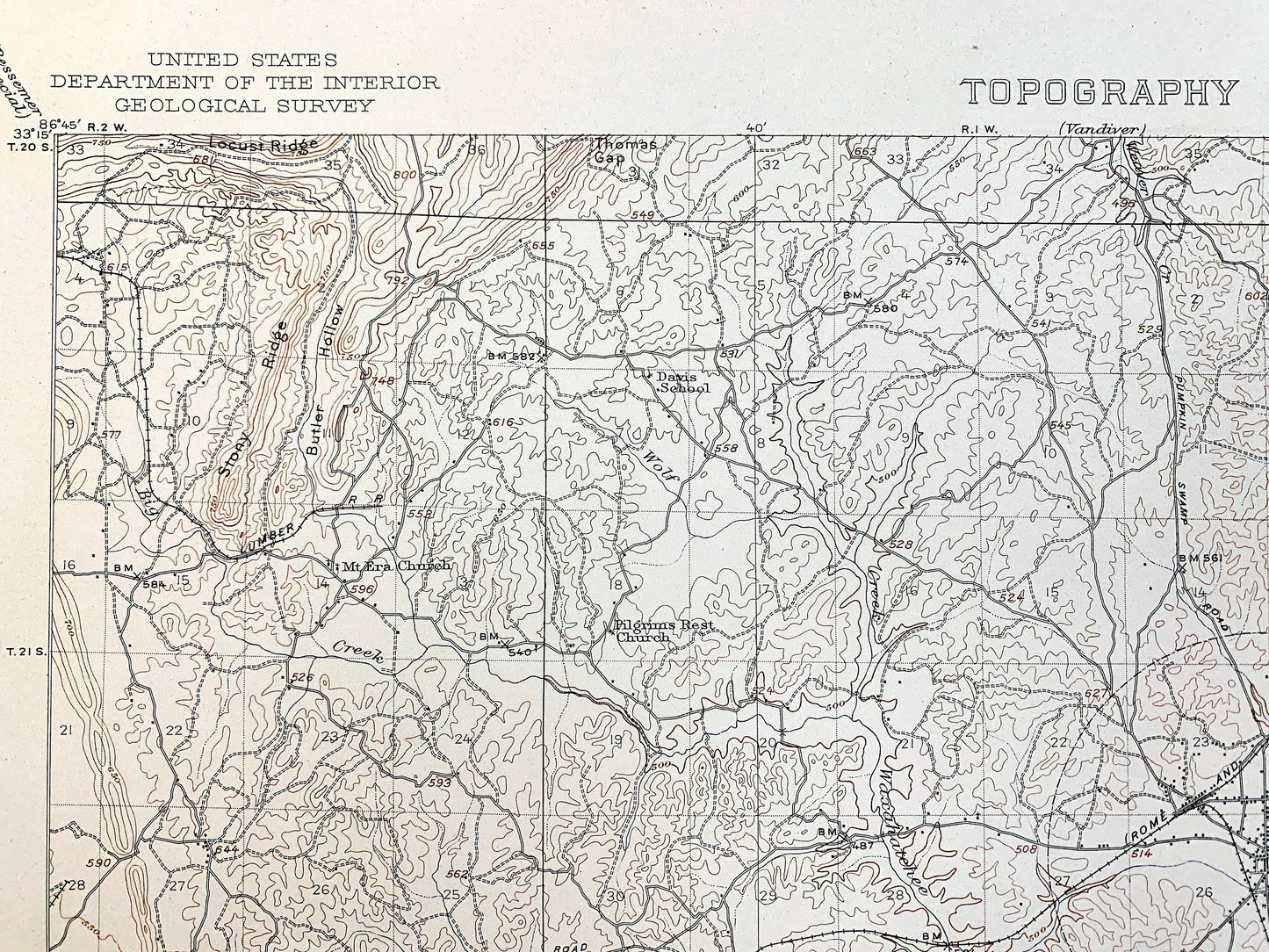
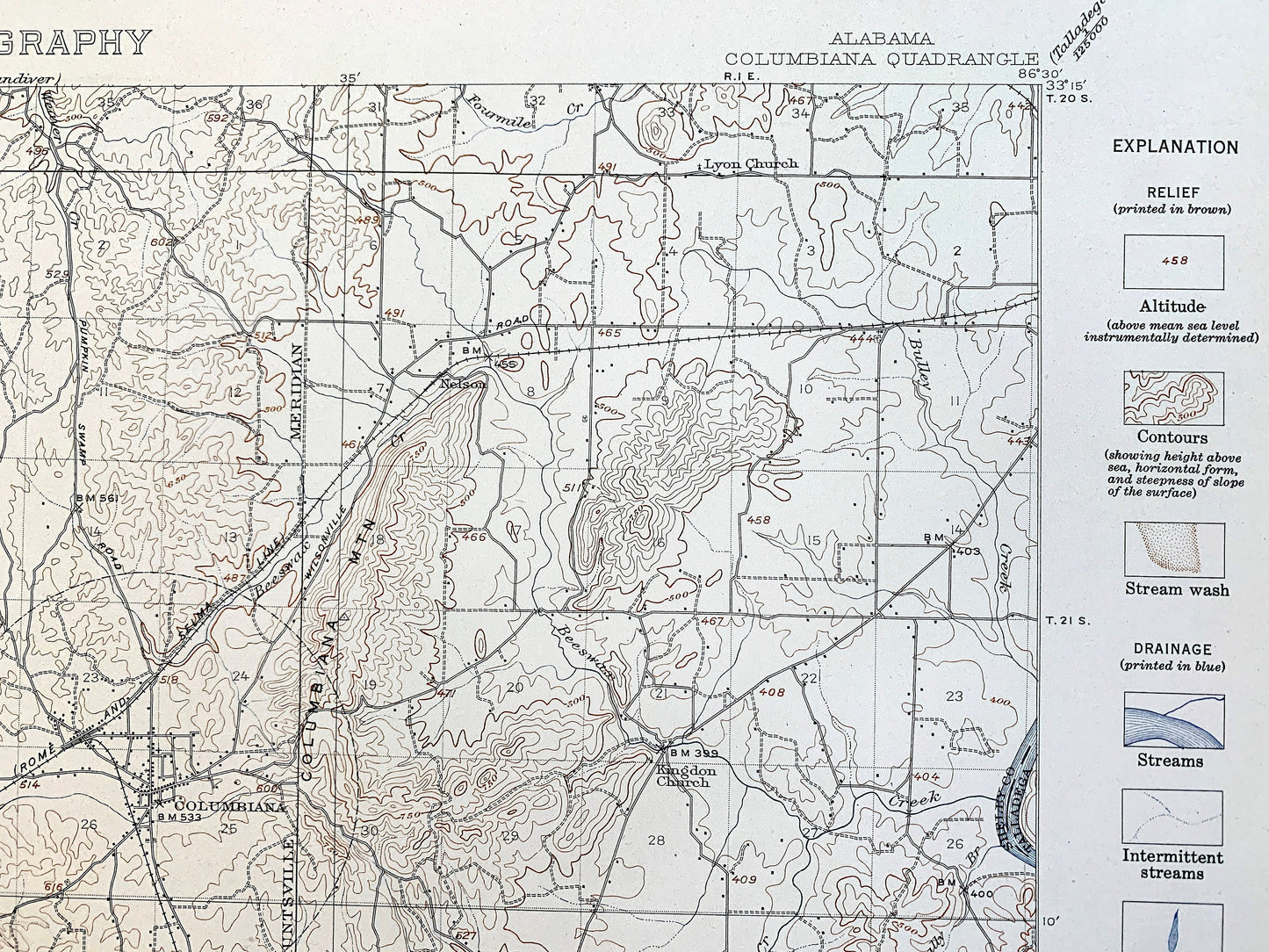
See what Alabama looked like over 80 years ago. Lots of intricate details and geological contours. Map even has little squares for every house that existed at the time. The USGS cartographers were very thorough back then! This is one of the rare maps where the topographic symbols and map guide are on the front.
Perfect for the historian, map-lover, the curious or just as a conversation starter. Wonderful and rare. Vintage maps such as these make great gifts.
Edition of 1940, printed 1940
Dimensions: 18 1/2" width x 22" height
----
Features
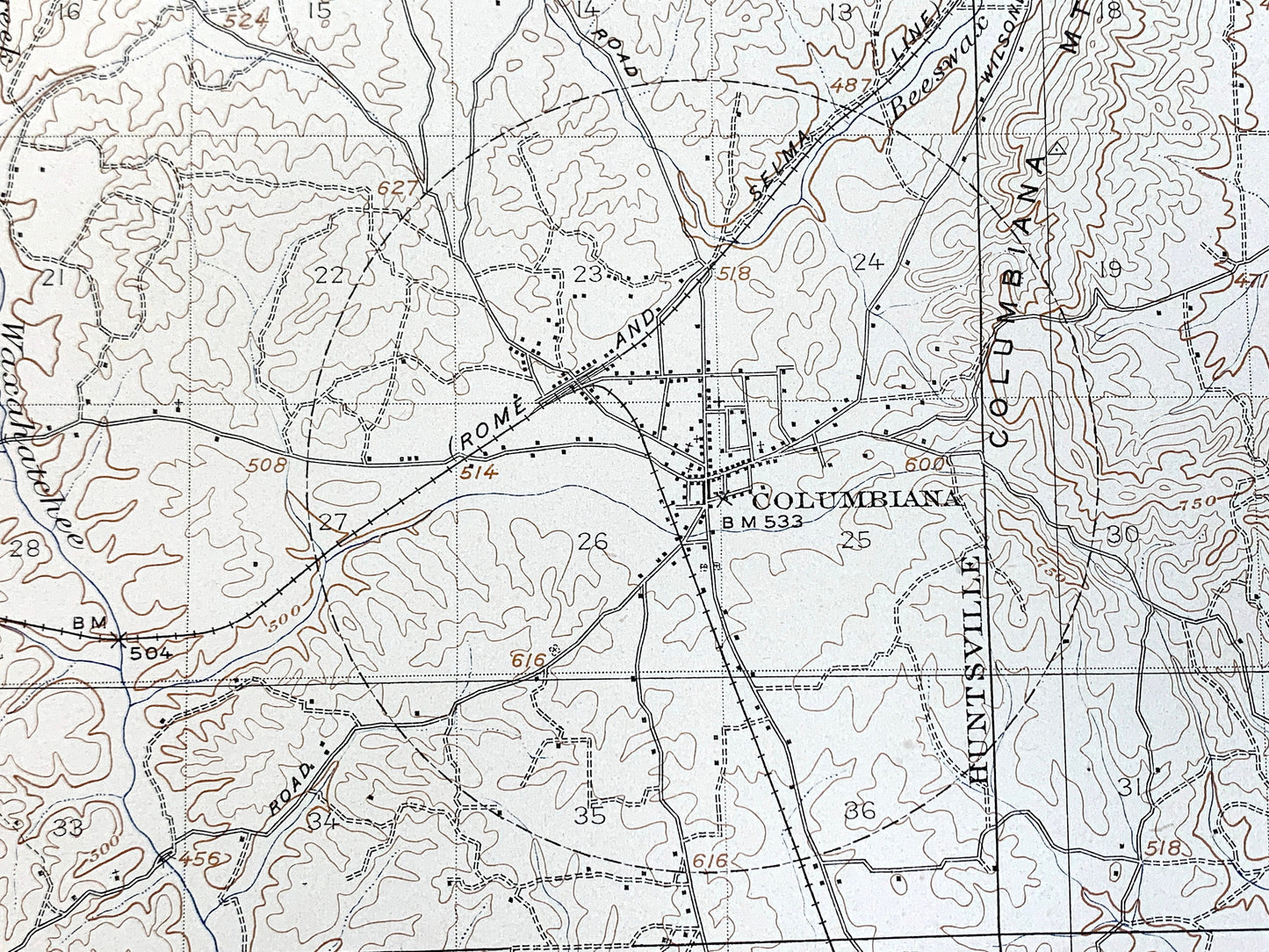
Cities & Towns: Columbiana, Shelby, Hillsdale, Kewahatchie, Ozan, Calera, Shelby Springs.
Points of Interest: Shelby County, Coosa County, Chilton County, Taladega County, Buxahatchee Creek, Huntsville Meridian, Stony Ridge, Locust Ridge, and lots more hills, mountains, creeks, towns, roads and train tracks.
Condition: Good Vintage condition, commensurate with age. This map is in great shape for being over 80 years old. Has staple-holes in margin from folio, foxing, toning and light wear, but this will all add to vintage character when framed.
----
We will happily adjust shipping price for multiple purchases. Maps are rolled up and shipped in sturdy mailing tubes, never folded.
Couldn't load pickup availability
Share