My Store
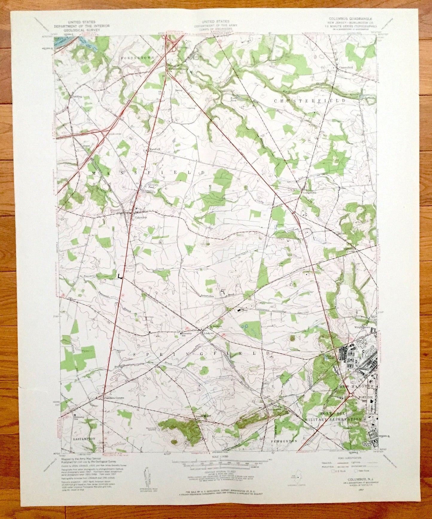
Antique Columbus, New Jersey 1957 US Geological Survey Topographic Map – Mansfield, Chesterfield, Springfield, New Hanover, Fort Dix, Sharp
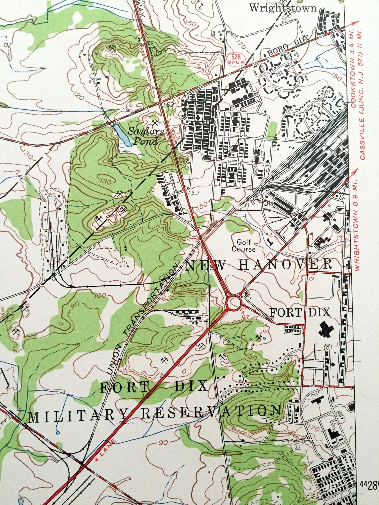
Antique Columbus, New Jersey 1957 US Geological Survey Topographic Map – Mansfield, Chesterfield, Springfield, New Hanover, Fort Dix, Sharp
Beautiful, antique map of Columbus, Springfield, Chesterfield, Mansfield, and New Hanover, New Jersey. This is an authentic 1957 print from the U.S. Geological Survey and NOT a computer reproduction.
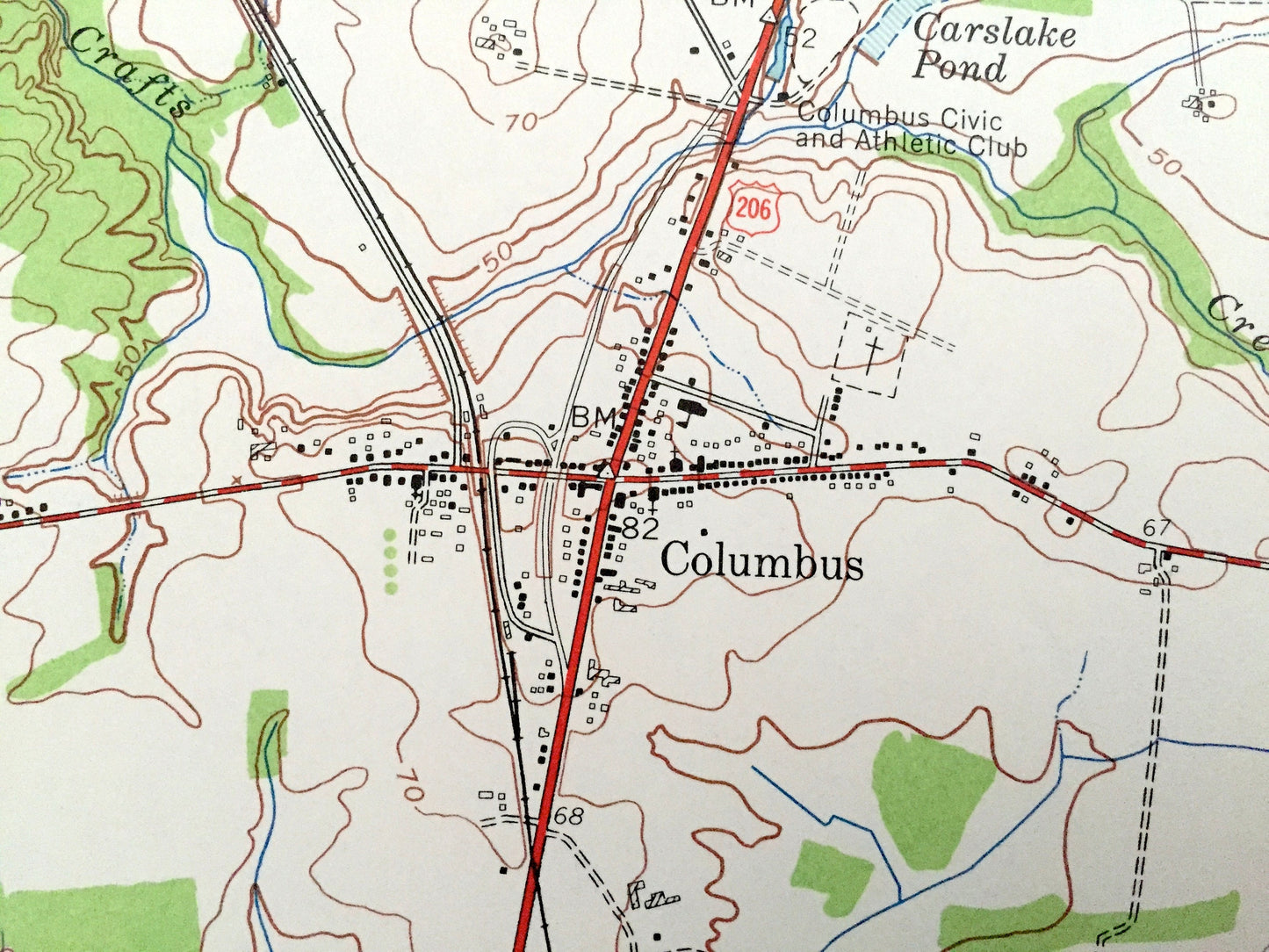
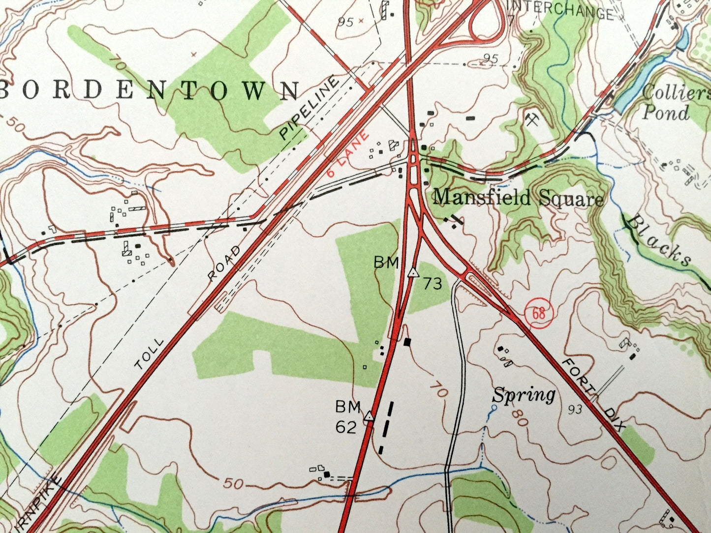
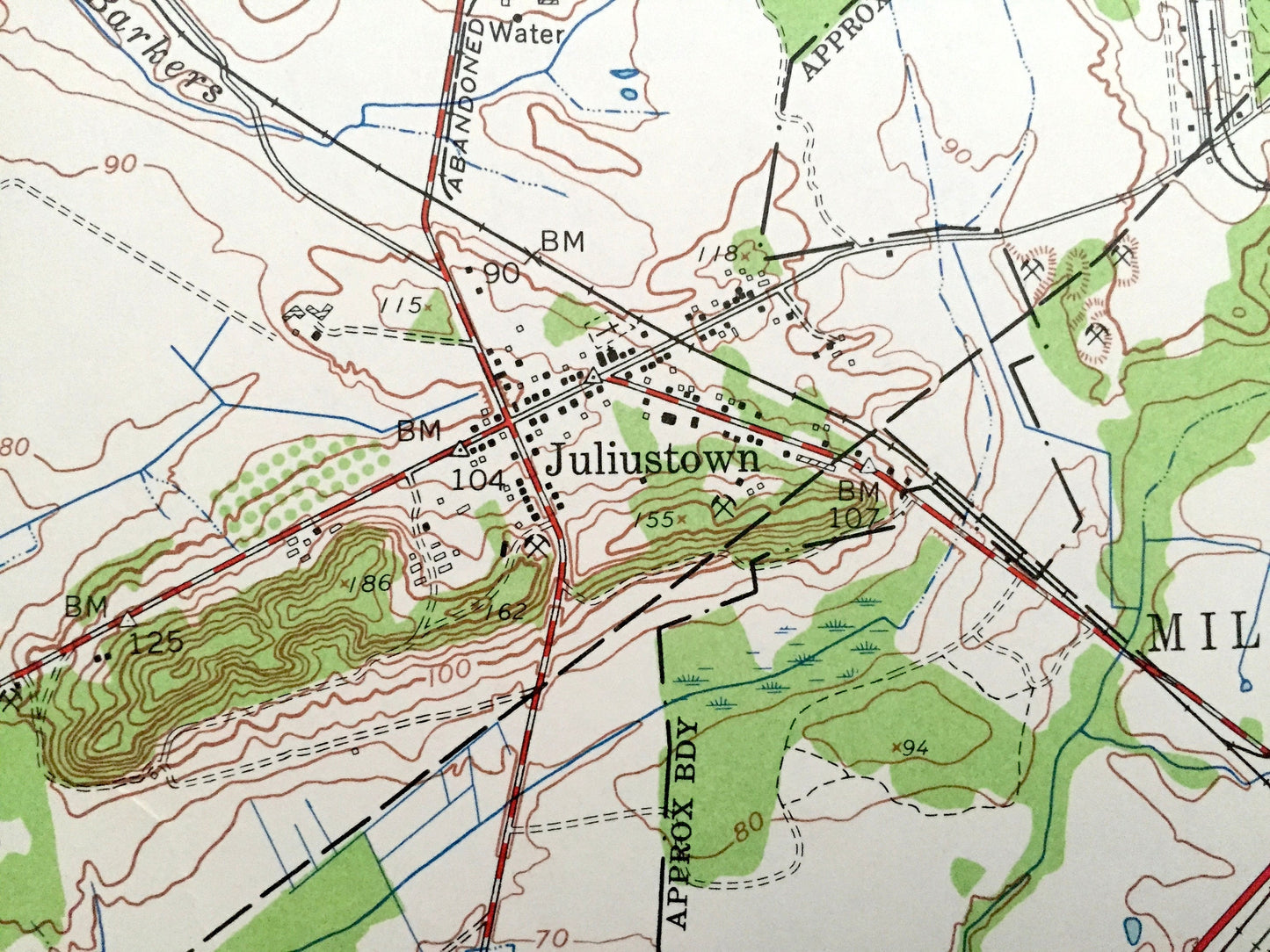
See what Burlington County of New Jersey looked like 60 years ago. Lots of intricate details and geological contours. Map even has little squares for every house that existed at the time. The USGS cartographers were very thorough back then!
Perfect for the historian, map-lover, the curious or just as a conversation starter. Wonderful and rare. Vintage maps such as these make great gifts.
Edition of 1957, printed 1957
Dimensions: 22" width x 27" height
----
Features
Cities & Towns: Bordentown, Mansfield Square, Mansfield, Columbus, Springfield, Chambers Corners, Arneys Mount, Pemberton, New Hanover, Wrightstown, Georgetown, Chesterfield, Jobstown, Sharp.
Points of Interest: Colliers Pond, Kuser Pond, St Andrews Church, Landing Strips, Fort Dix Military Reservation, Saylors Pond, Mount Holly Speedway, Township School, and lots more towns, ponds, houses, and roads.
Condition: Very Good condition, commensurate with age. There is a one inch tear on the left edge that does not touch the map area. This map is in incredible shape for being 60 years old.
----
We will happily adjust shipping price for multiple purchases. Maps are rolled up and shipped in sturdy mailing tubes, never folded.
Couldn't load pickup availability
Share