My Store
Antique Columbus, Ohio 1912 US Geological Survey Topographic Map – Dublin, Clinton, Olentangy, Upper Arlington, Westerville, Grove City
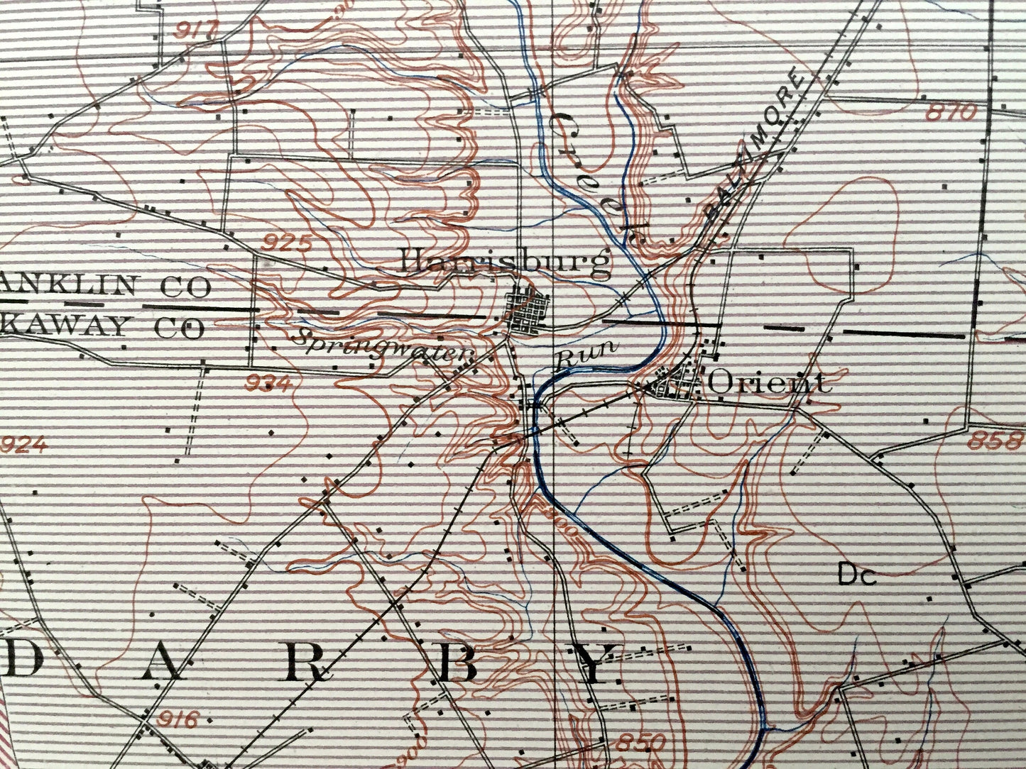
Antique Columbus, Ohio 1912 US Geological Survey Topographic Map – Dublin, Clinton, Olentangy, Upper Arlington, Westerville, Grove City
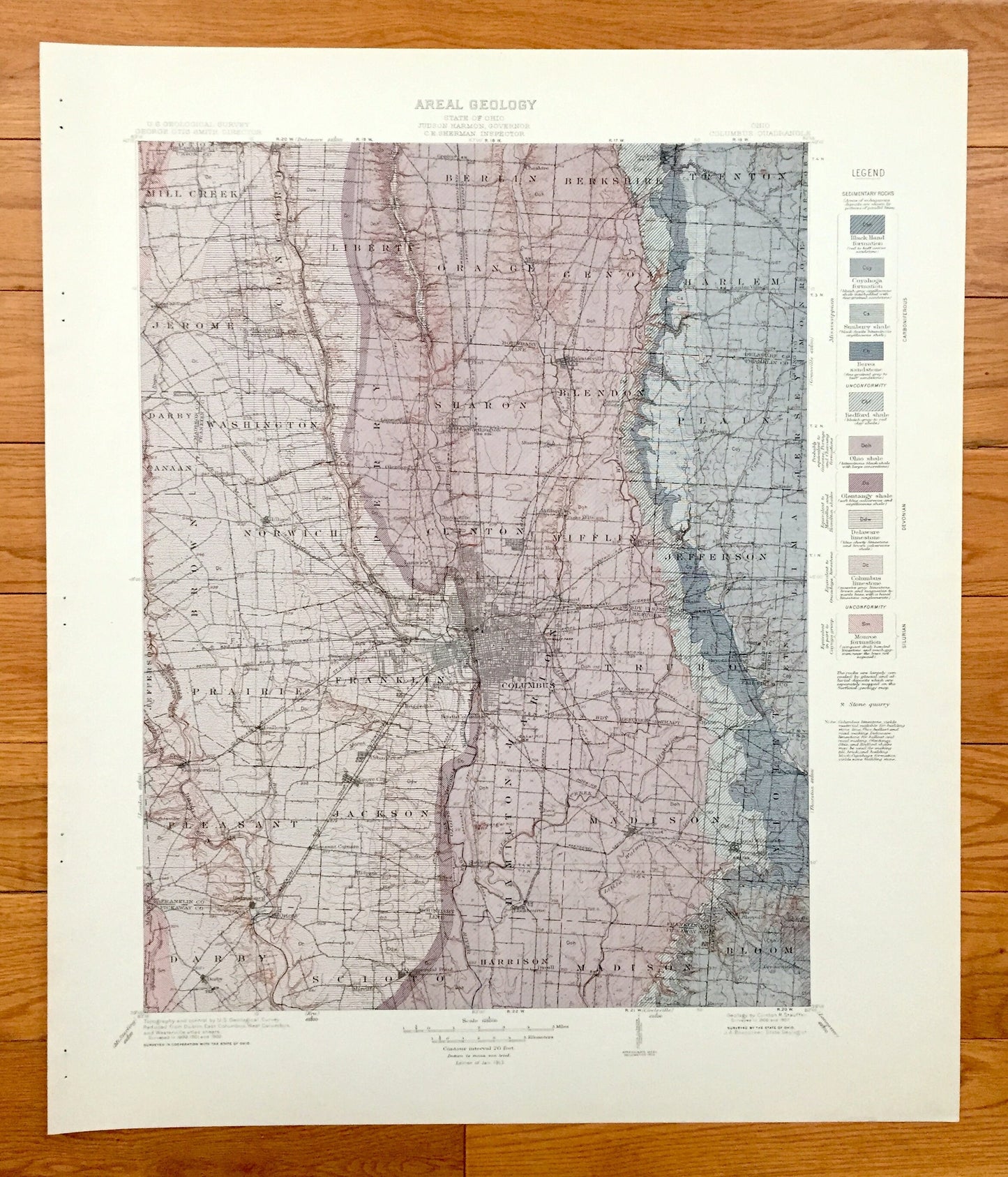
Beautiful, antique aerial map of the sedimentary rock formations of Columbus, Ohio and surrounding Franklin, Pickaway, Union, Madison, and Delaware County area. This is an authentic 1912 edition, 1913 print from from a U.S. Geological Survey folio and NOT a computer reproduction.
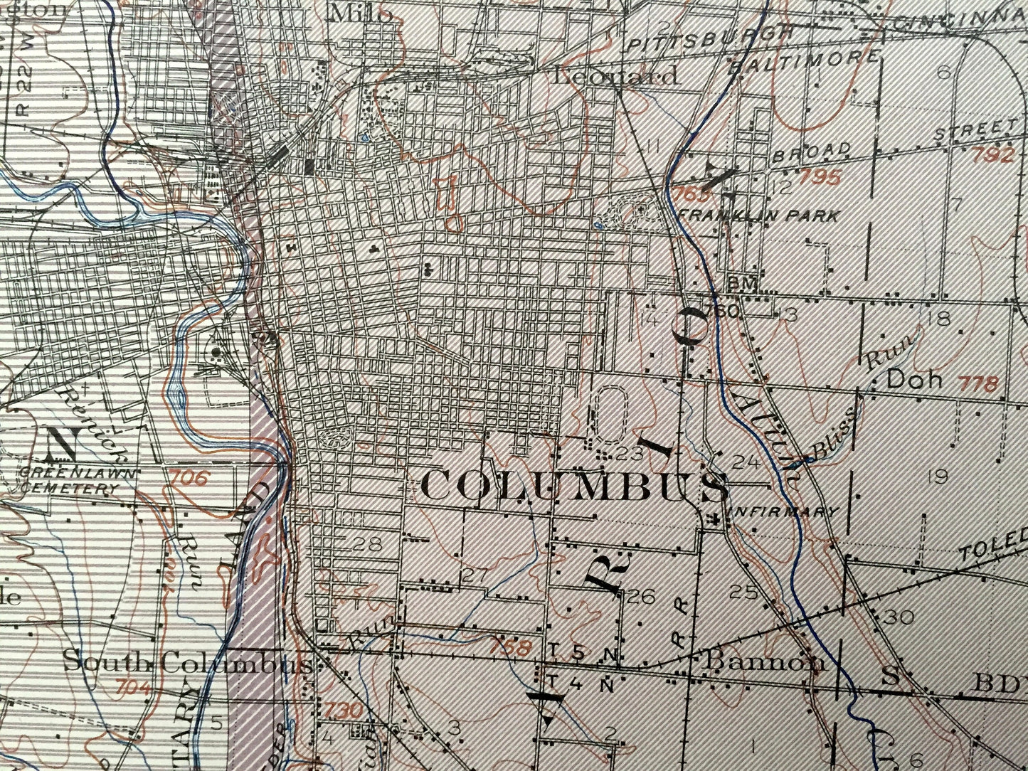
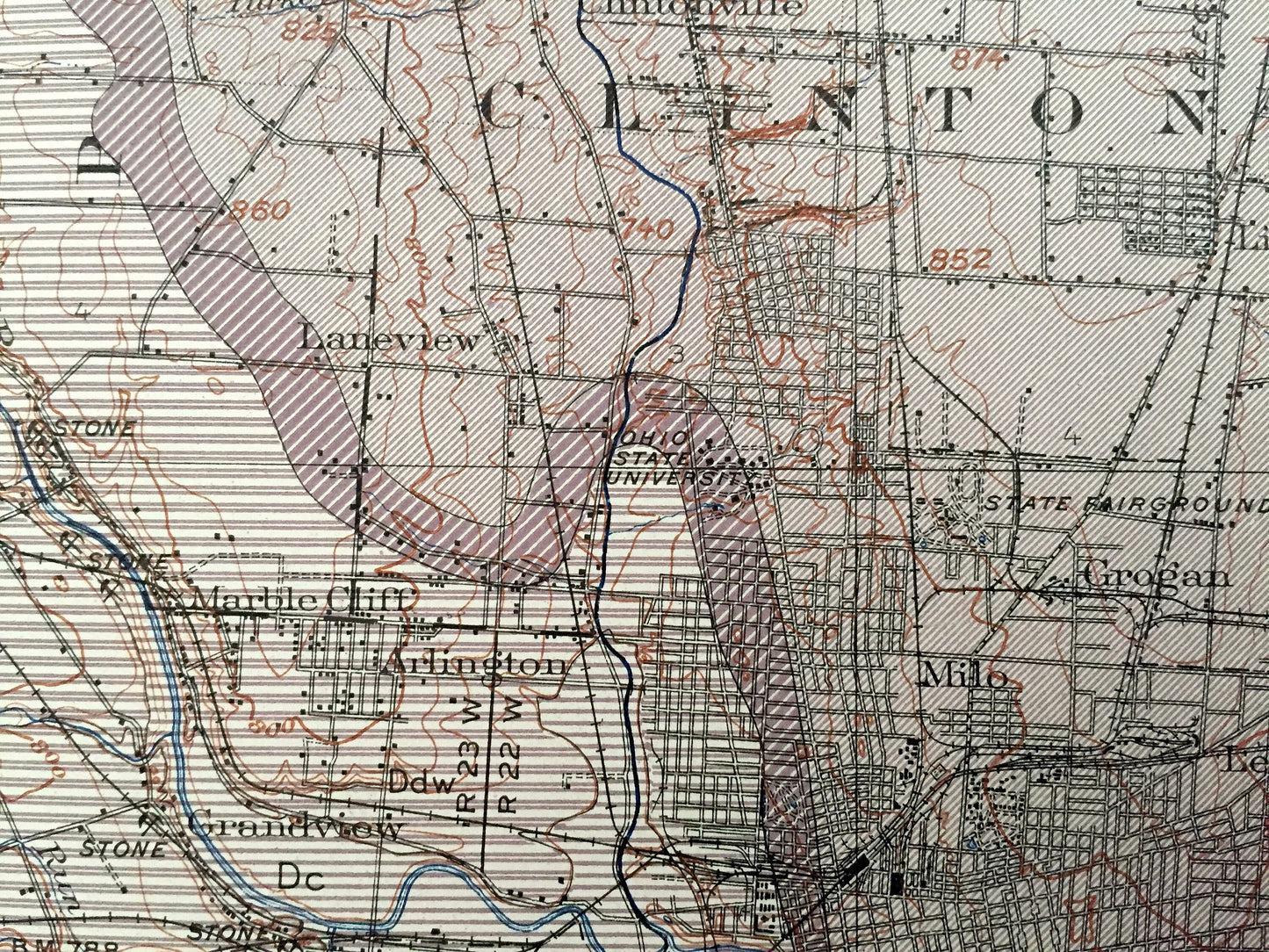
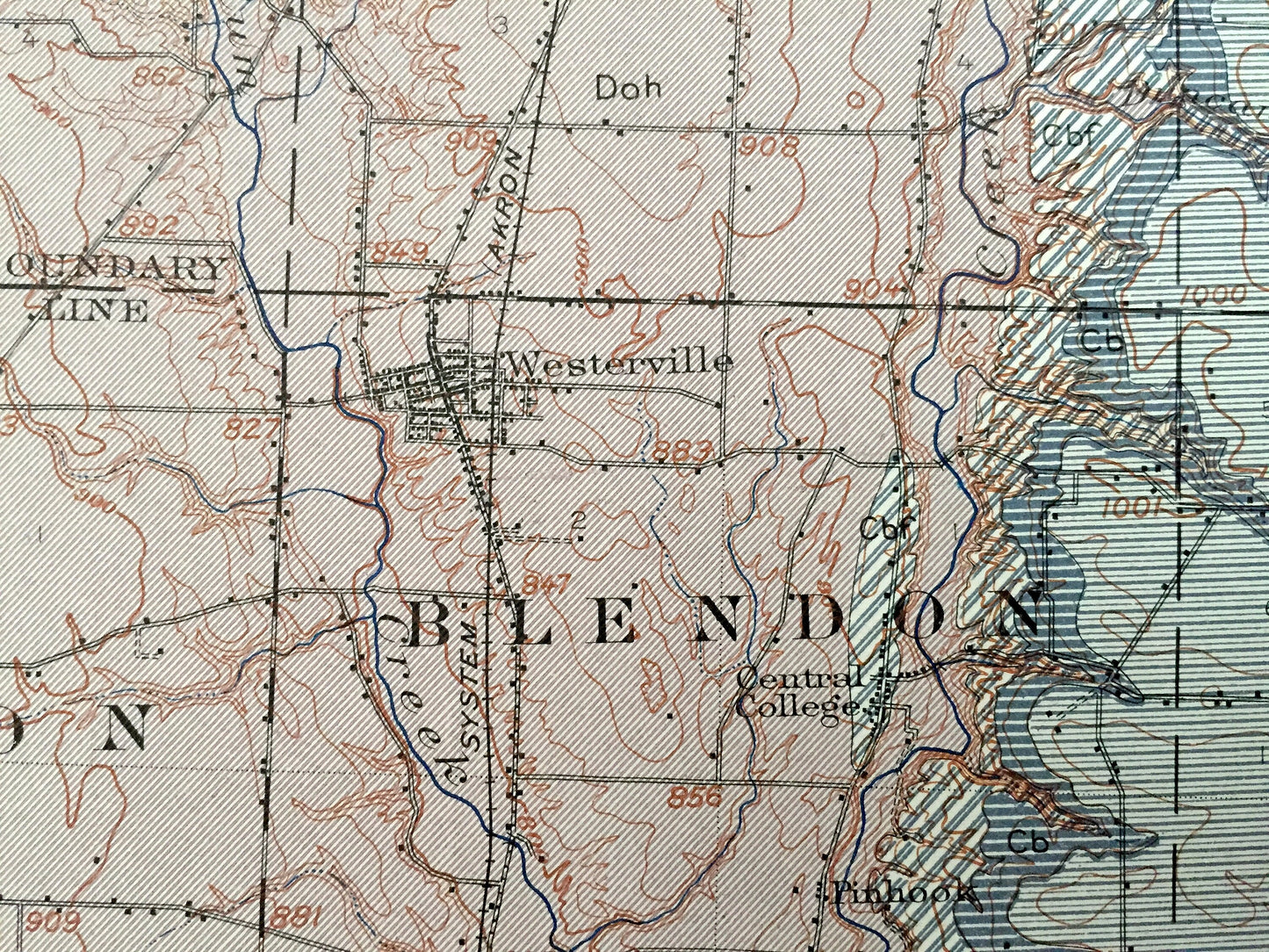
See what Ohio looked like over 115 years ago. Lots of intricate details and geological contours. Map even has little squares for every house that existed at the time. The USGS cartographers were very thorough back then! This is one of the rare maps with the map legend on the front.
Perfect for the historian, map-lover, the curious or just as a conversation starter. Wonderful and rare. Vintage maps such as these make great gifts.
Edition of 1912, printed 1913
Dimensions: 18 1/2" width x 21 1/2" height
----
Features
Cities & Towns: Columbus, Grove City, Upper Arlington, Dublin, Scioto, Dover, Mill Creek, Jerome, Darby, Canaan, Brown, Washington, Berlin, Liberty, Concord, Perry, Norwich, Clinton, Sharon, Orange, Elmwood, Hilliard, Bellpoint, Rathbone, Watkins, Powell, Hyattsville, Worthington, Olentangy, Clintonville, Galloway, Georgesville, Urbancrest, Harrisburg, Orient, Groveport, Reynoldsburg, Westerville, Galena, Linden Heights, Grogan, Milo, Leonard, Winchester, Brice, Lithopolis, Lockbourne, Zuber, Sunbury, Genoa, Harlem, Blendon, Mifflin, Truro, many more.
Points of Interest: Scioto River, Olentangy River, Toledo & Ohio Central Railroad, Pittsburg Cincinnati Chicago & St. Louis Railroad, Mill Creek, Hocking Valley Railway, and lots more hills, mountains, creeks, towns, roads and train tracks.
Condition: Very Good condition, commensurate with age. This map is in incredible shape for being over 115 years old. Has light edge-wear light and staple holes in the margin where it was removed from the folio, but these will add to vintage character when framed.
----
We will happily adjust shipping price for multiple purchases. Maps are rolled up and shipped in sturdy mailing tubes, never folded.
Couldn't load pickup availability
Share