My Store
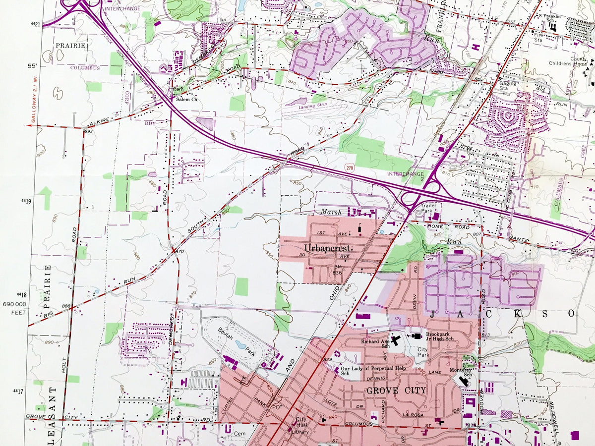
Antique Columbus, Ohio Southwest 1965 US Geological Survey Topographic Map – Franklin County, Upper Arlington, Ohio State University, Scioto
Antique Columbus, Ohio Southwest 1965 US Geological Survey Topographic Map – Franklin County, Upper Arlington, Ohio State University, Scioto
Beautiful, antique map of Columbus, Ohio Southwest and surrounding Franklin County area. This is an original 1965 edition, 1982 lithograph print from the U.S. Geological Survey and NOT a reprint.
See what Ohio looked like over 60 years ago. Lots of intricate details and geological contours. Map even has little squares for every house that existed. The USGS cartographers were very thorough back then!
Perfect for the historian, map-lover, the curious or just as a conversation starter. Wonderful and rare. Vintage maps such as these make great gifts.
Edition of 1965, printed 1982
Dimensions: 22" width x 27" height
----
Features
Cities & Towns: Columbus, Grove City, Upper Arlington, Grandview Heights, Marble Cliff, Valleyview, Urbancrest, Hilltop, South Hilltop, Southwest Hilltop, North Hilltop, Briggsdale, Brookshire, South Franklinton, Franklinton, Westgate, Georgian Heights, Highland West, Lincoln Village, Merion Village, Victorian Village, Harrison West, Brewery District, German Village, Southern Orchards, Vasser Village, Reeb-Hosack, Stambaugh-Elwood, San Margherita.
Points of Interest: Scioto River, Olentangy River, Scioto Big Run, Kian Run, Marsh Run, Republican Run, Griggs Reservoir, Griggs Dam, Big Run Park, Westgate Park, Campbell Memorial Park, Greenlawn Park, Hauntz Park, Harrison West Park, Gantz Park, Glenwood Park, Hilltop Community Park, Holton Park, McCoy Park, McKinley Avenue Park, McKinley Field Park, Rhodes Park, Westmoor Park, Westbank Park, Wrexham Park, Willow Creek Park, Wheeler Memorial Park, Scioto Woods Park, Sensenbrenner Park, Thompson Park, Genoa Park, Lou Berliner Park, Raymond Memorial Golf Course, Scioto Golf Course, Wee Bonnie Golf Course, Ohio State Arsenal, Old State Arsenal, Camp Chase, Camp Chase Confederate Cemetery, Green Lawn Cemetery, Franklinton Cemetery, Grove City Cemetery, Clime Cemetery, Mount Calvary Cemetery, Salem Cemetery, Union Methodist Cemetery, State of Ohio Asylum for the Insane Cemetery, Old Insane and Penal Cemetery, Ohio State University, Ohio Stadium, Mount Carmel West Hospital, Nationwide Arena, North Market Historic District, Short North Historic District, Fifth Avenue and North High Historic District, Third Avenue and North High Historic District, Ohio Center, WBNS Radio Tower, WOSU, WCMH-TV, Westland Mall, Cooper Stadium, Columbus Limestone Quarry, Fifth Avenue Low Head Dam, Greenlawn Avenue Low Head Dam, Rich Street Low Head Dam, Dublin Road Water Treatment Plant, and many more hills, ditches, streams, creeks, ponds, houses, schools, railroads, churches and roads.
Condition: Very Good Vintage condition, commensurate with age. This map is in great shape for being over 40 years old. Has light wear, and folds as-issued, but these will flatten easily and all will add to vintage character when framed.
----
We will happily adjust shipping price for multiple purchases. Maps are rolled up and shipped in sturdy mailing tubes, never folded.
Couldn't load pickup availability
Share