My Store
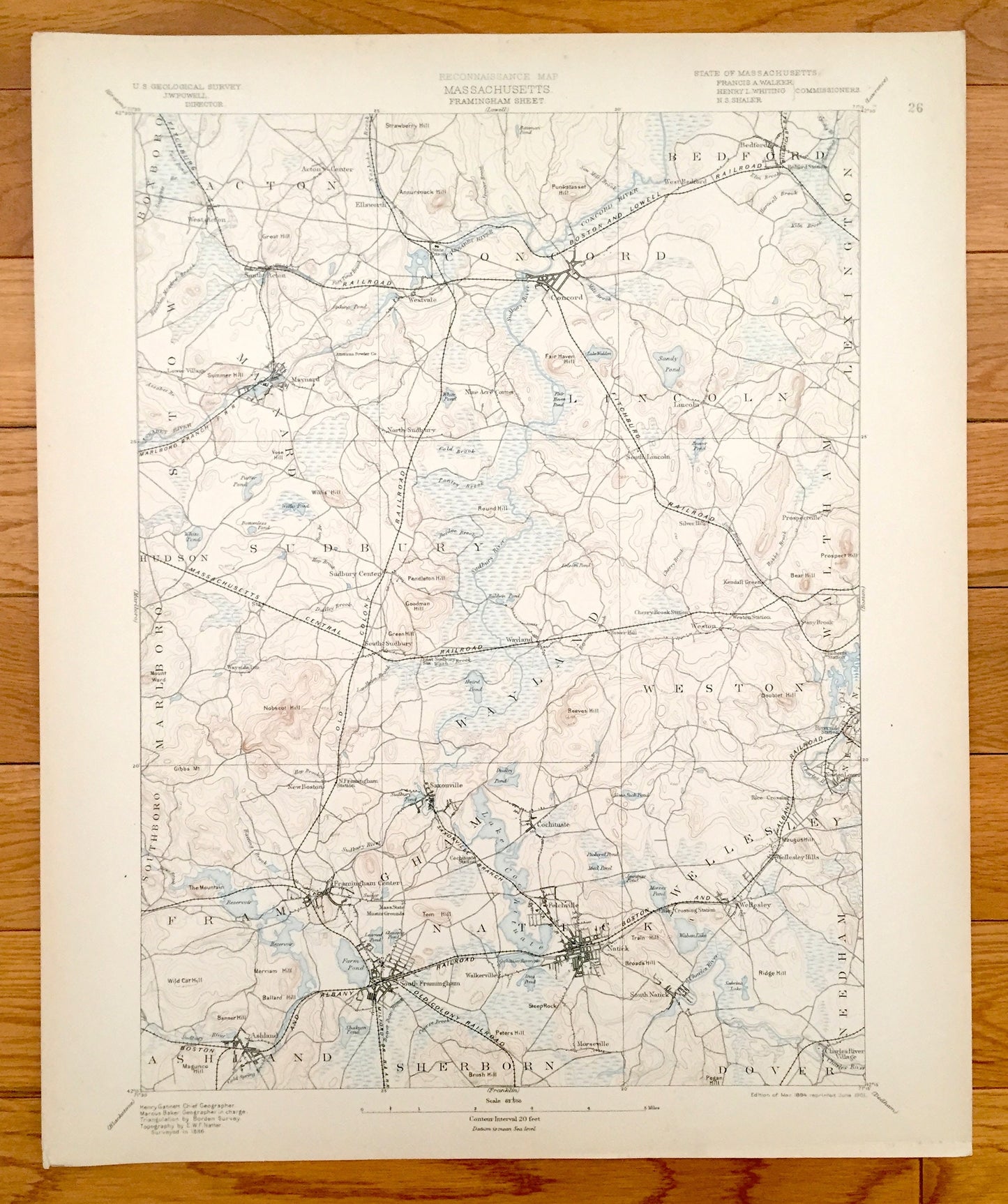
Antique Concord, Massachusetts 1894 US Geological Survey Topographic Map – Waltham, Framingham, Bedford, Wellesley, Natick, Walden Pond, MA
Antique Concord, Massachusetts 1894 US Geological Survey Topographic Map – Waltham, Framingham, Bedford, Wellesley, Natick, Walden Pond, MA
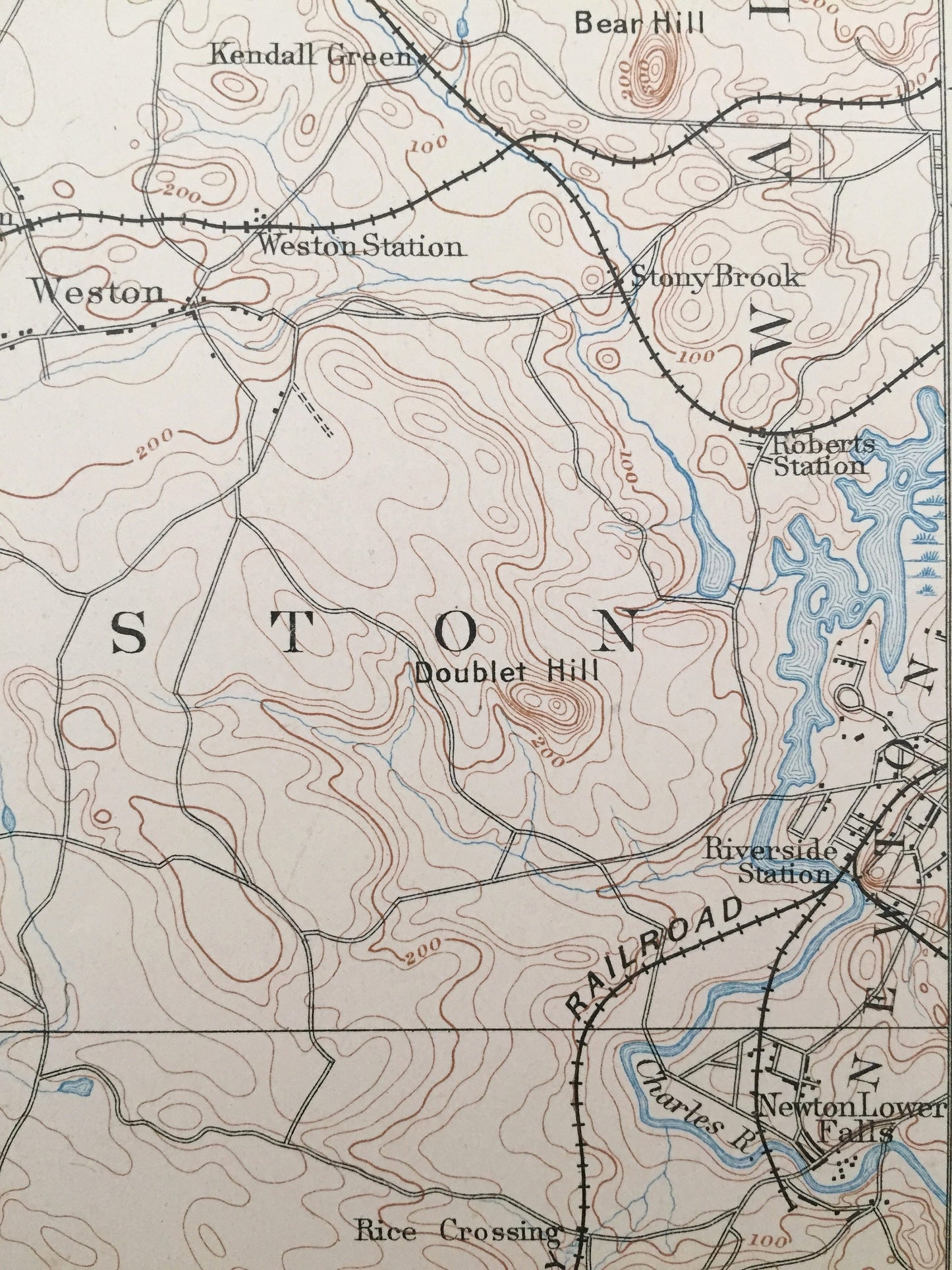
Beautiful, antique map of Middlesex and Norfolk County, Massachusetts, just west of Boston. This is an authentic 1894 edition, 1901 print from the U.S. Geological Survey and NOT a computer reproduction.
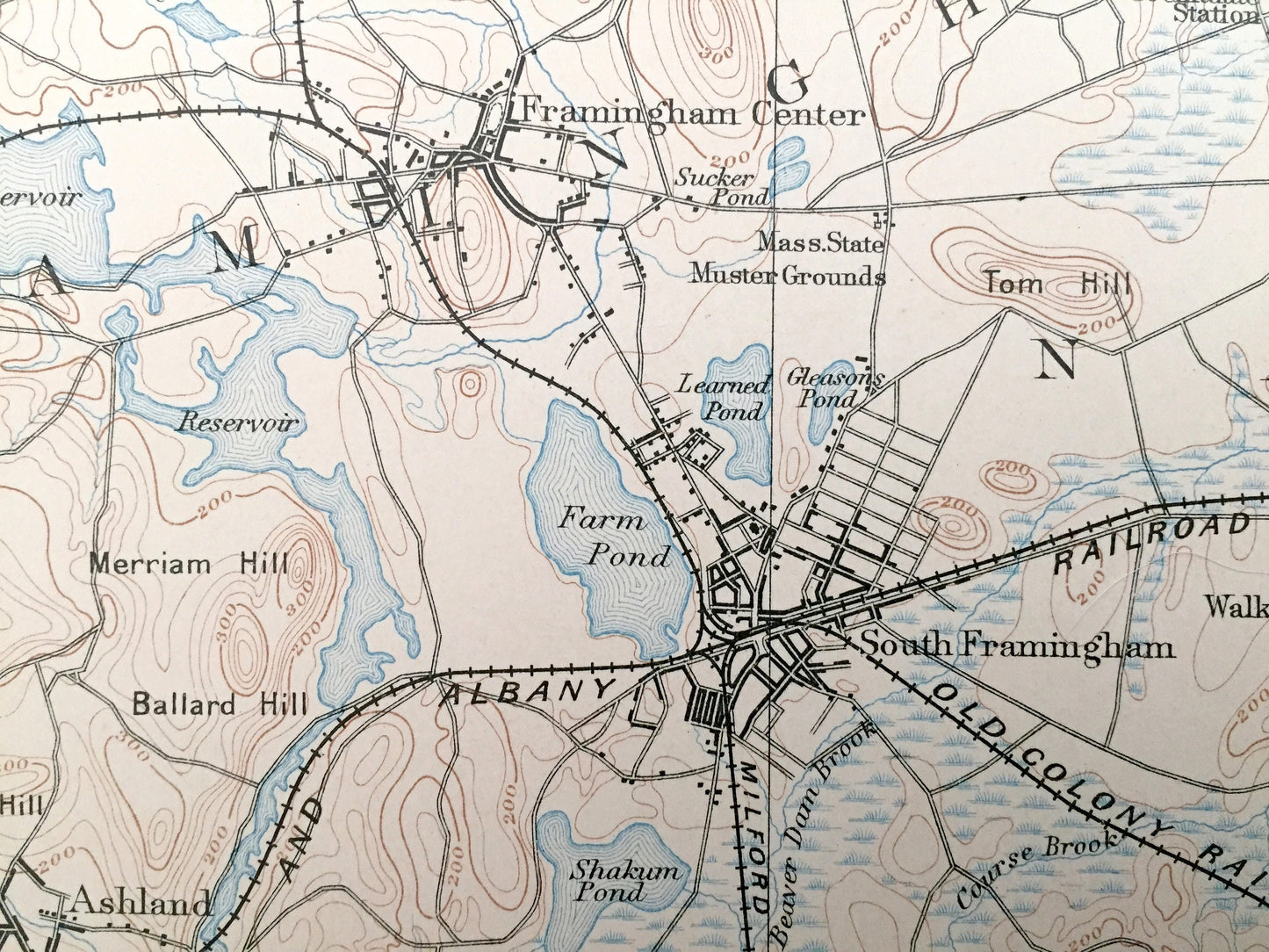
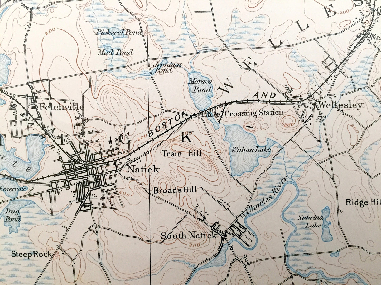
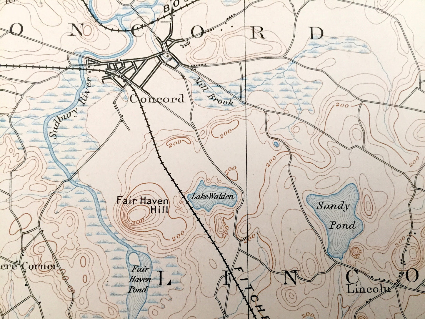
See what Framingham, Natick, Lincoln, Bedford, Sudbury, Wayland and Concord looked like more than 120 years ago, back when Walden Pond was still called Lake Walden, as is shown on this map. Lots of intricate details and geological contours. Map even has little squares for every house that existed at the time. The USGS cartographers were very thorough back then! On the back is a description of topographic symbols and map guide.
Perfect for the historian, map-lover, the curious or just as a conversation starter. Wonderful and rare. Vintage maps such as these make great gifts.
Edition of 1894, printed 1901
Dimensions: 16 1/2" width x 20" height
----
Features
Cities & Towns: Boxboro, Acton, Stow, Maynard, Concord, Bedford, Lexington, Lincoln, Hudson, Sudbury, Wayland, Weston, Waltham, Marlboro, Southboro, Framingham, Ashland, Sherborn, Natick, Dover, Needham, Newton, Wellesley, Westvale, Cochituate, Felchville, Wellesley Hills, Morseville, Charles River Village, Saxonville, Lower Village, Tower Hill.
Points of Interest: Walden Pond (written as Lake Walden), Concord River, Charles River, Assabet River, Sandy Pond, Prospect Hill, Nobscot Hill, Sudbury River, Farm Pond, Lake Cochituate, Morses Pond, Waban Lake, Train Hill, Broads Hill, Ridge Hill, Mass State Muster Grounds, Tom Hill, Strawberry Hill, Boston and Lowell Railroad, Massachusetts Central Railroad, Heathen Meadow Brook, Reeves Hill, and lots more hills, mountains, brooks, ponds, villages, roads and train tracks.
Condition: Very Good Vintage condition, commensurate with age. This map is in great shape for being over 115 years old.
----
We will happily adjust shipping price for multiple purchases. Maps are rolled up and shipped in sturdy mailing tubes, never folded.
Couldn't load pickup availability
Share