My Store
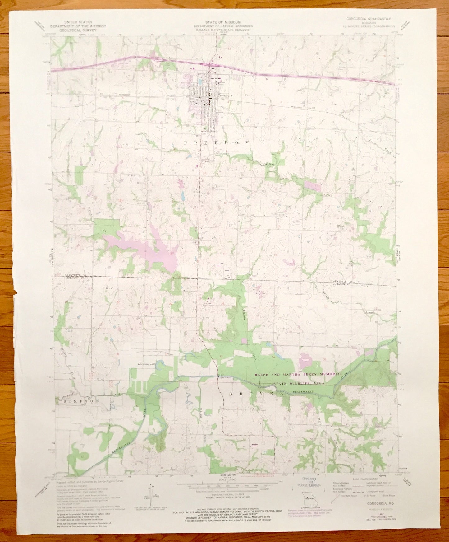
Antique Concordia, Missouri 1962 US Geological Survey Topographic Map – Freedom, Grover, Lafayette, Johnson County, Ralph Martha Perry MO
Antique Concordia, Missouri 1962 US Geological Survey Topographic Map – Freedom, Grover, Lafayette, Johnson County, Ralph Martha Perry MO
Beautiful, antique map of Freedom, Concordia, Simpson, and Grover, Missouri. This is an authentic 1981 of print of 1962 survey data from the U.S. Geological Survey and NOT a computer reproduction.
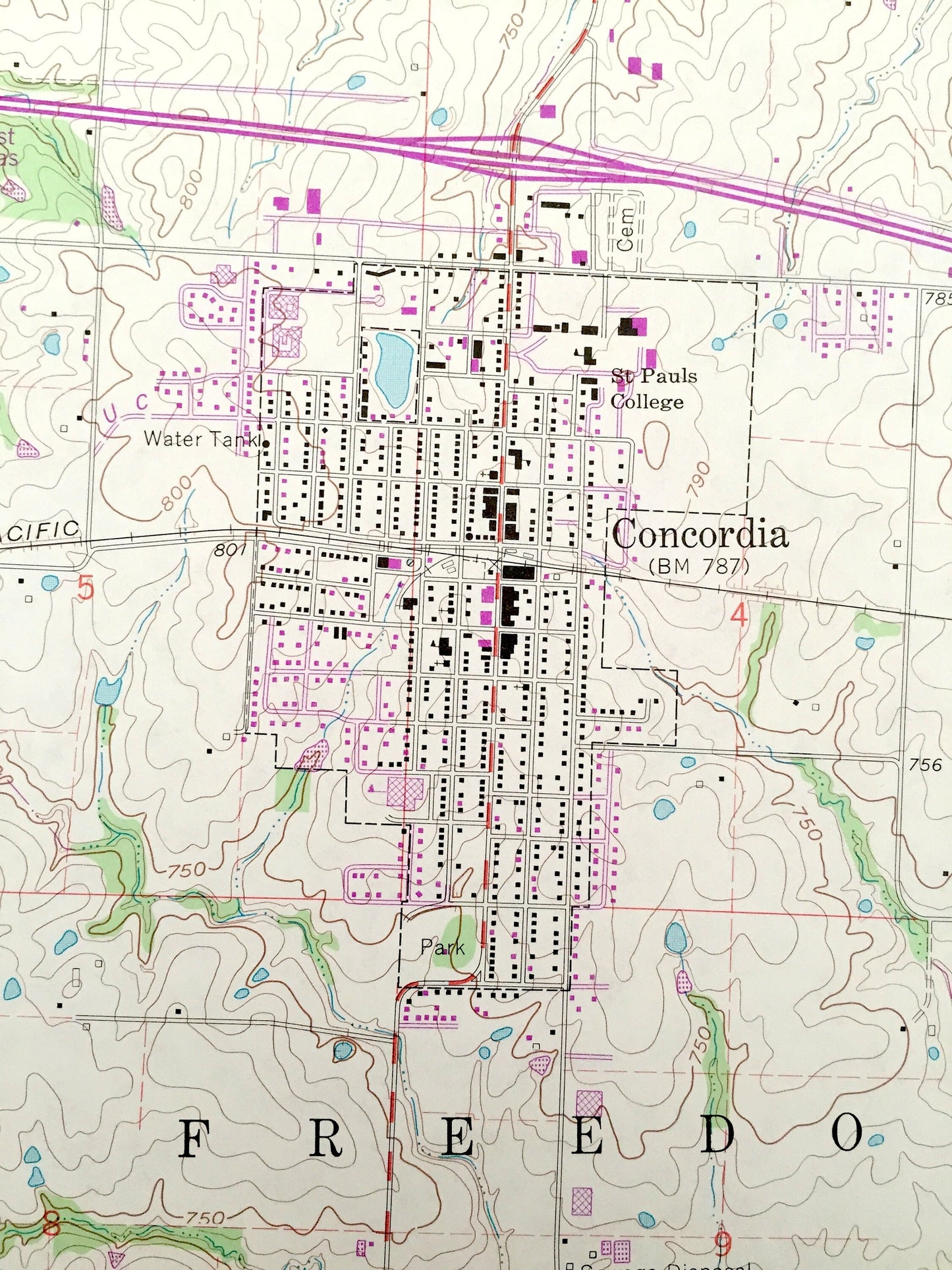
See what Lafayette and Johnson Counties of Missouri looked like 55 years ago. Lots of intricate details and geological contours. Map even has little squares for every house that existed at the time. The USGS cartographers were very thorough back then!
Perfect for the historian, map-lover, the curious or just as a conversation starter. Wonderful and rare. Vintage maps such as this make great gifts.
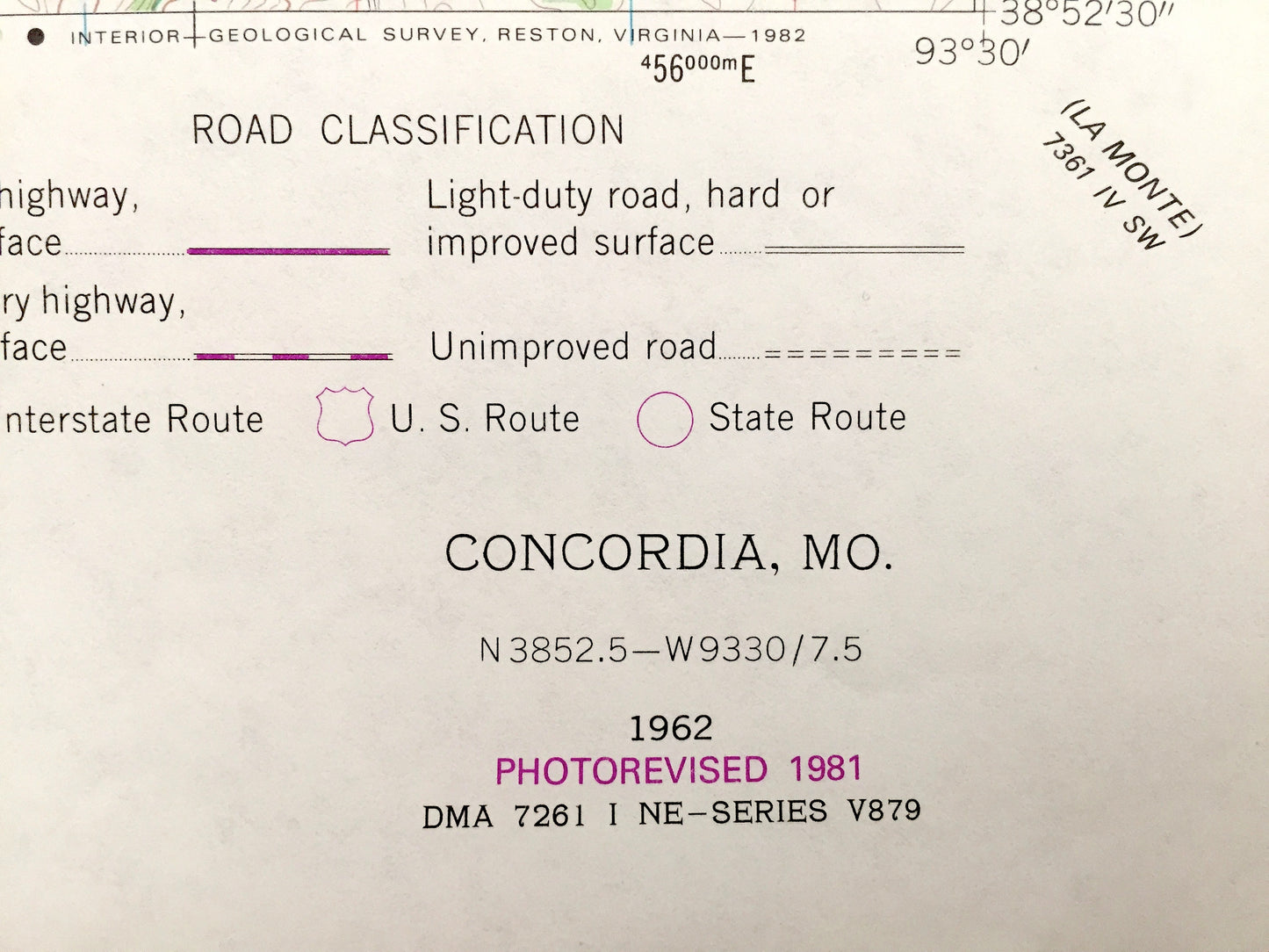
Edition of 1962, printed 1981
Dimensions: 22" width x 27" height
----
Features
Cities & Towns: Concordia, Simpson, Grover, Freedom.
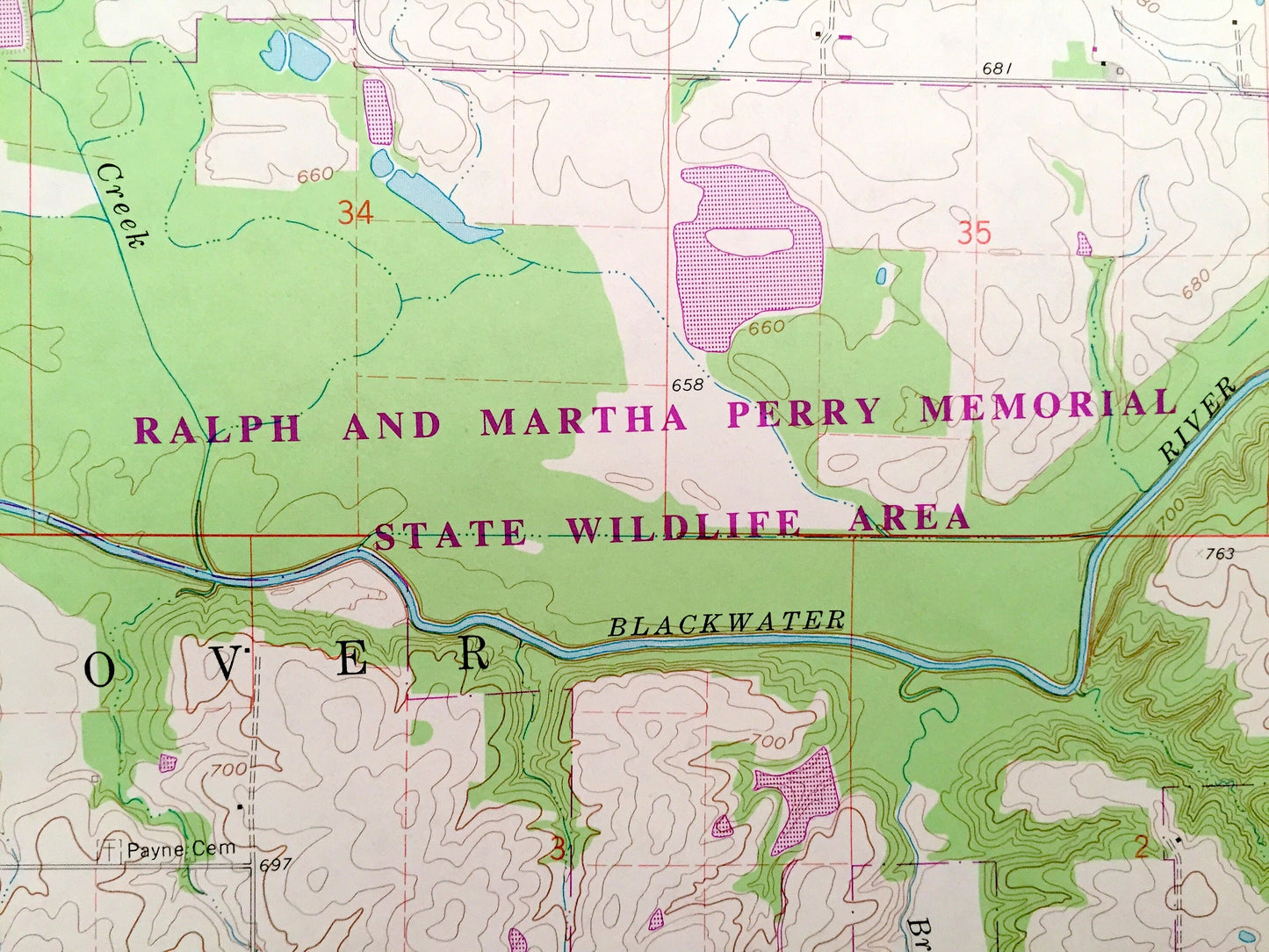
Points of Interest: Missouri Pacific Railroad, Concordia Water Tank, Pauls College, Trailer Park, Horseshoe Lake, Peavine Creek, Blackwater River, and many more roads ponds and houses.
Condition: Very Good condition, commensurate with age. This map is in incredible shape for being over 35 years old.
----
We will happily adjust shipping price for multiple purchases. Maps are rolled up and shipped in sturdy mailing tubes, never folded.
Couldn't load pickup availability
Share