My Store
Antique Concrete, Washington 1962 US Geological Survey Topographic Map – Van Horn, Rockport, Granite Falls, Darrington, Newhalem, Canada
Antique Concrete, Washington 1962 US Geological Survey Topographic Map – Van Horn, Rockport, Granite Falls, Darrington, Newhalem, Canada
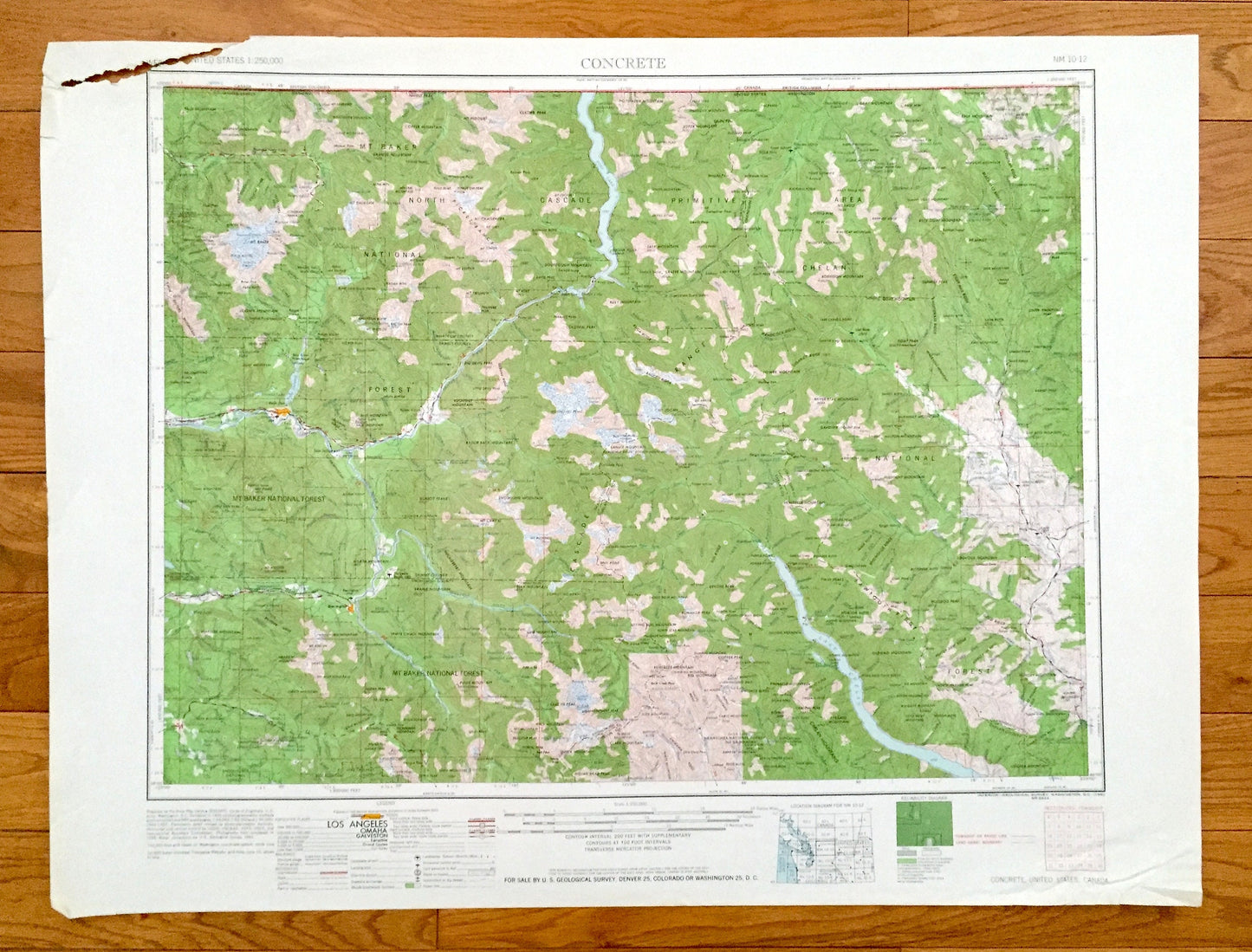
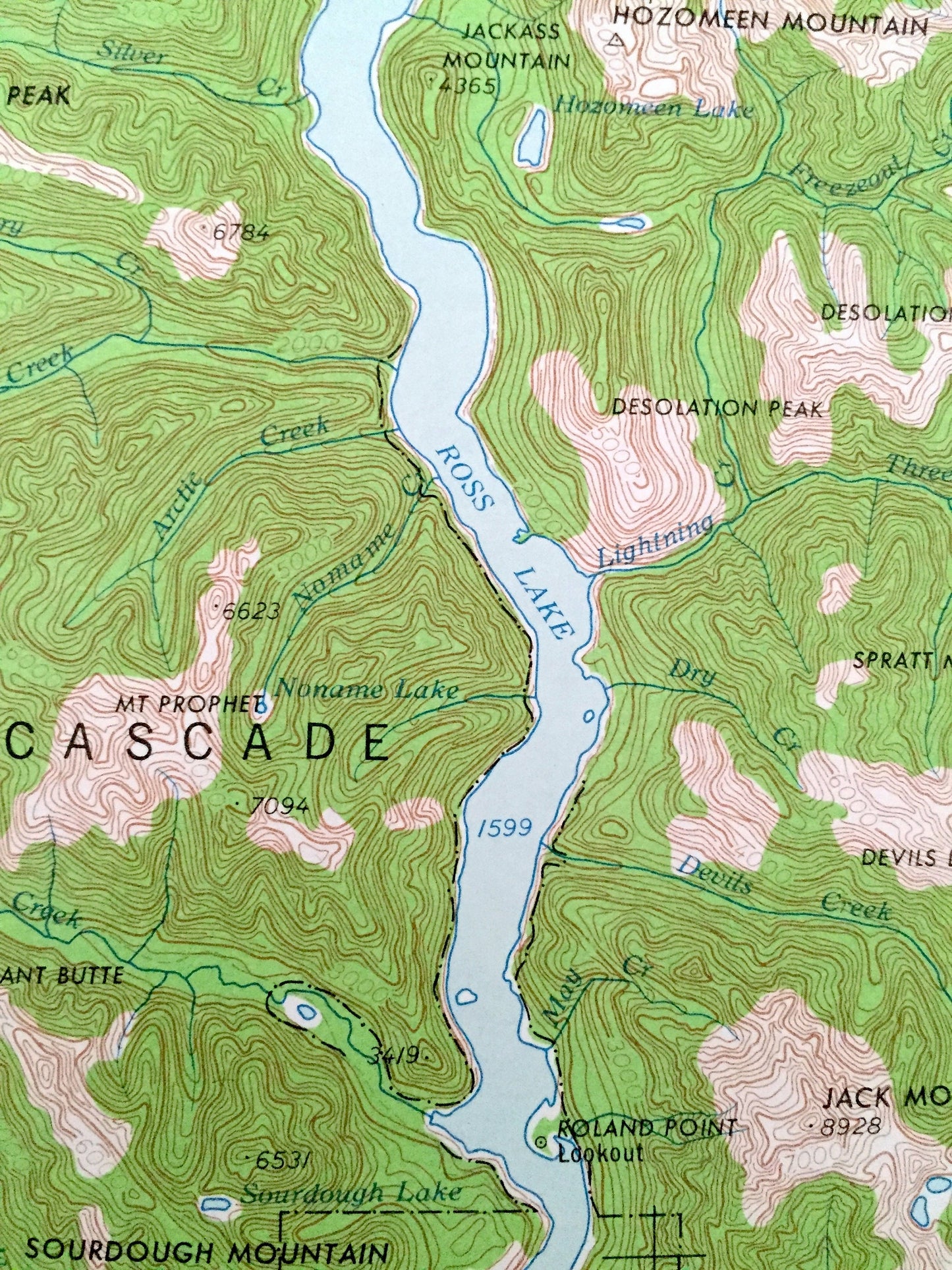
Beautiful, antique map of Concrete, Washington and surrounding British Columbia, Canada areas. This is an authentic 1962 edition, 1962 print from the U.S. Geological Survey and NOT a computer reproduction.
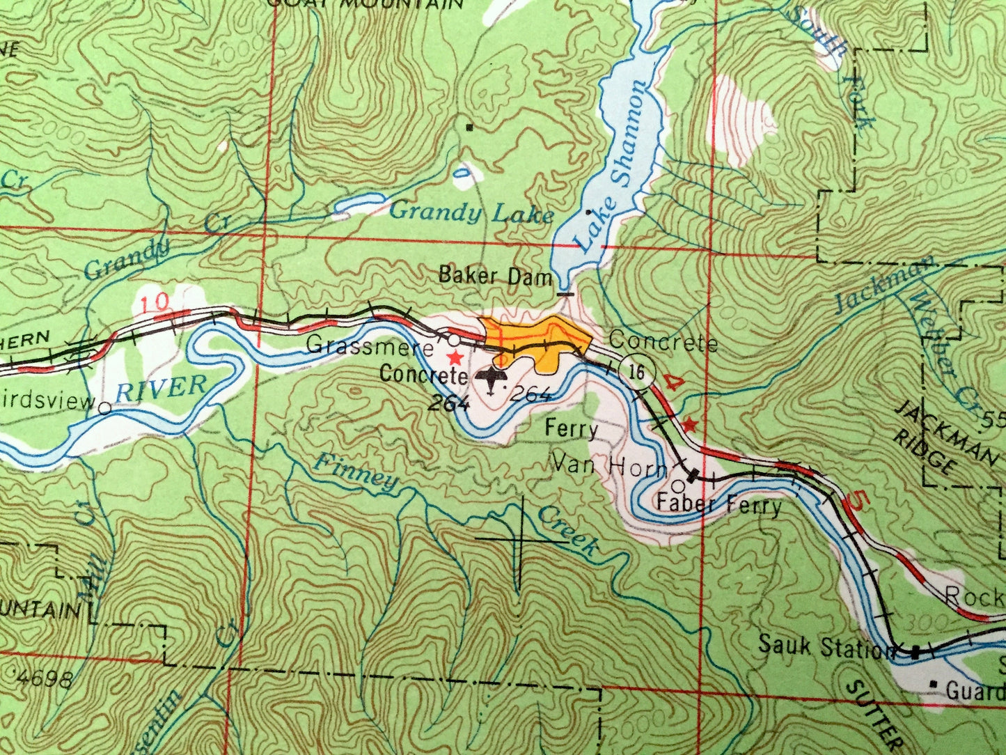
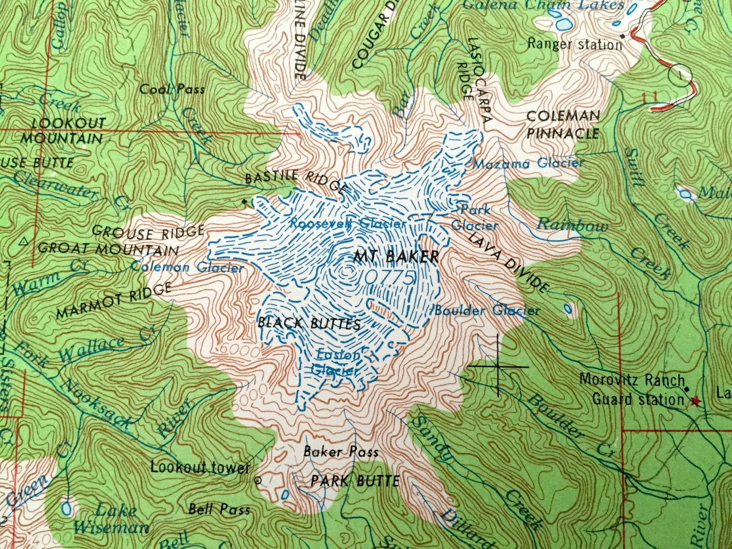
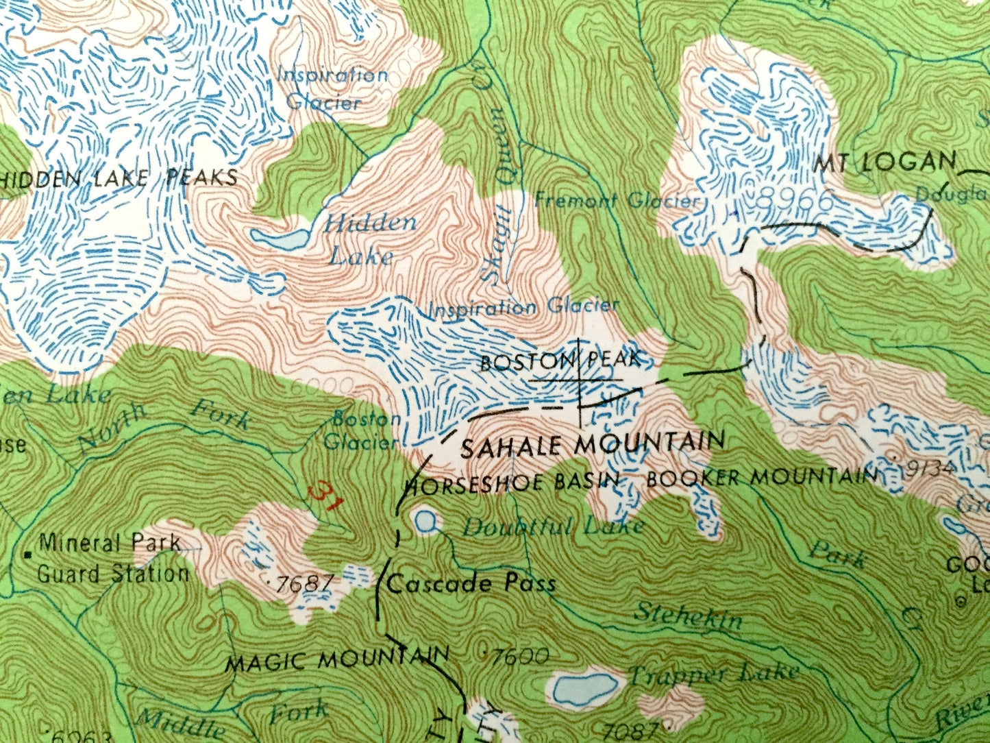
See what Washington and British Columbia looked like over 55 years ago. Lots of intricate details and geological contours. Map is incredibly large and in the grand 1:250,000 scale. The USGS cartographers were very thorough back then!
Perfect for the historian, map-lover, the curious or just as a conversation starter. Wonderful and rare. Vintage maps such as these make great gifts.
Edition of 1962, printed 1962
Dimensions: 32" width x 22 1/2" height
----
Features
Cities & Towns: Concrete, Cicero, Oso, Rowan, Hazel, Methow, Carlton, Twisp, Winthrop, Marblemount, Van Horn, Rockport, Granite Falls, Darrington, Newhalem.
Points of Interest: North Cascade Primitive Area, Mount Baker National Forest, Chelan National Forest, Cascade Range, Picket Range, Chelan Mountains, Mount Baker, Sauk River, Skagit River, Methow River, Lake Chelan, Ross Lake, Colonial Peak, Sunrise Peak and British Columbia, Canada and lots more hills, mountains, lakes, rivers, creeks, roads, highways and railroads.
Condition: Very Good condition, commensurate with age. This map is in incredible shape for being over 55 years old. Has light edge-wear and a tear on the top left side, all of which will read as vintage character when framed.
----
We will happily adjust shipping price for multiple purchases. Maps are rolled up and shipped in sturdy mailing tubes, never folded.
Couldn't load pickup availability
Share