My Store
Antique Connecticut 1965 US Geological Survey Topographic Map – Hartford, Manchester, New Haven, New Britain, Bristol, Bridgeport, Norwich
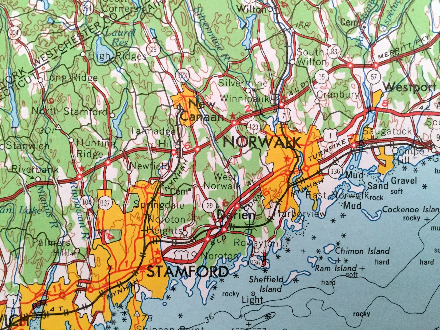
Antique Connecticut 1965 US Geological Survey Topographic Map – Hartford, Manchester, New Haven, New Britain, Bristol, Bridgeport, Norwich
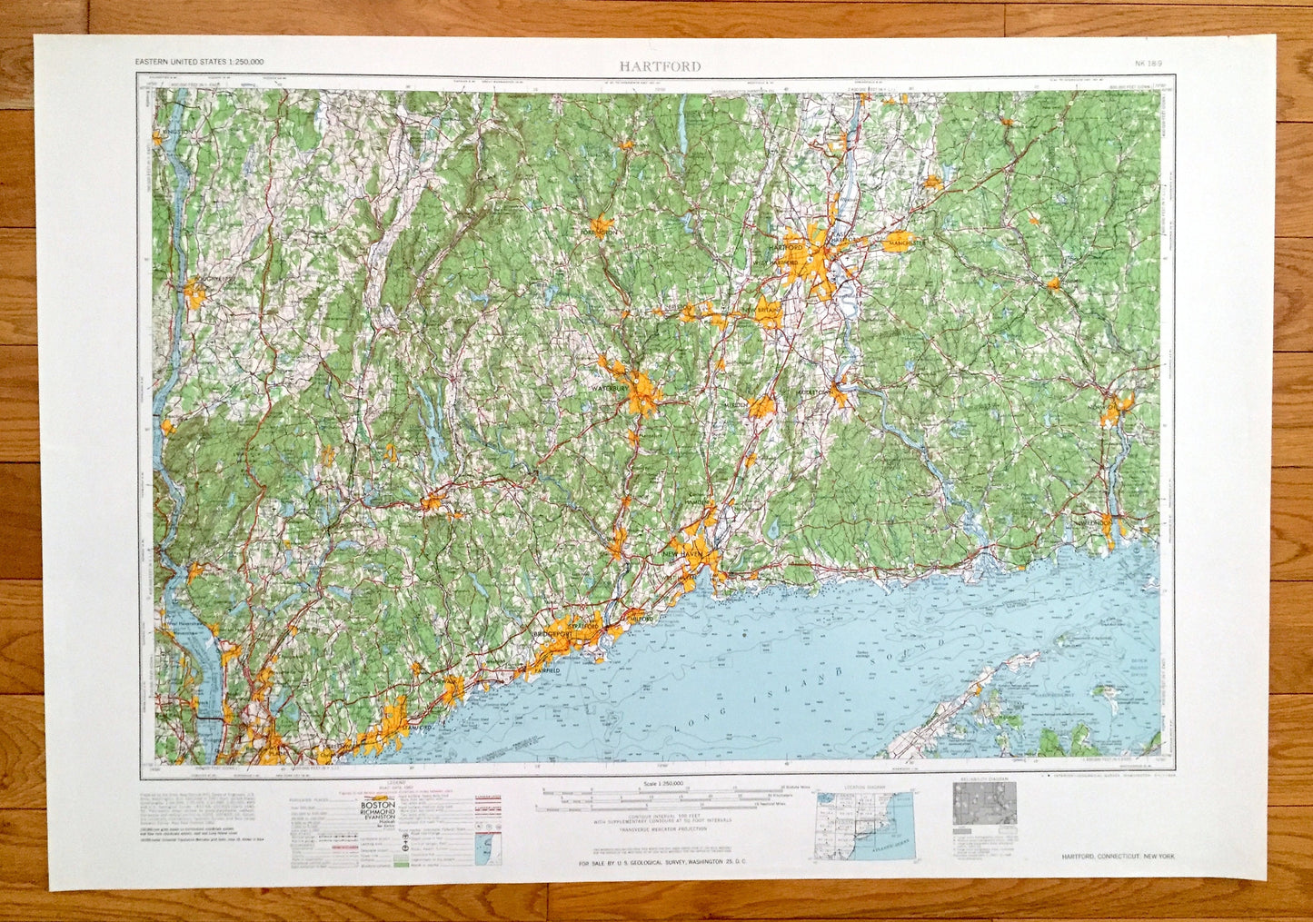
Beautiful, antique map of Hartford, Connecticut and surrounding New York, New Jersey and Massachusetts areas. This is an authentic 1965 edition, 1965 print from the U.S. Geological Survey and NOT a computer reproduction.
See what Connecticut, New York, New Jersey and Massachusetts looked like over 55 years ago. Lots of intricate details and geological contours. Map is incredibly large and in the grand 1:250,000 scale. The USGS cartographers were very thorough back then!
Perfect for the historian, map-lover, the curious or just as a conversation starter. Wonderful and rare. Vintage maps such as these make great gifts.
Edition of 1965, printed 1965
Dimensions: 32" width x 22 1/2" height
----
Features
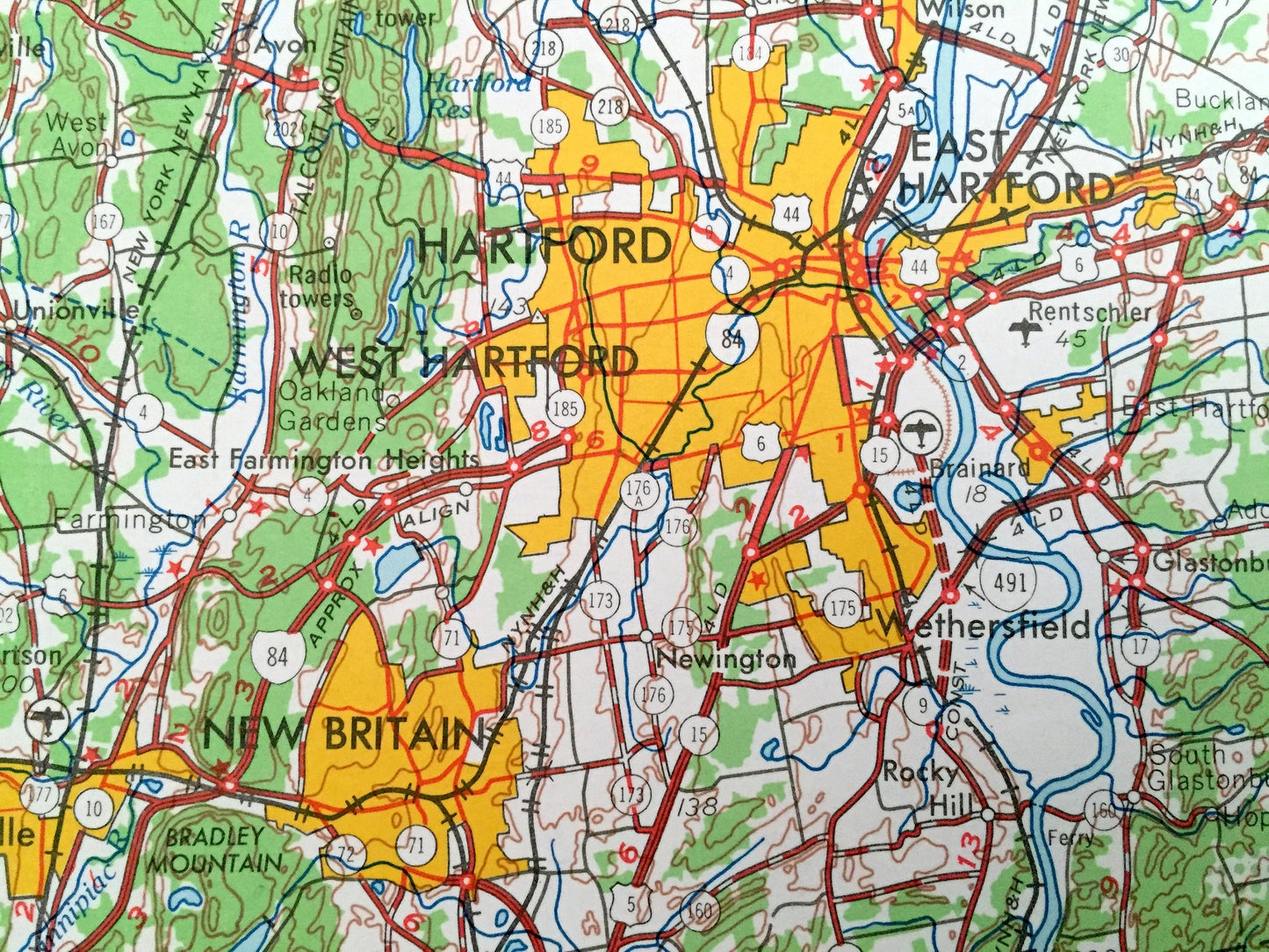
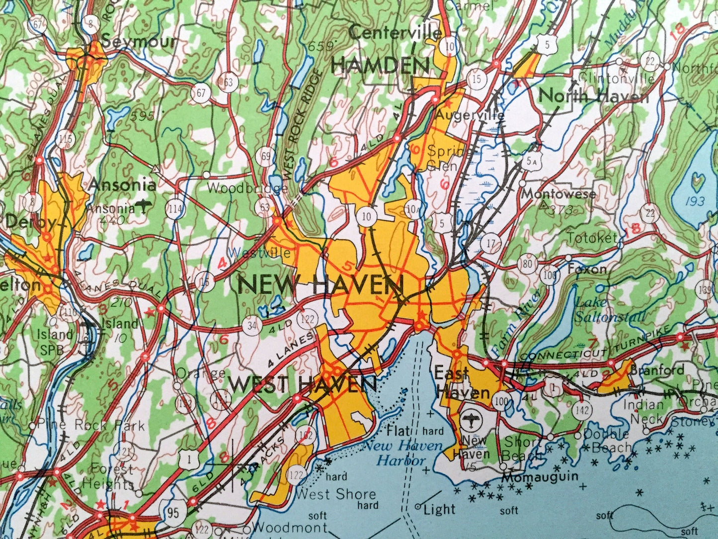
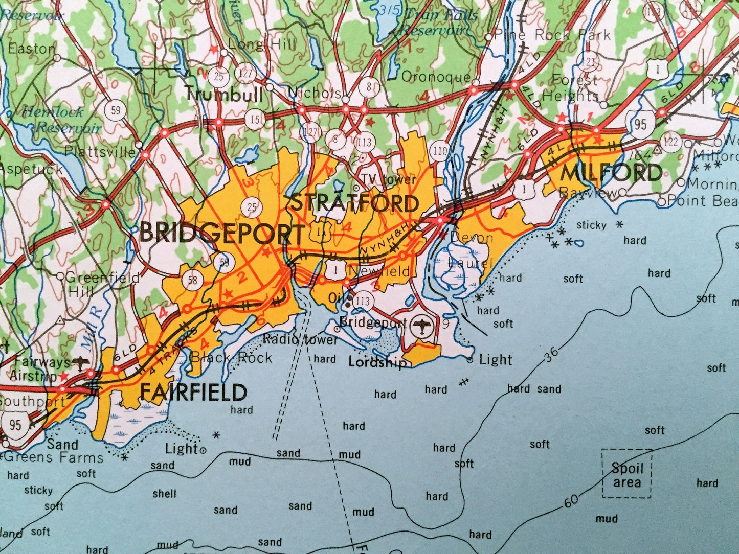
Cities & Towns: CONNECTICUT - Hartford, East Hartford, West Hartford, Newington, Torrington, Watertown, Oakville, Waterbury, Naugatuck, Wallingford, Meriden, Middletown, Portland, Hamden, Shelton, Trumbull, New Haven, East Haven, West Haven, Milford, Westport, Stamford, Greenwich, Norwalk, New London, Groton, Norwich, Willimantic, Glastonbury, Southington, Plantsville, Kensington, Clinton, Wilton, Ridgefield, Danbury, Bethel, Seymour.
NEW YORK - White Plains, Port Chester, Tarrytown, Irvington, Dobbs, Nyack, Valley Cottage, New City, Thornwood, Peekskill, West Point, Beacon, Wappingers Falls, Poughkeepsie, Arlington, Fairview, Kingston, Hyde Park, Yorktown, Yorktown Heights, Red Hook, Long Island.
NEW JERSEY - Northvale.
Points of Interest: CONNECTICUT - Long Island Sound, Norwalk Islands, Sherwood Island State Park, Silver Sands State Park, Hammonasset Beach State Park, Westbrook Harbor, New Haven Harbor, Connecticut River, Thames River, Shippan Point, Walnut Beach, West Shore and lots more hills, mountains, rivers, lakes, creeks, roads, highways and railroads.
NEW YORK - Long Island Sound, Shelter Island, Fishers Island, Gardiners Island, Orient Beach State Park, Block Island sound, Gardiners Bay, Hudson River, Hook Mountain State Park, Tallman Mountain State Park, Clove Mountain, Stissing Mountain and lots more hills, mountains, rivers, lakes, creeks, roads, highways and railroads.
NEW JERSEY - Hudson River, Bergen County and lots more hills, mountains, rivers, lakes, creeks, roads, highways and railroads.
MASSACHUSETTS - Hampden County.
Condition: Very Good condition, commensurate with age. This map is in incredible shape for being over 55 years old. Has light edge-wear, all of which will read as vintage character when framed.
----
We will happily adjust shipping price for multiple purchases. Maps are rolled up and shipped in sturdy mailing tubes, never folded.
Couldn't load pickup availability
Share