My Store
Antique Cornwall, Vermont 1946 US Geological Survey Topographic Map – Middlebury, Salisbury, Farmingdale, West Salisbury, Shoreham, VT
Antique Cornwall, Vermont 1946 US Geological Survey Topographic Map – Middlebury, Salisbury, Farmingdale, West Salisbury, Shoreham, VT
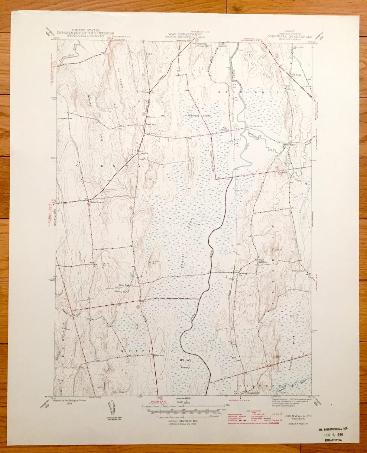
Beautiful, antique map of Middlebury, Cornwall, West Cornwall, Shoreham, Whiting and West Salisbury, Vermont. This is an authentic 1946 print of survey data from the U.S. Geological Survey and NOT a computer reproduction.
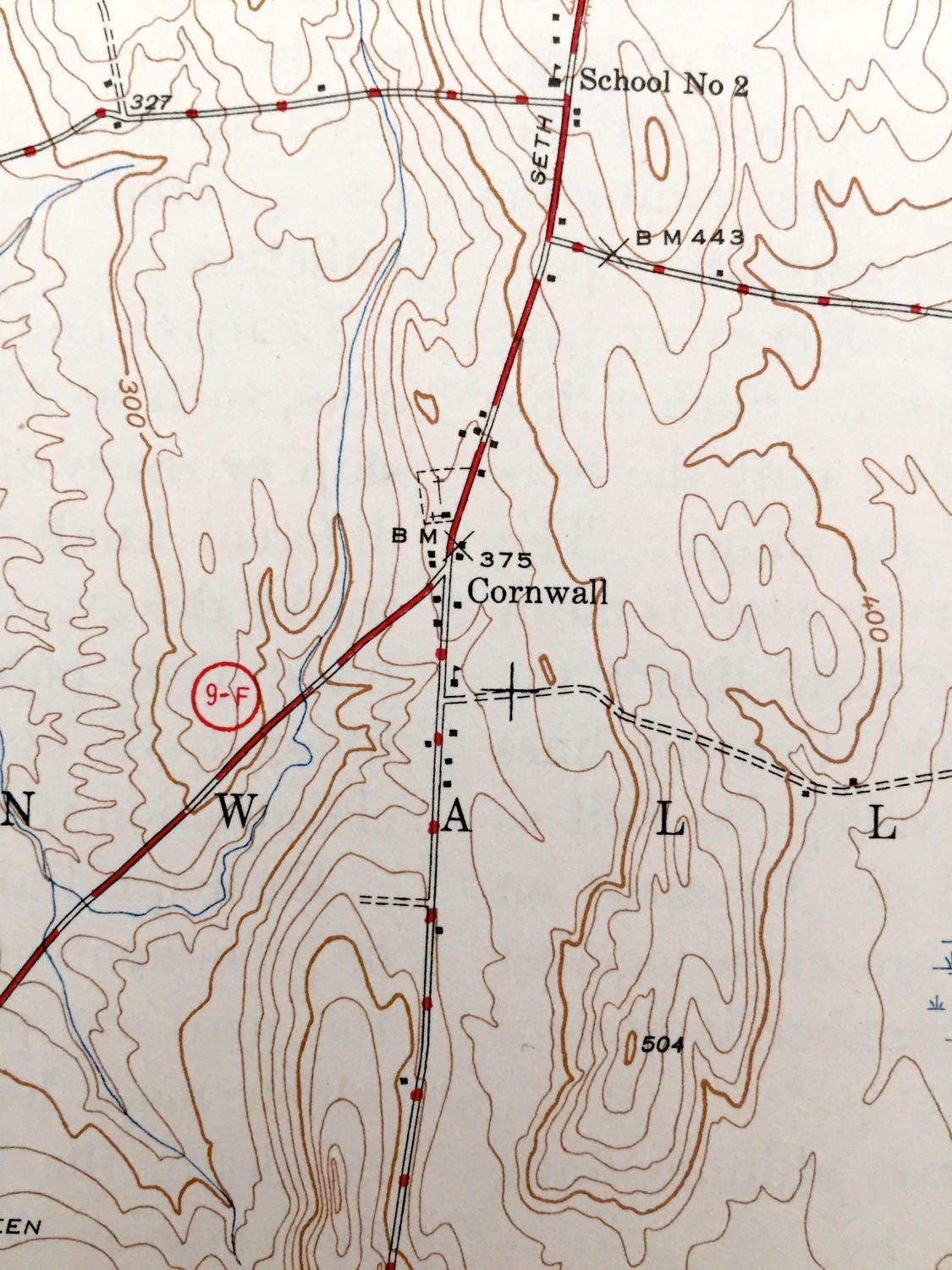
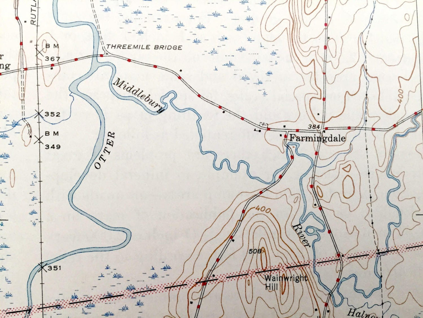
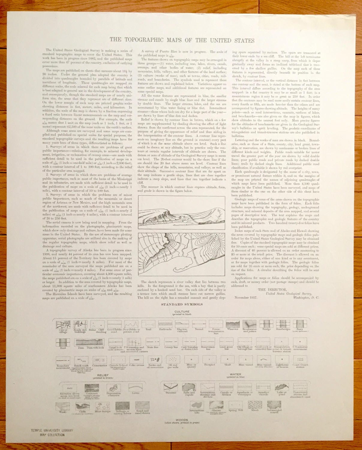
See what Addison County of Vermont looked like over 75 years ago. Lots of intricate details and geological contours. Map even has little squares for every house that existed at the time. The USGS cartographers were very thorough back then! On the back is a description of topographic symbols and map guide.
Perfect for the historian, map-lover, the curious or just as a conversation starter. Wonderful and rare. Vintage maps such as these make great gifts.
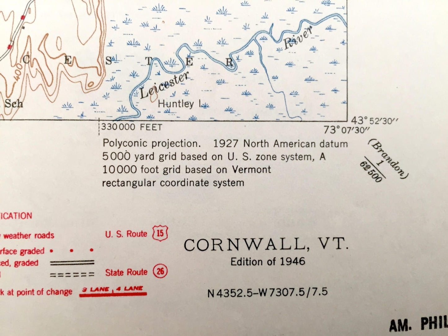
Edition of 1946, printed 1946
Dimensions: 17" width x 21" height
----
Features
Cities & Towns: Middlebury, Piper Crossing, Farmingdale, Cornwall, West Cornwall, Shoreham, Whiting, West Salisbury.
Points of Interest: Lemon Fair River, The Ledges, School No. 2, Middlebury Swamp, Cedar Swamp, Otter Creek, Three Mile Bridge, Cady School, Middlebury Country Club, Porter Hospital, Salisbury Station, School No. 1, Jerusalem School, Scove Hill, and lots more hills, mountains, streams, ponds, houses, schools and roads.
Condition: Very Good Vintage condition, commensurate with age. This map is in great shape for being over 75 years old.
----
We will happily adjust shipping price for multiple purchases. Maps are rolled up and shipped in sturdy mailing tubes, never folded.
Couldn't load pickup availability
Share